Black Rock

Island in Cornwall

England

Black Rock

Cadgwith Cove
Cadgwith Cove Credit: Arthur Sherry

Black Rock is a small island located off the coast of Cornwall, England. It is situated in the Celtic Sea, about 2.5 miles southeast of the town of Perranporth. The island spans an area of approximately 10 acres and is known for its striking black cliffs and rocky terrain, which give it its name.

Access to Black Rock is only possible during low tide, as the island becomes completely submerged during high tide. A natural causeway, known as Black Rock Causeway, connects the island to the mainland at low tide, allowing visitors to explore its unique landscape. However, caution must be exercised when crossing the causeway, as the rising tide can quickly cut off access to the island.

The island is home to a variety of seabirds, including fulmars, cormorants, and gulls, making it a popular spot for birdwatching enthusiasts. The rugged cliffs also provide nesting sites for these birds.

Although Black Rock lacks any permanent human inhabitants, it has a rich history. It is believed that the island was used as a lookout point during World War II, due to its strategic location overlooking the coast. Additionally, there are remnants of an old fisherman's cottage on the island, serving as a reminder of its past use.

Black Rock is a unique and picturesque destination, offering visitors a chance to witness the beauty of Cornwall's coastline and observe its diverse wildlife.

If you have any feedback on the listing, please let us know in the comments section below.
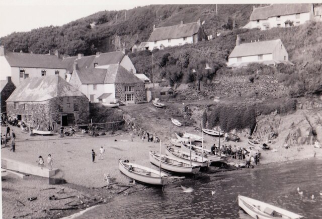
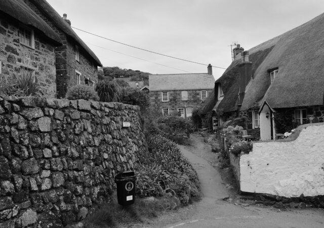
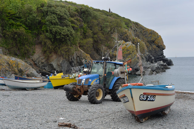
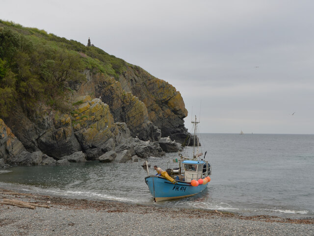
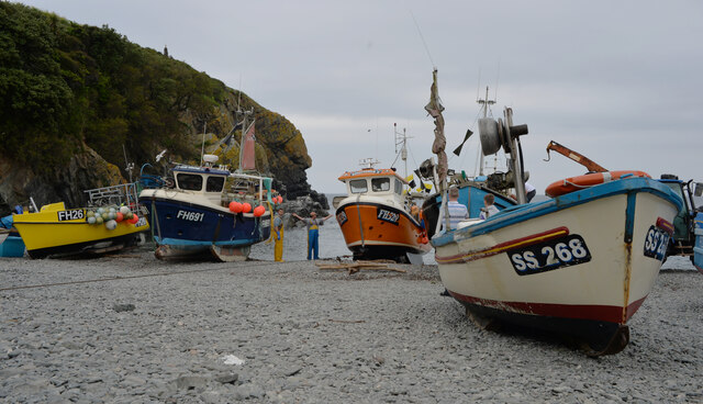
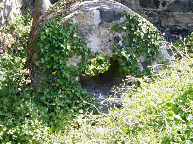
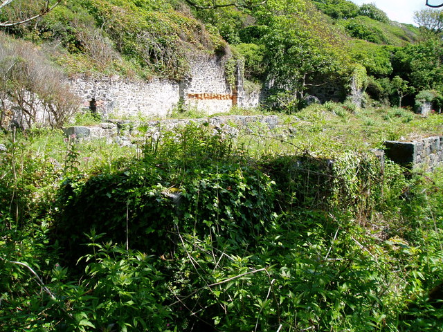
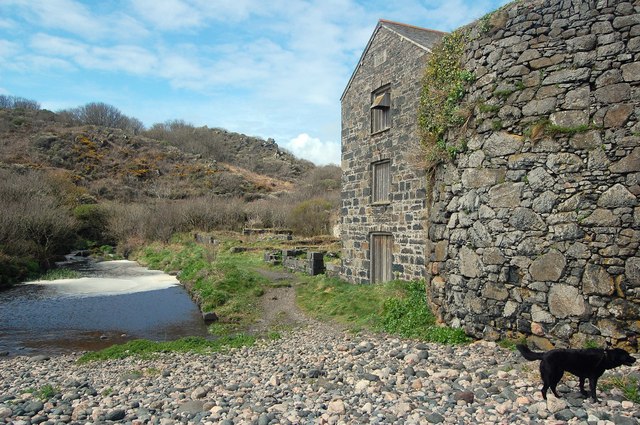
Black Rock Images

Images are sourced within 2km of 49.996029/-5.1706157 or Grid Reference SW7215. Thanks to Geograph Open Source API. All images are credited.

Cadgwith Cove
Cadgwith Cove
The footpath to the car park, Cadgwith
Cadgwith Cove
Cadgwith Cove
A fishing boat landing at Cadgwith Cove
Fishing boats, Cadgwith Cove
Boat, tractor and fishing gear, Cadgwith
Narrow road in Cadgwith, Cornwall
Grade - Ruan Church of England School
Old Serpentine Works, Poltesco The ruins of the serpentine factory - with the pilchard tower on the end, taken from the pebbly beach at Carleon Cove.
Old Serpentine Works, Poltesco
The ruins of the serpentine factory - with the pilchard tower on the end, taken from the pebbly beach at Carleon Cove.
Chimney Stack ..  all that remains The Poltesco Serpentine Works was initially powered by a water wheel feed by a leat from the Poltesco Valley stream. Then as technology moved on the machinery in the works was powered by a steam engine. The tall chimney shown in the old photos of the Lizard Serpentine Company's works is no longer standing and all that remains is one small section which is shown in this photograph. <a href="https://www.geograph.org.uk/photo/2430524">SW7215 : Derelict Serpentine Works at Carleon Cove</a>
Chimney Stack .. all that remains
The Poltesco Serpentine Works was initially powered by a water wheel feed by a leat from the Poltesco Valley stream. Then as technology moved on the machinery in the works was powered by a steam engine. The tall chimney shown in the old photos of the Lizard Serpentine Company's works is no longer standing and all that remains is one small section which is shown in this photograph. SW7215 : Derelict Serpentine Works at Carleon Cove
Water-wheel pit (remains) In the early days of the serpentine rock processing works on this site the power for the machinery came from a water-wheel. The water came from the nearby stream containing rain water which came as run-off from the high lands of Goonhilly Downs. The water was fed from the stream along in a leat and then finally delivered to the overshot water-wheel by means of an overhead wooden channel known as a launder.  

The iron framed wheel was 25 feet in diameter. It had wooden buckets and was made locally in Helston. The wheel was located on a substantial wooden framework over a deep pit.  The pit in which it ran is now the only element of the water-wheel which remains and that is overgrown with vegetation including trees as shown in this photograph.

The used water was then channelled to return to the Poltesco valley stream which flowed out to sea. The stream is to the right of photograph. <a href="https://www.geograph.org.uk/photo/2430419">SW7215 : Poltesco Valley stream reaches the beach</a>
Water-wheel pit (remains)
In the early days of the serpentine rock processing works on this site the power for the machinery came from a water-wheel. The water came from the nearby stream containing rain water which came as run-off from the high lands of Goonhilly Downs. The water was fed from the stream along in a leat and then finally delivered to the overshot water-wheel by means of an overhead wooden channel known as a launder. The iron framed wheel was 25 feet in diameter. It had wooden buckets and was made locally in Helston. The wheel was located on a substantial wooden framework over a deep pit. The pit in which it ran is now the only element of the water-wheel which remains and that is overgrown with vegetation including trees as shown in this photograph. The used water was then channelled to return to the Poltesco valley stream which flowed out to sea. The stream is to the right of photograph. SW7215 : Poltesco Valley stream reaches the beach
Poltesco Valley stream reaches the beach This photograph shows a number of features of this quiet and delightful cove. Quiet now, but not in the period around 1860s when this would have been a noisy and busy industrial site creating wonderful features pieces for the grand homes and London shopfronts of the Victorian era.

Just visible right of centre and hidden by vegetation is the site of the 25 foot diameter water-wheel. <a href="https://www.geograph.org.uk/photo/2430402">SW7215 : Water-wheel pit (remains)</a>

On the right on the edge of the stream can just be seen the stone quay for barges to dock alongside the serpentine works to collect the stone items produced by the works and transport them out to waiting sailing ships.

Finally, the effects of the powerful  easterly winter storms can be seen in the foreground. Masses of large and small stones have been washed into Carleon Cove to create a bank blocking the mouth of the river as it flows out of the Poltesco valley onto the seashore and on out to sea. <a href="https://www.geograph.org.uk/photo/2430431">SW7215 : View from the quay at Carleon Cove</a>
Poltesco Valley stream reaches the beach
This photograph shows a number of features of this quiet and delightful cove. Quiet now, but not in the period around 1860s when this would have been a noisy and busy industrial site creating wonderful features pieces for the grand homes and London shopfronts of the Victorian era. Just visible right of centre and hidden by vegetation is the site of the 25 foot diameter water-wheel. SW7215 : Water-wheel pit (remains) On the right on the edge of the stream can just be seen the stone quay for barges to dock alongside the serpentine works to collect the stone items produced by the works and transport them out to waiting sailing ships. Finally, the effects of the powerful easterly winter storms can be seen in the foreground. Masses of large and small stones have been washed into Carleon Cove to create a bank blocking the mouth of the river as it flows out of the Poltesco valley onto the seashore and on out to sea. SW7215 : View from the quay at Carleon Cove
View from the quay at Carleon Cove The small stone quay in the foreground is where the delicate serpentine products from the Lizard Serpentine Company's works were loaded onto barges for delivery to ships anchored off shore. <a href="https://www.geograph.org.uk/photo/2430419">SW7215 : Poltesco Valley stream reaches the beach</a>

The photos shows the stream from the Poltesco valley looking more like a lake. The reason is that it is held back from flowing directly out to sea by the build-up of storm driven pebbles on the seashore.
View from the quay at Carleon Cove
The small stone quay in the foreground is where the delicate serpentine products from the Lizard Serpentine Company's works were loaded onto barges for delivery to ships anchored off shore. SW7215 : Poltesco Valley stream reaches the beach The photos shows the stream from the Poltesco valley looking more like a lake. The reason is that it is held back from flowing directly out to sea by the build-up of storm driven pebbles on the seashore.
Wall - Local Serpentine Stone used for building This photo shows the great variety of serpentine rocks used in the building of what was the home of the manager of the Lizard Serpentine Company's stone works at Carleon Cove, Poltesco. <a href="https://www.geograph.org.uk/photo/2431176">SW7215 : Owner's House for Serpentine Quarries and Factory</a>

The many of the rocks in the Lizard area are special, but not unique. They have come from the mantle deep below the earth's surface. Some 350 million years ago a mass of molten rock burst up from within the earth's mantle and picked up all sorts of different rock types on its passage to the surface of the earth. Then later, due to movement of the tectonic plates, this same rock was subjected to even more heat and pressure resulting in a rock we see today which varies in colour, texture and patterning. This rock, called 'serpentine' can now be seen in outcrops all around the Lizard. Some of the rock is suitable for turning on a lathe or for being sculptured into delicate ornaments the best know being a lighthouse shaped ornament. Such ornaments sold mostly as tourist souvenirs are made locally by a handful of craftsmen. There are only few craftsmen left from what years ago was a flourishing serpentine industry of the Victorian period. 

The stone not suitable for decorative work was used in ordinary buildings as shown in this photo.  <a href="https://www.geograph.org.uk/photo/2430473">SW7216 : Lighthouse ornament created from serpentine rock</a> <a href="https://www.geograph.org.uk/photo/2430402">SW7215 : Water-wheel pit (remains)</a>
Wall - Local Serpentine Stone used for building
This photo shows the great variety of serpentine rocks used in the building of what was the home of the manager of the Lizard Serpentine Company's stone works at Carleon Cove, Poltesco. SW7215 : Owner's House for Serpentine Quarries and Factory The many of the rocks in the Lizard area are special, but not unique. They have come from the mantle deep below the earth's surface. Some 350 million years ago a mass of molten rock burst up from within the earth's mantle and picked up all sorts of different rock types on its passage to the surface of the earth. Then later, due to movement of the tectonic plates, this same rock was subjected to even more heat and pressure resulting in a rock we see today which varies in colour, texture and patterning. This rock, called 'serpentine' can now be seen in outcrops all around the Lizard. Some of the rock is suitable for turning on a lathe or for being sculptured into delicate ornaments the best know being a lighthouse shaped ornament. Such ornaments sold mostly as tourist souvenirs are made locally by a handful of craftsmen. There are only few craftsmen left from what years ago was a flourishing serpentine industry of the Victorian period. The stone not suitable for decorative work was used in ordinary buildings as shown in this photo. SW7216 : Lighthouse ornament created from serpentine rock SW7215 : Water-wheel pit (remains)
Lighthouse ornament created from serpentine rock An example of the traditional lighthouse ornament created from the local rock known as serpentine. There are currently (2011) only five craftsmen and one young apprentice creating such ornaments.
Lighthouse ornament created from serpentine rock
An example of the traditional lighthouse ornament created from the local rock known as serpentine. There are currently (2011) only five craftsmen and one young apprentice creating such ornaments.
Derelict Serpentine Works at Carleon Cove On the ground it is not difficult to trace out the walls of the old industrial buildings, but from this photograph it looks very much overgrown.

By comparing this photo with an old postcard of the site, it is possible to identify the part of the works where the steam engine was housed and which would have had a tall stone chimney. In this photo the site of the steam engine house is at the back in the very shadowy area and there you can just detect all that remains of the fallen chimney. For a closer look at all that remains of that tall chimney go to the following link. <a href="https://www.geograph.org.uk/photo/2430392">SW7215 : Chimney Stack ..  all that remains</a>
Derelict Serpentine Works at Carleon Cove
On the ground it is not difficult to trace out the walls of the old industrial buildings, but from this photograph it looks very much overgrown. By comparing this photo with an old postcard of the site, it is possible to identify the part of the works where the steam engine was housed and which would have had a tall stone chimney. In this photo the site of the steam engine house is at the back in the very shadowy area and there you can just detect all that remains of the fallen chimney. For a closer look at all that remains of that tall chimney go to the following link. SW7215 : Chimney Stack .. all that remains
Show me another place!

Black Rock is located at Grid Ref: SW7215 (Lat: 49.996029, Lng: -5.1706157)

Unitary Authority: Cornwall

Police Authority: Devon and Cornwall

What 3 Words

///hawks.mysteries.wing. Near Landewednack, Cornwall

Related Wikis

Poltesco

Poltesco is a hamlet and valley in the parish of Grade-Ruan, on the Lizard Peninsula, Cornwall, UK. The lower part of the valley is owned by the National...

Kuggar

Kuggar (Cornish: Koger) is a hamlet in the parish of Grade-Ruan in Cornwall, England. Kuggar, within the Cornwall Area of Outstanding Natural Beauty (AONB...
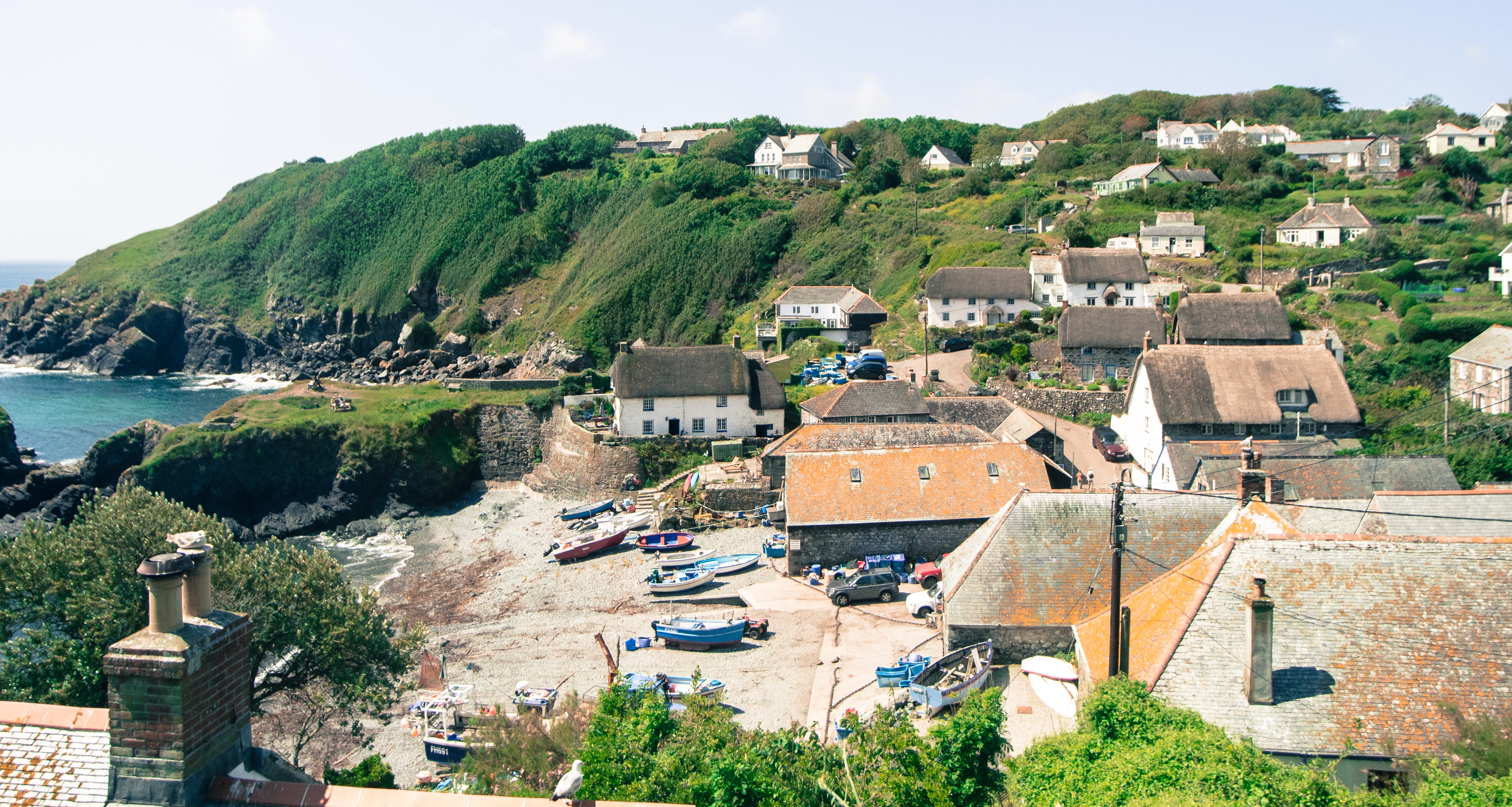
Cadgwith

Cadgwith (Cornish: Porthkajwydh, meaning cove of the thicket) is a village and fishing port in Cornwall, England, United Kingdom. It is on the Lizard Peninsula...
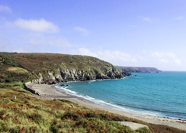
Kennack Sands

Kennack Sands is a beach and sand-dune system on the east coast of the Lizard Peninsula, Cornwall, England, UK. == Geography == The beach is approximately...

Nearby Amenities

Located within 500m of 49.996029,-5.1706157
Poltesco
Is In: Cornwall, England, UK
Place: hamlet
Source: npe
Wikidata: Q7226036
Wikipedia: en:Poltesco
Lat/Long: 49.9981861/-5.1767108
Carleon Cove
Is In: Cornwall, England, UK
Place: locality
Lat/Long: 49.997607/-5.1708945
Polbream Point
Is In: Cornwall, England, UK
Place: locality
Lat/Long: 49.9991739/-5.1686858
Bench
Backrest: no
Lat/Long: 49.9981036/-5.1720597
Waste Basket
Source: survey
Waste: dog_excrement
Lat/Long: 49.9984348/-5.1759652
Post Box
Brand: Royal Mail
Brand Wikidata: Q638098
Collection Times: Mo-Fr 09:00; Sa 07:00; Su off
Drive Through: no
Operator: Royal Mail
Operator Wikidata: Q638098
Post Box Design: type_c
Post Box Mounting: stone_wall
Post Box Type: wall
Ref: TR12 67D
Royal Cypher: GR
Royal Cypher Wikidata: Q33102273
Source: survey;streetlevel imagery;aerial imagery
Lat/Long: 49.9980909/-5.1766647
The data included in this document is from www.openstreetmap.org. The data is made available under ODbL.

Have you been to Black Rock?

Leave your review of Black Rock below (or comments, questions and feedback).