Bloxwich, Little

Settlement in Staffordshire

England

Bloxwich, Little

Wyrley & Essington Canal, Pelsall Wood A boat heads towards Pelsall Junction along an unusually open stretch of the canal.
Wyrley & Essington Canal, Pelsall Wood Credit: Stephen McKay

Bloxwich, Little is a small village located in the county of Staffordshire, England. Situated about 6 miles north of the town of Stafford, it is nestled in the picturesque countryside of the Staffordshire Moorlands. With a population of around 500 residents, Bloxwich, Little maintains a close-knit and friendly community.

The village is characterized by its charming rural setting, surrounded by rolling hills and lush green fields. The area boasts a rich history, with evidence of human settlement dating back to the Roman period. The village itself is dotted with traditional stone cottages and historic buildings, providing a glimpse into its past.

Despite its small size, Bloxwich, Little offers a range of amenities for its residents. These include a local pub, a village hall, and a primary school, catering to the needs of the community. The village also benefits from its proximity to Stafford, which provides access to a wider range of services and facilities.

Nature enthusiasts are drawn to Bloxwich, Little for its beautiful countryside, which offers ample opportunities for outdoor activities such as hiking, cycling, and horse riding. The village is also surrounded by several nature reserves and parks, making it an ideal destination for those seeking tranquility and natural beauty.

Overall, Bloxwich, Little is a picturesque and idyllic village that offers a peaceful and close community spirit. Its rural charm, combined with its convenient location near Stafford, makes it an attractive place to live for those seeking a quieter pace of life within easy reach of urban amenities.

If you have any feedback on the listing, please let us know in the comments section below.

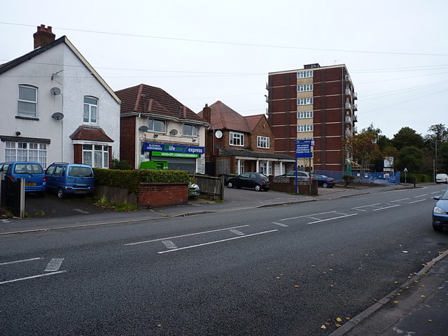
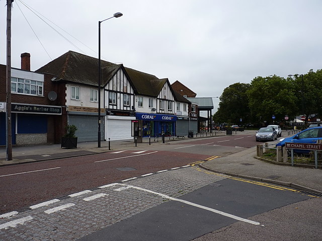
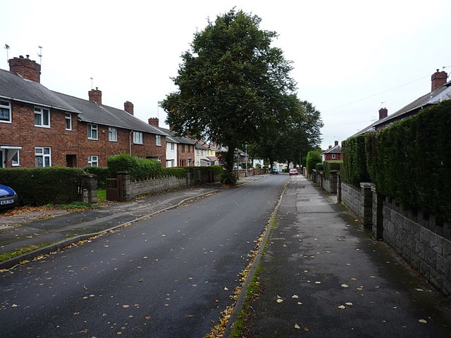
Bloxwich, Little Images

Images are sourced within 2km of 52.627432/-1.987705 or Grid Reference SK0003. Thanks to Geograph Open Source API. All images are credited.

Wyrley & Essington Canal, Pelsall Wood A boat heads towards Pelsall Junction along an unusually open stretch of the canal.
Wyrley & Essington Canal, Pelsall Wood
A boat heads towards Pelsall Junction along an unusually open stretch of the canal.
York's Bridge, Wyrley & Essington Canal The pub here is now called the Fingerpost but was formerly the Royal Oak.
York's Bridge, Wyrley & Essington Canal
The pub here is now called the Fingerpost but was formerly the Royal Oak.
Hildicks Bridge, Wyrley & Essington Canal The canal passes under Goscote Lane as it winds through the Walsall suburbs.
Hildicks Bridge, Wyrley & Essington Canal
The canal passes under Goscote Lane as it winds through the Walsall suburbs.
Wyrley & Essington Canal, Pelsall The remains of an old arm are totally choked with reeds close to York's Foundry Bridge. The sky here looks distinctly threatening.
Wyrley & Essington Canal, Pelsall
The remains of an old arm are totally choked with reeds close to York's Foundry Bridge. The sky here looks distinctly threatening.
Victoria Avenue, Blakenhall Heath Just north of Walsall, Blakenhall Heath is primarily given over to housing. Old maps prior to WW2 suggest that it was still very rural up until about the early 1930s, but building of the estates put an end to that between the wars. Many of the houses date from that period, although the ones on the right here are clearly more recent.
Victoria Avenue, Blakenhall Heath
Just north of Walsall, Blakenhall Heath is primarily given over to housing. Old maps prior to WW2 suggest that it was still very rural up until about the early 1930s, but building of the estates put an end to that between the wars. Many of the houses date from that period, although the ones on the right here are clearly more recent.
Shops, houses and flats on Field Road Described as Field Street on some of the older maps (1880s until 1938, at any rate) Field Road runs north-south through Blakenhall Heath, joining the High St B4210 to the A4142 Lichfield Road.
Shops, houses and flats on Field Road
Described as Field Street on some of the older maps (1880s until 1938, at any rate) Field Road runs north-south through Blakenhall Heath, joining the High St B4210 to the A4142 Lichfield Road.
OS benchmark - Blakenhall Heath, 214 Field Road An OS cutmark on the NW angle of 214 Field Road; originally levelled, probably in 1957, at 161.904m above Ordnance Datum Newlyn.
OS benchmark - Blakenhall Heath, 214 Field Road
An OS cutmark on the NW angle of 214 Field Road; originally levelled, probably in 1957, at 161.904m above Ordnance Datum Newlyn.
Penderel Street crosses Hamilton Street in Blakenhall Heath Part of the extensive inter-war housing developments north of Walsall.
Penderel Street crosses Hamilton Street in Blakenhall Heath
Part of the extensive inter-war housing developments north of Walsall.
Ash Street towards Ryle Street Interwar housing developments in Blakenhall Heath
Ash Street towards Ryle Street
Interwar housing developments in Blakenhall Heath
OS benchmark - Blakenhall Heath, 30 Ryle Street An OS cutmark on the front wall of 30 Ryle Street; originally levelled, probably in 1957, at 148.87m above Ordnance Datum Newlyn.
OS benchmark - Blakenhall Heath, 30 Ryle Street
An OS cutmark on the front wall of 30 Ryle Street; originally levelled, probably in 1957, at 148.87m above Ordnance Datum Newlyn.
OS benchmark - Blakenhall Heath, 136 Valley Road An OS cutmark on the north wall of 136 Valley Road; originally levelled, probably in 1957, at 114.411m above Ordnance Datum Newlyn.
OS benchmark - Blakenhall Heath, 136 Valley Road
An OS cutmark on the north wall of 136 Valley Road; originally levelled, probably in 1957, at 114.411m above Ordnance Datum Newlyn.
OS benchmark - Blakenhall Heath, 47 Green Rock Lane An OS cutmark on the NE wall of 47 Green Rock Lane; originally levelled, probably in 1957, at 150.023m above Ordnance Datum Newlyn.
OS benchmark - Blakenhall Heath, 47 Green Rock Lane
An OS cutmark on the NE wall of 47 Green Rock Lane; originally levelled, probably in 1957, at 150.023m above Ordnance Datum Newlyn.
The Green Rock Tavern, Blakenhall Heath Mapped in the 1920s as 'Rock House', this had become a public house by the late 1930s.
The Green Rock Tavern, Blakenhall Heath
Mapped in the 1920s as 'Rock House', this had become a public house by the late 1930s.
OS benchmark - Blakenhall Heath, 1 Green Rock Lane An OS cutmark on the side wall of 1 Green Rock Lane; originally levelled, probably in 1957, at 149.483m above Ordnance Datum Newlyn.
OS benchmark - Blakenhall Heath, 1 Green Rock Lane
An OS cutmark on the side wall of 1 Green Rock Lane; originally levelled, probably in 1957, at 149.483m above Ordnance Datum Newlyn.
Shops and businesses on Blakenall Lane A very similar view to the one in <a href="https://www.geograph.org.uk/photo/1213597">SK0001 : Blakenall Lane, Blakenall Heath</a>; it's a different time of year, and there are some slight changes to the businesses in the retail units over the last 6 or 7 years.
Shops and businesses on Blakenall Lane
A very similar view to the one in SK0001 : Blakenall Lane, Blakenall Heath; it's a different time of year, and there are some slight changes to the businesses in the retail units over the last 6 or 7 years.
Foster Street, Blakenall Heath A mixture of Victorian terracing and slightly more recent (inter- and post-war) housing development.
Foster Street, Blakenall Heath
A mixture of Victorian terracing and slightly more recent (inter- and post-war) housing development.
Hollemeadow Avenue, Blakenall Heath Closely-packed inter-war housing developments in Blakenall Heath
Hollemeadow Avenue, Blakenall Heath
Closely-packed inter-war housing developments in Blakenall Heath
Shops and stores, Hollemeadow Avenue
Show me another place!

Bloxwich, Little is located at Grid Ref: SK0003 (Lat: 52.627432, Lng: -1.987705)

Unitary Authority: Walsall

Police Authority: West Midlands

What 3 Words

///finger.crunch.vouch. Near Pelsall, West Midlands

Related Wikis

Little Bloxwich

Little Bloxwich is a residential area of Bloxwich, West Midlands, England. It is situated in the extreme north of the Metropolitan Borough of Walsall on...

Lower Farm Estate

Lower Farm Estate is a suburb of Bloxwich, in the Metropolitan Borough of Walsall, West Midlands, England. There are two multi-storey blocks of council...

Walsall Academy

Walsall Academy is a secondary school based in Bloxwich, Walsall, West Midlands, England. == School == It opened in January 2003 with 470 students on the...

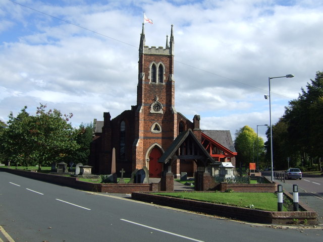
St Michael & All Angels Church, Pelsall

St Michael & All Angels Church is an Anglican parish church in Pelsall, West Midlands, England. It was built in 1844 to replace an older church on Paradise...

Pelsall

Pelsall is a village and civil parish in the Metropolitan Borough of Walsall, West Midlands, England. Forming part of the borough's border with Staffordshire...

Christ Church, Blakenall Heath

Christ Church is a grade-II listed church in the suburban village of Blakenall Heath, in the Metropolitan Borough of Walsall, in the county of the West...
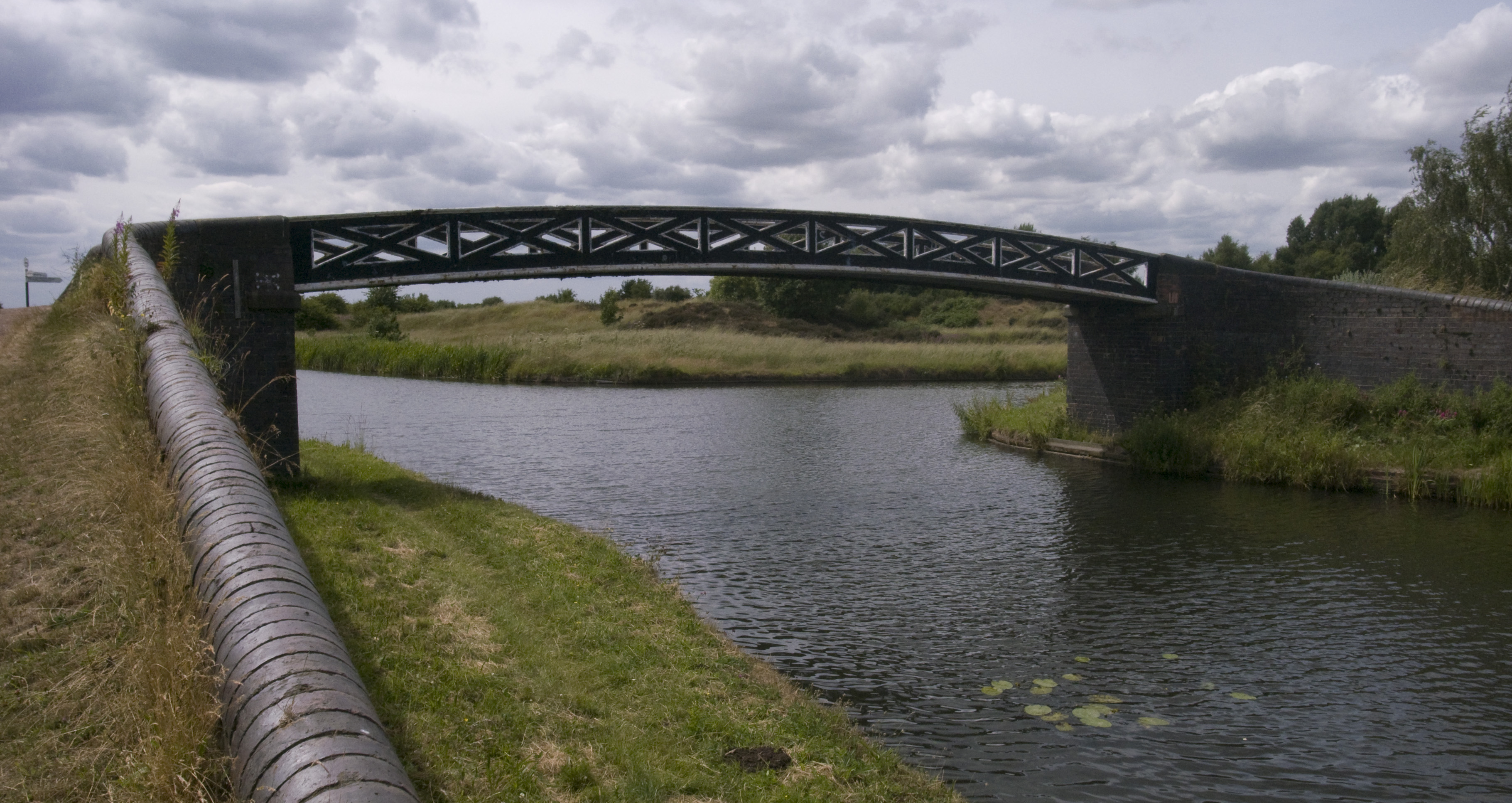
Pelsall Junction

Pelsall Junction (grid reference SK018044) is a canal junction at the southern limit of the Cannock Extension Canal where it meets the Wyrley and Essington...

Blakenall Heath

Blakenall Heath is a suburban village in the Metropolitan Borough of Walsall in the West Midlands County, England. It straddles the border of Walsall and...

Related Videos

Walking The McClean Way

Walking along the McClean Way, starting in Walsall Town centre, we briefly follow National Cycle Route 5 to the Walsall end of ...

Walking The Wyrley & Essington Canal (Part 3)

A continuation along the towpath of the Wyrley and Essington Canal, starting at Sneyd Junction where we finished in part 2, ...

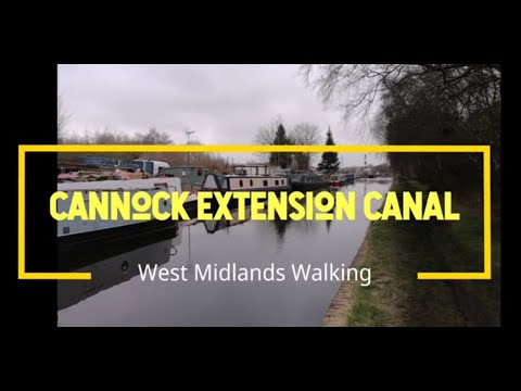
Walking The Cannock Extension Canal

A walk along the towpath of the short Cannock Extension Canal from Pelsall Junction, where the canal meets the Wyrley and ...

Walking The Wyrley and Essington Canal (Part 4)

Continuing a walk along the towpath of the Wyrley and Essington canal, from Birchills Junction near Reedswood, where our part ...

Nearby Amenities

Located within 500m of 52.627432,-1.987705
Little Bloxwich
Place: suburb
Source: NPE;OS_OpenData_StreetView
Lat/Long: 52.6256376/-1.9886202
Source: www.npemap.org.uk
Uk Postcode Centroid: WS3
Lat/Long: 52.625385/-1.986473
Traffic Signals
Crossing: traffic_signals
Crossing Ref: pelican
Lat/Long: 52.6249025/-1.9901769
Bus Stop
Abbotts St / Lichfield Rd
Asset Ref: 0620701
Bench: no
Bus: yes
Location: Abbott Street;Lichfield Road
Naptan AtcoCode: 43000620701
Naptan Bearing: N
Naptan BusStopType: MKD
Naptan CommonName: Lichfield Rd
Naptan Indicator: adj
Naptan NaptanCode: nwmgwmgj
Naptan PlusbusZoneRef: BHAMNWS
Naptan Status: ACT
Naptan StopType: BCT
Naptan Street: ABBOTTS ST
Naptan Towards: Bloxwich
Naptan Verified: yes
Public Transport: platform
Route Ref: 19
Shelter: no
Source: WMCA
Tactile Paving: no
Towards: Bloxwich
Lat/Long: 52.6241933/-1.9908482
Bus Stop
Abbotts St / Lichfield Rd
Asset Ref: 0620702
Bench: no
Bus: yes
Location: Abbott Street;Lichfield Road
Naptan AtcoCode: 43000620702
Naptan Bearing: S
Naptan BusStopType: MKD
Naptan CommonName: Lichfield Rd
Naptan Indicator: opp
Naptan NaptanCode: nwmgwmgm
Naptan PlusbusZoneRef: BHAMNWS
Naptan Status: ACT
Naptan StopType: BCT
Naptan Street: ABBOTTS ST
Naptan Towards: Walsall
Naptan Verified: yes
Public Transport: platform
Route Ref: 19
Shelter: no
Source: WMCA
Tactile Paving: no
Towards: Walsall
Lat/Long: 52.6239853/-1.9905377
Bus Stop
Mallory Cres / Cook Rd
Bench: no
Naptan AtcoCode: 43000620901
Naptan Bearing: N
Naptan BusStopType: MKD
Naptan CommonName: Cook Rd
Naptan Indicator: adj
Naptan NaptanCode: nwmtapdg
Naptan PlusbusZoneRef: BHAMNWS
Naptan Status: ACT
Naptan StopType: BCT
Naptan Street: MALLORY CRES
Naptan Towards: Pelsall, Bloxwich
Naptan Verified: no
Public Transport: platform
Route Ref: 23
Shelter: no
Source: WMCA
Tactile Paving: no
Lat/Long: 52.6230407/-1.9862764
Bus Stop
Lichfield Rd / Stoney Lane
NaPTANAreaCode: 43000627201
Bench: yes
Bus: yes
Location: Lichfield Road;Stoney Lane
Naptan AtcoCode: 43000627201
Naptan Bearing: E
Naptan BusStopType: MKD
Naptan CommonName: Stoney Lane
Naptan Indicator: adj
Naptan NaptanCode: nwmgwpta
Naptan PlusbusZoneRef: BHAMNWS
Naptan Status: ACT
Naptan StopType: BCT
Naptan Street: LICHFIELD RD
Naptan Towards: Pelsall
Naptan Verified: yes
Public Transport: platform
Route Ref: 8A;89
Shelter: yes
Shelter Ref: 201515
Source: WMCA
Tactile Paving: no
Towards: Pelsall;Brownhills
Lat/Long: 52.6255843/-1.9881211
Bus Stop
Lichfield Rd / Stoney Lane
Asset Ref: 0627202
Bench: no
Bus: yes
Location: Lichfield Road;Stoney Lane
Naptan AtcoCode: 43000627202
Naptan Bearing: W
Naptan BusStopType: MKD
Naptan CommonName: Stoney Lane
Naptan Indicator: opp
Naptan NaptanCode: nwmgwptd
Naptan PlusbusZoneRef: BHAMNWS
Naptan Status: ACT
Naptan StopType: BCT
Naptan Street: LICHFIELD RD
Naptan Towards: Bloxwich
Naptan Verified: yes
Public Transport: platform
Route Ref: 8A;89
Shelter: no
Source: WMCA
Tactile Paving: no
Towards: Bloxwich
Lat/Long: 52.6254692/-1.9886391
Bus Stop
Buxton Rd / Stoney Lane
NaPTANAreaCode: 43000628101
Bench: yes
Bus: yes
Location: Buxton Road;Stoney Lane
Naptan AtcoCode: 43000628101
Naptan Bearing: NW
Naptan BusStopType: MKD
Naptan CommonName: Stoney Lane
Naptan Indicator: adj
Naptan NaptanCode: nwmgwptg
Naptan PlusbusZoneRef: BHAMNWS
Naptan Status: ACT
Naptan StopType: BCT
Naptan Street: BUXTON RD
Naptan Towards: Lower Farm
Naptan Verified: yes
Public Transport: platform
Route Ref: 302
Shelter: yes
Shelter Ref: 201506
Source: WMCA
Tactile Paving: no
Towards: Bloxwich
Lat/Long: 52.6269859/-1.9942781
Bus Stop
Buxton Rd / Stoney Lane
NaPTANAreaCode: 43000628102
Bench: yes
Bus: yes
Location: Buxton Road;Stoney Lane
Naptan AtcoCode: 43000628102
Naptan Bearing: SE
Naptan BusStopType: MKD
Naptan CommonName: Stoney Lane
Naptan Indicator: opp
Naptan NaptanCode: nwmgwptj
Naptan PlusbusZoneRef: BHAMNWS
Naptan Status: ACT
Naptan StopType: BCT
Naptan Street: BUXTON RD
Naptan Towards: Bloxwich
Public Transport: platform
Route Ref: 302
Shelter: yes
Shelter Ref: 201501
Source: WMCA
Tactile Paving: no
Towards: Bloxwich
Lat/Long: 52.6270817/-1.9942137
Bus Stop
Wolverhampton Road / Foundry Lane
NaPTANAreaCode: 43000633101
Asset Ref: 201503
Bench: yes
Location: Wolverhampton Road;Foundary Lane
Naptan AtcoCode: 43000633101
Naptan Bearing: NE
Naptan BusStopType: MKD
Naptan CommonName: Foundry Lane
Naptan Indicator: opp
Naptan NaptanCode: nwmgwtwa
Naptan PlusbusZoneRef: BHAMNWS
Naptan Status: ACT
Naptan StopType: BCT
Naptan Street: WOLVERHAMPTON ROAD
Naptan Towards: Pelsall, Brownhills
Public Transport: platform
Route Ref: 8A;23;89
Shelter: yes
Shelter Ref: 201503
Source: WMCA
Tactile Paving: no
Towards: Pelsall;Brownhills
Lat/Long: 52.6267351/-1.9824045
Bus Stop
Wolverhampton Road / Foundry Lane
NaPTANAreaCode: 43000633102
Bench: yes
Location: Wolverhampton Road;Foundary Lane
Naptan AtcoCode: 43000633102
Naptan Bearing: SW
Naptan BusStopType: MKD
Naptan CommonName: Foundry Lane
Naptan Indicator: adj
Naptan NaptanCode: nwmgwtwd
Naptan PlusbusZoneRef: BHAMNWS
Naptan Status: ACT
Naptan StopType: BCT
Naptan Street: WOLVERHAMPTON ROAD
Naptan Towards: Bloxwich
Public Transport: platform
Route Ref: 8A;23;89
Shelter: yes
Shelter Ref: 201508
Source: WMCA
Tactile Paving: no
Towards: Bloxwich
Lat/Long: 52.6263968/-1.9826848
Bus Stop
Stoney Lane / Lichfield Rd
Asset Ref: 6270003
Bench: no
Bin: no
Bus: yes
Lit: no
Location: Stoney Lane;Lichfield Road
Naptan AtcoCode: 43006270003
Naptan Bearing: NW
Naptan BusStopType: MKD
Naptan CommonName: Lichfield Rd
Naptan Indicator: after
Naptan NaptanCode: nwmpmdjd
Naptan PlusbusZoneRef: BHAMNWS
Naptan Status: ACT
Naptan StopType: BCT
Naptan Street: STONEY LANE
Naptan Towards: Lower Farm
Naptan Verified: yes
Public Transport: platform
Route Ref: 302
Shelter: no
Source: WMCA
Tactile Paving: no
Towards: Bloxwich
Lat/Long: 52.6260005/-1.9897775
Bus Stop
Stoney Lane / Lichfield Rd
NaPTANAreaCode: 43006270004
Asset Ref: 201502B
Bench: yes
Bin: no
Bus: yes
Lit: no
Location: Stoney Lane;Lichfield Road
Naptan AtcoCode: 43006270004
Naptan Bearing: SE
Naptan BusStopType: MKD
Naptan CommonName: Lichfield Rd
Naptan Indicator: before
Naptan NaptanCode: nwmpmdjg
Naptan PlusbusZoneRef: BHAMNWS
Naptan Status: ACT
Naptan StopType: BCT
Naptan Street: STONEY LANE
Naptan Towards: Bloxwich
Naptan Verified: yes
Public Transport: platform
Route Ref: 302
Shelter: yes
Shelter Ref: 201502
Source: WMCA
Tactile Paving: no
Towards: Bloxwich
Lat/Long: 52.626137/-1.9896919
Crossing
Crossing: zebra
Crossing Island: no
Tactile Paving: yes
Lat/Long: 52.6265782/-1.9933761
Barrier: bollard
Bollard: fixed
Lat/Long: 52.6259113/-1.9889302
Costcutter
Addr City: Walsall
Addr Housenumber: 2
Addr Postcode: WS3 3PR
Addr Street: Fishley Lane
Brand: Costcutter
Brand Wikidata: Q5175072
Brand Wikipedia: en:Costcutter
Fhrs Id: 996475
Shop: convenience
Source Addr: FHRS Open Data
Lat/Long: 52.626822/-1.9932321
Crossing
Crossing: traffic_signals
Crossing Island: no
Crossing Ref: pelican
Tactile Paving: yes
Lat/Long: 52.6250385/-1.9900404
Social Facility
Little Bloxwich Day Hospice
Hospice: day_hospice
Social Facility: hospice
Lat/Long: 52.6262586/-1.9892866
Pub
The Beacon Way
Addr City: Walsall
Addr Postcode: WS3 3DW
Addr Street: Stoney Lane
Fhrs Id: 188313
Source: GPS Survey
Source Addr: FHRS Open Data
Lat/Long: 52.6260135/-1.9893179
Simmonds Close
Operator: Central Networks
Operator Wikidata: Q3045727
Power: substation
Ref: 13829
Utility: electric
Lat/Long: 52.6280546/-1.9916943
Grit Bin
Note: Exact location: somewhere at the junction
Operator: Walsall District Council
Ref: 22
Type: concrete
Lat/Long: 52.6265718/-1.9918601
Barrier: cycle_barrier
Bicycle: dismount
Centralkey: nks
Wheelchair: yes
Lat/Long: 52.6241504/-1.9895448
Crossing
Crossing: uncontrolled
Crossing Island: no
Tactile Paving: yes
Lat/Long: 52.6257079/-1.9895889
Generator Method: photovoltaic
Generator Output Electricity: yes
Generator Source: solar
Generator Type: solar_photovoltaic_panel
Location: roof
Power: generator
Lat/Long: 52.6284655/-1.9941554
Generator Method: photovoltaic
Generator Output Electricity: yes
Generator Source: solar
Generator Type: solar_photovoltaic_panel
Location: roof
Power: generator
Lat/Long: 52.6284769/-1.9942734
Generator Method: photovoltaic
Generator Output Electricity: yes
Generator Source: solar
Generator Type: solar_photovoltaic_panel
Location: roof
Power: generator
Lat/Long: 52.6291607/-1.9914745
Generator Method: photovoltaic
Generator Output Electricity: yes
Generator Source: solar
Generator Type: solar_photovoltaic_panel
Location: roof
Power: generator
Lat/Long: 52.6292299/-1.9918956
Generator Method: photovoltaic
Generator Output Electricity: yes
Generator Source: solar
Generator Type: solar_photovoltaic_panel
Location: roof
Power: generator
Lat/Long: 52.6292527/-1.992483
Generator Method: photovoltaic
Generator Output Electricity: yes
Generator Source: solar
Generator Type: solar_photovoltaic_panel
Location: roof
Power: generator
Lat/Long: 52.6292673/-1.9927284
Generator Method: photovoltaic
Generator Output Electricity: yes
Generator Source: solar
Generator Type: solar_photovoltaic_panel
Location: roof
Power: generator
Lat/Long: 52.6292804/-1.9928612
Generator Method: photovoltaic
Generator Output Electricity: yes
Generator Source: solar
Generator Type: solar_photovoltaic_panel
Location: roof
Power: generator
Lat/Long: 52.6292885/-1.9929618
Barrier: cycle_barrier
Bicycle: dismount
Centralkey: nks
Cycle Barrier: triple
Wheelchair: yes
Lat/Long: 52.6265286/-1.9909906
Entrance: main
Lat/Long: 52.6249339/-1.9863216
Entrance: main
Lat/Long: 52.62509/-1.9863009
Generator Method: photovoltaic
Generator Output Electricity: yes
Generator Source: solar
Generator Type: solar_photovoltaic_panel
Location: roof
Power: generator
Lat/Long: 52.6250725/-1.9895715
Generator Method: photovoltaic
Generator Output Electricity: yes
Generator Source: solar
Generator Type: solar_photovoltaic_panel
Location: roof
Power: generator
Lat/Long: 52.6245336/-1.9882035
Generator Method: photovoltaic
Generator Output Electricity: yes
Generator Source: solar
Generator Type: solar_photovoltaic_panel
Location: roof
Power: generator
Lat/Long: 52.6245141/-1.9883001
Generator Method: photovoltaic
Generator Output Electricity: yes
Generator Source: solar
Generator Type: solar_photovoltaic_panel
Location: roof
Power: generator
Lat/Long: 52.6247567/-1.9885656
Generator Method: photovoltaic
Generator Output Electricity: yes
Generator Source: solar
Generator Type: solar_photovoltaic_panel
Location: roof
Power: generator
Lat/Long: 52.6261048/-1.9884235
Generator Method: photovoltaic
Generator Output Electricity: yes
Generator Source: solar
Generator Type: solar_photovoltaic_panel
Location: roof
Power: generator
Lat/Long: 52.6267023/-1.9907704
Generator Method: photovoltaic
Generator Output Electricity: yes
Generator Source: solar
Generator Type: solar_photovoltaic_panel
Location: roof
Power: generator
Lat/Long: 52.6267072/-1.9907194
Generator Method: photovoltaic
Generator Output Electricity: yes
Generator Source: solar
Generator Type: solar_photovoltaic_panel
Location: roof
Power: generator
Lat/Long: 52.6270572/-1.9906202
Generator Method: photovoltaic
Generator Output Electricity: yes
Generator Source: solar
Generator Type: solar_photovoltaic_panel
Location: roof
Power: generator
Lat/Long: 52.6274952/-1.9925594
Generator Method: photovoltaic
Generator Output Electricity: yes
Generator Source: solar
Generator Type: solar_photovoltaic_panel
Location: roof
Power: generator
Lat/Long: 52.6274968/-1.9923019
Generator Method: photovoltaic
Generator Output Electricity: yes
Generator Source: solar
Generator Type: solar_photovoltaic_panel
Location: roof
Power: generator
Lat/Long: 52.6248226/-1.9874927
Generator Method: photovoltaic
Generator Output Electricity: yes
Generator Source: solar
Generator Type: solar_photovoltaic_panel
Location: roof
Power: generator
Lat/Long: 52.6257222/-1.9876228
Generator Method: photovoltaic
Generator Output Electricity: yes
Generator Source: solar
Generator Type: solar_photovoltaic_panel
Location: roof
Power: generator
Lat/Long: 52.6247648/-1.9881888
Generator Method: photovoltaic
Generator Output Electricity: yes
Generator Source: solar
Generator Type: solar_photovoltaic_panel
Location: roof
Power: generator
Lat/Long: 52.6247567/-1.988284
The data included in this document is from www.openstreetmap.org. The data is made available under ODbL.

Have you been to Bloxwich, Little?

Leave your review of Bloxwich, Little below (or comments, questions and feedback).