Blencow, Little

Settlement in Cumberland Eden

England

Blencow, Little

High Dykes View eastward across the Vale of Eden to Cross Fell.
High Dykes Credit: Richard Webb

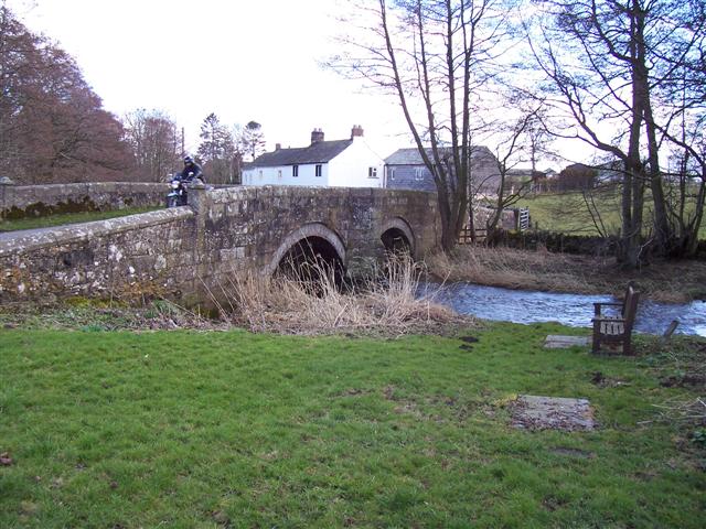
Blencow, Little, Cumberland is a small village located in the Eden district of Cumbria, England. Situated in the picturesque Lake District National Park, this rural settlement offers stunning natural beauty and a peaceful atmosphere.

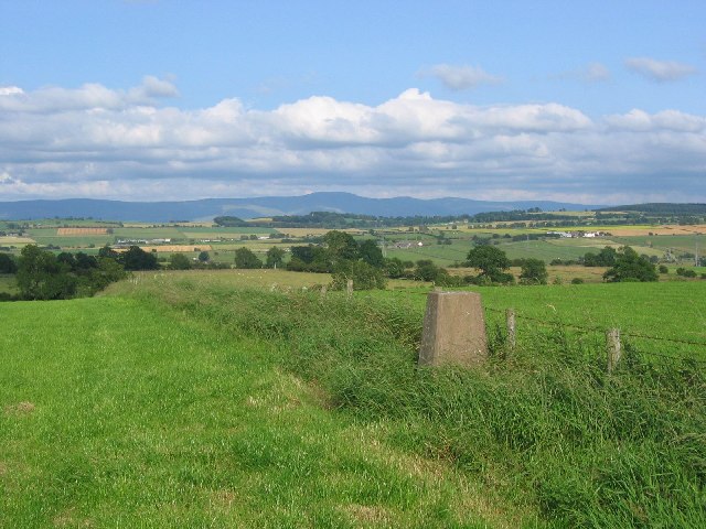
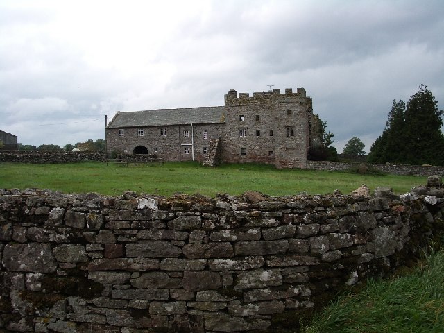
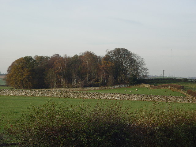
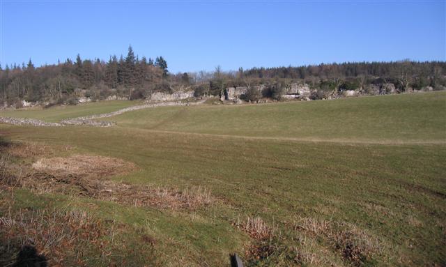
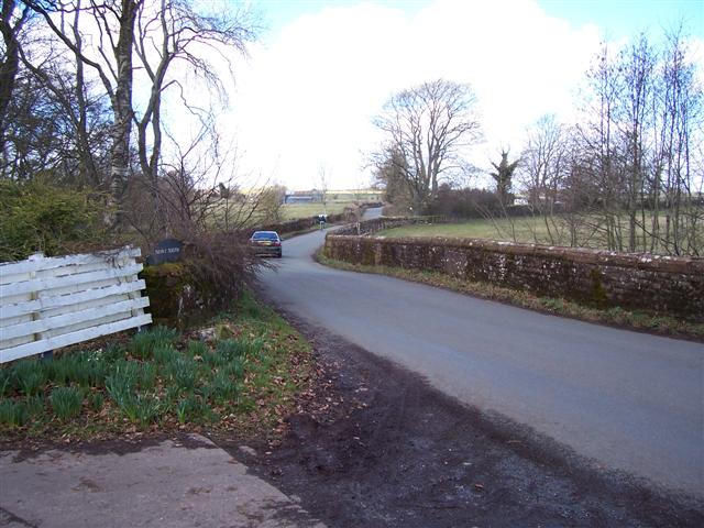
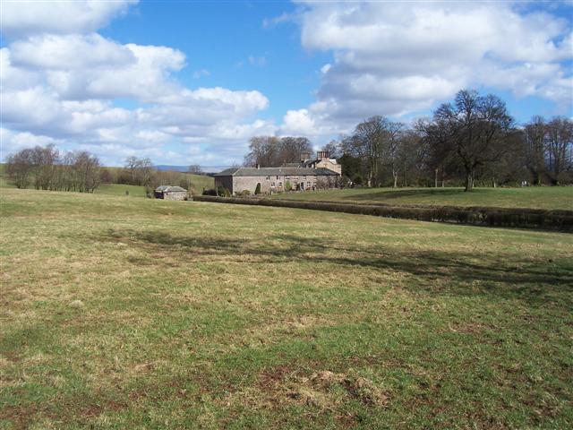
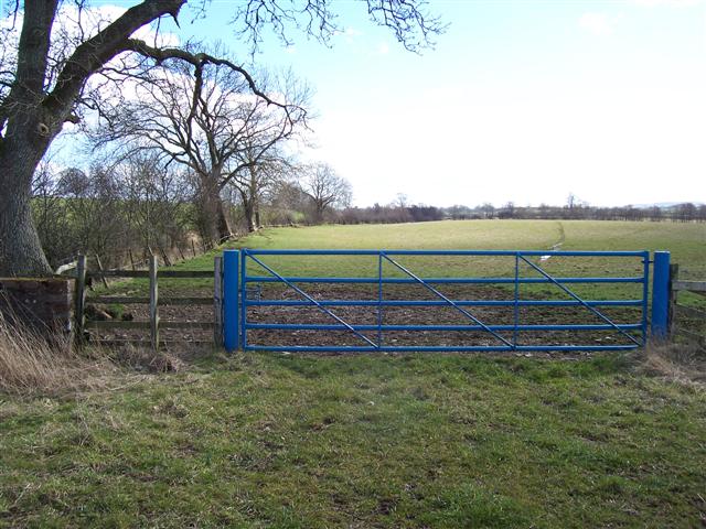
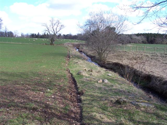
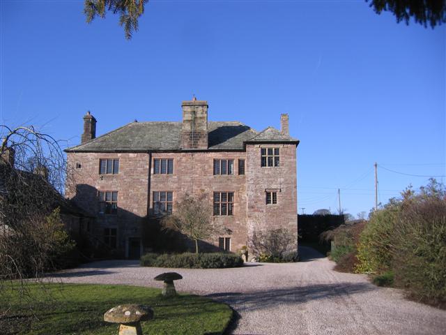
With a population of around 200 residents, Blencow is known for its idyllic countryside views and charming traditional stone houses. The village is surrounded by rolling hills, verdant farmland, and scenic woodlands, making it an ideal destination for nature lovers and outdoor enthusiasts.

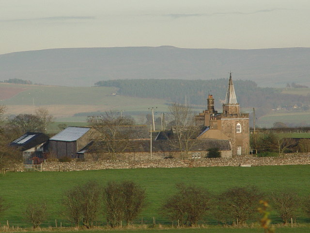
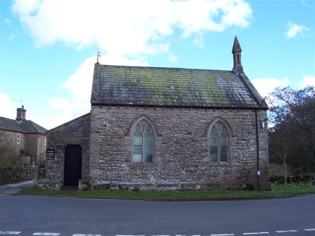
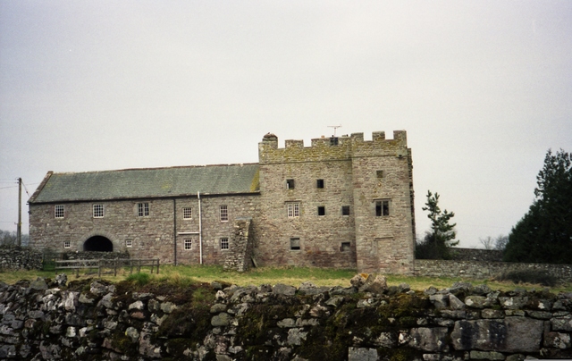
Blencow is home to a 17th-century church, St. Kentigern's, which is a prominent landmark in the area. The church features an impressive tower and is known for its beautiful stained glass windows and historic architecture.

Although Blencow is a small village, it has a strong sense of community and offers basic amenities to its residents. There is a local pub, The Shepherd's Inn, which serves as a meeting place for locals and visitors alike. The village also has a primary school, providing education for young children in the area.

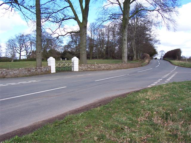
Blencow is conveniently located near the M6 motorway, providing easy access to larger towns and cities in the region. The village serves as a peaceful retreat for those looking to escape the hustle and bustle of urban life while still having access to modern conveniences.

Overall, Blencow, Little, Cumberland offers a tranquil and picturesque setting, making it an attractive destination for both residents and visitors seeking to experience the beauty of the English countryside.

If you have any feedback on the listing, please let us know in the comments section below.

Blencow, Little Images

Images are sourced within 2km of 54.687761/-2.845397 or Grid Reference NY4532. Thanks to Geograph Open Source API. All images are credited.

High Dykes View eastward across the Vale of Eden to Cross Fell.
High Dykes
View eastward across the Vale of Eden to Cross Fell.
Blencow Hall nr Penrith
Fort Putnam, Greystoke
Spire House, near Greystoke
Farmland near Greystoke
Limestone outcrop near Johnby. Fertile land in this the eden valley but every now and then the rock pops up out of the ground but the trees don't seem to mind at all.
Limestone outcrop near Johnby.
Fertile land in this the eden valley but every now and then the rock pops up out of the ground but the trees don't seem to mind at all.
Beck Bridge at Townend. laithes showing in the distance and road junction off to the right just past the cyclist.
Beck Bridge at Townend.
laithes showing in the distance and road junction off to the right just past the cyclist.
Beck and Bridge at Townend. The building you can see through the trees is on the footpath.
Beck and Bridge at Townend.
The building you can see through the trees is on the footpath.
River bridge at Great Blencow. A misleading picture as it was a really nice sunny day just right for the motor cyclist.
River bridge at Great Blencow.
A misleading picture as it was a really nice sunny day just right for the motor cyclist.
Blencow Methodist Church A church right on the roadside at the road junction tends to indicate an old site. The church has 1877 on it.
Blencow Methodist Church
A church right on the roadside at the road junction tends to indicate an old site. The church has 1877 on it.
The Laithes cross roads entrance. The Laithes lies through the second pair of white posts and uses another entrance, presumably on the grounds of safety.
The Laithes cross roads entrance.
The Laithes lies through the second pair of white posts and uses another entrance, presumably on the grounds of safety.
The Laithes.
The Laithes.
Blue gate and beck. The colour will be significant to the estate denoting all the fields that are theirs and the small beck is on the left with a lot of growth forming a hedge.
Blue gate and beck.
The colour will be significant to the estate denoting all the fields that are theirs and the small beck is on the left with a lot of growth forming a hedge.
Do not plough too near the beck! A fairly sandy soil in this area prevents the farmers from cultivating too close or the water will undermine the field.
Do not plough too near the beck!
A fairly sandy soil in this area prevents the farmers from cultivating too close or the water will undermine the field.
Fowrass. A recently rebuilt farmhouse.
Fowrass.
A recently rebuilt farmhouse.
Fowrass farm. A large spread of buildings well hidden from the main road by a hollow.
Fowrass farm.
A large spread of buildings well hidden from the main road by a hollow.
Auldby Farm. Private and no parking may be to help in the fight against disease.
Auldby Farm.
Private and no parking may be to help in the fight against disease.
Old farm track This track leads off the Little Blencow - Lamonby road towards Auldby.
Old farm track
This track leads off the Little Blencow - Lamonby road towards Auldby.
Show me another place!

Blencow, Little is located at Grid Ref: NY4532 (Lat: 54.687761, Lng: -2.845397)

Administrative County: Cumbria

District: Eden

Police Authority: Cumbria

What 3 Words

///historic.ringers.protest. Near Penrith, Cumbria

Related Wikis

Nearby Amenities

Located within 500m of 54.687761,-2.845397
Little Blencow
Alt Name: Little Blencowe
Place: village
Source: npe
Lat/Long: 54.6873471/-2.849855
Village Green
Naptan AtcoCode: 090074261846
Naptan Bearing: W
Naptan BusStopType: CUS
Naptan CommonName: Village Green
Naptan Indicator: opp
Naptan Landmark: Methodist Church
Naptan NaptanCode: cumdajaw
Naptan Street: No name
Naptan Verified: no
Source: naptan_import
Lat/Long: 54.687054/-2.8492394
Post Box
Ref: CA11 167
Source: survey
Lat/Long: 54.6872156/-2.8491876
Generator Method: photovoltaic
Generator Output Electricity: yes
Generator Source: solar
Generator Type: solar_photovoltaic_panel
Location: roof
Power: generator
Lat/Long: 54.6867494/-2.8498026
Generator Method: photovoltaic
Generator Output Electricity: yes
Generator Source: solar
Generator Type: solar_photovoltaic_panel
Location: roof
Power: generator
Lat/Long: 54.6875076/-2.8506127
Power: pole
Lat/Long: 54.6910138/-2.8484511
Power: pole
Lat/Long: 54.6904528/-2.8470752
Power: pole
Lat/Long: 54.689951/-2.8458343
Power: pole
Lat/Long: 54.6894541/-2.8445933
Power: pole
Lat/Long: 54.688787/-2.8429273
Power: pole
Lat/Long: 54.6881074/-2.8411536
Power: pole
Lat/Long: 54.6874219/-2.83952
Power: pole
Lat/Long: 54.6900392/-2.8438355
Power: pole
Lat/Long: 54.6906957/-2.8430074
Power: pole
Lat/Long: 54.6914476/-2.8420167
Power: pole
Lat/Long: 54.6873106/-2.8423745
Power: pole
Lat/Long: 54.686534/-2.8435678
Power: pole
Lat/Long: 54.6860062/-2.8444359
Power: pole
Lat/Long: 54.6855015/-2.8452014
Power: pole
Lat/Long: 54.6859238/-2.8433952
Power: pole
Lat/Long: 54.6849057/-2.8430574
Power: pole
Lat/Long: 54.6838818/-2.8427172
Power: pole
Lat/Long: 54.69034/-2.8493967
Power: pole
Lat/Long: 54.6896734/-2.8502948
Power: pole
Lat/Long: 54.689014/-2.8511929
Power: pole
Lat/Long: 54.6883445/-2.8521286
Power: pole
Lat/Long: 54.6879136/-2.8527215
Power: pole
Lat/Long: 54.6875926/-2.8531568
The data included in this document is from www.openstreetmap.org. The data is made available under ODbL.

Have you been to Blencow, Little?

Leave your review of Blencow, Little below (or comments, questions and feedback).