Blakenham, Little

Settlement in Suffolk Mid Suffolk

England

Blakenham, Little

The road divides at Nettlestead
The road divides at Nettlestead Credit: Adrian S Pye

Blakenham, Little is a small village located in the county of Suffolk, in the eastern part of England. Situated about 8 miles north of Ipswich, the village is nestled amidst the picturesque countryside, offering residents and visitors a tranquil and idyllic setting.

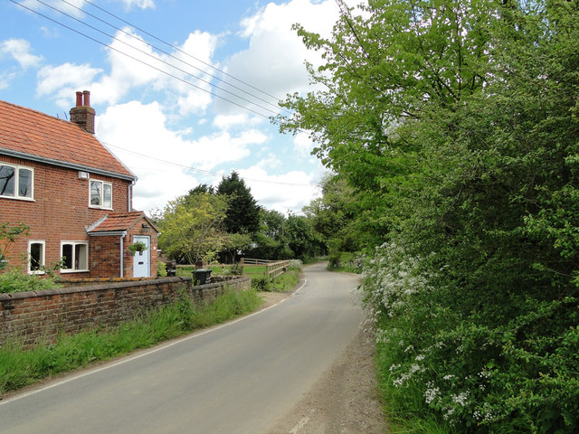
The village of Blakenham, Little is known for its charming and traditional English architecture, with many of its buildings dating back several centuries. The village is primarily residential, with a small population of around 200 residents. The community in Blakenham, Little is close-knit, and there is a strong sense of community spirit among its inhabitants.

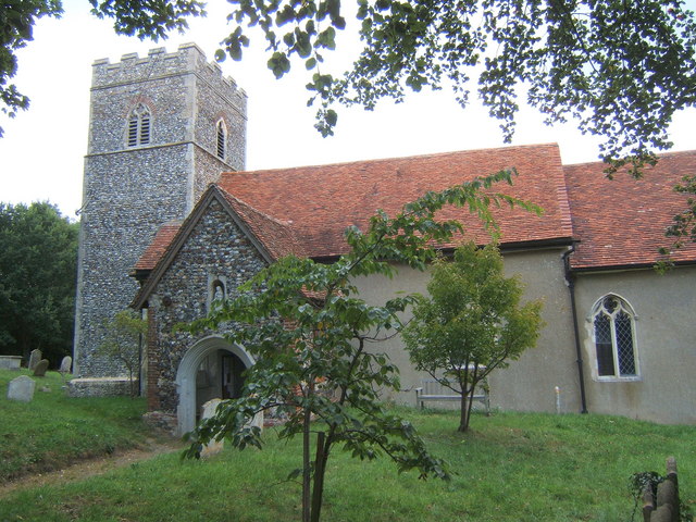
Although small in size, Blakenham, Little offers a range of amenities to cater to the needs of its residents. These include a village hall, a local pub, and a small convenience store. The village is also home to a church, which serves as a focal point for religious and community events.

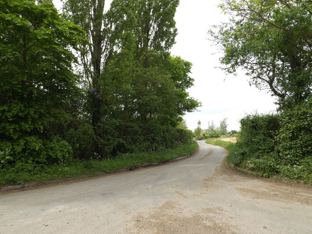
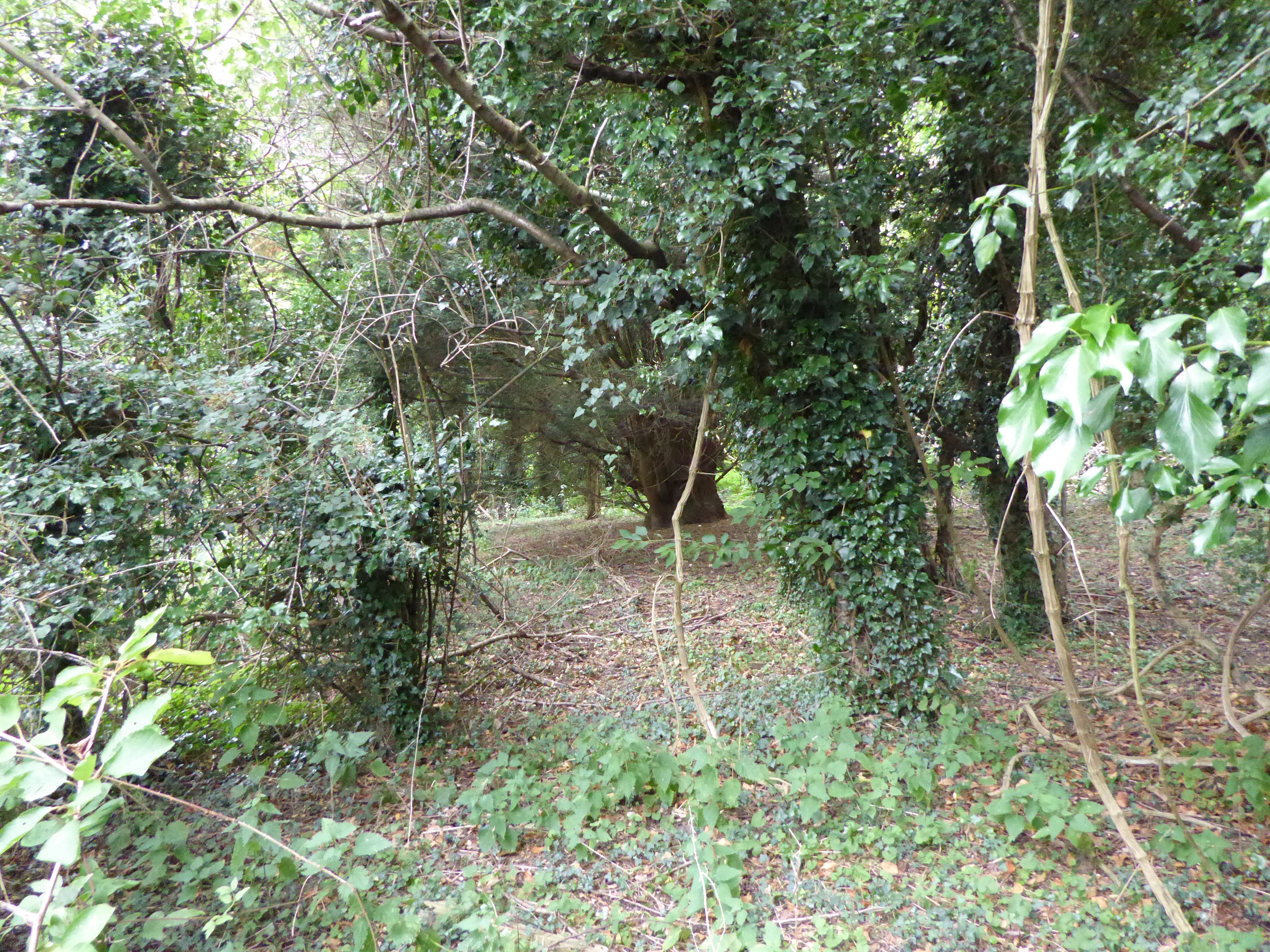
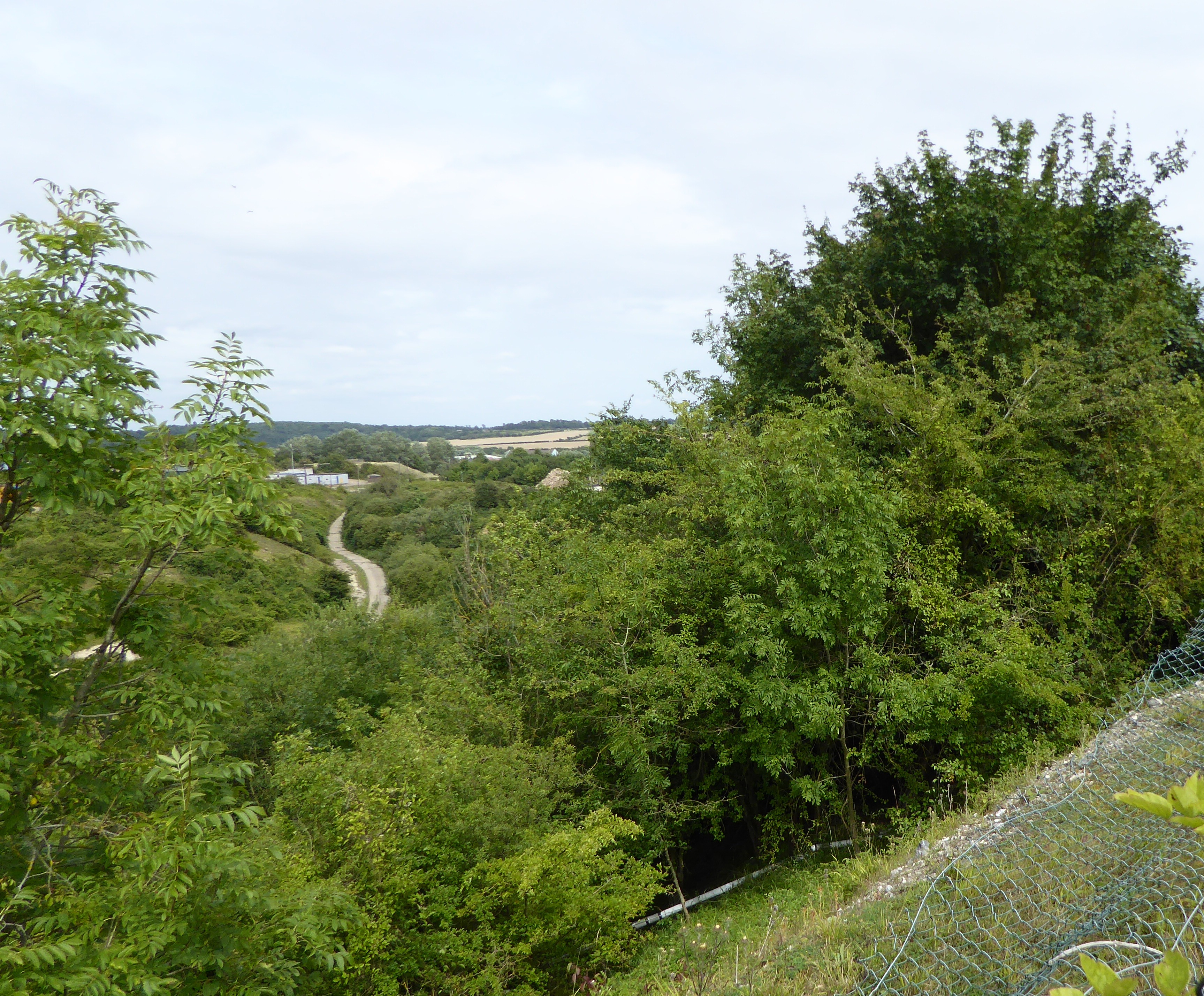
Blakenham, Little is surrounded by beautiful countryside, making it an attractive destination for nature lovers and outdoor enthusiasts. There are several walking and cycling trails in the vicinity, allowing visitors to explore the stunning landscapes and enjoy the peaceful atmosphere.

Overall, Blakenham, Little is a charming and picturesque village in Suffolk, offering a peaceful and welcoming environment for residents and visitors alike. Its natural beauty and sense of community make it a delightful place to live or to spend time exploring.

If you have any feedback on the listing, please let us know in the comments section below.

Blakenham, Little Images

Images are sourced within 2km of 52.096558/1.075002 or Grid Reference TM1048. Thanks to Geograph Open Source API. All images are credited.

The road divides at Nettlestead
Tree-lined footpath to The Elms
Houses on Tye Lane
Houses on Tye Lane
Tye Lane, Flowton
Tye Lane, Flowton
Nettlestead War Memorial Only three men were lost in both Wars.
Nettlestead War Memorial
Only three men were lost in both Wars.
Ordnance Survey Flush Bracket S8107 This can be found on the wall of the school in Somersham.
For more detail see : <span class="nowrap"><a title="http://www.bench-marks.org.uk/bm12640" rel="nofollow ugc noopener" href="http://www.bench-marks.org.uk/bm12640">Link</a><img style="margin-left:2px;" alt="External link" title="External link - shift click to open in new window" src="https://s1.geograph.org.uk/img/external.png" width="10" height="10"/></span>
Ordnance Survey Flush Bracket S8107
This can be found on the wall of the school in Somersham. For more detail see : LinkExternal link
The Church of St Mary at Somersham Viewed from the south.
The Church of St Mary at Somersham
Viewed from the south.
Ordnance Survey Cut Mark This can be found on the wall of St Mary's Church in Somersham.
For more detail see : <span class="nowrap"><a title="http://www.bench-marks.org.uk/bm30973" rel="nofollow ugc noopener" href="http://www.bench-marks.org.uk/bm30973">Link</a><img style="margin-left:2px;" alt="External link" title="External link - shift click to open in new window" src="https://s1.geograph.org.uk/img/external.png" width="10" height="10"/></span>
Ordnance Survey Cut Mark
This can be found on the wall of St Mary's Church in Somersham. For more detail see : LinkExternal link
War Memorials at Somersham In Honour of those who served and in Memory of those who fell. 

NORFOLK - <a title="https://www.geograph.org.uk/article/War-Memorials-in-Norfolk" href="https://www.geograph.org.uk/article/War-Memorials-in-Norfolk">Link</a>
SUFFOLK - <a title="https://www.geograph.org.uk/article/War-Memorials-in-Suffolk" href="https://www.geograph.org.uk/article/War-Memorials-in-Suffolk">Link</a>
War Memorials at Somersham
In Honour of those who served and in Memory of those who fell. NORFOLK - Link SUFFOLK - Link
Nettlestead Road, Nettlestead At the junction with The Lane
Nettlestead Road, Nettlestead
At the junction with The Lane
Roadsign on Nettlestead Road At the junction with The Lane
Roadsign on Nettlestead Road
At the junction with The Lane
The Lane, Nettlestead At the junction with Nettlestead Road
The Lane, Nettlestead
At the junction with Nettlestead Road
Nettlestead Road, Nettlestead At the junction with The Lane
Nettlestead Road, Nettlestead
At the junction with The Lane
Nettlestead Road, Nettlestead At the junction with The Lane
Nettlestead Road, Nettlestead
At the junction with The Lane
The Lane, Nettlestead At the junction with Nettlestead Road
The Lane, Nettlestead
At the junction with Nettlestead Road
Nettlestead Road, Nettlestead At the junction with Hall Lane
Nettlestead Road, Nettlestead
At the junction with Hall Lane
Hall Lane, Nettlestead T the junction with Nettlestead Road
Hall Lane, Nettlestead
T the junction with Nettlestead Road
Roadsign on Nettlestead Road At the junction with Hall Lane
Roadsign on Nettlestead Road
At the junction with Hall Lane
Show me another place!

Blakenham, Little is located at Grid Ref: TM1048 (Lat: 52.096558, Lng: 1.075002)

Administrative County: Suffolk

District: Mid Suffolk

Police Authority: Suffolk

What 3 Words

///awkward.tissue.thus. Near Bramford, Suffolk

Related Wikis

Little Blakenham

Little Blakenham is a village and civil parish in the Mid Suffolk district of Suffolk in eastern England. Located around two miles north-west of Ipswich...

Little Blakenham Pit

Little Blakenham Pit is a 3.4-hectare (8.4-acre) biological Site of Special Scientific Interest in Little Blakenham in Suffolk. A 127 metre long tunnel...

Great Blakenham Pit

Great Blakenham Pit is a 2.2-hectare (5.4-acre) geological Site of Special Scientific Interest south of Great Blakenham in Suffolk. It is a Geological...

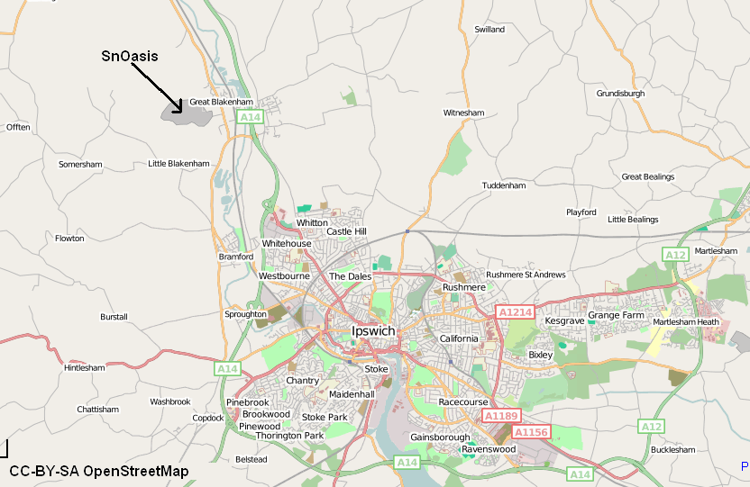
Valley Ridge (Winter sports resort)

Valley Ridge (formerly known as SnOasis) was a proposed ski and sports resort in Great Blakenham near Ipswich, Suffolk, England. In March 2021, the plan...

Nearby Amenities

Located within 500m of 52.096558,1.075002
Little Blakenham
Place: village
Wikidata: Q2170278
Wikipedia: en:Little Blakenham
Lat/Long: 52.0972212/1.0749915
Power: tower
Lat/Long: 52.0939593/1.0723762
Power: tower
Lat/Long: 52.0968623/1.0701219
Power: tower
Lat/Long: 52.0985994/1.0687884
Bus Stop
The Beeches
Local Ref: adj
Naptan AtcoCode: 390040321
Naptan Bearing: E
Naptan CommonName: Red House
Naptan Landmark: Red House
Naptan NaptanCode: sufawmtw
Naptan Street: Leather Bottle Hill
Naptan Verified: no
Public Transport: platform
Source: naptan_import
Lat/Long: 52.0965509/1.0768583
Bus Stop
The Beeches
Local Ref: opp
Naptan AtcoCode: 390040322
Naptan Bearing: W
Naptan BusStopType: CUS
Naptan CommonName: Red House
Naptan Landmark: Red House
Naptan NaptanCode: sufawmwa
Naptan Street: Leather Bottle Hill
Naptan Verified: no
Public Transport: platform
Source: naptan_import
Lat/Long: 52.0965154/1.0765667
Power: pole
Lat/Long: 52.0946788/1.0729705
Power: pole
Lat/Long: 52.0950725/1.0695791
Power: pole
Lat/Long: 52.0926781/1.0780655
Power: pole
Lat/Long: 52.0944687/1.0748815
Power: pole
Lat/Long: 52.0948583/1.0714057
Power: pole
Lat/Long: 52.0932666/1.0770191
Power: pole
Lat/Long: 52.0938776/1.0759325
Public Bookcase
Booth: K6
Disused Amenity: telephone
Man Made: telephone_box
Public Bookcase Type: phone_box
Lat/Long: 52.0970923/1.073038
Post Box
Operator: Openreach
Post Box Mounting: pier
Post Box Type: lamp
Ref: IP8 1027
Royal Cypher: EIIR
Lat/Long: 52.0971104/1.0729978
The data included in this document is from www.openstreetmap.org. The data is made available under ODbL.

Have you been to Blakenham, Little?

Leave your review of Blakenham, Little below (or comments, questions and feedback).