Eilean Naomhachd

Island in Argyllshire

Scotland

Eilean Naomhachd

Sound of Jura Point of Knap with Jura in the distance
Sound of Jura Credit: Ceri

Eilean Naomhachd, also known as the Island of Sanctity, is a small island located in Argyllshire, Scotland. The island is known for its tranquil and picturesque surroundings, making it a popular destination for those seeking a peaceful retreat.

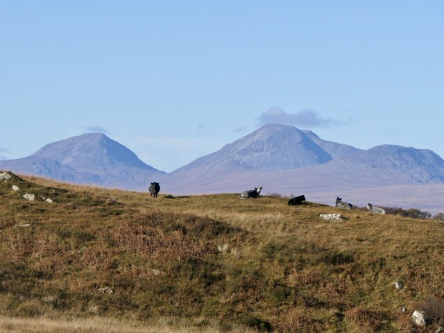
Eilean Naomhachd is uninhabited, with no permanent residents, and is only accessible by boat. The island is home to a variety of wildlife, including seabirds and seals, making it a popular spot for birdwatching and wildlife enthusiasts.

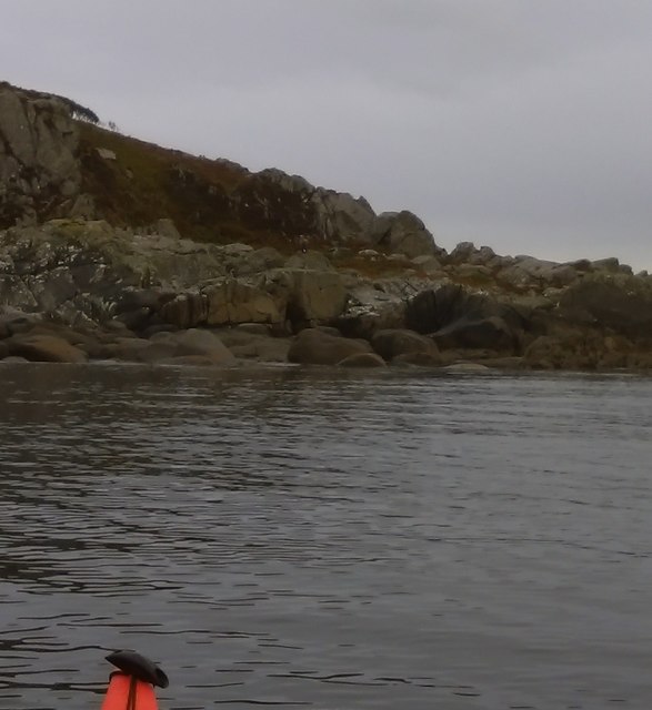
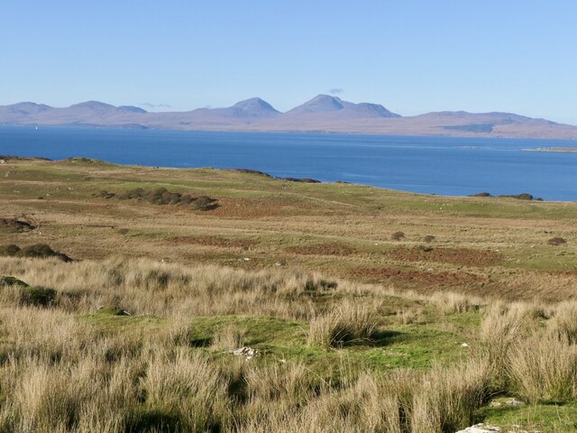
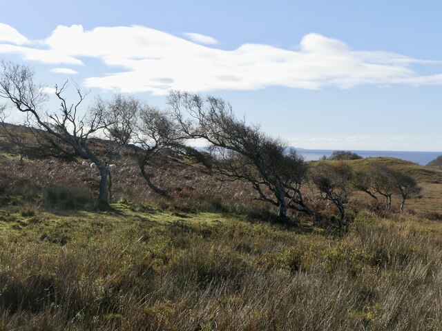
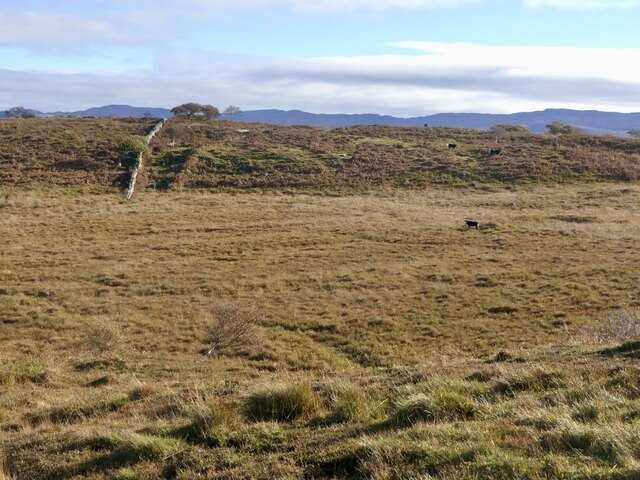
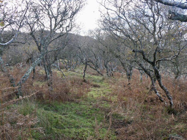
The landscape of Eilean Naomhachd is dominated by rugged cliffs and rocky shores, offering stunning views of the surrounding sea and nearby islands. The island is also home to a number of ancient ruins, including the remains of a chapel and burial ground, which are believed to date back to the early Christian period.

Visitors to Eilean Naomhachd can enjoy hiking and exploring the island's natural beauty, as well as taking in the historic sites that dot the landscape. Overall, Eilean Naomhachd is a peaceful and idyllic island retreat, perfect for those looking to escape the hustle and bustle of everyday life.

If you have any feedback on the listing, please let us know in the comments section below.

Eilean Naomhachd Images

Images are sourced within 2km of 55.896508/-5.6899992 or Grid Reference NR6973. Thanks to Geograph Open Source API. All images are credited.

Sound of Jura Point of Knap with Jura in the distance
Sound of Jura
Point of Knap with Jura in the distance
Camouflaged Sea Eagle at the Point of Knap More used to seeing seagulls on the rocky shoreline on the Point of Knap, I was a bit surprised to see a Sea Eagle perched on a boulder. The birds plumage blending well with its surroundings with only a white tail giving it away (can you spot it?)
Camouflaged Sea Eagle at the Point of Knap
More used to seeing seagulls on the rocky shoreline on the Point of Knap, I was a bit surprised to see a Sea Eagle perched on a boulder. The birds plumage blending well with its surroundings with only a white tail giving it away (can you spot it?)
Small Islets North of the Point of Knap Gigha is seen on the horizon as we paddle through the small Islets inshore of Eilean Naomhachd heading for the Point of Knap.
Small Islets North of the Point of Knap
Gigha is seen on the horizon as we paddle through the small Islets inshore of Eilean Naomhachd heading for the Point of Knap.
Minor road near Kilmory
Rough grazing land near Balimore
Ruin, Balimore Balimore was a township at what is now the end of the Kilmory public road. There is now just one modern building.
Ruin, Balimore
Balimore was a township at what is now the end of the Kilmory public road. There is now just one modern building.
Road to Ellary The private section of the road around the north of Knapdale. Taken from the public road end at Balimore.
Road to Ellary
The private section of the road around the north of Knapdale. Taken from the public road end at Balimore.
Waterlogged road, Balimore An old road which served the glen around Muilean Eiteag which is marked as a disused mill on 1890s maps.  The road is very waterlogged with mud and deep puddles.
Waterlogged road, Balimore
An old road which served the glen around Muilean Eiteag which is marked as a disused mill on 1890s maps. The road is very waterlogged with mud and deep puddles.
Track to Muileann Eiteag An old road which served the glen around Muilean Eiteag which is marked as a disused mill on 1890s maps.  The road is very waterlogged with mud and deep puddles.
Track to Muileann Eiteag
An old road which served the glen around Muilean Eiteag which is marked as a disused mill on 1890s maps. The road is very waterlogged with mud and deep puddles.
Druim Fuar, Balimore Above the road to Ellary.
Druim Fuar, Balimore
Above the road to Ellary.
Cnoc Mòine, summit
Cnoc Mòine, summit
Inland view from Cnoc Mòine A big unforested bit of Knapdale.
Inland view from Cnoc Mòine
A big unforested bit of Knapdale.
Rough pasture, Balimore Grazed by cattle.
Rough pasture, Balimore
Grazed by cattle.
Cnoc Mòine View along the ridge towards Point of Knap.
Cnoc Mòine
View along the ridge towards Point of Knap.
Wind shaped birches near Point of Knap
Cattle near Balimore Rough grazing with the Paps of Jura beyond. The wisp of cloud is a sign of more humid air, cloud cover appeared not long after this was taken.
Cattle near Balimore
Rough grazing with the Paps of Jura beyond. The wisp of cloud is a sign of more humid air, cloud cover appeared not long after this was taken.
Boggy grassland, Point of Knap Grazed by cattle.
Boggy grassland, Point of Knap
Grazed by cattle.
Birchwood, Point of Knap
Show me another place!

Eilean Naomhachd is located at Grid Ref: NR6973 (Lat: 55.896508, Lng: -5.6899992)

Unitary Authority: Argyll and Bute

Police Authority: Argyll and West Dunbartonshire

What 3 Words

///syndicate.walked.blip. Near Tarbert, Argyll & Bute

Related Wikis

Kilmory Knap Chapel

Kilmory Knap Chapel is a 13th-century Christian chapel, located at the tiny hamlet of Kilmory, in Knapdale, Argyll and Bute, on the west coast of Scotland...

Kilmory, Knapdale

Kilmory (Scottish Gaelic: Cill Mhoire) is a hamlet in the civil parish of South Knapdale, on Knapdale, Argyll and Bute, Scotland. It is situated near the...

Eilean Mòr, MacCormaig Isles

Eilean Mòr ("Big Isle") is one of the MacCormaig Isles situated near the entrance to Loch Sween in the Sound of Jura, Argyll and Bute, Scotland. Eilean...

Druimdrishaig

Druimdrishaig is a hamlet in Argyll and Bute, Scotland, on the shore of Loch Caolisport. == References ==

Have you been to Eilean Naomhachd?

Leave your review of Eilean Naomhachd below (or comments, questions and feedback).