An Glas-eilean

Island in Inverness-shire

Scotland

An Glas-eilean

Raised beach inland from Camas Ghaoideil Flat farm land is the location of a fossil raised beach inland from Camas Ghaoideil
Raised beach inland from Camas Ghaoideil Credit: Simon Wellings

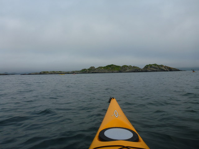
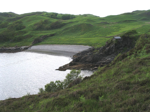
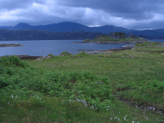
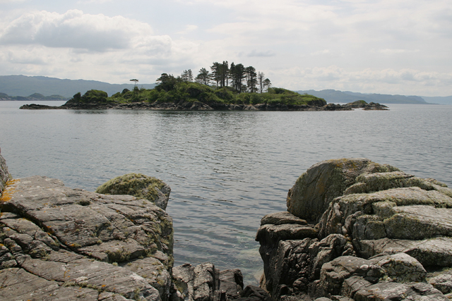
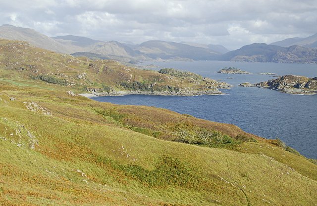
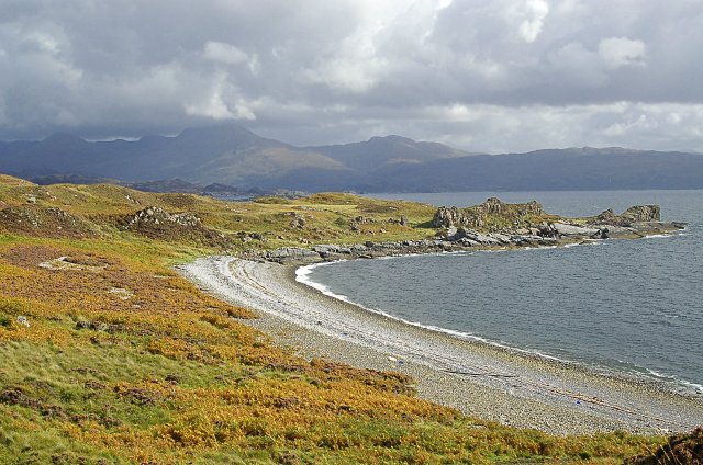
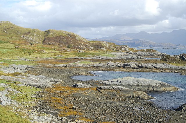
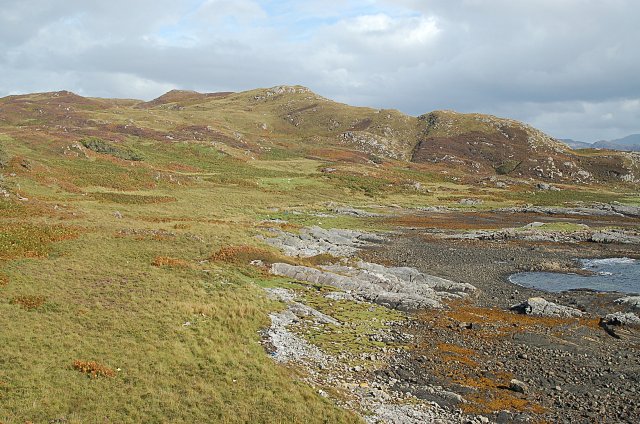
An Glas-eilean, also known as Green Isle, is a small, uninhabited island located off the coast of Inverness-shire in Scotland. The island is part of the Inner Hebrides archipelago and measures approximately 1.5 hectares in size.

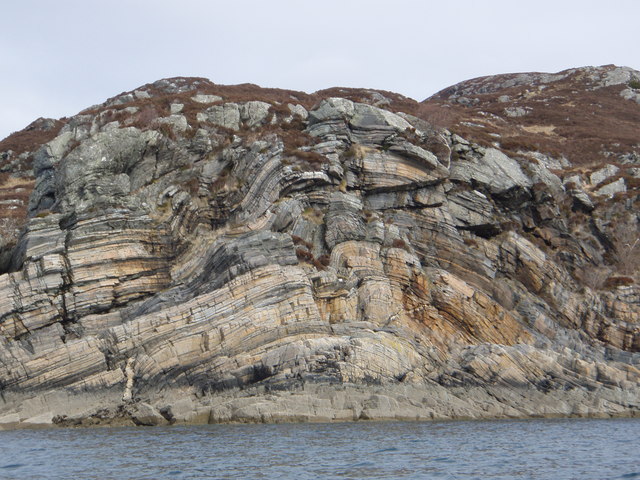
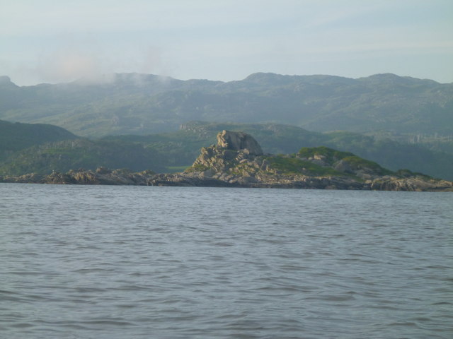
An Glas-eilean is characterized by its rugged coastline, rocky cliffs, and lush green vegetation, which gives the island its name. The island is home to a variety of seabirds, including gulls, puffins, and cormorants, making it a popular spot for birdwatching.

Access to An Glas-eilean is limited, with no regular ferry service to the island. However, visitors can reach the island by private boat or kayak, weather permitting. The island offers stunning views of the surrounding waters and nearby islands, making it a popular destination for photographers and nature enthusiasts.

Overall, An Glas-eilean is a peaceful and secluded spot, perfect for those looking to escape the hustle and bustle of daily life and immerse themselves in the beauty of Scotland's natural landscapes.

If you have any feedback on the listing, please let us know in the comments section below.

An Glas-eilean Images

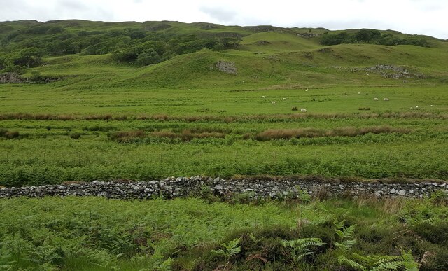
Images are sourced within 2km of 56.87471/-5.8305462 or Grid Reference NM6682. Thanks to Geograph Open Source API. All images are credited.

Raised beach inland from Camas Ghaoideil Flat farm land is the location of a fossil raised beach inland from Camas Ghaoideil
Raised beach inland from Camas Ghaoideil
Flat farm land is the location of a fossil raised beach inland from Camas Ghaoideil
Rock Formations Rock formations taken at the narrows between An Garbh eilean and the mainland.
Rock Formations
Rock formations taken at the narrows between An Garbh eilean and the mainland.
An Glas-eilean A short paddle from Druimindarroch, quite difficult to land.
An Glas-eilean
A short paddle from Druimindarroch, quite difficult to land.
Eilean an Sgurra Interesting rock formations
Eilean an Sgurra
Interesting rock formations
Cragtop Hut The building marked on the map at Camus Ghaoideil is perched atop a narrow rocky spur.
Cragtop Hut
The building marked on the map at Camus Ghaoideil is perched atop a narrow rocky spur.
Eilean nan Cabar Taken from the mainland, this image shows that Eilean nan Cabar, safe from grazing sheep, has a significant number of trees on it, although you would never guess this from the bleak 1:50000 OS map representation.
Eilean nan Cabar
Taken from the mainland, this image shows that Eilean nan Cabar, safe from grazing sheep, has a significant number of trees on it, although you would never guess this from the bleak 1:50000 OS map representation.
Eilean nan Cabar The view of Eilean nan Cabar from the southern tip of Rubh Aird Mhoir.
Eilean nan Cabar
The view of Eilean nan Cabar from the southern tip of Rubh Aird Mhoir.
Car an Daimh A small tidal island in the south facing bay. Tidal grasses have almost made the connection with the shore and soon the island will only be an island on the highest tides due to the rapidly rising land. An Stac and Rois Bheinn in the far distance.
Car an Daimh
A small tidal island in the south facing bay. Tidal grasses have almost made the connection with the shore and soon the island will only be an island on the highest tides due to the rapidly rising land. An Stac and Rois Bheinn in the far distance.
Camus Ghaoideil Looking east from the slopes of Doire Fhada towards Ghaoideil. Fairly typical ground cover for this area Bracken, heathers rough grass and scrub oaks where the sheep can't get at them.
Camus Ghaoideil
Looking east from the slopes of Doire Fhada towards Ghaoideil. Fairly typical ground cover for this area Bracken, heathers rough grass and scrub oaks where the sheep can't get at them.
Dubh Loch ground This flat area was once a lochan. Over time it has been back filled by nature although in places it is still just a skim of vegetation floating on black oily peaty water. The finest examples move as you walk across them but this one was fairly tame.
Dubh Loch ground
This flat area was once a lochan. Over time it has been back filled by nature although in places it is still just a skim of vegetation floating on black oily peaty water. The finest examples move as you walk across them but this one was fairly tame.
Camas Leathann from the west The eastern half of the bay with the Roishven hills under cloud.

The shingle extends right up under the vegetation almost to the left edge of the photo.

This demonstrates just how much the land has risen in a short space of time geologically speaking.
Camas Leathann from the west
The eastern half of the bay with the Roishven hills under cloud. The shingle extends right up under the vegetation almost to the left edge of the photo. This demonstrates just how much the land has risen in a short space of time geologically speaking.
East shore, Camas Leathann On the very edge of the grid and the line almost seems to be marked on the ground by this volcanic dyke like rock feature ( more obvious in <a href="https://www.geograph.org.uk/photo/561124">NM6483 : Camas Leathann from the west</a> ) running at 90deg to the shoreline.
East shore, Camas Leathann
On the very edge of the grid and the line almost seems to be marked on the ground by this volcanic dyke like rock feature ( more obvious in NM6483 : Camas Leathann from the west ) running at 90deg to the shoreline.
Car an Daimh bay The bay with the southern slopes of Doire Fhada.
Car an Daimh bay
The bay with the southern slopes of Doire Fhada.
Above Car an Daimh bay Above Car an Daimh bay

Shoreline and the ground above the bay. At one time this area supported several families and livestock.
Above Car an Daimh bay
Above Car an Daimh bay Shoreline and the ground above the bay. At one time this area supported several families and livestock.
Croft house ruin Tucked in under the hillside giving it protection from all directions except southerlies and beside running water it has just about an ideal stance above the bay. The rounded corners seem to be a feature of this area.
Croft house ruin
Tucked in under the hillside giving it protection from all directions except southerlies and beside running water it has just about an ideal stance above the bay. The rounded corners seem to be a feature of this area.
Car an Daimh bay From the shoulder of Doire Fhada
Car an Daimh bay
From the shoulder of Doire Fhada
Rough grazers Five cattle beasts and around a dozen Red Deer on the western side of Doire Fhada. 

The cattle are this side of the grid line with the stags on the other side. 

I wondered at the time why the deer didn't run but I met up the reason later. Two ladies climbing the gully on the other side of the ridge line towards their position.
Rough grazers
Five cattle beasts and around a dozen Red Deer on the western side of Doire Fhada. The cattle are this side of the grid line with the stags on the other side. I wondered at the time why the deer didn't run but I met up the reason later. Two ladies climbing the gully on the other side of the ridge line towards their position.
Show me another place!

An Glas-eilean is located at Grid Ref: NM6682 (Lat: 56.87471, Lng: -5.8305462)

Unitary Authority: Highland

Police Authority: Highlands and Islands

What 3 Words

///conducted.inflates.blending. Near Arisaig, Highland

Nearby Locations

An Glas-eilean

Related Wikis

Druimindarroch

Druimindarroch (Scottish Gaelic: Druim nan Darach) is a small settlement which lies on the north coast of Loch nan Uamh in Lochaber, Scottish Highlands...

Rhu Peninsula

Rhu Peninsula (Scottish Gaelic: Rudha Arasaig) and originally known as the Rhu Arisaig peninsula is a small, remote and largely deserted peninsula, at...

Sound of Arisaig

The Sound of Arisaig Lochaber, Scotland, separates the Arisaig peninsula to the north from the Moidart peninsula to the south. At the eastern, landward...

Prince Charlie's Cave

There are many Prince Charlies Caves in the Highlands, caves where Charles Edward Stuart was said to have sheltered when on the run from the Duke of Cumberland...

Nearby Amenities

Located within 500m of 56.87471,-5.8305462
Created By: dmgroom_coastlines
Source: PGS
Lat/Long: 56.874394/-5.832519
Created By: dmgroom_coastlines
Source: PGS
Lat/Long: 56.874661/-5.832071
Created By: dmgroom_coastlines
Source: PGS
Lat/Long: 56.875177/-5.831876
Created By: dmgroom_coastlines
Source: PGS
Lat/Long: 56.87522/-5.830008
Created By: dmgroom_coastlines
Source: PGS
Lat/Long: 56.875731/-5.830046
Created By: dmgroom_coastlines
Source: PGS
Lat/Long: 56.87589/-5.828655
Created By: dmgroom_coastlines
Source: PGS
Lat/Long: 56.876123/-5.827898
Created By: dmgroom_coastlines
Source: PGS
Lat/Long: 56.876295/-5.82775
Created By: dmgroom_coastlines
Source: PGS
Lat/Long: 56.876433/-5.827292
Created By: dmgroom_coastlines
Source: PGS
Lat/Long: 56.87671/-5.826378
Created By: dmgroom_coastlines
Source: PGS
Lat/Long: 56.876977/-5.82593
Created By: dmgroom_coastlines
Source: PGS
Lat/Long: 56.877243/-5.825482
Created By: dmgroom_coastlines
Source: PGS
Lat/Long: 56.877509/-5.825035
Created By: dmgroom_coastlines
Source: PGS
Lat/Long: 56.877147/-5.824071
Created By: dmgroom_coastlines
Source: PGS
Lat/Long: 56.877137/-5.824538
Created By: dmgroom_coastlines
Source: PGS
Lat/Long: 56.876625/-5.8245
Created By: dmgroom_coastlines
Source: PGS
Lat/Long: 56.876604/-5.825434
Created By: dmgroom_coastlines
Source: PGS
Lat/Long: 56.876093/-5.825395
Created By: dmgroom_coastlines
Source: PGS
Lat/Long: 56.876209/-5.825872
Created By: dmgroom_coastlines
Source: PGS
Lat/Long: 56.876199/-5.826339
Created By: dmgroom_coastlines
Source: PGS
Lat/Long: 56.875955/-5.827565
Created By: dmgroom_coastlines
Source: PGS
Lat/Long: 56.875523/-5.827926
Created By: dmgroom_coastlines
Source: PGS
Lat/Long: 56.875389/-5.828149
Created By: dmgroom_coastlines
Source: PGS
Lat/Long: 56.875379/-5.828616
Created By: dmgroom_coastlines
Source: PGS
Lat/Long: 56.875368/-5.829083
Created By: dmgroom_coastlines
Source: PGS
Lat/Long: 56.875236/-5.829308
Created By: dmgroom_coastlines
Source: PGS
Lat/Long: 56.874713/-5.829736
Created By: dmgroom_coastlines
Source: PGS
Lat/Long: 56.874197/-5.82993
Created By: dmgroom_coastlines
Source: PGS
Lat/Long: 56.874047/-5.830855
Created By: dmgroom_coastlines
Source: PGS
Lat/Long: 56.87377/-5.831769
Created By: dmgroom_coastlines
Source: PGS
Lat/Long: 56.873622/-5.832694
The data included in this document is from www.openstreetmap.org. The data is made available under ODbL.

Have you been to An Glas-eilean?

Leave your review of An Glas-eilean below (or comments, questions and feedback).