Benton, Little

Settlement in Northumberland

England

Benton, Little

Allotment Gardens, Clousden Drive, Longbenton
Allotment Gardens, Clousden Drive, Longbenton Credit: Alex McGregor

Benton, Little is a small village located in the county of Northumberland, England. Situated approximately 12 miles north of Newcastle upon Tyne, it falls within the administrative boundaries of the North Tyneside Council. The village is nestled in a picturesque countryside setting, surrounded by rolling hills and lush green fields.

With a population of around 1,500 residents, Benton, Little maintains a close-knit community atmosphere. The village is known for its peaceful and tranquil environment, making it an ideal place for those seeking a retreat from the hustle and bustle of city life.

Despite its small size, Benton, Little offers a range of amenities to its residents. The village is home to a primary school, providing quality education for local children. There is also a local shop and a post office, ensuring that residents have easy access to everyday necessities.

For those seeking recreational activities, Benton, Little boasts several beautiful parks and open spaces. These provide opportunities for leisurely walks, picnics, and enjoying the natural beauty of the surrounding countryside. The village is also within close proximity to the Northumberland coastline, allowing residents to easily access the stunning beaches and coastal attractions.

Transport links in Benton, Little are well-developed, with regular bus services connecting the village to nearby towns and cities. The village also benefits from its close proximity to major road networks, making it easily accessible by car.

In summary, Benton, Little is a charming village in Northumberland, offering a peaceful and idyllic setting for its residents. With its community spirit, amenities, and beautiful surroundings, it is a place that many are proud to call home.

If you have any feedback on the listing, please let us know in the comments section below.

Benton, Little Images

Images are sourced within 2km of 55.007436/-1.570162 or Grid Reference NZ2768. Thanks to Geograph Open Source API. All images are credited.

Allotment Gardens, Clousden Drive, Longbenton
Glebe Villas, Forest Hall Residential area in the northeastern suburbs of Newcastle-upon-Tyne.
Glebe Villas, Forest Hall
Residential area in the northeastern suburbs of Newcastle-upon-Tyne.
Allotments on Clousden Drive, Longbenton One of the many huts is sporting the Union flag. See also <a href="https://www.geograph.org.uk/photo/3767835">NZ2870 : Allotments on Clousden Drive, Longbenton</a>.
Allotments on Clousden Drive, Longbenton
One of the many huts is sporting the Union flag. See also NZ2870 : Allotments on Clousden Drive, Longbenton.
The Junior School, Delaval Road, Forest Hall
Glebe Road, Forest Hall A residential street in Forest Hall on the border between Newcastle and North Tyneside.
Glebe Road, Forest Hall
A residential street in Forest Hall on the border between Newcastle and North Tyneside.
Fir Tree Farm and Quorum Business Park
Footbridge at Longbenton station A long full-circular ramp leads up to the footbridge which crosses the Metro line at Longbenton Station. There is also a flight of steps for those who prefer a more direct approach. A further bridge, accessed by steps only, is sited within the station premises.
Footbridge at Longbenton station
A long full-circular ramp leads up to the footbridge which crosses the Metro line at Longbenton Station. There is also a flight of steps for those who prefer a more direct approach. A further bridge, accessed by steps only, is sited within the station premises.
Neuron e-scooter Public-hire Neuron e-scooters have been on trial in Newcastle since 2020. The scheme has now been extended to 2024. Under revised arrangements, scooters can only be left in designated parking areas, so this one in the passageway leading from Cosgrove Court to the Freeman Hospital is probably parked illegally. The helmet is an integral part of the system.
Neuron e-scooter
Public-hire Neuron e-scooters have been on trial in Newcastle since 2020. The scheme has now been extended to 2024. Under revised arrangements, scooters can only be left in designated parking areas, so this one in the passageway leading from Cosgrove Court to the Freeman Hospital is probably parked illegally. The helmet is an integral part of the system.
Passage between Cosgrove Court and Freeman Hospital The railings to the left mark the boundary of the Benton Park View site.
Passage between Cosgrove Court and Freeman Hospital
The railings to the left mark the boundary of the Benton Park View site.
Benton Park View Benton Park View, aka "The Ministry" is a vast multi-government agency office site. Formerly, it was largely involved with the administration of pensions and at one time housed up to 10,000 staff. Currently occupied by HMRC and DWP. The office blocks are surrounded by extensive car parks.
Benton Park View
Benton Park View, aka "The Ministry" is a vast multi-government agency office site. Formerly, it was largely involved with the administration of pensions and at one time housed up to 10,000 staff. Currently occupied by HMRC and DWP. The office blocks are surrounded by extensive car parks.
Cube Cargo Hybrid bike Seen on the cycle racks at the rear of the Freeman Hospital. Cargo bikes are a common sight in cycle-friendly countries like the Netherlands and Denmark but rare in this country. Propelled by a combination of human pedal power and electrical assistance. The basic box at the front which comes as standard has been supplemented with twin child seats and a rain cover.
Cube Cargo Hybrid bike
Seen on the cycle racks at the rear of the Freeman Hospital. Cargo bikes are a common sight in cycle-friendly countries like the Netherlands and Denmark but rare in this country. Propelled by a combination of human pedal power and electrical assistance. The basic box at the front which comes as standard has been supplemented with twin child seats and a rain cover.
Western end of the Coxlodge Waggnway Steps and ramp lead down to the Haddricks Mill Junction.
Western end of the Coxlodge Waggnway
Steps and ramp lead down to the Haddricks Mill Junction.
East Coast Mainline at Benton Quarry Bridge The junction in the middle distance is where the re-established Northumberland Line to Ashington leaves the main line.
East Coast Mainline at Benton Quarry Bridge
The junction in the middle distance is where the re-established Northumberland Line to Ashington leaves the main line.
Benton Hand Car Wash On Whitley Road, A191.
Benton Hand Car Wash
On Whitley Road, A191.
Procter and Gamble Company specialising in personal health/consumer health, personal care and hygiene products.  Located on Whitley Road, A191 at Benton.
Procter and Gamble
Company specialising in personal health/consumer health, personal care and hygiene products. Located on Whitley Road, A191 at Benton.
View from old spoil heap in Rising Sun Country Park Looking towards the west-north-west. The East Benton Rise housing development in the middle distance.
View from old spoil heap in Rising Sun Country Park
Looking towards the west-north-west. The East Benton Rise housing development in the middle distance.
Old Milepost by the A191, Front Street, Longbenton parish Metal post with attached metal plate by the A191, in parish of Longbenton (North Tyneside District), Front Street, by turning into Manorfields, set in footpath, on South side of road. Smith Patterson iron shield, erected by the North Shields & Newcastle upon Tyne turnpike trust in the 19th century. 

Inscription reads:-
NEWCASTLE
4 {arrow>->}
NORTH
SHIELDS
{<-<arrow} 6 
Maker:-
: SMITH PATTERSON / & CO / BLAYDON :

Grade II listed. 
List Entry Number: 1392672 <span class="nowrap"><a title="https://historicengland.org.uk/listing/the-list/list-entry/1392672" rel="nofollow ugc noopener" href="https://historicengland.org.uk/listing/the-list/list-entry/1392672">Link</a><img style="margin-left:2px;" alt="External link" title="External link - shift click to open in new window" src="https://s1.geograph.org.uk/img/external.png" width="10" height="10"/></span>

Milestone Society National ID: NB_NCNS04
Old Milepost by the A191, Front Street, Longbenton parish
Metal post with attached metal plate by the A191, in parish of Longbenton (North Tyneside District), Front Street, by turning into Manorfields, set in footpath, on South side of road. Smith Patterson iron shield, erected by the North Shields & Newcastle upon Tyne turnpike trust in the 19th century. Inscription reads:- NEWCASTLE 4 {arrow>->} NORTH SHIELDS {<-<arrow} 6 Maker:- : SMITH PATTERSON / & CO / BLAYDON : Grade II listed. List Entry Number: 1392672 LinkExternal link Milestone Society National ID: NB_NCNS04
Direction Sign – Signpost on College Lane, Benton Fixed to a brick wall on the east side of College Lane, Benton, beside the Black Bull PH, just north of its junction with the A191 Front Street. See also &lt;a title=&quot;https://www.geograph.org.uk/photo/6780029&quot; href=&quot;https://www.geograph.org.uk/photo/6780029&quot;&gt;Link&lt;/a&gt;.

Milestone Society National ID: NB_NZ2768
Direction Sign – Signpost on College Lane, Benton
Fixed to a brick wall on the east side of College Lane, Benton, beside the Black Bull PH, just north of its junction with the A191 Front Street. See also Link. Milestone Society National ID: NB_NZ2768
Show me another place!

Benton, Little is located at Grid Ref: NZ2768 (Lat: 55.007436, Lng: -1.570162)

Unitary Authority: North Tyneside

Police Authority: Northumbria

What 3 Words

///couch.almost.shock. Near Wallsend, Tyne & Wear

Related Wikis

Team Northumbria F.C.

Team Northumbria Football Club is a football club based in Newcastle upon Tyne. They are the football team of Northumbria University and currently play...

West Allotment Celtic F.C.

West Allotment Celtic Football Club is a football club who currently play their home games at East Palmersville Sports Pavilion, Palmersville, near Newcastle...

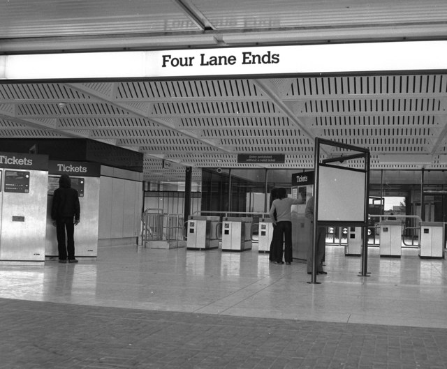
Four Lane Ends Interchange

Four Lane Ends is a Tyne and Wear Metro station, serving the suburbs of Benton and Longbenton, North Tyneside in Tyne and Wear, England. It joined the...

Little Benton

Little Benton is a small suburb of Newcastle upon Tyne, which holds two modern housing estates (Church Green and Haydon Grange) along with the site of...

Nearby Amenities

Located within 500m of 55.007436,-1.570162
Source: Bing
Lat/Long: 55.0102188/-1.573769
Crossing
Crossing: traffic_signals
Lat/Long: 55.0040512/-1.5720472
Give Way
Direction: forward
Lat/Long: 55.0111537/-1.5687551
Traffic Calming: hump
Lat/Long: 55.0064393/-1.5734559
Pub
Benton Ale House
Addr City: Newcastle Upon Tyne
Addr Postcode: NE7 7XE
Addr Street: Front Street
Addr Suburb: Benton
Brand: Marston's
Brand Wikidata: Q6773982
Fhrs Id: 1605078
Website: https://www.bentonalehousenewcastle.co.uk/
Lat/Long: 55.0097281/-1.5768913
Post Box
Ref: NE7 381
Lat/Long: 55.0049983/-1.5746471
Turning Circle
Lat/Long: 55.0051727/-1.5758702
Post Box
Collection Times: Mo-Fr 09:00; Sa 07:00
Operator: Royal Mail
Post Box Design: type_m
Post Box Type: lamp
Ref: NE12 404
Royal Cypher: EIIR
Royal Cypher Wikidata: Q33102113
Lat/Long: 55.0109398/-1.5709448
Bus Stop
Coach Lane
Bench: yes
Bus: yes
Departures Board: timetable
Lit: yes
Local Ref: N
Naptan AtcoCode: 410000009500
Naptan Bearing: N
Naptan CommonName: COACH LANE-ROSEMONT WAY-S/B
Naptan Indicator: N
Naptan Landmark: OUTSIDE CAMPUS PLAYING FIELDS
Naptan NaptanCode: twrapgdm
Naptan PlusbusZoneRef: NWCSTLE
Naptan Street: COACH LANE
Naptan Verified: no
Passenger Information Display: no
Public Transport: platform
Shelter: yes
Source: naptan_import
Lat/Long: 55.0064257/-1.572192
Bus Stop
Coach Lane
Bench: yes
Bus: yes
Departures Board: timetable
Lit: yes
Local Ref: N
Naptan AtcoCode: 410000009502
Naptan Bearing: N
Naptan CommonName: COACH LANE-PLAYING FIELDS-N/B
Naptan Indicator: N
Naptan Landmark: OPPOSITE CAMPUS PLAYING FIELDS
Naptan NaptanCode: twrapgdt
Naptan PlusbusZoneRef: NWCSTLE
Naptan Street: COACH LANE
Naptan Verified: no
Public Transport: platform
Shelter: yes
Source: naptan_import
Lat/Long: 55.0060805/-1.5724348
Bus Stop
Coach Lane
Bench: no
Bus: yes
Departures Board: timetable
Local Ref: N
Naptan AtcoCode: 410000009503
Naptan Bearing: N
Naptan CommonName: COACH LANE-PORTRUSH WAY-N/B
Naptan Indicator: N
Naptan Landmark: AT JUNCTION WITH PORTRUSH WAY
Naptan NaptanCode: twrapgdw
Naptan PlusbusZoneRef: NWCSTLE
Naptan Street: COACH LANE
Naptan Verified: no
Public Transport: platform
Shelter: no
Source: naptan_import
Lat/Long: 55.0074666/-1.572728
Bus Stop
COACH LANE-PORTRUSH WAY-S/B
Bench: no
Bus: yes
Departures Board: timetable
Local Ref: S
Naptan AtcoCode: 410000009916
Naptan Bearing: S
Naptan CommonName: COACH LANE-PORTRUSH WAY-S/B
Naptan Indicator: S
Naptan Landmark: OPPOSITE PORTRUSH WAY JUNCTION
Naptan NaptanCode: twrapgtg
Naptan PlusbusZoneRef: NWCSTLE
Naptan Street: COACH LANE
Naptan Verified: no
Public Transport: platform
Shelter: no
Source: naptan_import
Lat/Long: 55.0086558/-1.5729025
Bus Stop
FRONT STREET-COLLEGE LANE-W/B
Bench: no
Bus: yes
Departures Board: timetable
Local Ref: W
Naptan AtcoCode: 410000009978
Naptan Bearing: W
Naptan CommonName: FRONT STREET-COLLEGE LANE-W/B
Naptan Indicator: W
Naptan Landmark: OPPOSITE THE BLACK BULL INN
Naptan NaptanCode: twrapjgd
Naptan Street: FRONT STREET
Naptan Verified: no
Public Transport: platform
Shelter: no
Source: naptan_import
Lat/Long: 55.0098857/-1.5750921
Bus Stop
FRONT STREET-COLLEGE LANE-E/B
Bench: yes
Bus: yes
Departures Board: timetable
Local Ref: E
Naptan AtcoCode: 410000009065
Naptan Bearing: E
Naptan CommonName: FRONT STREET-COLLEGE LANE-E/B
Naptan Indicator: E
Naptan Landmark: OUTSIDE THE BLACK BULL PUBLIC HOUSE
Naptan NaptanCode: twramjtg
Naptan Street: FRONT STREET
Naptan Verified: no
Passenger Information Display: no
Public Transport: platform
Shelter: yes
Source: naptan_import
Lat/Long: 55.0101171/-1.5744486
Bus Stop
FRONT STREET-SCHOOL-E/B
Bench: no
Bus: yes
Departures Board: timetable
Local Ref: E
Naptan AtcoCode: 410000009066
Naptan Bearing: E
Naptan CommonName: FRONT STREET-SCHOOL-E/B
Naptan Indicator: E
Naptan Landmark: OPPOSITE ST BARTHOLOMEWS PRIMARY SCHOOL
Naptan NaptanCode: twramjtj
Naptan Street: FRONT STREET
Naptan Verified: no
Passenger Information Display: no
Public Transport: platform
Shelter: no
Source: naptan_import
Lat/Long: 55.0109306/-1.5706558
Bus Stop
DWP Tyneview Park
Bus: yes
Departures Board: timetable
Local Ref: C
Naptan AtcoCode: 410000009072
Naptan Bearing: W
Naptan CommonName: DSS TYNEVIEW PARK
Naptan Indicator: W
Naptan Landmark: OUTSIDE ENTRANCE TO DSS BESIDE TRAFFIC LIGHTS
Naptan NaptanCode: twramjwd
Naptan Street: WHITLEY ROAD
Naptan Verified: no
Public Transport: platform
Shelter: yes
Source: naptan_import
Lat/Long: 55.0111004/-1.5678549
Bus Stop
FRONT STREET-EASTFIELD ROAD-W/B
Bench: no
Bus: yes
Departures Board: timetable
Local Ref: W
Naptan AtcoCode: 410000009073
Naptan Bearing: W
Naptan CommonName: FRONT STREET-EASTFIELD ROAD-W/B
Naptan Indicator: W
Naptan Landmark: WEST OF ST BARTHOLOMEWS PRIMARY SCHOOL
Naptan NaptanCode: twramjwg
Naptan Street: FRONT STREET
Naptan Verified: no
Passenger Information Display: no
Public Transport: platform
Shelter: no
Source: naptan_import
Lat/Long: 55.0103802/-1.5726006
Bus Stop
DSS TYNEVIEW PARK STAND A
Local Ref: W
Naptan AtcoCode: 4100009DSSWA
Naptan Bearing: W
Naptan CommonName: DSS TYNEVIEW PARK STAND A
Naptan Indicator: W
Naptan Landmark: TYNEVIEW PARK GROUNDS
Naptan NaptanCode: twrapjtg
Naptan Street: TYNEVIEW PARK
Naptan Verified: no
Source: naptan_import
Lat/Long: 55.0076985/-1.566453
Bus Stop
DSS TYNEVIEW PARK STAND B
Local Ref: W
Naptan AtcoCode: 4100009DSSWB
Naptan Bearing: W
Naptan CommonName: DSS TYNEVIEW PARK STAND B
Naptan Indicator: W
Naptan Landmark: TYNEVIEW PARK GROUNDS
Naptan NaptanCode: twrapjtj
Naptan Street: TYNEVIEW PARK
Naptan Verified: no
Source: naptan_import
Lat/Long: 55.0076883/-1.5661091
Bus Stop
DSS TYNEVIEW PARK STAND C
Local Ref: W
Naptan AtcoCode: 4100009DSSWC
Naptan Bearing: W
Naptan CommonName: DSS TYNEVIEW PARK STAND C
Naptan Indicator: W
Naptan Landmark: TYNEVIEW PARK GROUNDS
Naptan NaptanCode: twrapjtm
Naptan Street: TYNEVIEW PARK
Naptan Verified: no
Source: naptan_import
Lat/Long: 55.0077137/-1.565671
Bus Stop
DSS TYNEVIEW PARK STAND D
Local Ref: W
Naptan AtcoCode: 4100009DSSWD
Naptan Bearing: W
Naptan CommonName: DSS TYNEVIEW PARK STAND D
Naptan Indicator: W
Naptan Landmark: TYNEVIEW PARK GROUNDS
Naptan NaptanCode: twrapjtp
Naptan Street: TYNEVIEW PARK
Naptan Verified: no
Source: naptan_import
Lat/Long: 55.0077576/-1.5653891
Traffic Signals
Lat/Long: 55.0112034/-1.5660005
Benton
Is In: North Tyneside
Place: suburb
Lat/Long: 55.0105418/-1.5672131
Mini Roundabout
Lat/Long: 55.008616/-1.5651281
Source: Bing
Lat/Long: 55.0113563/-1.5693466
Barrier: block
Bicycle: no
Foot: yes
Maxwidth: 0.5
Lat/Long: 55.0073342/-1.5626237
Barrier: block
Bicycle: no
Foot: yes
Maxwidth: 0.5
Lat/Long: 55.0073728/-1.5626487
Entrance: yes
Lat/Long: 55.0064109/-1.5696242
Street Lamp
Camera Mount: street_lamp
Camera Type: dome
Man Made: surveillance
Surveillance Type: camera
Lat/Long: 55.0102779/-1.5737371
Bus Stop
Coach Lane Campus
Bench: yes
Bin: yes
Bus: yes
Departures Board: timetable
Naptan AtcoCode: 410000009923
Naptan NaptanCode: twrjdata
Public Transport: platform
Shelter: yes
Lat/Long: 55.0059665/-1.5700292
Vending Machine
Payment Coins: yes
Payment Debit Cards: yes
Vending: parking_tickets
Lat/Long: 55.0063391/-1.5696788
Bicycle Parking
Bicycle Parking: stands
Covered: yes
Lat/Long: 55.0063429/-1.5696274
Entrance: emergency
Lat/Long: 55.0064472/-1.5691068
Entrance: emergency
Lat/Long: 55.0067575/-1.5691806
Entrance: emergency
Lat/Long: 55.0067423/-1.5694146
Traffic Signals
Lat/Long: 55.011185/-1.5665735
Traffic Calming: cushion
Lat/Long: 55.0095957/-1.5726268
Traffic Calming: cushion
Lat/Long: 55.0097836/-1.5716825
Addr Housenumber: 5
Lat/Long: 55.0071795/-1.5751397
Addr Housenumber: 2
Lat/Long: 55.0076793/-1.5777322
Addr Housenumber: 7
Lat/Long: 55.0071951/-1.5750236
Addr Housenumber: 1
Lat/Long: 55.007063/-1.5755728
Parking
Access: permit
Lat/Long: 55.0072614/-1.5665651
Natural: wetland
Lat/Long: 55.0054955/-1.5654113
Addr Housenumber: 19
Lat/Long: 55.0047303/-1.572357
Addr Housenumber: 9
Lat/Long: 55.0071858/-1.5748234
Addr Housenumber: 15
Addr Street: Coach Lane
Lat/Long: 55.0049179/-1.5723203
Addr Housenumber: 51
Addr Street: Coach Lane
Lat/Long: 55.0061885/-1.572614
Addr Housenumber: 29
Addr Street: Coach Lane
Lat/Long: 55.0053906/-1.5724421
Generator Method: photovoltaic
Generator Output Electricity: yes
Generator Source: solar
Generator Type: solar_photovoltaic_panel
Location: roof
Power: generator
Lat/Long: 55.0116997/-1.5708712
Generator Method: photovoltaic
Generator Output Electricity: yes
Generator Source: solar
Generator Type: solar_photovoltaic_panel
Location: roof
Power: generator
Lat/Long: 55.0114875/-1.5704796
Barrier: lift_gate
Lat/Long: 55.0059974/-1.5707623
Turning Circle
Lat/Long: 55.0042366/-1.5741395
Addr City: Newcastle upon Tyne
Addr Housenumber: 25
Addr Postcode: NE7 7XN
Addr Street: Manor Drive
Lat/Long: 55.0086929/-1.5768842
Traffic Signals
Traffic Signals: signal
Traffic Signals Direction: forward
Lat/Long: 55.0101661/-1.574041
Traffic Signals
Traffic Signals: signal
Traffic Signals Direction: backward
Lat/Long: 55.010278/-1.5734624
Traffic Signals
Traffic Signals: signal
Traffic Signals Direction: backward
Lat/Long: 55.0100579/-1.5736762
Cycleway: asl
Direction: forward
Lat/Long: 55.0101762/-1.5739868
Cycleway: asl
Direction: backward
Lat/Long: 55.0102656/-1.5735268
Cycleway: asl
Direction: backward
Lat/Long: 55.0100876/-1.5736904
The data included in this document is from www.openstreetmap.org. The data is made available under ODbL.

Have you been to Benton, Little?

Leave your review of Benton, Little below (or comments, questions and feedback).