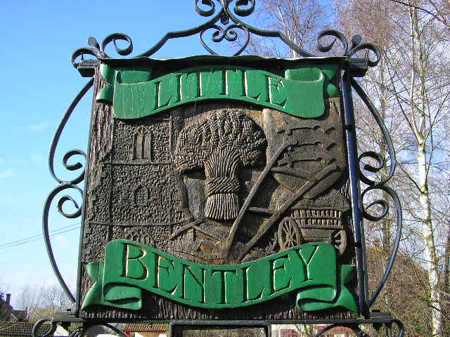
Bentley, Little

Settlement in Essex Tendring

England

Bentley, Little

Tendring Union Workhouse In a triangle of roads at Tendring Heath. Although Oaktree Manor <span class="nowrap"><a title="http://www.partnershipsincare.co.uk/facilities/oaktree_manor.html" rel="nofollow ugc noopener" href="http://www.partnershipsincare.co.uk/facilities/oaktree_manor.html">Link</a><img style="margin-left:2px;" alt="External link" title="External link - shift click to open in new window" src="https://s1.geograph.org.uk/img/external.png" width="10" height="10"/></span> has only been operating since about 2002, they could use the slogan "170 years of residential care" for this is the workhouse which opened about 1836 to serve the thirty or so parishes of the Tendring Poor Law Union. See also Peter Higginbotham's page: <span class="nowrap"><a title="http://users.ox.ac.uk/~peter/workhouse/Tendring/Tendring.shtml" rel="nofollow ugc noopener" href="http://users.ox.ac.uk/~peter/workhouse/Tendring/Tendring.shtml">Link</a><img style="margin-left:2px;" alt="External link" title="External link - shift click to open in new window" src="https://s1.geograph.org.uk/img/external.png" width="10" height="10"/></span> .
Tendring Union Workhouse Credit: Roger W Haworth

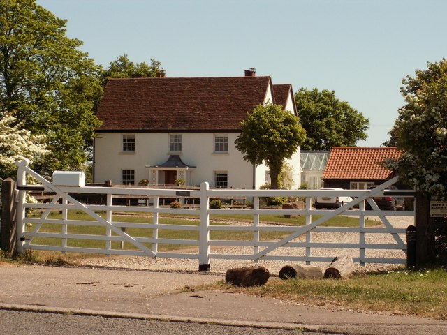
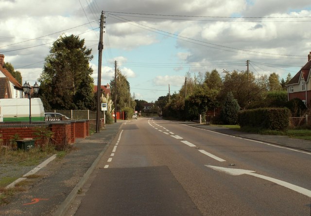
Bentley, Little is a small village located in the county of Essex, England. Situated approximately 8 miles northwest of the city of Colchester, Bentley, Little is characterized by its picturesque rural setting and charming atmosphere. The village is part of the larger civil parish of Bentley, which also includes the neighboring village of Bentley, Great.

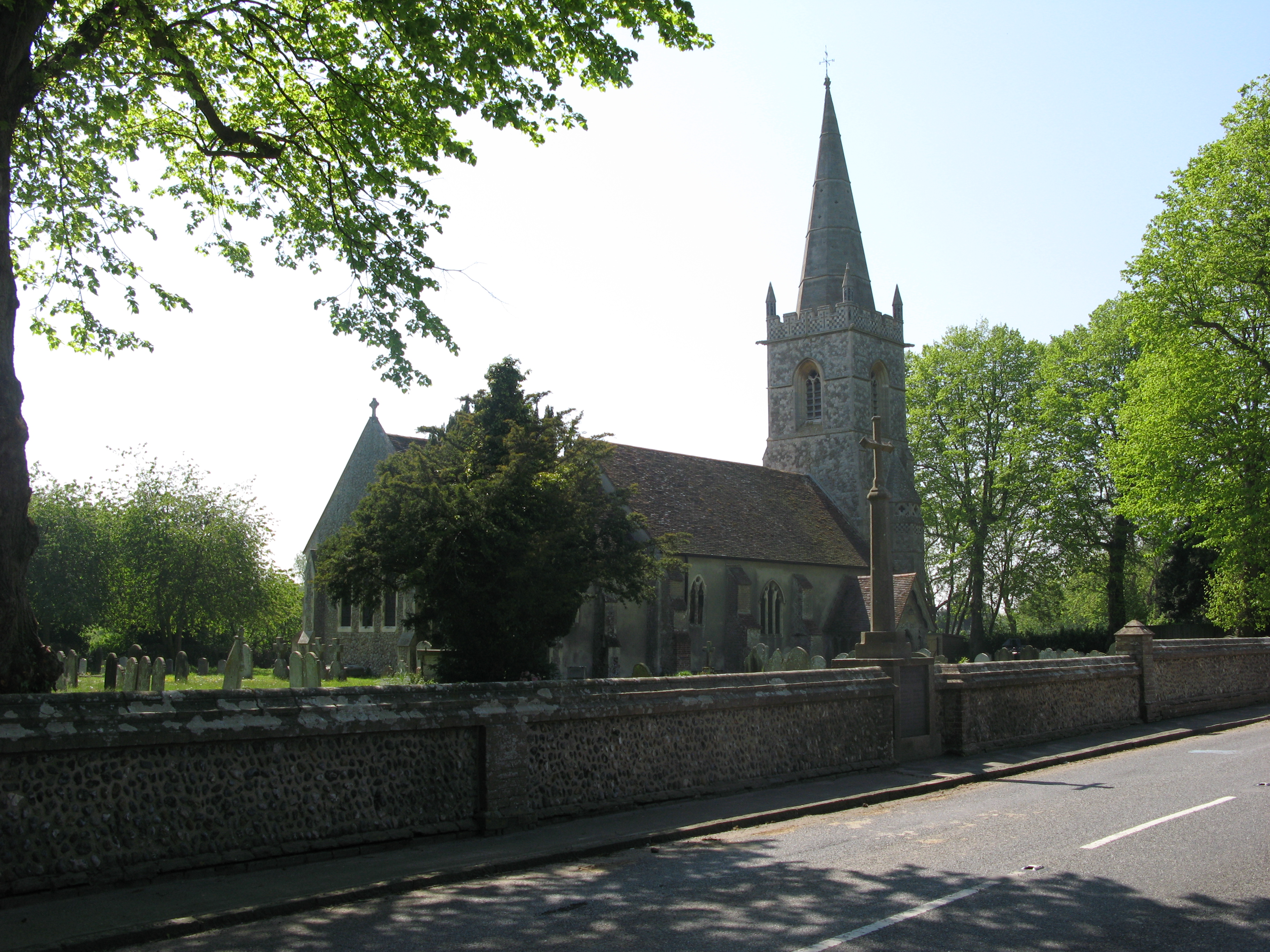
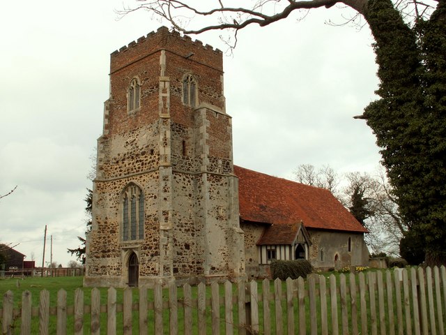
The history of Bentley, Little can be traced back to the medieval period, with records of the village dating as far back as the 12th century. The village grew around the local church, St. Mary the Virgin, which stands as a prominent landmark to this day. The church is known for its beautiful architecture and is a popular destination for visitors interested in historical and religious sites.

Bentley, Little is primarily an agricultural community, with farming playing a crucial role in the local economy. The surrounding countryside is dotted with fields of crops and grazing livestock, adding to the village's bucolic charm. The village is also home to a handful of small businesses and local shops, catering to the needs of its residents.

In terms of amenities, Bentley, Little offers a range of facilities for its residents, including a primary school, a village hall, and a pub. The village enjoys a close-knit community spirit, with various events and activities organized throughout the year to bring residents together.

Overall, Bentley, Little is a serene and idyllic village, offering a peaceful retreat for those seeking a slower pace of life amidst the beauty of the English countryside.

If you have any feedback on the listing, please let us know in the comments section below.

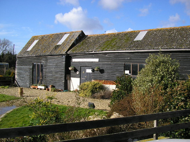
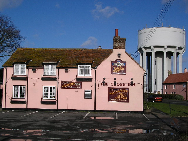
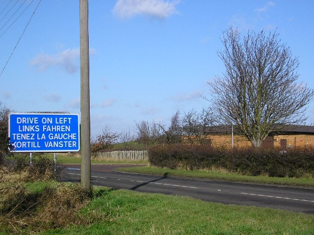
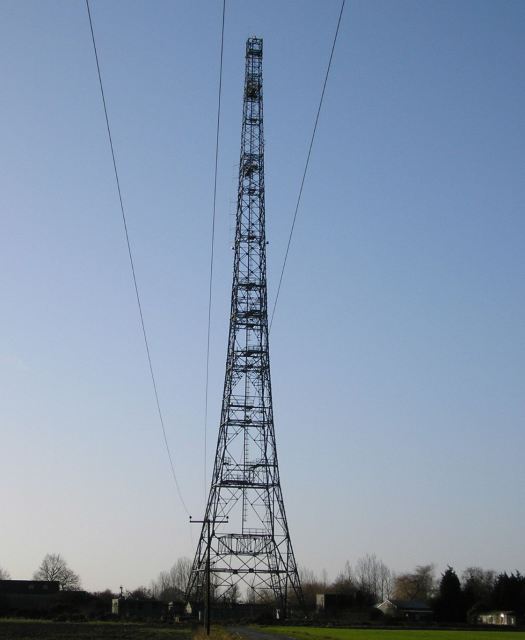
Bentley, Little Images

Images are sourced within 2km of 51.890106/1.074441 or Grid Reference TM1125. Thanks to Geograph Open Source API. All images are credited.

Tendring Union Workhouse In a triangle of roads at Tendring Heath. Although Oaktree Manor <span class="nowrap"><a title="http://www.partnershipsincare.co.uk/facilities/oaktree_manor.html" rel="nofollow ugc noopener" href="http://www.partnershipsincare.co.uk/facilities/oaktree_manor.html">Link</a><img style="margin-left:2px;" alt="External link" title="External link - shift click to open in new window" src="https://s1.geograph.org.uk/img/external.png" width="10" height="10"/></span> has only been operating since about 2002, they could use the slogan "170 years of residential care" for this is the workhouse which opened about 1836 to serve the thirty or so parishes of the Tendring Poor Law Union. See also Peter Higginbotham's page: <span class="nowrap"><a title="http://users.ox.ac.uk/~peter/workhouse/Tendring/Tendring.shtml" rel="nofollow ugc noopener" href="http://users.ox.ac.uk/~peter/workhouse/Tendring/Tendring.shtml">Link</a><img style="margin-left:2px;" alt="External link" title="External link - shift click to open in new window" src="https://s1.geograph.org.uk/img/external.png" width="10" height="10"/></span> .
Tendring Union Workhouse
In a triangle of roads at Tendring Heath. Although Oaktree Manor LinkExternal link has only been operating since about 2002, they could use the slogan "170 years of residential care" for this is the workhouse which opened about 1836 to serve the thirty or so parishes of the Tendring Poor Law Union. See also Peter Higginbotham's page: LinkExternal link .
Spring House in Church Road, Little Bentley
Spring House
in Church Road, Little Bentley
Essex geometry This thatched cottage in Church Road, Little Bentley just opposite the church is called "The Round House" even though it is patently octagonal. It was probably built as a gatehouse for the nearby Bentley Manor. Now for a genuinely round house see <a href="https://www.geograph.org.uk/photo/125801">SP9374 : The Round House</a>.
Essex geometry
This thatched cottage in Church Road, Little Bentley just opposite the church is called "The Round House" even though it is patently octagonal. It was probably built as a gatehouse for the nearby Bentley Manor. Now for a genuinely round house see SP9374 : The Round House.
Spring Studios at Pump Farm, Tendring Road, Little Bromley. Has a resident potter, exhibits work by other local painters and potters and provides pottery lessons.
Spring Studios
at Pump Farm, Tendring Road, Little Bromley. Has a resident potter, exhibits work by other local painters and potters and provides pottery lessons.
Pylon seen from Little Bentley Road, Tendring Heath. The <a href="https://www.geograph.org.uk/photo/126486">TM1026 : Radio mast</a> can be seen in the background.
Pylon
seen from Little Bentley Road, Tendring Heath. The TM1026 : Radio mast can be seen in the background.
The Cross Inn at Horsley Cross. The main water tower of the Tendring Hundred Water Services Ltd is behind it.
The Cross Inn
at Horsley Cross. The main water tower of the Tendring Hundred Water Services Ltd is behind it.
Kortill Vanster Clacton Road, Horsley Cross just north of the Wix By-pass (A120). If a foreign visitor having landed at Harwich is at this point they will have just made their first right turn after driving "straight" for 12 km. And possibly there was a serious accident here caused by someone driving on the wrong side. Of course the sign should be on the other side of the road! Essex is not always this helpful - if the foreign visitor continues along this road, they may land up in the Crown Hotel, Manningtree. There, if they go to the toilet, they will have to work out for themselves which of "Gulls" or "Buoys" is appropriate for their sex. The buildings on the right are part of the main treatment works of Tendring Hundred Water Services Ltd.
Kortill Vanster
Clacton Road, Horsley Cross just north of the Wix By-pass (A120). If a foreign visitor having landed at Harwich is at this point they will have just made their first right turn after driving "straight" for 12 km. And possibly there was a serious accident here caused by someone driving on the wrong side. Of course the sign should be on the other side of the road! Essex is not always this helpful - if the foreign visitor continues along this road, they may land up in the Crown Hotel, Manningtree. There, if they go to the toilet, they will have to work out for themselves which of "Gulls" or "Buoys" is appropriate for their sex. The buildings on the right are part of the main treatment works of Tendring Hundred Water Services Ltd.
Wesleyan Methodist Chapel in Church Road, Little Bentley. Foundation stone laid in 1874. Closed circa 1966 <span class="nowrap"><a title="http://www.nationalarchives.gov.uk/nra/searches/sidocs.asp?SIR=O66914" rel="nofollow ugc noopener" href="http://www.nationalarchives.gov.uk/nra/searches/sidocs.asp?SIR=O66914">Link</a><img style="margin-left:2px;" alt="External link" title="External link - shift click to open in new window" src="https://s1.geograph.org.uk/img/external.png" width="10" height="10"/></span>
Wesleyan Methodist Chapel
in Church Road, Little Bentley. Foundation stone laid in 1874. Closed circa 1966 LinkExternal link
Radio mast just off Hilliards Road. Right on the boundary of Great Bromley and Little Bromley civil parishes. Can also be seen in the <a href="https://www.geograph.org.uk/photo/126105">TM1226 : Pylon</a> photo.
Radio mast
just off Hilliards Road. Right on the boundary of Great Bromley and Little Bromley civil parishes. Can also be seen in the TM1226 : Pylon photo.
'Bricklayers' public house, Little Bentley, Essex This appears to be the only pub in the village.
'Bricklayers' public house, Little Bentley, Essex
This appears to be the only pub in the village.
St. Mary the Virgin church, Little Bentley, Essex This is a Norman church with a fine 16th century tower that stands close to the road. There is evidence of Roman brick used in the chancel and inside there is a fine hammerbeam roof.
St. Mary the Virgin church, Little Bentley, Essex
This is a Norman church with a fine 16th century tower that stands close to the road. There is evidence of Roman brick used in the chancel and inside there is a fine hammerbeam roof.
Brampton Hall Farm
Brampton Hall Farm
The farmhouse at Clip Hedge Farm
The farmhouse at Byes Farm
Pilcox Hall Lane
Pilcox Hall Lane
Clearing in Little Bentleyhall Wood Coppicing in action: the coppiced trees in the clearing had been cut back over winter and new shoots developed during spring and summer.  To the right, growing stands of coppiced woodland can be seen.
Clearing in Little Bentleyhall Wood
Coppicing in action: the coppiced trees in the clearing had been cut back over winter and new shoots developed during spring and summer. To the right, growing stands of coppiced woodland can be seen.
Footpath and ride within Little Bentleyhall Wood The wider view gives a good feeling of this attractive managed woodland.
Footpath and ride within Little Bentleyhall Wood
The wider view gives a good feeling of this attractive managed woodland.
Paintball arena between Holland Brook and woodland I was approaching this area through a quiet pasture when suddenly shouts and shooting burst out.  By the time I got the picture the participants in "Sport attitude Nelson Paintballs" had vanished!
Paintball arena between Holland Brook and woodland
I was approaching this area through a quiet pasture when suddenly shouts and shooting burst out. By the time I got the picture the participants in "Sport attitude Nelson Paintballs" had vanished!
Show me another place!

Bentley, Little is located at Grid Ref: TM1125 (Lat: 51.890106, Lng: 1.074441)

Administrative County: Essex

District: Tendring

Police Authority: Essex

What 3 Words

///demoted.romance.clinic. Near Great Bentley, Essex

Related Wikis

Little Bentley

Little Bentley is a village and civil parish in the Tendring district of Essex, England. It sits on rising ground just to the west of the Holland Brook...

Horsley Cross

Horsley Cross is a hamlet in the English county of Essex. Horsley Cross lies on the B1035 road just to the north of the main A120 that connects London...

Bradfield Heath

Bradfield Heath is a village in Essex, England. It is located in between the A120 road and the B1352 road. It is the location of the former Bradfield Hall...

Hare Green

Hare Green is a hamlet on Harwich Road, in the Tendring district, in the English county of Essex. In 2018 it had an estimated population of 707. Hare Green...

Horsleycross Street

Horsleycross Street is a hamlet in the English county of Essex. Horsleycross Street lies on the B1035 road about a mile to the north of the main A120 that...

Tendring

Tendring is a village and civil parish in Essex. It gives its name to the Tendring District and before that the Tendring Hundred. Its name was given to...

St Mary the Virgin's Church, Little Bromley

St Mary the Virgin's Church is a former Anglican church near the village of Little Bromley, Essex, England. It is recorded in the National Heritage List...

Great Bromley

Great Bromley is a village and civil parish in the Tendring district of Essex, England. It lies 6 kilometres (4 mi) south of Manningtree and 9 kilometres...

Nearby Amenities

Located within 500m of 51.890106,1.074441
Post Box
Post Box Mounting: pier
Post Box Type: lamp
Postal Code: CO7 8SL
Ref: CO7 196
Royal Cypher: EIIR
Royal Cypher Wikidata: Q33102113
Lat/Long: 51.8903628/1.0748918
Public Bookcase
Booth: K6
Colour: red
Disused Amenity: telephone
Man Made: telephone_box
Note: sign inside says "Swap Only This is not a book dump"
Public Bookcase Sort: book_swap
Public Bookcase Type: phone_box
Lat/Long: 51.8903777/1.0748543
Bus Stop
The Bricklayers Arms
Local Ref: 1
Naptan AtcoCode: 150029102009
Naptan Bearing: SE
Naptan BusStopType: CUS
Naptan CommonName: The Bricklayers Arms
Naptan Crossing: Rectory Road
Naptan Indicator: Stop 1
Naptan Landmark: The Bricklayers Arms
Naptan NaptanCode: esxgdwjg
Naptan Street: Manningtree Road
Naptan Verified: no
Public Transport: platform
Source: naptan_import
Lat/Long: 51.8905374/1.0747813
The Bricklayers Arms
Local Ref: 2
Naptan AtcoCode: 1500IM1125
Naptan Bearing: NW
Naptan BusStopType: CUS
Naptan CommonName: The Bricklayers Arms
Naptan Crossing: Rectory Road
Naptan Indicator: Stop 2
Naptan Landmark: The Bricklayers Arms
Naptan NaptanCode: esxgdwat
Naptan Status: ina
Naptan Street: Manningtree Road
Naptan Verified: no
Public Transport: platform
Source: naptan_import
Lat/Long: 51.8906075/1.0745099
The Bricklayers Arms
Local Ref: 3
Naptan AtcoCode: 1500IM11251
Naptan Bearing: NE
Naptan BusStopType: CUS
Naptan CommonName: The Bricklayers Arms
Naptan Crossing: Manningtree Road
Naptan Indicator: Stop 3
Naptan Landmark: The Bricklayers Arms
Naptan NaptanCode: esxjgdgt
Naptan Street: Rectory Road
Naptan Verified: no
Public Transport: platform
Source: naptan_import
Lat/Long: 51.8902075/1.0746715
The Bricklayers Arms
Local Ref: 4
Naptan AtcoCode: 1500IM11251Y
Naptan Bearing: SW
Naptan BusStopType: CUS
Naptan CommonName: The Bricklayers Arms
Naptan Crossing: Manningtree Road
Naptan Indicator: Stop 4
Naptan Landmark: The Bricklayers Arms
Naptan NaptanCode: esxjgdgw
Naptan Street: Rectory Road
Naptan Verified: no
Public Transport: platform
Source: naptan_import
Lat/Long: 51.8901603/1.0747555
Little Bentley
Place: village
Lat/Long: 51.889617/1.0750615
Power: pole
Source: bing
Lat/Long: 51.8873059/1.0780508
Power: pole
Source: bing
Lat/Long: 51.8877269/1.0792808
Power: pole
Source: bing
Lat/Long: 51.8879774/1.0801054
Power: pole
Source: bing
Lat/Long: 51.8882775/1.0809158
Leisure: picnic_table
Lat/Long: 51.8903178/1.0746272
Leisure: picnic_table
Lat/Long: 51.8903443/1.0746592
Defibrillator
Access: yes
Defibrillator Location: outside Bricklayers Arms, Little Bentley - on corner nearest car park entrance
Emergency: defibrillator
Indoor: no
Lat/Long: 51.8903566/1.0744376
Man Made: village_sign
Lat/Long: 51.8903025/1.0749588
Information: guidepost
Tourism: information
Lat/Long: 51.8902633/1.0751546
Information: board
Tourism: information
Lat/Long: 51.8902506/1.0745833
Give Way
Direction: backward
Lat/Long: 51.8902074/1.0753105
Give Way
Direction: forward
Lat/Long: 51.8898811/1.0764786
Give Way
Direction: forward
Lat/Long: 51.8899929/1.0759205
Give Way
Direction: backward
Lat/Long: 51.8896856/1.0761735
The data included in this document is from www.openstreetmap.org. The data is made available under ODbL.

Have you been to Bentley, Little?

Leave your review of Bentley, Little below (or comments, questions and feedback).