Gealltuig

Island in Ross-shire

Scotland

Gealltuig

Butt of Lewis Lighthouse The Butt of Lewis is the northernmost point of the Isle of Lewis in the Outer Hebrides. There is a lighthouse designed and built by David & Thomas Stevenson (sons of Robert and brother of Alan - all lighthouse engineers) and constructed in 1862. It is 37m (121ft) tall at an elevation of 52m (170ft) with a nominal range of 25 nautical miles. It flashes a white light every five seconds, and since 1998 is fully automated, being one of the last four Scottish lighthouses to dispense with the services of their keepers. It is looked after by the Northern Lighthouse Board (the Scottish equivalent to Trinity House) and is monitored remotely from Edinburgh.
The Butt of Lewis has appeared in the Guinness Book of Records as the windiest place in the United Kingdom, sticking out as it does into the North Atlantic.
Butt of Lewis Lighthouse Credit: Ralph Greig

Gealltuig is a small island located off the coast of Ross-shire, in the Scottish Highlands. With a land area of approximately 2 square miles, it is a picturesque and secluded destination for nature lovers and those seeking tranquility.

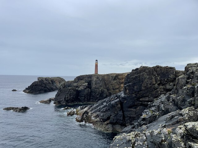
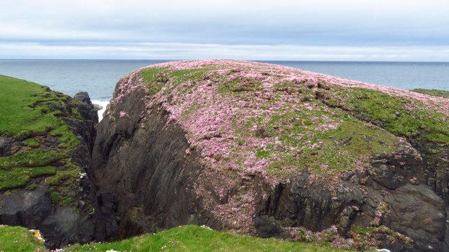
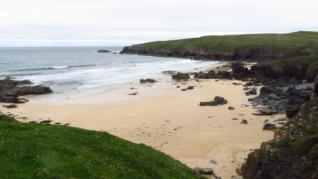
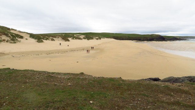
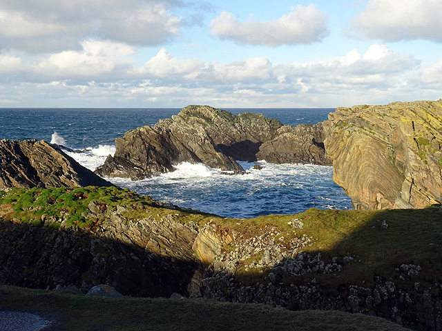
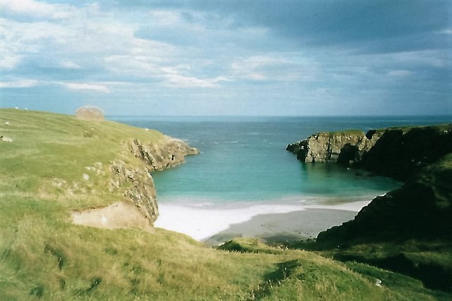
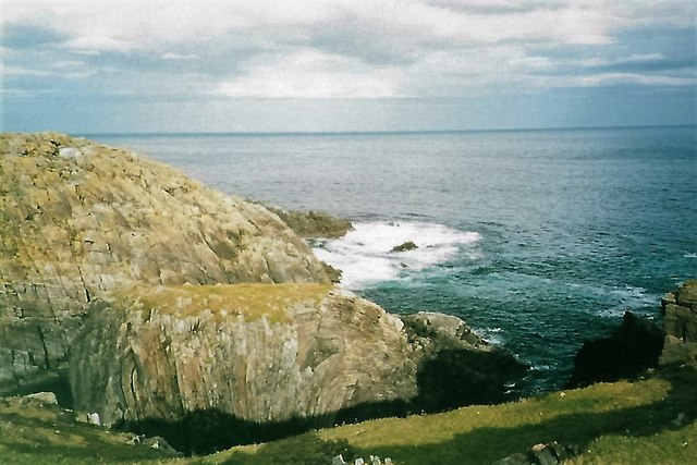
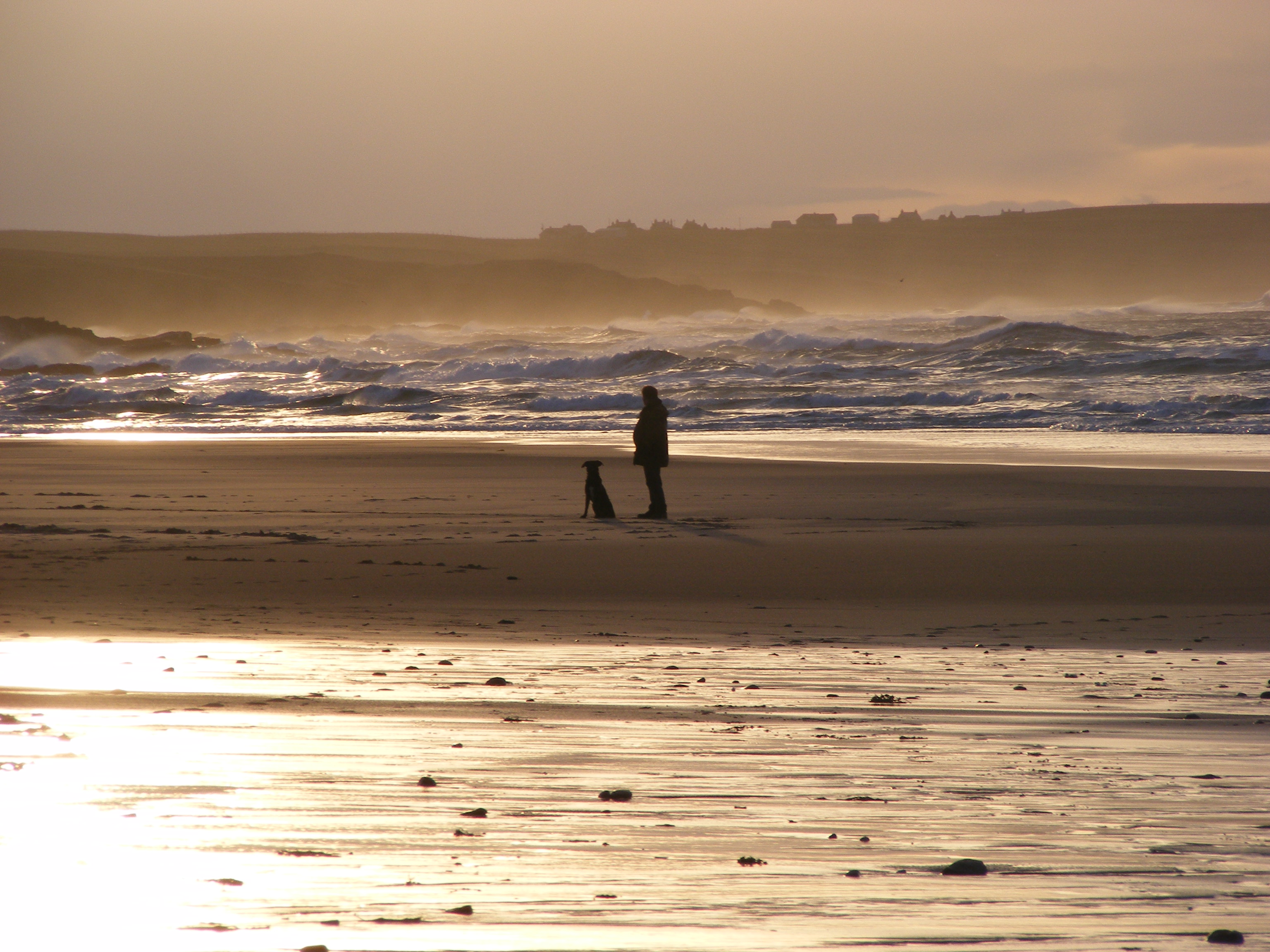
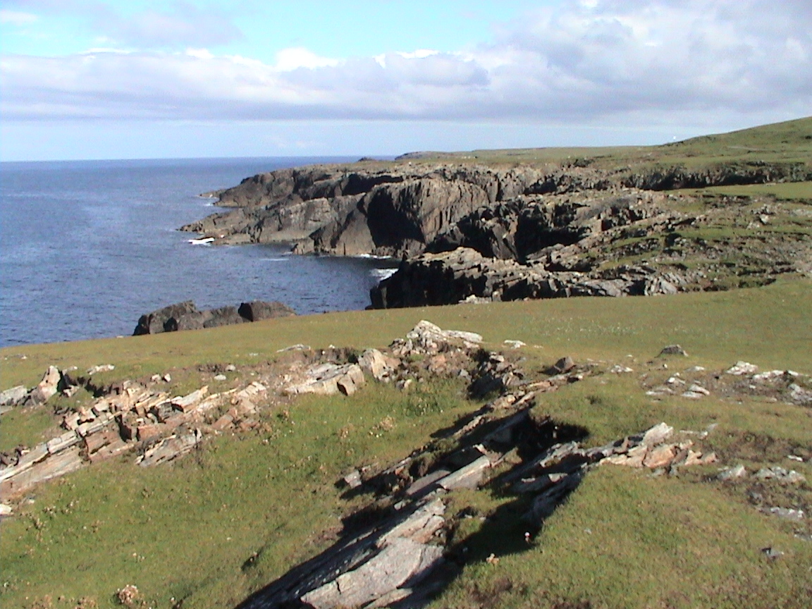
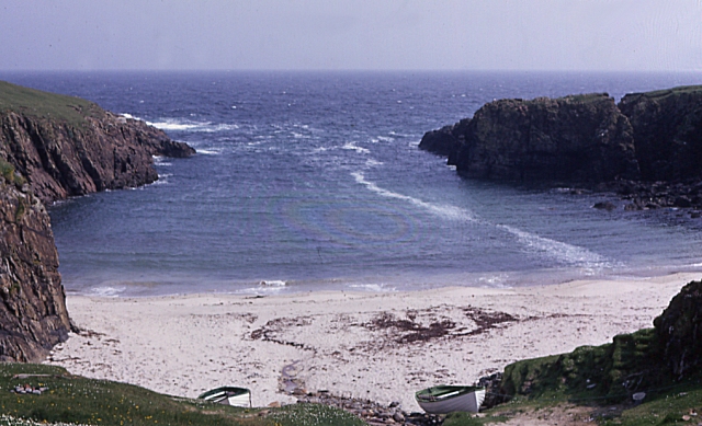
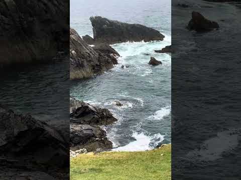
The island is known for its rugged coastline, characterized by towering cliffs and rocky outcrops. These cliffs provide nesting sites for seabirds, including puffins, guillemots, and razorbills, making Gealltuig a haven for birdwatchers. The surrounding waters are also rich in marine life, attracting seals and dolphins, which can often be spotted from the shoreline.

Despite its small size, Gealltuig boasts diverse flora and fauna. The island is covered in moorland, heather, and native woodlands, providing habitats for a variety of plant and animal species. Exploring the island on foot, visitors may come across red deer, otters, and a myriad of bird species.

Gealltuig is accessible only by boat, adding to its remote charm. The island has no permanent residents, and there are no facilities or accommodations available. It is a place for day trips and outdoor activities, such as hiking, birdwatching, and picnicking.

Visitors to Gealltuig are advised to bring their own supplies, including food, water, and appropriate clothing for the changeable weather conditions. It is important to respect the island's delicate ecosystem and leave no trace behind.

In conclusion, Gealltuig is a beautiful and untouched island in Ross-shire, offering a unique opportunity to experience the raw beauty of the Scottish Highlands. Its rugged coastline, diverse wildlife, and serene atmosphere make it a must-visit destination for nature enthusiasts.

If you have any feedback on the listing, please let us know in the comments section below.
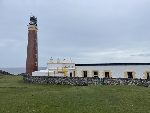
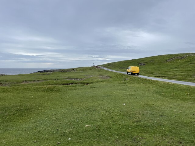
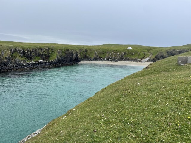
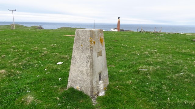
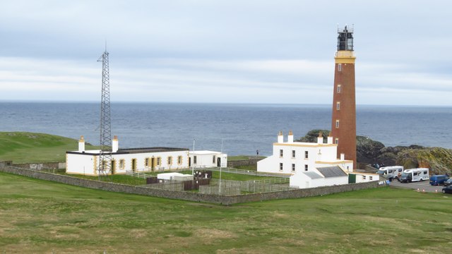
Gealltuig Images

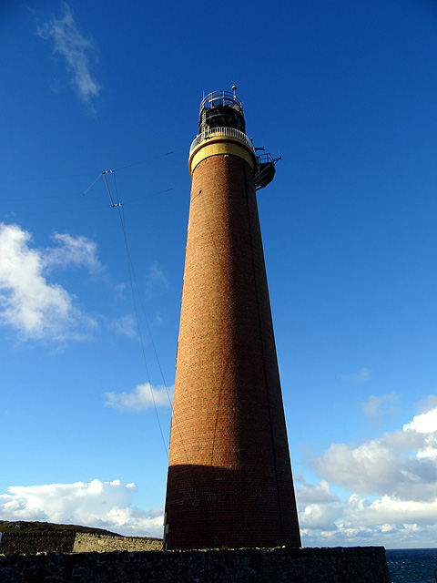
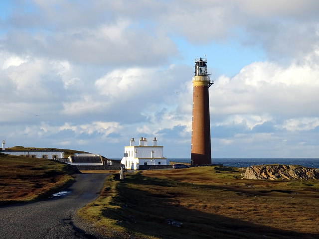
Images are sourced within 2km of 58.507888/-6.283922 or Grid Reference NB5065. Thanks to Geograph Open Source API. All images are credited.

Butt of Lewis Lighthouse The Butt of Lewis is the northernmost point of the Isle of Lewis in the Outer Hebrides. There is a lighthouse designed and built by David & Thomas Stevenson (sons of Robert and brother of Alan - all lighthouse engineers) and constructed in 1862. It is 37m (121ft) tall at an elevation of 52m (170ft) with a nominal range of 25 nautical miles. It flashes a white light every five seconds, and since 1998 is fully automated, being one of the last four Scottish lighthouses to dispense with the services of their keepers. It is looked after by the Northern Lighthouse Board (the Scottish equivalent to Trinity House) and is monitored remotely from Edinburgh.
The Butt of Lewis has appeared in the Guinness Book of Records as the windiest place in the United Kingdom, sticking out as it does into the North Atlantic.
Butt of Lewis Lighthouse
The Butt of Lewis is the northernmost point of the Isle of Lewis in the Outer Hebrides. There is a lighthouse designed and built by David & Thomas Stevenson (sons of Robert and brother of Alan - all lighthouse engineers) and constructed in 1862. It is 37m (121ft) tall at an elevation of 52m (170ft) with a nominal range of 25 nautical miles. It flashes a white light every five seconds, and since 1998 is fully automated, being one of the last four Scottish lighthouses to dispense with the services of their keepers. It is looked after by the Northern Lighthouse Board (the Scottish equivalent to Trinity House) and is monitored remotely from Edinburgh. The Butt of Lewis has appeared in the Guinness Book of Records as the windiest place in the United Kingdom, sticking out as it does into the North Atlantic.
Road to the lighthouse The Butt of Lewis is the northernmost point of the Isle of Lewis in the Outer Hebrides. There is a lighthouse designed and built by David & Thomas Stevenson (sons of Robert and brother of Alan - all lighthouse engineers) and constructed in 1862. It is 37m (121ft) tall at an elevation of 52m (170ft) with a nominal range of 25 nautical miles. It flashes a white light every five seconds, and since 1998 is fully automated, being one of the last four Scottish lighthouses to dispense with the services of their keepers. It is looked after by the Northern Lighthouse Board (the Scottish equivalent to Trinity House) and is monitored remotely from Edinburgh.
The Butt of Lewis has appeared in the Guinness Book of Records as the windiest place in the United Kingdom, sticking out as it does into the North Atlantic.
Road to the lighthouse
The Butt of Lewis is the northernmost point of the Isle of Lewis in the Outer Hebrides. There is a lighthouse designed and built by David & Thomas Stevenson (sons of Robert and brother of Alan - all lighthouse engineers) and constructed in 1862. It is 37m (121ft) tall at an elevation of 52m (170ft) with a nominal range of 25 nautical miles. It flashes a white light every five seconds, and since 1998 is fully automated, being one of the last four Scottish lighthouses to dispense with the services of their keepers. It is looked after by the Northern Lighthouse Board (the Scottish equivalent to Trinity House) and is monitored remotely from Edinburgh. The Butt of Lewis has appeared in the Guinness Book of Records as the windiest place in the United Kingdom, sticking out as it does into the North Atlantic.
Port Stoth Geocaching is a type of global treasure hunt of people looking for caches, or hidden stashes of objects. Geocaching may also be described as a series of hide-and-seek games, where hiders provide online clues for seekers. Seekers use global positioning system (GPS) devices to find hidden caches
Port Stoth
Geocaching is a type of global treasure hunt of people looking for caches, or hidden stashes of objects. Geocaching may also be described as a series of hide-and-seek games, where hiders provide online clues for seekers. Seekers use global positioning system (GPS) devices to find hidden caches
St Molveg's Church, Eoropie
Trig point at Butt of Lewis
Butt of Lewis Lighthouse
Sea thrift on islet at Geodha nan Each, Butt of Lewis
Beach at Cunndal, Eoropie
Cunndal Drownings Memorial, Eoropie This is a memorial to the men lost here on 5th March 1885, when the local fishing fleet was caught in a terrible gale. Two boats attempted to seek shelter at Cunndal, just north of this point. Both boats and twelve men – all from Eoropie - were lost.
Cunndal Drownings Memorial, Eoropie
This is a memorial to the men lost here on 5th March 1885, when the local fishing fleet was caught in a terrible gale. Two boats attempted to seek shelter at Cunndal, just north of this point. Both boats and twelve men – all from Eoropie - were lost.
Traigh Shanndaigh, Eoropie
Butt of Lewis Lighthouse I did consider correcting the converging verticals in this shot but then I got an attack of acrophobia so could no longer look at it!
Butt of Lewis Lighthouse
I did consider correcting the converging verticals in this shot but then I got an attack of acrophobia so could no longer look at it!
Cleite Gile Rocks at the Butt of Lewis.
Cleite Gile
Rocks at the Butt of Lewis.
Butt of Lewis lighthouse
Port Stoth Port Stoth is the most northerly beach on the Western Isles. All the materials for the construction of the Butt of Lewis lighthouse were landed here between 1851 and 1862. As it was a sheltered spot the beach continued to be used to bring supplies to the lighthouse until the 1960s. 
On 22nd January 1901 a wooden lugsail (Lugger) in ballast was stranded at Port Stoth. Surprisingly, no name is recorded of the unregistered vessel but its date of building was known to be 1893 and the master was a Captain Gunn.
Port Stoth
Port Stoth is the most northerly beach on the Western Isles. All the materials for the construction of the Butt of Lewis lighthouse were landed here between 1851 and 1862. As it was a sheltered spot the beach continued to be used to bring supplies to the lighthouse until the 1960s. On 22nd January 1901 a wooden lugsail (Lugger) in ballast was stranded at Port Stoth. Surprisingly, no name is recorded of the unregistered vessel but its date of building was known to be 1893 and the master was a Captain Gunn.
Cleite Gile, Rubha Robhanais Cliffs at Butt of Lewis
Cleite Gile, Rubha Robhanais
Cliffs at Butt of Lewis
Butt of Lewis lighthouse with Transocean Winner offshore The ineptly-named oilrig slowly rounds the Butt at a safe distance, having been refloated from Dalmore beach the previous evening.  See <a href="https://www.geograph.org.uk/photo/5088125">NB5268 : Transocean Winner rounds the Butt</a>.
Butt of Lewis lighthouse with Transocean Winner offshore
The ineptly-named oilrig slowly rounds the Butt at a safe distance, having been refloated from Dalmore beach the previous evening. See NB5268 : Transocean Winner rounds the Butt.
The Northwest extremity of Scotland, Butt of Lewis
Show me another place!

Gealltuig is located at Grid Ref: NB5065 (Lat: 58.507888, Lng: -6.283922)

Unitary Authority: Na h-Eileanan an Iar

Police Authority: Highlands and Islands

What 3 Words

///grunt.preoccupied.respect. Near North Tolsta, Na h-Eileanan Siar

Related Wikis

Related Videos

Isle of Lewis virtual tour | walking | Butt of Lewis | POV | walking videos | lighthouse | ASMR |

Join me for part 2 of my Ness adventure, a relaxing video of my walk around the Butt of Lewis on the Isle of Lewis, a windy and ...

Exploring the stunning Butt of Lewis and Stornoway | Outer Hebrides | Scotland

HikeWithHiiker #HebrideanWay Exploring Stornoway & Butt of Lewis with tough girl tribe member Isi @galopin82 ℹ️ Tuesday ...

Butt of Lewis Sea Birds

Isle of Lewis and Harris, Outer Hebrides, Scotland. Sept. 2023.

Nearby Amenities

Located within 500m of 58.507888,-6.283922
Gealltiug
Note: Geodetic reference point for UK baseline
Ref: 3
Source: The Territorial Sea (Amendment) Order 1998 (No. 2564)
Lat/Long: 58.5118293/-6.2830471
Roinn a' Roidh
Natural: cape
Lat/Long: 58.5094973/-6.2800851
Geodha nan Each
Natural: bay
Lat/Long: 58.5108179/-6.277495
Cunndal
Natural: bay
Lat/Long: 58.5066258/-6.2773877
Luchruban
Archaeological Site: tumulus
Historic: archaeological_site
Historic Civilization: neolithic
Lat/Long: 58.5107566/-6.280664
The data included in this document is from www.openstreetmap.org. The data is made available under ODbL.

Have you been to Gealltuig?

Leave your review of Gealltuig below (or comments, questions and feedback).