Barningham, Little
Settlement in Norfolk North Norfolk
England
Barningham, Little
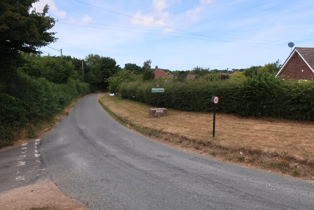
Barningham, Little is a small village located in the county of Norfolk, England. Situated about 5 miles northeast of Thetford, this picturesque village is nestled amidst the beautiful Norfolk countryside, characterized by rolling hills, lush green fields, and charming rural landscapes.
The village of Barningham, Little is home to a close-knit community comprising around 150 residents. It boasts a tranquil and peaceful atmosphere, offering a respite from the hustle and bustle of city life. The village is predominantly residential, with a mix of traditional cottages and more modern houses. Its quaint streets are lined with trees, creating a pleasant environment for residents and visitors alike.
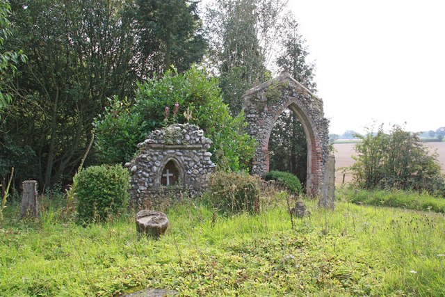
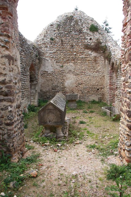
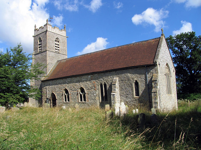
One of the notable features of Barningham, Little is its historic church, dedicated to St. Andrew. Dating back to the 14th century, this beautiful medieval church serves as a place of worship for the local community. Its architecture and stained glass windows are of cultural and historical significance.
Although Barningham, Little is a small village, it is well-connected to nearby towns and cities. The A134 road runs through the village, providing easy access to Thetford and other major routes. Additionally, the village is surrounded by scenic walking trails, offering opportunities for outdoor enthusiasts to explore the surrounding countryside.
Overall, Barningham, Little is a charming and idyllic village that offers a peaceful and close community atmosphere, making it an attractive place to live for those seeking a slower-paced rural lifestyle in the heart of Norfolk.
If you have any feedback on the listing, please let us know in the comments section below.
Barningham, Little Images
Images are sourced within 2km of 52.854559/1.177617 or Grid Reference TG1433. Thanks to Geograph Open Source API. All images are credited.


Barningham, Little is located at Grid Ref: TG1433 (Lat: 52.854559, Lng: 1.177617)
Administrative County: Norfolk
District: North Norfolk
Police Authority: Norfolk
What 3 Words
///heightens.wonderful.regretted. Near Briston, Norfolk
Nearby Locations
Related Wikis

Little Barningham
Little Barningham is a village and a civil parish in the English county of Norfolk. The village is 19 miles (31 km) north of Norwich, 10 miles (16 km)...
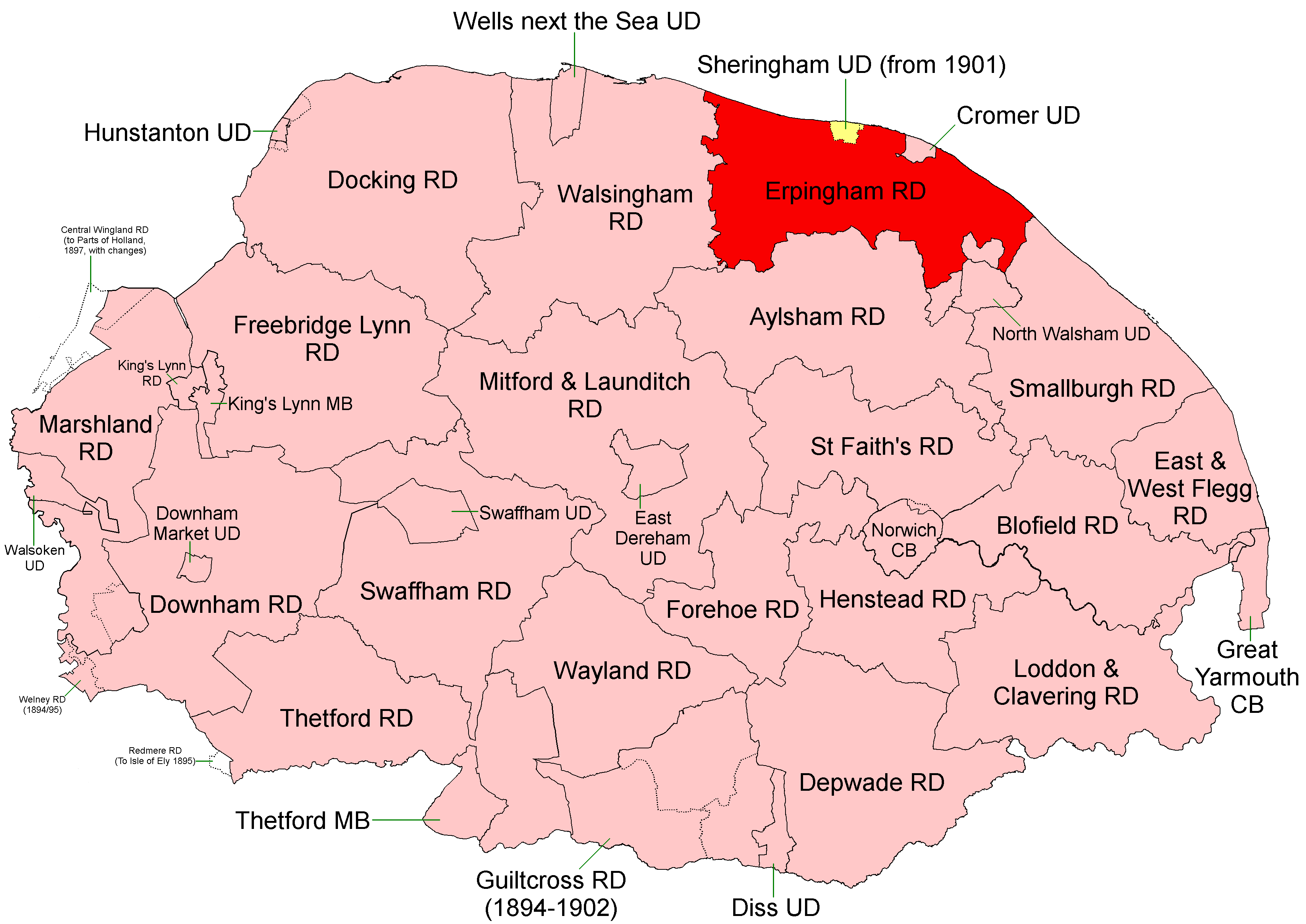
Erpingham Rural District
Erpingham Rural District was a rural district in Norfolk, England from 1894 to 1974.It was formed under the Local Government Act 1894 based on the Erpingham...
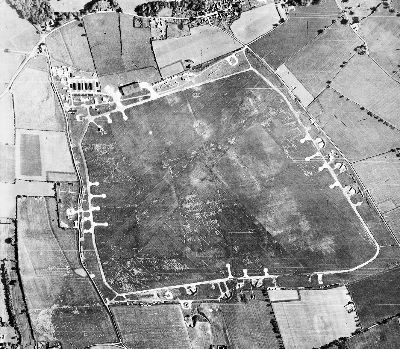
RAF Matlaske
Royal Air Force Matlaske or more simply RAF Matlaske is a former Royal Air Force satellite station to RAF Coltishall, situated near Matlaske in Norfolk...
Plumstead, Norfolk
Plumstead is a village and a civil parish in the English county of Norfolk. The village is 19.7 miles (31.7 km) north north west of Norwich, 9.5 miles...
Nearby Amenities
Located within 500m of 52.854559,1.177617Have you been to Barningham, Little?
Leave your review of Barningham, Little below (or comments, questions and feedback).