Battery Rocks

Island in Cornwall

England

Battery Rocks

Newlyn harbour from Fore Street
Newlyn harbour from Fore Street Credit: David Gearing

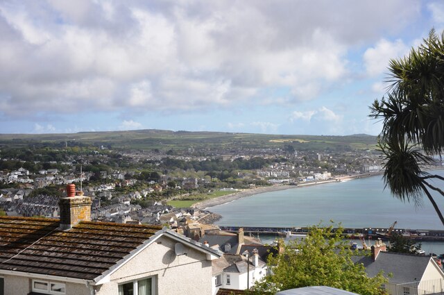
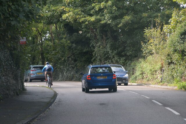
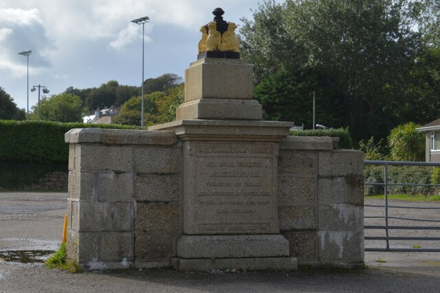
Battery Rocks is a small island located off the coast of Penzance in Cornwall, England. The island is connected to the mainland by a causeway that is submerged during high tide, making it inaccessible for a few hours each day. The island is named after the old battery that was once located there, which was used to defend the area during times of war.

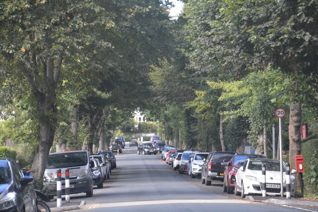
Battery Rocks is a popular spot for tourists and locals alike, who come to enjoy the stunning views of the surrounding coastline and the crystal-clear waters of the Atlantic Ocean. The island is also home to a variety of seabirds, including gulls and cormorants, making it a great spot for birdwatching.

Visitors can explore the rocky shores of Battery Rocks, which are dotted with tide pools filled with marine life such as crabs and sea anemones. The island is also a great place for picnicking and relaxing in the sunshine, with plenty of space to spread out and enjoy the peaceful surroundings.

Overall, Battery Rocks is a beautiful and peaceful island that offers visitors a chance to escape the hustle and bustle of everyday life and connect with nature in a tranquil setting.

If you have any feedback on the listing, please let us know in the comments section below.

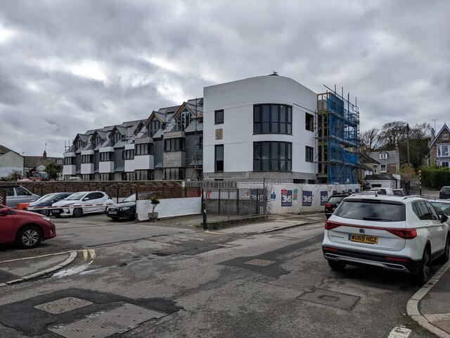
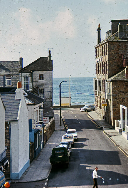
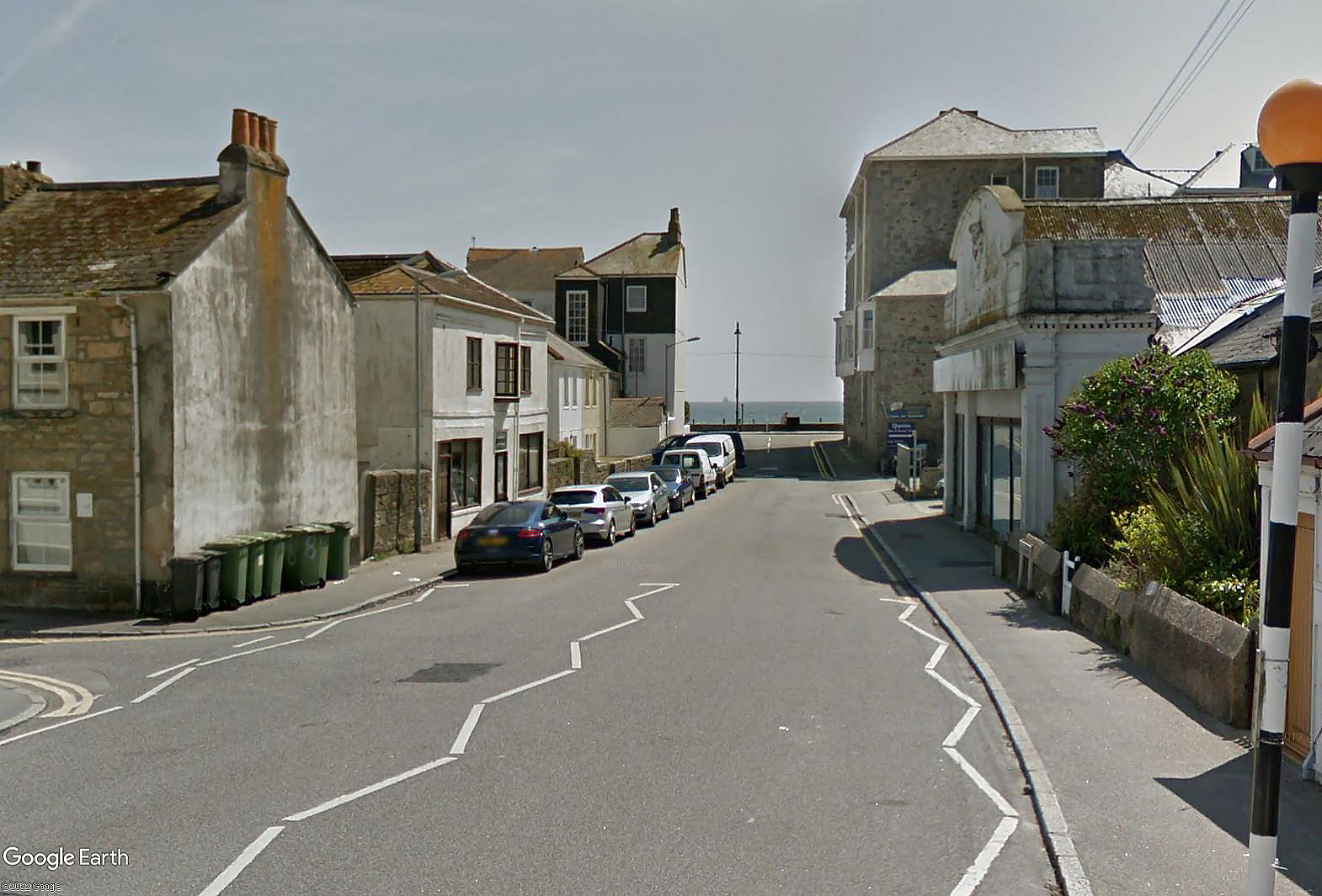
Battery Rocks Images

Images are sourced within 2km of 50.114163/-5.5298014 or Grid Reference SW4729. Thanks to Geograph Open Source API. All images are credited.

Newlyn harbour from Fore Street
The Newlyn Fishermen Memorial
Royal National Mission to Deep Sea Fishermen, Newlyn
Coastal views
Coastal views
View towards Newlyn Tidal Observatory from Tolcarne FBM
Newlyn Harbour A view of Newlyn Harbour taken from behind the RNLI station and looking southeast with the Mary Williams Pier on the left and the South Pier in the background.
Newlyn Harbour
A view of Newlyn Harbour taken from behind the RNLI station and looking southeast with the Mary Williams Pier on the left and the South Pier in the background.
Newlyn Harbour View of Newlyn Harbour, taken looking south from the Mary Williams Pier.
Newlyn Harbour
View of Newlyn Harbour, taken looking south from the Mary Williams Pier.
Street in Tolcarne
Street in Tolcarne
Looking across towards Penzance A view from Chywoone Hill across Newlyn towards Penzance.  Newlyn Harbour North  Quay crosses the bay from left to right.
Looking across towards Penzance
A view from Chywoone Hill across Newlyn towards Penzance. Newlyn Harbour North Quay crosses the bay from left to right.
Looking in to Mennaye Field
The gates to Penzance football club ground
Sponsored by Jewsons
Where once a garage stood Apartments have replaced the old garage. See: <a title="https://www.geograph.org.uk/photo/5749923" href="https://www.geograph.org.uk/photo/5749923">Link</a>
Where once a garage stood
Apartments have replaced the old garage. See: Link
Fish pond in Morrab Gardens
Morrab Road, Penzance c.1970 From the upstairs window of the former Marine Park Hotel. Streetview image Sep 2021: <span class="nowrap"><a title="https://media.geograph.org.uk/files/7eabe3a1649ffa2b3ff8c02ebfd5659f/Morrab_Rd_Penzance_Sep_2021-original.jpg" rel="nofollow ugc noopener" href="https://media.geograph.org.uk/files/7eabe3a1649ffa2b3ff8c02ebfd5659f/Morrab_Rd_Penzance_Sep_2021-original.jpg">Link</a><img style="margin-left:2px;" alt="External link" title="External link - shift click to open in new window" src="https://s1.geograph.org.uk/img/external.png" width="10" height="10"/></span>

<a href="https://www.geograph.org.uk/photo/7416705">SW4729 : Marine Park Hotel, Morab Road, Penzance c.1970</a>
Morrab Road, Penzance c.1970
From the upstairs window of the former Marine Park Hotel. Streetview image Sep 2021: LinkExternal link SW4729 : Marine Park Hotel, Morab Road, Penzance c.1970
Penzance : Road A road heading out from Penzance.
Penzance : Road
A road heading out from Penzance.
Penzance : Alexandra Road Looking along Alexandra Road.
Penzance : Alexandra Road
Looking along Alexandra Road.
Penzance : Plinth and Plaque The plinth and plaque stands at the entrance to the Pirates rugby ground. It was originally topped by a fountain – possibly to publicise the availability of mains water – and stood on the roundabout at the bottom of Alexandra Road. It was moved to its present site in the 1930s, having been declared a hazard to traffic.
Penzance : Plinth and Plaque
The plinth and plaque stands at the entrance to the Pirates rugby ground. It was originally topped by a fountain – possibly to publicise the availability of mains water – and stood on the roundabout at the bottom of Alexandra Road. It was moved to its present site in the 1930s, having been declared a hazard to traffic.
Show me another place!

Battery Rocks is located at Grid Ref: SW4729 (Lat: 50.114163, Lng: -5.5298014)

Unitary Authority: Cornwall

Police Authority: Devon and Cornwall

What 3 Words

///signs.musician.scraper. Near Penzance, Cornwall

Related Wikis

Battery Rocks

Battery Rocks are a rocky headland to the south of the harbour of Penzance, Cornwall, UK.The rocks take their name from a gun battery that was situated...
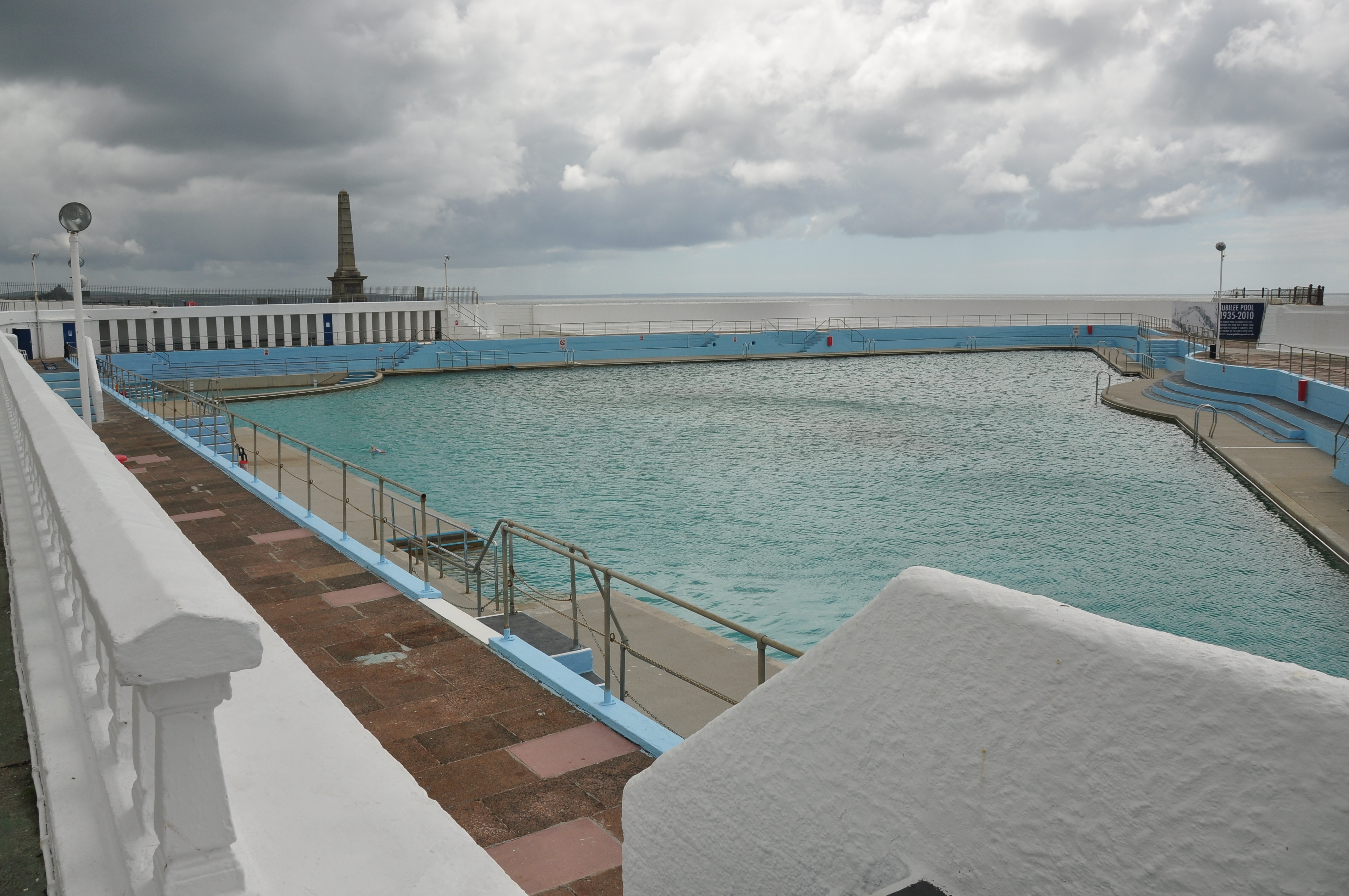
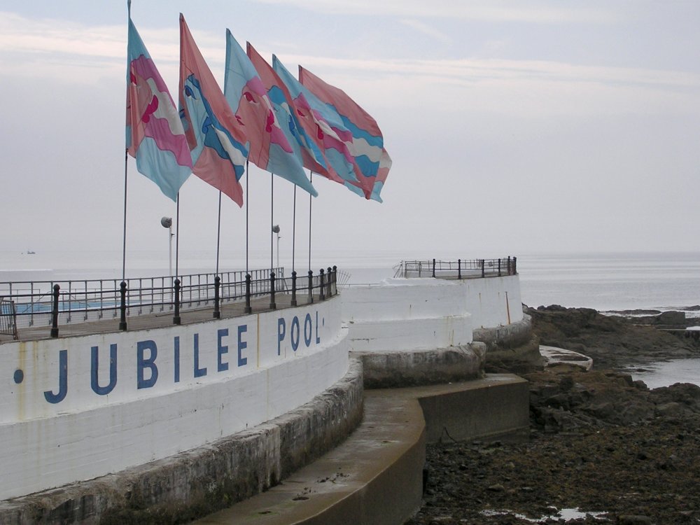
Jubilee Pool

Jubilee Pool (Cornish: Poll Jubile) is an Art Deco lido in Penzance, Cornwall. It is Grade II listed, being recognised as the finest surviving example...

Trinity House National Lighthouse Museum

Trinity House National Lighthouse Centre was a museum in Penzance, Cornwall, UK which housed the national collection of Trinity House. It included significant...

South Pier, Penzance

South Pier is located in Penzance, Cornwall, England. The original pier predated 1512, but was rebuilt in the 18th century. The pier is a Grade II* listed...

Nearby Amenities

Located within 500m of 50.114163,-5.5298014
Source: PGS
Lat/Long: 50.1143821/-5.5360933
Source: PGS
Lat/Long: 50.114607/-5.5354206
Source: PGS
Lat/Long: 50.114781/-5.5346698
Source: PGS
Lat/Long: 50.1150718/-5.5333604
Source: PGS
Lat/Long: 50.114159/-5.5311355
Traffic Signals
Lat/Long: 50.1175458/-5.5323579
Crossing
Crossing: zebra
Crossing Island: no
Tactile Paving: yes
Lat/Long: 50.1152778/-5.5320968
Bench
Backrest: yes
Lat/Long: 50.1143046/-5.5365526
Bench
Backrest: yes
Lat/Long: 50.1142709/-5.5366423
Bench
Backrest: yes
Lat/Long: 50.1142253/-5.5367784
Bench
Lat/Long: 50.1144224/-5.5361837
Litter Bin
Lat/Long: 50.114364/-5.5364006
The Lugger Inn
Alt Name: The Lugger Hotel
Internet Access: wlan
Tourism: hotel
Lat/Long: 50.1146611/-5.5362719
Bench
Backrest: yes
Lat/Long: 50.1145247/-5.5358925
Bench
Backrest: yes
Lat/Long: 50.1145882/-5.5356939
Post Box
Collection Times: Mo-Fr 09:00; Sa 07:00
Ref: TR18 17
Royal Cypher: EIIR
Royal Cypher Wikidata: Q33102113
Lat/Long: 50.1169591/-5.5340124
The Chocolate House
Addr Housenumber: 44
Addr Street: Chapel Street
Lat/Long: 50.116942/-5.5338529
The Abbey Hotel
Tourism: hotel
Wikidata: Q26579423
Lat/Long: 50.1175711/-5.533952
Recycling
Lat/Long: 50.1161492/-5.5301456
Seamark Light Category: vertical
Seamark Light Character: F
Seamark Light Colour: red
Seamark Light Height: 6
Seamark Light Multiple: 2
Seamark Light Range: 2
Seamark Light Reference: A 0051
Seamark Type: light_minor
Source: US NGA Pub. 114. 2011-05-26.
Lat/Long: 50.1176199/-5.5304747
Seamark Information: 309
Seamark Light Category: vertical
Seamark Light Character: F
Seamark Light Colour: green
Seamark Light Height: 11
Seamark Light Multiple: 2
Seamark Light Range: 2
Seamark Light Reference: A 0048
Seamark Type: light_minor
Source: US NGA Pub. 114. 2011-05-26.
Lat/Long: 50.1182152/-5.5297895
Penzance South Pier Light
Man Made: lighthouse
Name De: Leuchtturm Penzance Südpier
Seamark Light 1 Character: Fl
Seamark Light 1 Colour: red
Seamark Light 1 Height: 11
Seamark Light 1 Period: 5
Seamark Light 1 Range: 12
Seamark Light 1 Sector End: 224
Seamark Light 1 Sector Start: 159
Seamark Light 1 Visibility: unintensified
Seamark Light 2 Character: Fl
Seamark Light 2 Colour: red
Seamark Light 2 Height: 11
Seamark Light 2 Period: 5
Seamark Light 2 Range: 12
Seamark Light 2 Sector End: 268
Seamark Light 2 Sector Start: 224
Seamark Light 3 Character: Fl
Seamark Light 3 Colour: white
Seamark Light 3 Height: 11
Seamark Light 3 Period: 5
Seamark Light 3 Range: 17
Seamark Light 3 Sector End: 344.5
Seamark Light 3 Sector Start: 268
Seamark Light 4 Character: Fl
Seamark Light 4 Colour: red
Seamark Light 4 Height: 11
Seamark Light 4 Period: 5
Seamark Light 4 Range: 12
Seamark Light 4 Sector End: 45
Seamark Light 4 Sector Start: 344.5
Seamark Light Reference: A 0046
Seamark Type: light_minor
Source: US NGA Pub. 114. 2011-05-26.
Wikidata: Q28465899
Lat/Long: 50.117702/-5.5280167
Seamark Beacon Isolated Danger Colour: black;red;black
Seamark Beacon Isolated Danger Colour Pattern: horizontal
Seamark Light Character: Fl
Seamark Light Colour: white
Seamark Light Group: 2
Seamark Light Period: 10
Seamark Light Reference: A 0045
Seamark Name: The Gear
Seamark Topmark Colour: black
Seamark Topmark Shape: 2 spheres
Seamark Type: beacon_isolated_danger
Source: US NGA Pub. 114. 2011-05-26.
Lat/Long: 50.1104/-5.5269167
Penzance
Harbour: yes
Seamark Harbour Category: fishing
Seamark Type: harbour
Wikidata: Q105845399
Lat/Long: 50.1169244/-5.5303758
Pub
Yacht Inn
Addr City: Penzance
Addr Country: GB
Addr Housename: Yacht Inn
Addr Postcode: TR18 4AU
Addr Street: Green Street
Check Date: 2023-09-03
Fhrs Id: 402624
Lat/Long: 50.1157603/-5.532796
Pub
The Dock Inn
Addr City: Penzance
Addr Country: GB
Addr Housename: Dock Inn
Addr Housenumber: 17
Addr Postcode: TR18 4BD
Addr Street: Quay Street
Check Date: 2023-09-03
Fhrs Id: 909989
Lat/Long: 50.1160511/-5.5313578
Pub
Admiral Benbow
Addr City: Penzance
Addr Country: GB
Addr Housenumber: 46
Addr Postcode: TR18 4AF
Addr Street: Chapel Street
Fhrs Id: 1044534
Lat/Long: 50.117075/-5.5343453
Pub
The Turks Head
Addr City: Penzance
Addr Country: GB
Addr Housename: The Turks Head
Addr Housenumber: 49
Addr Postcode: TR18 4AF
Addr Street: Chapel Steet
Fhrs Id: 1475612
Wikidata: Q26435944
Lat/Long: 50.1172847/-5.5348001
Restaurant
Taj Mahal
Addr City: Penzance
Addr Country: GB
Addr Housenumber: 63
Addr Postcode: TR18 4DU
Addr Street: Daniel Place
Cuisine: indian
Fhrs Id: 447736
Lat/Long: 50.1152632/-5.5359459
Ferry Terminal
Isles of Scilly ferry
Ferry: yes
Public Transport: station
Lat/Long: 50.1177192/-5.5279854
Leisure: slipway
Seamark Small Craft Facility Category: slipway
Seamark Type: small_craft_facility
Lat/Long: 50.1176472/-5.5322822
Street Lamp
Lamp Flames: 1
Lamp Mount: bent_mast
Lamp Type: electric
Ref: L151
Survey Date: 2022-05-07
Lat/Long: 50.1171215/-5.531932
Street Lamp
Lamp Flames: 1
Lamp Mount: bent_mast
Lamp Type: electric
Lat/Long: 50.1173686/-5.5320605
Street Lamp
Lamp Flames: 1
Lamp Mount: bent_mast
Lamp Type: electric
Lat/Long: 50.1174853/-5.5324065
Street Lamp
Lamp Flames: 1
Lamp Mount: bent_mast
Lamp Type: electric
Lat/Long: 50.1177751/-5.5327291
Power: cable_distribution_cabinet
Lat/Long: 50.1177877/-5.5327441
Street Lamp
Lamp Flames: 1
Lamp Mount: bent_mast
Lamp Type: electric
Ref: L153
Survey Date: 2022-05-07
Lat/Long: 50.1180141/-5.5329203
Removed Amenity: telephone
Lat/Long: 50.1153918/-5.5322285
Bench
Lat/Long: 50.1153669/-5.5321963
Bench
Lat/Long: 50.1154202/-5.532199
Bench
Lat/Long: 50.1154804/-5.532199
Bench
Lat/Long: 50.1155277/-5.5322016
Bench
Lat/Long: 50.115365/-5.5320823
Bench
Lat/Long: 50.1156394/-5.5318295
Bench
Lat/Long: 50.1156221/-5.5317303
Bench
Lat/Long: 50.1156035/-5.5315941
Bench
Lat/Long: 50.1154574/-5.5315751
Bench
Lat/Long: 50.1154812/-5.5314624
Bench
Lat/Long: 50.11546/-5.5317225
Bench
Lat/Long: 50.1154791/-5.5318399
Bench
Lat/Long: 50.1154308/-5.5318543
Fountain
Lat/Long: 50.1155616/-5.5316416
Bench
Backrest: yes
Lat/Long: 50.1147005/-5.5352634
Bench
Backrest: yes
Lat/Long: 50.1148407/-5.5346947
Defibrillator
Emergency: defibrillator
Indoor: no
Lat/Long: 50.1171106/-5.53482
Post Box
Check Date: 2022-05-07
Collection Times: Mo-Fr 17:15; Sa 11:30
Operator: Royal Mail
Operator Wikidata: Q638098
Post Box Type: pillar
Ref: TR18 94
Royal Cypher: GVIR
Royal Cypher Wikidata: Q33102169
Lat/Long: 50.1160762/-5.5312125
Restaurant
Artist Residence
Addr City: Penzance
Addr Country: GB
Addr Housenumber: 20-22
Addr Postcode: TR18 4AW
Addr Street: Chapel Street
Opening Hours: Mo-Su 07:30-21:00
Lat/Long: 50.1169634/-5.5345061
Restaurant
Sea Palace
Addr City: Penzance
Addr Country: GB
Addr Housenumber: 19
Addr Postcode: TR18 4BD
Addr Street: Quay Street
Check Date: 2023-08-10
Fhrs Id: 402281
Lat/Long: 50.1160927/-5.5315897
Restaurant
The Pirates Rest
Addr City: Penzance
Addr Country: GB
Addr Housename: Captains Fish Bar
Addr Housenumber: 62
Addr Postcode: TR18 4DU
Addr Street: Daniel Place
Cuisine: fish_and_chips
Fhrs Id: 528391
Opening Hours: Mo-Th 16:30-21:30; Fr 12:00-14:00,16:30-21:30; Sa-Su 16:30-20:00
Source: Bing
Source Addr: FHRS Open Data
Takeaway: yes
Lat/Long: 50.1151485/-5.5358957
Bench
Backrest: no
Mapillary: 177667694227537
Survey Date: 2016-07-22
Lat/Long: 50.1154552/-5.531065
Pub
The Navy Inn
Addr City: Penzance
Addr Country: GB
Addr Housename: Navy Inn
Addr Postcode: TR18 4DE
Addr Street: Queen Street
Fhrs Id: 1070804
Website: http://navyinn.co.uk
Lat/Long: 50.1148398/-5.5358809
WW2 Anti-Aircraft Gun Battery (site of)
Building: bunker
Bunker Type: gun_emplacement
Military: bunker
Lat/Long: 50.1152723/-5.5313581
Bicycle Parking
Access: yes
Bicycle Parking: stands
Capacity: 20
Covered: yes
Fee: no
Lat/Long: 50.1153516/-5.5322606
Life Ring
Emergency: life_ring
Survey Date: 2022-05-07
Lat/Long: 50.1175881/-5.5325187
Waste Basket
Survey Date: 2022-05-07
Lat/Long: 50.1152401/-5.5316099
Fire Hydrant
Emergency: fire_hydrant
Fire Hydrant Type: underground
Survey Date: 2022-05-07
Lat/Long: 50.1161119/-5.5309486
Life Ring
Emergency: life_ring
Survey Date: 2022-05-07
Lat/Long: 50.1162958/-5.5307721
Life Ring
Emergency: life_ring
Survey Date: 2022-05-07
Lat/Long: 50.1150593/-5.5309656
Fire Hydrant
Emergency: fire_hydrant
Fire Hydrant Type: underground
Survey Date: 2022-05-07
Lat/Long: 50.1173741/-5.5321898
Defibrillator
Emergency: defibrillator
Indoor: no
Survey Date: 2022-05-07
Lat/Long: 50.1162323/-5.5311831
Waste Basket
Survey Date: 2022-05-07
Lat/Long: 50.1153847/-5.5309578
Waste Basket
Survey Date: 2022-05-07
Lat/Long: 50.1151939/-5.5332737
Waste Basket
Survey Date: 2022-05-07
Lat/Long: 50.1148926/-5.5344185
Fire Hydrant
Emergency: fire_hydrant
Fire Hydrant Type: underground
Survey Date: 2022-05-07
Lat/Long: 50.1163147/-5.5312445
Recycling
Recycling Type: container
Survey Date: 2022-05-07
Lat/Long: 50.1152401/-5.5316099
Life Ring
Emergency: life_ring
Survey Date: 2022-05-07
Lat/Long: 50.1151808/-5.5329917
Recycling
Recycling Type: container
Survey Date: 2022-05-07
Lat/Long: 50.1148935/-5.5344293
Waste Basket
Survey Date: 2022-05-07
Lat/Long: 50.1146737/-5.5354393
Life Ring
Emergency: life_ring
Survey Date: 2022-05-07
Lat/Long: 50.1145932/-5.5355269
Fire Hydrant
Emergency: fire_hydrant
Survey Date: 2022-05-07
Lat/Long: 50.1159337/-5.535597
Fire Hydrant
Emergency: fire_hydrant
Fire Hydrant Diameter Signed: no
Fire Hydrant Position: lane
Fire Hydrant Type: underground
Survey Date: 2022-05-07
Lat/Long: 50.1169743/-5.534329
Fire Hydrant
Emergency: fire_hydrant
Fire Hydrant Diameter Signed: no
Fire Hydrant Position: sidewalk
Fire Hydrant Type: underground
Survey Date: 2022-05-07
Lat/Long: 50.1173077/-5.533982
Fire Hydrant
Emergency: fire_hydrant
Survey Date: 2022-05-07
Lat/Long: 50.1161436/-5.535613
Restaurant
The Boatshed
Lat/Long: 50.1168708/-5.5317552
The data included in this document is from www.openstreetmap.org. The data is made available under ODbL.

Have you been to Battery Rocks?

Leave your review of Battery Rocks below (or comments, questions and feedback).