Ballinluig, Little

Settlement in Perthshire

Scotland

Ballinluig, Little

A827 The A827 is a cross-country route through the glens of central Scotland, running 35 miles along the entire length of Loch Tay, from Lix Toll to Ballinluig. 
<span class="nowrap"><a title="https://www.sabre-roads.org.uk/wiki/index.php?title=A827" rel="nofollow ugc noopener" href="https://www.sabre-roads.org.uk/wiki/index.php?title=A827">Link</a><img style="margin-left:2px;" alt="External link" title="External link - shift click to open in new window" src="https://s1.geograph.org.uk/img/external.png" width="10" height="10"/></span>
A827 Credit: N Chadwick

The requested URL returned error: 429 Too Many Requests

If you have any feedback on the listing, please let us know in the comments section below.

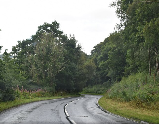
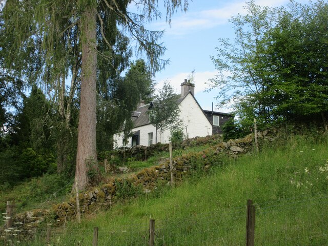
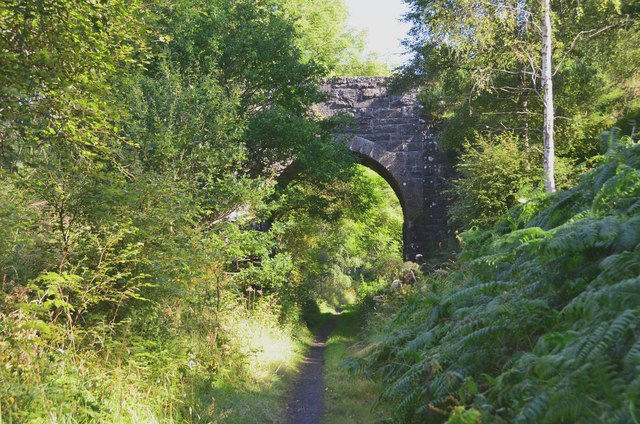
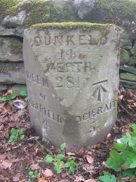
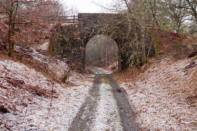
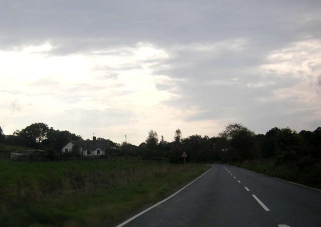
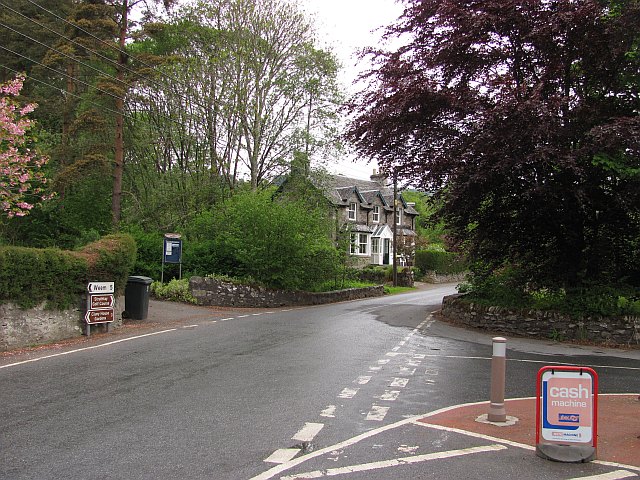
Ballinluig, Little Images

Images are sourced within 2km of 56.652389/-3.77999 or Grid Reference NN9052. Thanks to Geograph Open Source API. All images are credited.

A827 The A827 is a cross-country route through the glens of central Scotland, running 35 miles along the entire length of Loch Tay, from Lix Toll to Ballinluig. 
<span class="nowrap"><a title="https://www.sabre-roads.org.uk/wiki/index.php?title=A827" rel="nofollow ugc noopener" href="https://www.sabre-roads.org.uk/wiki/index.php?title=A827">Link</a><img style="margin-left:2px;" alt="External link" title="External link - shift click to open in new window" src="https://s1.geograph.org.uk/img/external.png" width="10" height="10"/></span>
A827
The A827 is a cross-country route through the glens of central Scotland, running 35 miles along the entire length of Loch Tay, from Lix Toll to Ballinluig. LinkExternal link
The Laigh of Clochfoldich White-washed cottage at Clochfoldich, viewed from the road below.
The Laigh of Clochfoldich
White-washed cottage at Clochfoldich, viewed from the road below.
Path to Grandtully Footpath along the former railway from Aberfeldy to Ballinluig, also used by the Rob Roy Way to Pitlochry.
Path to Grandtully
Footpath along the former railway from Aberfeldy to Ballinluig, also used by the Rob Roy Way to Pitlochry.
Bridge over former railway On the path to Grandtully following the old railway trackbed - see <a href="https://www.geograph.org.uk/photo/2312570">NN8952 : Bridge over dismantled railway</a> for a view from the other side.
Bridge over former railway
On the path to Grandtully following the old railway trackbed - see NN8952 : Bridge over dismantled railway for a view from the other side.
Footpath on the Rob Roy Way
Woodland beside the Tay Deciduous woodland between the old railway and river.
Woodland beside the Tay
Deciduous woodland between the old railway and river.
Raspberry patch Raspberries growing in woodland near Grandtully. Beyond the plants is the trackbed of the Aberfeldy branch line, now a path.
Raspberry patch
Raspberries growing in woodland near Grandtully. Beyond the plants is the trackbed of the Aberfeldy branch line, now a path.
Aberfeldy Branch The trackbed crossing a high embankment.
Aberfeldy Branch
The trackbed crossing a high embankment.
Old Milestone in Strath Tay, Weem parish Milestone by the UC road, in parish of Weem (District), Derculich, beside stone wall near 'Red Squirrels' sign.

Inscription reads:-
: WEEM / OR / ABERFELDY / 4½ : : DUNKELD / 14½ / PERTH / 28½ : : LOGIERAIT / 5½ : 
Carved benchmark on right face.

Surveyed

Milestone Society National ID: PK_AFLG04
Old Milestone in Strath Tay, Weem parish
Milestone by the UC road, in parish of Weem (District), Derculich, beside stone wall near 'Red Squirrels' sign. Inscription reads:- : WEEM / OR / ABERFELDY / 4½ : : DUNKELD / 14½ / PERTH / 28½ : : LOGIERAIT / 5½ : Carved benchmark on right face. Surveyed Milestone Society National ID: PK_AFLG04
Road near to The Laigh of Clochfoldich Looking south-westward.
Road near to The Laigh of Clochfoldich
Looking south-westward.
Bridge over dismantled railway This bridge crosses the former railway line between Aberfeldy and Grandtully. The bridge once gave access to a strip of land between the railway and the Tay, but doesn't seem to serve any purpose now.

The railway line forms part of the Rob Roy Way now. The picture was taken in a light snow shower.
Bridge over dismantled railway
This bridge crosses the former railway line between Aberfeldy and Grandtully. The bridge once gave access to a strip of land between the railway and the Tay, but doesn't seem to serve any purpose now. The railway line forms part of the Rob Roy Way now. The picture was taken in a light snow shower.
House by the A827
House by the A827
Balnacroft, Little Ballinluig, Perthshire
Ballinduin Clochfoldich Former cottar house of hill farm in Strathtay. In 1813 the address appears in an Old Parish Register as Bailintun of Clochfoldich and in 1815 as Balinduin, Parish of Logierait.
Ballinduin Clochfoldich
Former cottar house of hill farm in Strathtay. In 1813 the address appears in an Old Parish Register as Bailintun of Clochfoldich and in 1815 as Balinduin, Parish of Logierait.
A riverside woodland Woodland beside the Tay.
A riverside woodland
Woodland beside the Tay.
Road to Findynate A farm drive with waterbars climbs steeply away from the River Tay.
Road to Findynate
A farm drive with waterbars climbs steeply away from the River Tay.
Track leading to Greenfields
Path through the Woods to Clochfoldich Fishing Beat A fly fishing beat run by Aberfeldy Angling Club.
Path through the Woods to Clochfoldich Fishing Beat
A fly fishing beat run by Aberfeldy Angling Club.
Show me another place!

Ballinluig, Little is located at Grid Ref: NN9052 (Lat: 56.652389, Lng: -3.77999)

Unitary Authority: Perth and Kinross

Police Authority: Tayside

What 3 Words

///alongside.having.refer. Near Aberfeldy, Perth & Kinross

Related Wikis

Grandtully

Grandtully (pronounced as "Grantly" and sometimes also spelt "Grantully") is a small village in Perthshire, Scotland. It is situated close to the River...

Grandtully railway station

Grandtully railway station served the village of Grandtully, Perthshire, Scotland from 1865 to 1965 on the Inverness and Perth Junction Railway. ��2�...

Strathtay

For the bus company, see Stagecoach Strathtay.Strathtay is a small rural village on the River Tay in Perthshire, Scotland. It is part of the Grandtully...
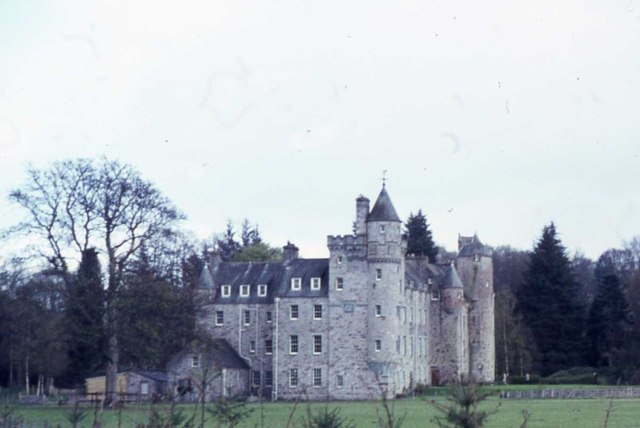
Grandtully Castle

Grandtully Castle is an historic building in Grandtully, Perth and Kinross, Scotland. It is a Category A listed building dating to 1560. An earlier castle...

Nearby Amenities

Located within 500m of 56.652389,-3.77999
Traffic Signals
Source: survey
Lat/Long: 56.6548924/-3.776308
Grandtully Slalom
Whitewater: put_in
Lat/Long: 56.6564294/-3.7774263
Traffic Signals
Source: survey
Lat/Long: 56.6555497/-3.7762491
Post Box
Brand: Royal Mail
Brand Wikidata: Q638098
Operator: Royal Mail
Operator Wikidata: Q638098
Post Box Mounting: pier
Post Box Type: lamp
Ref: PH15 29
Royal Cypher: scottish_crown
Source: survey
Lat/Long: 56.65311/-3.7798443
Bus Stop
Operator: Stagecoach
Source: survey
Lat/Long: 56.6531906/-3.7793994
Bus Stop
Bus: yes
Operator: Stagecoach
Public Transport: platform
Source: survey
Lat/Long: 56.6533374/-3.780259
Traffic Signals
Source: survey
Lat/Long: 56.6555007/-3.776117
Little Ballinluig
Name Gd: Baile Beag an Luig
Place: village
Lat/Long: 56.652751/-3.7808838
Generator Method: photovoltaic
Generator Output Electricity: yes
Generator Solar Modules: 10
Generator Source: solar
Generator Type: solar_photovoltaic_panel
Power: generator
Lat/Long: 56.6560343/-3.7753696
Power: pole
Lat/Long: 56.6489398/-3.7845351
Power: pole
Lat/Long: 56.649212/-3.7838445
Power: pole
Lat/Long: 56.6495917/-3.7828636
Power: pole
Lat/Long: 56.6499107/-3.7820437
Power: pole
Lat/Long: 56.6502627/-3.7811638
Power: pole
Lat/Long: 56.6506666/-3.7801577
Power: pole
Lat/Long: 56.6489727/-3.7797871
Power: pole
Lat/Long: 56.6497442/-3.7806323
Power: pole
Lat/Long: 56.6561024/-3.7840558
Power: pole
Lat/Long: 56.6559776/-3.782881
Power: pole
Lat/Long: 56.655891/-3.7821162
Power: pole
Lat/Long: 56.6554706/-3.7816636
Power: pole
Lat/Long: 56.6558944/-3.7804888
Power: pole
Lat/Long: 56.6563226/-3.7793346
Power: pole
Lat/Long: 56.6565523/-3.7788473
Power: pole
Lat/Long: 56.6537864/-3.7770244
Power: pole
Lat/Long: 56.6541279/-3.7769582
Power: pole
Lat/Long: 56.6543446/-3.7761634
Advertising: board
Lat/Long: 56.6531421/-3.7798464
Bench
Lat/Long: 56.6531721/-3.7798464
Grit Bin
Lat/Long: 56.6532045/-3.7798437
The data included in this document is from www.openstreetmap.org. The data is made available under ODbL.

Have you been to Ballinluig, Little?

Leave your review of Ballinluig, Little below (or comments, questions and feedback).