Atherfield, Little

Settlement in Hampshire

England

Atherfield, Little

HM Coastguard on watch near Whale Chine On the day of the 2022 Round the Island race.
HM Coastguard on watch near Whale Chine Credit: Paul Coueslant

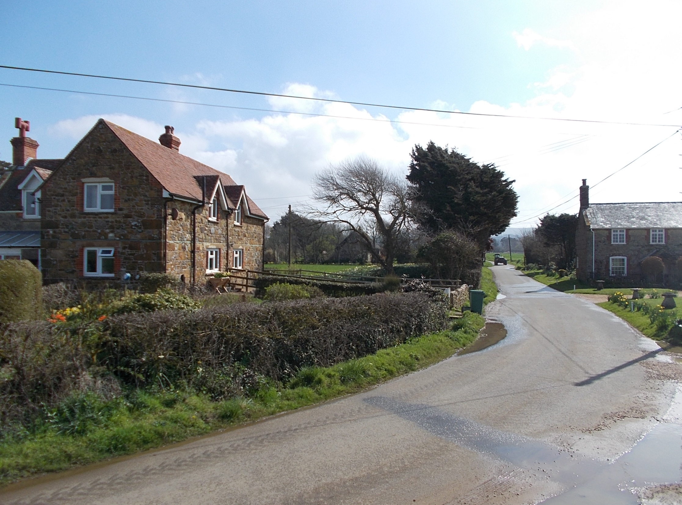
Atherfield, Little is a small village located in the county of Hampshire, England. Situated on the Isle of Wight, this picturesque village is known for its idyllic countryside and tranquil surroundings. With a population of around 200 residents, Atherfield, Little offers a peaceful and close-knit community.

The village boasts a rich history, dating back to medieval times. It is home to several historic buildings, including a beautiful 12th-century church, St. Mary's, which is a prominent landmark in the area. The church's architecture showcases the village's heritage and attracts visitors interested in history and architecture.

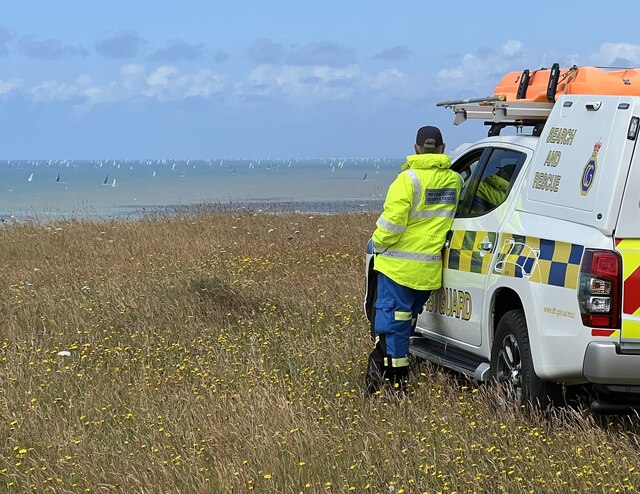
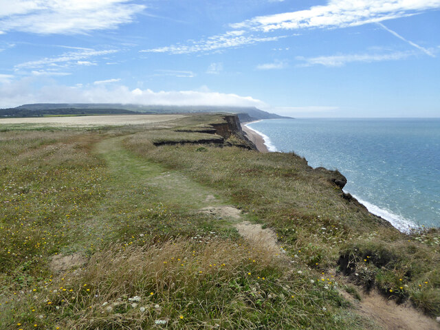
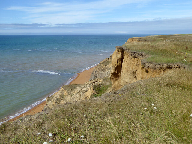
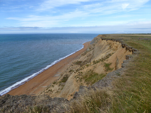
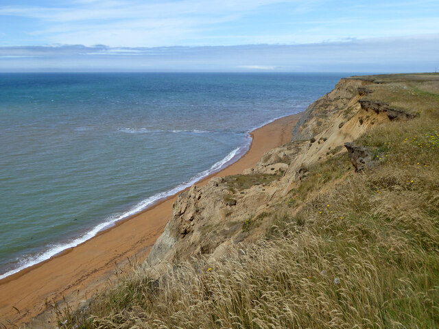
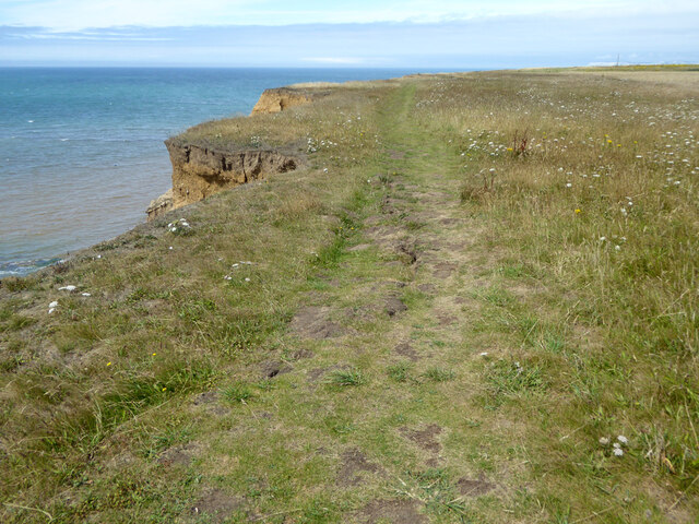
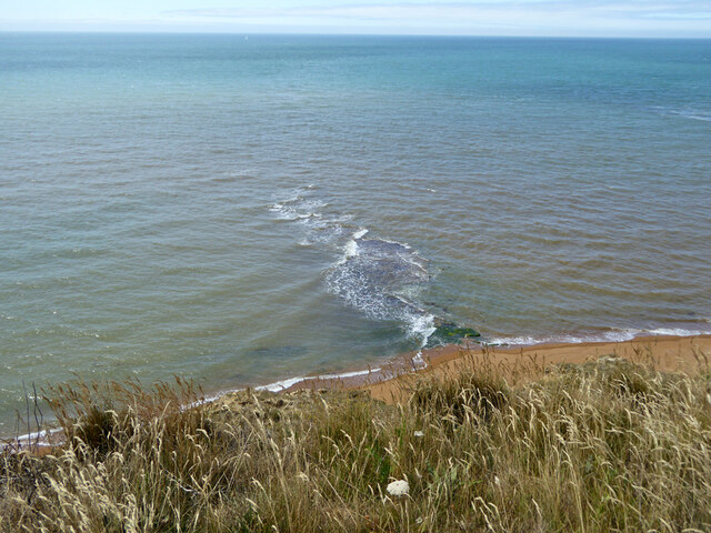
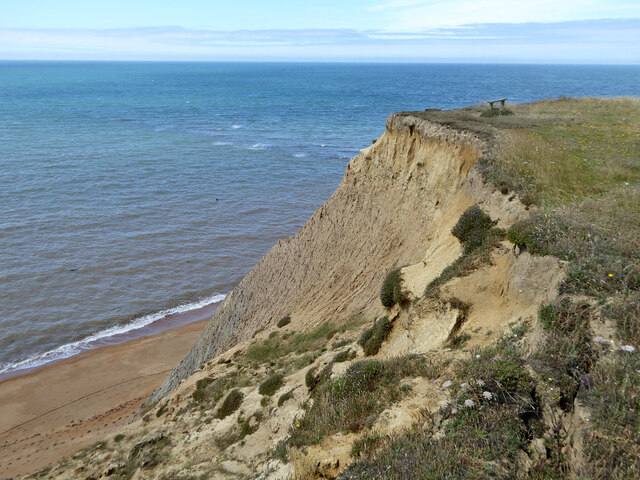
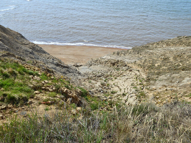
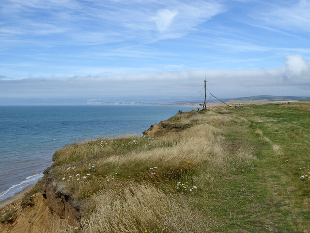
Nature enthusiasts will find plenty to explore in Atherfield, Little. Surrounded by rolling hills and lush green fields, the village offers breathtaking views of the surrounding countryside. The nearby Atherfield Bay provides an opportunity for beach walks and stunning coastal scenery.

Though small, the village has a strong sense of community and offers a range of amenities for its residents. These include a local pub, The White Mouse Inn, where locals and visitors can enjoy traditional British fare and a friendly atmosphere.

Atherfield, Little is well-connected to other parts of the Isle of Wight, with nearby towns such as Freshwater and Ventnor within easy reach. This allows residents to access a wider range of facilities and services, including schools, shops, and healthcare facilities.

Overall, Atherfield, Little offers a peaceful and charming village lifestyle, making it an attractive destination for those seeking a serene retreat in the heart of Hampshire.

If you have any feedback on the listing, please let us know in the comments section below.

Atherfield, Little Images

Images are sourced within 2km of 50.618481/-1.348568 or Grid Reference SZ4680. Thanks to Geograph Open Source API. All images are credited.

HM Coastguard on watch near Whale Chine On the day of the 2022 Round the Island race.
HM Coastguard on watch near Whale Chine
On the day of the 2022 Round the Island race.
View to sea near Whale Chine A couple of jet skis burning up the hydrocarbons.
View to sea near Whale Chine
A couple of jet skis burning up the hydrocarbons.
Coastal path SW30 heading east Along a stretch of cliff particularly liable to erosion.
Coastal path SW30 heading east
Along a stretch of cliff particularly liable to erosion.
Coastguard cottages, Atherfield Point
Cliff near Atherfield Point A stretch of cliff particularly liable to erosion. It is a good idea to study the turf for cracks if approaching the edge. The point is caused by a layer of harder rock at a lower level, it may be seen extending out to sea here.
Cliff near Atherfield Point
A stretch of cliff particularly liable to erosion. It is a good idea to study the turf for cracks if approaching the edge. The point is caused by a layer of harder rock at a lower level, it may be seen extending out to sea here.
Cliff east of Atherfield Point A stretch of cliff particularly liable to erosion. It is a good idea to study the turf for cracks if approaching the edge.
Cliff east of Atherfield Point
A stretch of cliff particularly liable to erosion. It is a good idea to study the turf for cracks if approaching the edge.
Cliff near Atherfield Point A stretch of cliff particularly liable to erosion. The point is caused by a layer of harder rock at a lower level, it may be seen extending out to sea here.
Cliff near Atherfield Point
A stretch of cliff particularly liable to erosion. The point is caused by a layer of harder rock at a lower level, it may be seen extending out to sea here.
Path SW30, Atherfield Point A stretch of cliff particularly liable to erosion. It is a good idea to study the turf for cracks if approaching the edge. This part looks suspicious, it may just be mole work, on the other hand the mole may have exploited an easily delved crack.
Path SW30, Atherfield Point
A stretch of cliff particularly liable to erosion. It is a good idea to study the turf for cracks if approaching the edge. This part looks suspicious, it may just be mole work, on the other hand the mole may have exploited an easily delved crack.
Ledge at Atherfield Point A stretch of cliff particularly liable to erosion. The point is caused by layers of harder rock at a lower level, one may be seen extending out to sea here. There is a broader ledge further west, presumably a different stratum.
Ledge at Atherfield Point
A stretch of cliff particularly liable to erosion. The point is caused by layers of harder rock at a lower level, one may be seen extending out to sea here. There is a broader ledge further west, presumably a different stratum.
Cliff, Atherfield Point A stretch of cliff particularly liable to erosion.
Cliff, Atherfield Point
A stretch of cliff particularly liable to erosion.
Cliff, Atherfield Point A stretch of cliff particularly liable to erosion. Here a mud flow plays a part.
Cliff, Atherfield Point
A stretch of cliff particularly liable to erosion. Here a mud flow plays a part.
Cliff, Atherfield Point At or near the bottom is a cache of fishing equipment with a braced post. There is a similar post on the cliff top with a lightweight cable heading down, hardly visible at a distance. Perhaps this is the bottom end.  The vegetated green strip is the east end of a long ledge that seems to be formed from a bodily slip of a length of cliff top, there is a bench on it, similar to those surviving elsewhere on the cliff top. The ledge rises to the west and appears to be the easy part of a descent on foot to here.
Cliff, Atherfield Point
At or near the bottom is a cache of fishing equipment with a braced post. There is a similar post on the cliff top with a lightweight cable heading down, hardly visible at a distance. Perhaps this is the bottom end. The vegetated green strip is the east end of a long ledge that seems to be formed from a bodily slip of a length of cliff top, there is a bench on it, similar to those surviving elsewhere on the cliff top. The ledge rises to the west and appears to be the easy part of a descent on foot to here.
Lookout post, Atherfield Point A lightweight cable goes down the cliff from the post, possibly connected to the post seen in <a href="https://www.geograph.org.uk/photo/7419923">SZ4579 : Cliff, Atherfield Point</a>. There was a weatherbeaten notice on the post with extracts from some publication detailing the vessels that foundered on the Atherfield Ledge, a rock formation off the point.
Lookout post, Atherfield Point
A lightweight cable goes down the cliff from the post, possibly connected to the post seen in SZ4579 : Cliff, Atherfield Point. There was a weatherbeaten notice on the post with extracts from some publication detailing the vessels that foundered on the Atherfield Ledge, a rock formation off the point.
Coast west of Atherfield Point
Slumped cliff west of Atherfield Point The British Geological Society's viewer describes this as 'Atherfield Clay Formation - Mudstone, sandy. Sedimentary bedrock formed between 126.3 and 113 million years ago during the Cretaceous period'.
Slumped cliff west of Atherfield Point
The British Geological Society's viewer describes this as 'Atherfield Clay Formation - Mudstone, sandy. Sedimentary bedrock formed between 126.3 and 113 million years ago during the Cretaceous period'.
Coastal footpath SW30 with paraglider One of two paragliders that suddenly appeared when I wasn't looking in the right direction.
Coastal footpath SW30 with paraglider
One of two paragliders that suddenly appeared when I wasn't looking in the right direction.
Cliff slide between Atherfield Point and Shepherd's Chine This embayment in the cliff top line appears from aerial photographs to have been largely initiated somewhere between 1999 and 2005, with enlargement by subsequent slips. Before this the cliff top protruded somewhat towards the sea.
Cliff slide between Atherfield Point and Shepherd's Chine
This embayment in the cliff top line appears from aerial photographs to have been largely initiated somewhere between 1999 and 2005, with enlargement by subsequent slips. Before this the cliff top protruded somewhat towards the sea.
View north from cliff top near Shepherd's Chine The far summit is on Limerstone Down.
View north from cliff top near Shepherd's Chine
The far summit is on Limerstone Down.
Show me another place!

Atherfield, Little is located at Grid Ref: SZ4680 (Lat: 50.618481, Lng: -1.348568)

Unitary Authority: Isle of Wight

Police Authority: Hampshire

What 3 Words

///hunk.promises.cherish. Near Chale, Isle of Wight

Related Wikis

Little Atherfield

Little Atherfield is a small settlement in the civil parish of Shorwell, on the Isle of Wight, England. It is near the coast in the Back of the Wight....

Atherfield

Atherfield is a rural location in the south west of the Isle of Wight, UK. It includes the small settlements of Atherfield Green and Little Atherfield...

Atherfield Ledge

Atherfield Ledge is a rocky outcrop extending from the coast of the Back of the Wight, Isle of Wight. This is a famous shipwreck location. Along with Brook...

Whale Chine

Whale Chine is a geological feature near Chale on the south-west coast of the Isle of Wight, England (the Back of the Wight). One of a number of such chines...

Nearby Amenities

Located within 500m of 50.618481,-1.348568
Source: Locally rectified NPE map
Lat/Long: 50.6186813/-1.3450577
Source: Locally rectified NPE map
Lat/Long: 50.6179777/-1.3439684
Source: Locally rectified NPE map
Lat/Long: 50.6142817/-1.3479745
Source: Locally rectified NPE map
Lat/Long: 50.6150932/-1.3519716
Source: Locally rectified NPE map
Lat/Long: 50.6162238/-1.3522454
Source: Locally rectified NPE map
Lat/Long: 50.6177858/-1.3526996
Source: Locally rectified NPE map
Lat/Long: 50.6184921/-1.3474775
Source: Locally rectified NPE map
Lat/Long: 50.6186574/-1.3486828
Source: Locally rectified NPE map
Lat/Long: 50.6212294/-1.3535223
Little Atherfield
Place: hamlet
Source: OS_OpenData_StreetView
Wikidata: Q6648966
Lat/Long: 50.6192966/-1.3488138
Barrier: stile
Lat/Long: 50.6147532/-1.3471968
Little Atherfield Farm Airstrip
Aeroway: airstrip
Lat/Long: 50.6180732/-1.3424489
The data included in this document is from www.openstreetmap.org. The data is made available under ODbL.

Have you been to Atherfield, Little?

Leave your review of Atherfield, Little below (or comments, questions and feedback).