An Dubh-sgeir

Island in Inverness-shire

Scotland

An Dubh-sgeir

Waterfall Ahead Burn in Glen Caladale just before it plunges to the sea - Minginish peninsula, Isle of Skye
Waterfall Ahead Credit: Adam Ward

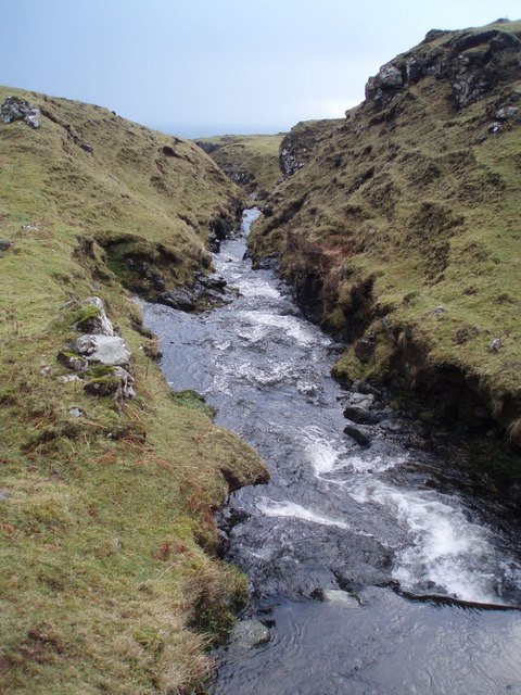
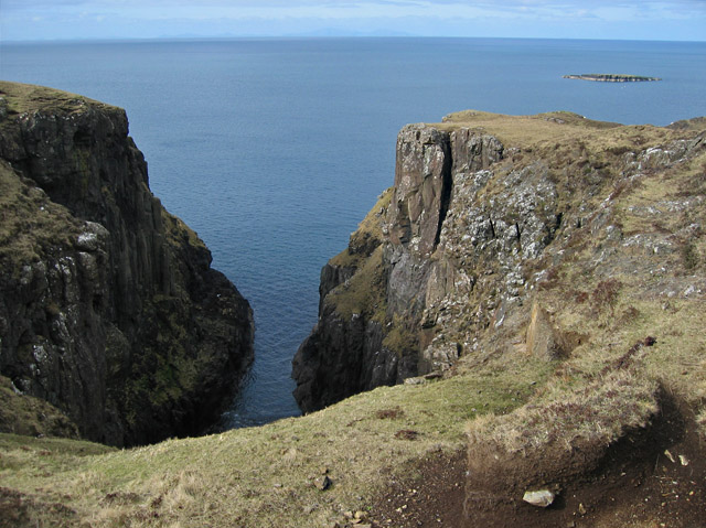
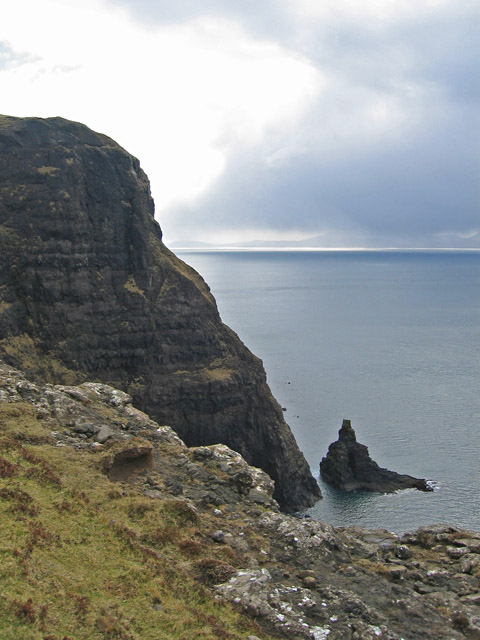
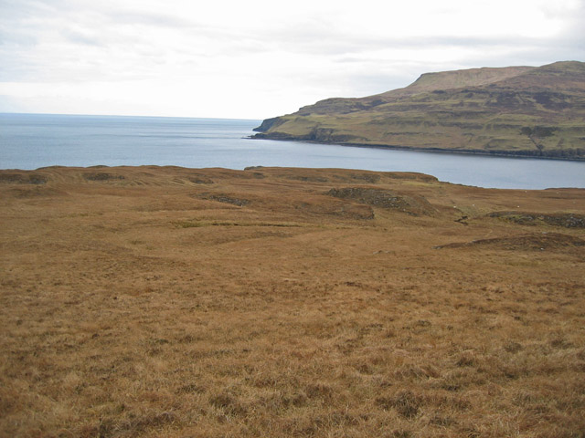
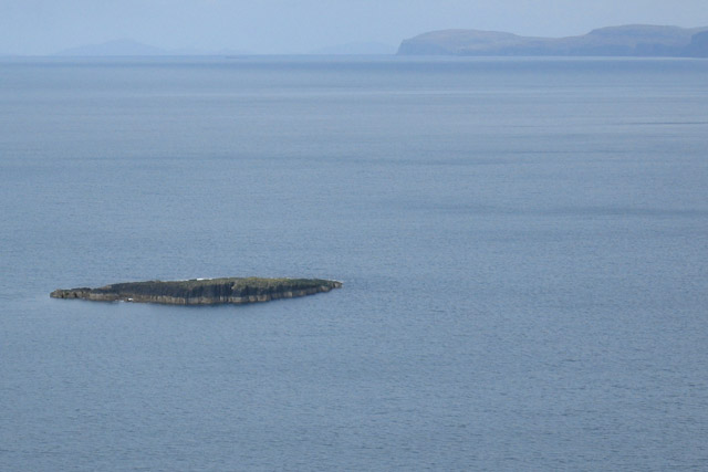
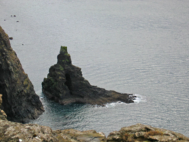
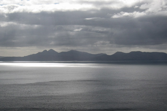
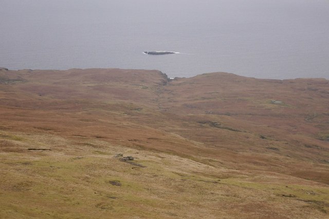
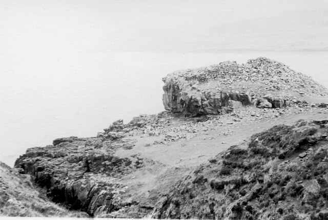
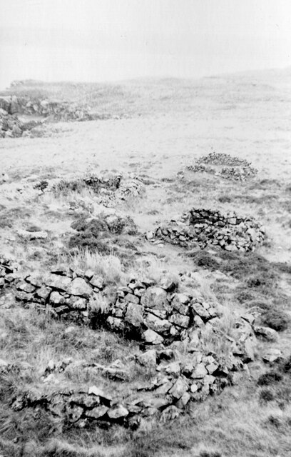
An Dubh-sgeir, located in Inverness-shire, Scotland, is a small island situated off the west coast of the Scottish mainland. Also known as "The Black Skerry," this uninhabited island is part of the Inner Hebrides archipelago. An Dubh-sgeir is approximately 13 hectares in size, with rugged and rocky terrain that rises to a maximum elevation of 15 meters above sea level.

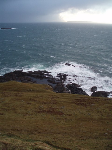
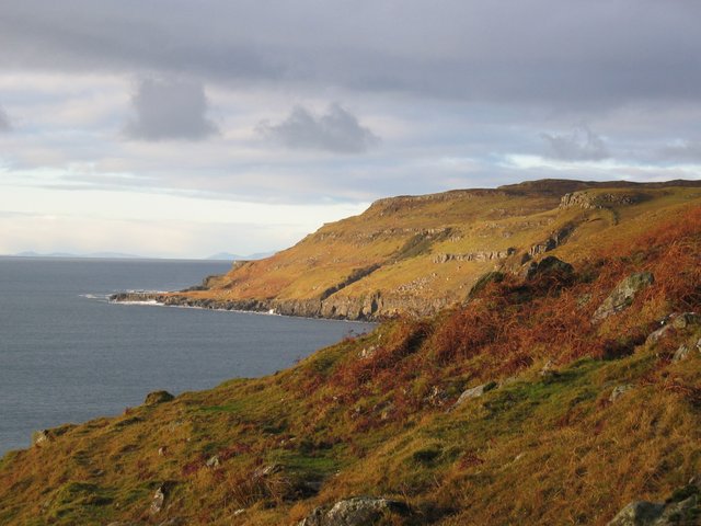
The island is renowned for its stunning natural beauty, featuring picturesque cliffs and breathtaking views of the surrounding sea and neighboring islands. Its remote location and lack of human habitation make it a haven for wildlife enthusiasts and birdwatchers. The island is home to various species of seabirds, including gannets, guillemots, and kittiwakes, which can be observed nesting on the cliffs during the breeding season.

An Dubh-sgeir is accessible by boat, and visitors can explore its rocky shores and discover the diverse marine life that inhabits its surrounding waters. The island offers opportunities for fishing, diving, and snorkeling, with the chance to encounter seals, dolphins, and even whales in the nearby sea.

While there are no facilities or accommodations on the island, nearby towns such as Mallaig and Arisaig provide services for visitors, including boat tours and guided trips to An Dubh-sgeir. The island's isolation and natural beauty make it a popular destination for those seeking a tranquil and untouched experience in the Scottish Highlands.

If you have any feedback on the listing, please let us know in the comments section below.

An Dubh-sgeir Images

Images are sourced within 2km of 57.218826/-6.4002548 or Grid Reference NG3422. Thanks to Geograph Open Source API. All images are credited.

Waterfall Ahead Burn in Glen Caladale just before it plunges to the sea - Minginish peninsula, Isle of Skye
Waterfall Ahead
Burn in Glen Caladale just before it plunges to the sea - Minginish peninsula, Isle of Skye
Coastline and Canna Coastal scenery of the Minginish peninsula with a dramatic sky above Canna. You can just see An Dubh-sgeir at left.
Coastline and Canna
Coastal scenery of the Minginish peninsula with a dramatic sky above Canna. You can just see An Dubh-sgeir at left.
Creagan Dubh Coastline on the north side of the entrance to Loch Eynort.
Creagan Dubh
Coastline on the north side of the entrance to Loch Eynort.
Geodha nan Gobhar A substantial geodh on the coast south of Loch Eynort. The cliff edges on this stretch of coast are convex and crumbly. Not a place to get too close to the edge.
Geodha nan Gobhar
A substantial geodh on the coast south of Loch Eynort. The cliff edges on this stretch of coast are convex and crumbly. Not a place to get too close to the edge.
Stac an Tuill The stack is so named because of its resemblance to a church belltower. It is holed through the middle in the manner of a high-arched window. The start of the hole can be seen in this view but it is not possible to see right through from a clifftop viewpoint - and there is no way down.
The cliff edges on this stretch of coast are convex and crumbly. Not a place to get too close to the edge.
Stac an Tuill
The stack is so named because of its resemblance to a church belltower. It is holed through the middle in the manner of a high-arched window. The start of the hole can be seen in this view but it is not possible to see right through from a clifftop viewpoint - and there is no way down. The cliff edges on this stretch of coast are convex and crumbly. Not a place to get too close to the edge.
Laimhrig na Moine Peaty moorland south of the mouth of Loch Eynort. Most of the land in the square can be seen in this view.
Laimhrig na Moine
Peaty moorland south of the mouth of Loch Eynort. Most of the land in the square can be seen in this view.
Radio station on Cnoc an Teine Presumably once a hill with a fire beacon, it now has the remains of a radio station on its summit. The two container-like boxes in the rear appear to be generators and the small wooden hut holds an empty computer cabinet with BT labels on it. I guess it is a redundant telephone relay that connected Skye and the Western Isles.
Radio station on Cnoc an Teine
Presumably once a hill with a fire beacon, it now has the remains of a radio station on its summit. The two container-like boxes in the rear appear to be generators and the small wooden hut holds an empty computer cabinet with BT labels on it. I guess it is a redundant telephone relay that connected Skye and the Western Isles.
Cairn by the Allt Sgeiteadh What appears to be a chambered burial cairn by the burn south of Cnoc an Teine. It is not marked on the OS maps.
Cairn by the Allt Sgeiteadh
What appears to be a chambered burial cairn by the burn south of Cnoc an Teine. It is not marked on the OS maps.
An Dubh-sgeir The sgeir is the only dry land in the square. This view is from the cliff top north of Geodha nan Gobhar.
An Dubh-sgeir
The sgeir is the only dry land in the square. This view is from the cliff top north of Geodha nan Gobhar.
Stac an Tuill The stack is so named because of its resemblance to a church belltower. It is holed through the middle in the manner of a high-arched window. The start of the hole can be seen in this view but it is not possible to see right through from the top of the cliffs - and there is no way down.
The cliff edges on this stretch of coast are convex and crumbly. Not a place to get too close to the edge.
Stac an Tuill
The stack is so named because of its resemblance to a church belltower. It is holed through the middle in the manner of a high-arched window. The start of the hole can be seen in this view but it is not possible to see right through from the top of the cliffs - and there is no way down. The cliff edges on this stretch of coast are convex and crumbly. Not a place to get too close to the edge.
Rum from Sgurr an Duine The view to Rum from the cliff top of Sgurr an Duine. A heavy, blustery, but thankfully brief hail shower had just passed over us on this otherwise sunny day. The picture shows the shower heading away across the sea to Rum, creating some interesting patterns of light and shade as it travels.
Rum from Sgurr an Duine
The view to Rum from the cliff top of Sgurr an Duine. A heavy, blustery, but thankfully brief hail shower had just passed over us on this otherwise sunny day. The picture shows the shower heading away across the sea to Rum, creating some interesting patterns of light and shade as it travels.
Signs of settlement at Caladale Ruined houses, sheep fanks and lazybeds of the deserted settlement at the foot of Caladale.
Distant left is part of the Cuillin, with An Cruachan to the right.
Signs of settlement at Caladale
Ruined houses, sheep fanks and lazybeds of the deserted settlement at the foot of Caladale. Distant left is part of the Cuillin, with An Cruachan to the right.
Abandoned cultivation above Sgurr Mor Lazybeds of the deserted settlement at the foot of Caladale.
Abandoned cultivation above Sgurr Mor
Lazybeds of the deserted settlement at the foot of Caladale.
An Dubh-sgeir A skerry of Loch Eynort, seen from the summit of An Cruachan.
An Dubh-sgeir
A skerry of Loch Eynort, seen from the summit of An Cruachan.
Dun on Loch Eynort, Skye The ruins of a stone structure on a rocky headland at the mouth of the sea loch. More details can be found at the Canmore website <span class="nowrap"><a title="https://canmore.org.uk/site/11042/skye-kraiknish" rel="nofollow ugc noopener" href="https://canmore.org.uk/site/11042/skye-kraiknish">Link</a><img style="margin-left:2px;" alt="External link" title="External link - shift click to open in new window" src="https://s1.geograph.org.uk/img/external.png" width="10" height="10"/></span> and the Megalithic Portal <span class="nowrap"><a title="https://www.megalithic.co.uk/article.php?sid=27605" rel="nofollow ugc noopener" href="https://www.megalithic.co.uk/article.php?sid=27605">Link</a><img style="margin-left:2px;" alt="External link" title="External link - shift click to open in new window" src="https://s1.geograph.org.uk/img/external.png" width="10" height="10"/></span>.
Dun on Loch Eynort, Skye
The ruins of a stone structure on a rocky headland at the mouth of the sea loch. More details can be found at the Canmore website LinkExternal link and the Megalithic Portal LinkExternal link.
Stone hut remains, Loch Eynort Skye I assume that these walls are the ones marked on the 1:25,000 map NE of the dun, but the positioning is approximate. 

See also the Canmore website <span class="nowrap"><a title="https://canmore.org.uk/site/11042/skye-kraiknish" rel="nofollow ugc noopener" href="https://canmore.org.uk/site/11042/skye-kraiknish">Link</a><img style="margin-left:2px;" alt="External link" title="External link - shift click to open in new window" src="https://s1.geograph.org.uk/img/external.png" width="10" height="10"/></span> and the Megalithic Portal <span class="nowrap"><a title="https://www.megalithic.co.uk/article.php?sid=27605" rel="nofollow ugc noopener" href="https://www.megalithic.co.uk/article.php?sid=27605">Link</a><img style="margin-left:2px;" alt="External link" title="External link - shift click to open in new window" src="https://s1.geograph.org.uk/img/external.png" width="10" height="10"/></span>.
Stone hut remains, Loch Eynort Skye
I assume that these walls are the ones marked on the 1:25,000 map NE of the dun, but the positioning is approximate. See also the Canmore website LinkExternal link and the Megalithic Portal LinkExternal link.
Stac an Tuill Stac an Tuill, from the South East, taken from Sgurr an Duine. The 'window' in the rock is clearly visible. Note also, in the further distance, the skerry of An Dubh-sgeir and the stack of Stac a Mheadais. The scale is indicated by the sheep on the grass at the right of the picture. One of MacLeod's Tables is visible in the very far distance.
Stac an Tuill
Stac an Tuill, from the South East, taken from Sgurr an Duine. The 'window' in the rock is clearly visible. Note also, in the further distance, the skerry of An Dubh-sgeir and the stack of Stac a Mheadais. The scale is indicated by the sheep on the grass at the right of the picture. One of MacLeod's Tables is visible in the very far distance.
Definitely derelict The installation here is marked by the OS as a 'wireless station'. John Allan visited here in 2008, and commented that the installation was 'redundant' (See <a href="https://www.geograph.org.uk/photo/728409">NG3622 : Radio station on Cnoc an Teine</a>). I can now confirm that this part is now completely derelict, and a few more storms will remove it from the landscape completely. Two more substantial boxes remain within a fenced enclosure nearby, however.
Definitely derelict
The installation here is marked by the OS as a 'wireless station'. John Allan visited here in 2008, and commented that the installation was 'redundant' (See NG3622 : Radio station on Cnoc an Teine). I can now confirm that this part is now completely derelict, and a few more storms will remove it from the landscape completely. Two more substantial boxes remain within a fenced enclosure nearby, however.
Show me another place!

An Dubh-sgeir is located at Grid Ref: NG3422 (Lat: 57.218826, Lng: -6.4002548)

Unitary Authority: Highland

Police Authority: Highlands and Islands

What 3 Words

///daffodils.homecare.crabmeat. Near Carbost, Highland

Nearby Locations

An Dubh-sgeir

Related Wikis

Eynort

Eynort (Scottish Gaelic: Aoineart) is a small remote hamlet, situated at the head of Loch Eynort, on the west coast of the Isle of Skye, Scottish Highlands...

Glen Brittle

Glen Brittle (Gleann Breadail in Scottish Gaelic) is a large glen in the south of the Isle of Skye, in Scotland. It runs roughly south to north, along...

Minginish

Minginish (Scottish Gaelic: Minginis) is a peninsula on the Isle of Skye in Scotland. It is situated on the west coast of the island and runs from Loch...

Bualintur

Bualintur (Scottish Gaelic: Buaile an Todhair) is a remote township, which lies at the head of Loch Brittle on the island of Skye in the Highlands of...

Nearby Amenities

Located within 500m of 57.218826,-6.4002548
Source: PGS
Lat/Long: 57.218146/-6.400041
Source: PGS
Lat/Long: 57.2182009/-6.4006705
Source: PGS
Lat/Long: 57.2184311/-6.4011879
Source: PGS
Lat/Long: 57.2187982/-6.4013848
Source: PGS
Lat/Long: 57.2191129/-6.4011317
Source: PGS
Lat/Long: 57.2193431/-6.4006041
Source: PGS
Lat/Long: 57.2194405/-6.4003304
Source: PGS
Lat/Long: 57.2189077/-6.3995143
Source: PGS
Lat/Long: 57.2184426/-6.3992378
The data included in this document is from www.openstreetmap.org. The data is made available under ODbL.

Have you been to An Dubh-sgeir?

Leave your review of An Dubh-sgeir below (or comments, questions and feedback).