Eilean nan Ròn

Island in Argyllshire

Scotland

Eilean nan Ròn

An Taigh Cearc (The Hen House) This small dwelling is of a type common in the eighteenth century
An Taigh Cearc (The Hen House) Credit: James Wood

The requested URL returned error: 429 Too Many Requests

If you have any feedback on the listing, please let us know in the comments section below.

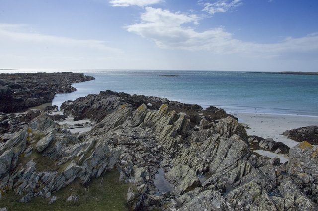
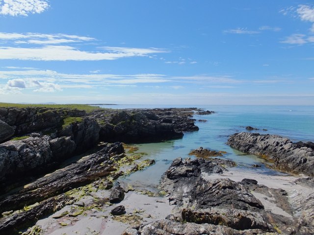
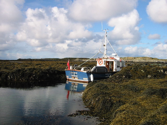
Eilean nan Ròn Images

Images are sourced within 2km of 55.998606/-6.2747795 or Grid Reference NR3386. Thanks to Geograph Open Source API. All images are credited.

An Taigh Cearc (The Hen House) This small dwelling is of a type common in the eighteenth century
An Taigh Cearc (The Hen House)
This small dwelling is of a type common in the eighteenth century
Bay on the west coast of Oronsay Low tide on a simple beach line.
Bay on the west coast of Oronsay
Low tide on a simple beach line.
On the west coast of Oronsay All the important elements.  A bay, machair, the home farm and Priory, Benn Oronsay and ---surprise, surprise --- a small building marked only on the most detailed maps.
On the west coast of Oronsay
All the important elements. A bay, machair, the home farm and Priory, Benn Oronsay and ---surprise, surprise --- a small building marked only on the most detailed maps.
Rocks, grass and seaweed at the southeastmost corner of Oronsay
Grassland at  Rubha Caol, southwest Oronsay
Grassland at Rubha Caol, southwest Oronsay
Bay on west coast of Oronsay
Small bothy on Oronsay The building was open but the only contents seemed to lead to its use being more to do with fishing than farming
Small bothy on Oronsay
The building was open but the only contents seemed to lead to its use being more to do with fishing than farming
Rocky inlet on the west side of Oronsay
Dry-stone dyke, Oronsay A fine, well built wall.  The yellow flags to each side offer good cover for young corncrakes.
Dry-stone dyke, Oronsay
A fine, well built wall. The yellow flags to each side offer good cover for young corncrakes.
Scotland's answer to a tropical beach Looking north across Oronsay's west beach. Shame the water was so cold.
Scotland's answer to a tropical beach
Looking north across Oronsay's west beach. Shame the water was so cold.
Cows on the Beach
Cows on the Beach
Eilean nan Ron The 'island of the seals' is aptly named, being alive with them. At low tide in calm weather it is possible to bring a boat in, but normally the sea is quite rough. Looking NW.
Eilean nan Ron
The 'island of the seals' is aptly named, being alive with them. At low tide in calm weather it is possible to bring a boat in, but normally the sea is quite rough. Looking NW.
One of the resident seals, Eilean nan Ron Eilean nan Ron is a seal's paradise. Looking SE towards Islay (R) and the Paps of Jura (L)
One of the resident seals, Eilean nan Ron
Eilean nan Ron is a seal's paradise. Looking SE towards Islay (R) and the Paps of Jura (L)
Building above beach in west of Oronsay Small building (of unknown use) standing just to the south east of the main beach on the west coast of Oronsay. It lies in the north west of the grid square.
Building above beach in west of Oronsay
Small building (of unknown use) standing just to the south east of the main beach on the west coast of Oronsay. It lies in the north west of the grid square.
Shepherd's bothy on Oronsay This single-roomed building is padlocked, but appears still to be in use.
Shepherd's bothy on Oronsay
This single-roomed building is padlocked, but appears still to be in use.
Port na Blathach, Oronsay Westward view of tidal inlet in the south of the grid square, with ubiquitous Hebridean irises in the foreground.
Port na Blathach, Oronsay
Westward view of tidal inlet in the south of the grid square, with ubiquitous Hebridean irises in the foreground.
Oronsay coastal prairie with rocky shore area beyond
Southwesternmost point of Oronsay The island of Jura lies in the distant background.
Southwesternmost point of Oronsay
The island of Jura lies in the distant background.
Show me another place!

Eilean nan Ròn is located at Grid Ref: NR3386 (Lat: 55.998606, Lng: -6.2747795)

Unitary Authority: Argyll and Bute

Police Authority: Argyll and West Dunbartonshire

What 3 Words

///botanists.sheds.spin. Near Scalasaig, Argyll & Bute

Nearby Locations

An t-Sàil Eilean nan Ròn

Related Wikis

Oronsay Priory

Oronsay Priory was a monastery of canons regular on the island of Oronsay, Inner Hebrides, Argyll, off the coast of Scotland. It was in existence by 1353...

Oronsay, Colonsay

Oronsay (Scottish Gaelic: Orasaigh), also sometimes spelt and pronounced Oransay by the local community, is a small tidal island south of Colonsay in the...

Ardskenish

Ardskenish is a hamlet on the island of Colonsay, in the civil parish of Colonsay and Oronsay, in the council area of Argyll and Bute, Scotland. ��2�...

Dùn Cholla

Dùn Cholla is a hill fort located on the Inner Hebridean island of Colonsay, Scotland. The site is located at grid reference NR37759150.According to tradition...

Have you been to Eilean nan Ròn?

Leave your review of Eilean nan Ròn below (or comments, questions and feedback).