Eilean a' Chalmain

Island in Argyllshire

Scotland

Eilean a' Chalmain

Unnamed skerry south of Erraid With a metre or so of swell, the waves were breaking well over the south side of this skerry as we approached. So much so that on our side, water was pouring down through a gap like a waterfall. We reckoned a plastic river boat would be the only way to paddle that, and it would require a degree of foolhardiness well in excess of that available in our group. Even landing on such a rock in a fibreglass boat would be a bit more adventure than we'd care to undertake...
Unnamed skerry south of Erraid Credit: Andy Waddington

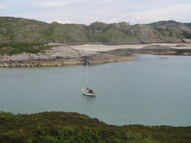
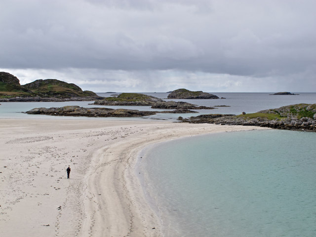
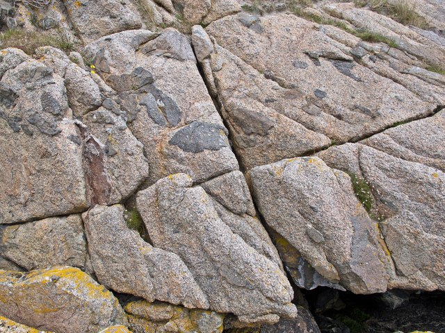
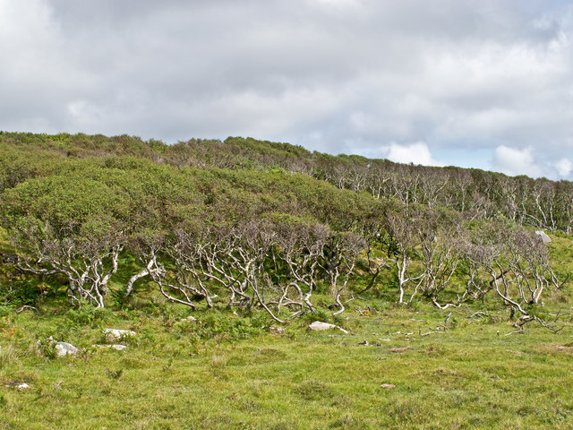
Eilean a' Chalmain is a small uninhabited island located in Argyllshire, Scotland. The island is situated in Loch Linnhe, near the town of Ballachulish. Eilean a' Chalmain is a rocky and rugged island, with steep cliffs and a diverse range of plant and animal species.

The island is approximately 0.3 hectares in size and is accessible only by boat. It is a popular destination for birdwatchers, as it is home to a variety of seabirds, including puffins, guillemots, and razorbills. The island's remote location and natural beauty make it a peaceful and tranquil spot for visitors looking to enjoy the stunning scenery and wildlife of the Scottish Highlands.

Eilean a' Chalmain has a rich history, with evidence of human occupation dating back to the Bronze Age. The island was once used as a hunting ground and has also been the site of a chapel dedicated to St. Columba. Today, the island remains largely untouched by modern development, making it a perfect retreat for those seeking a peaceful escape in the heart of the Scottish wilderness.

If you have any feedback on the listing, please let us know in the comments section below.

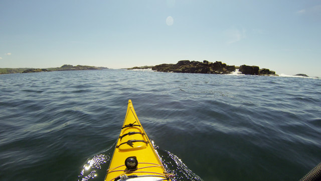
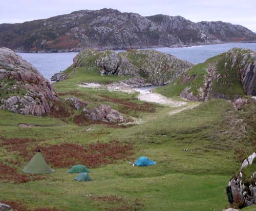
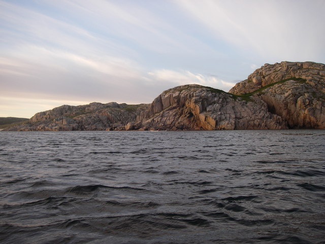
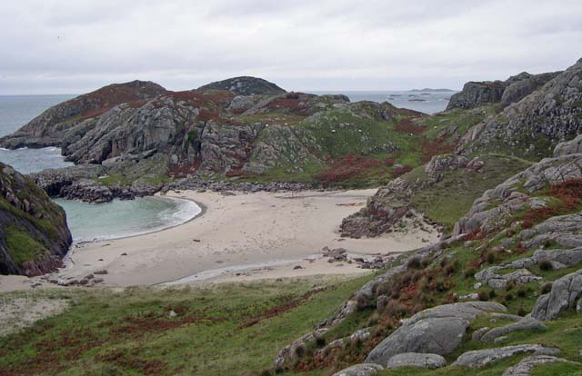
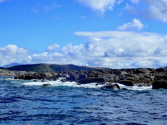
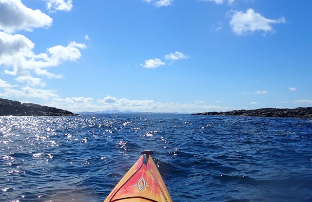
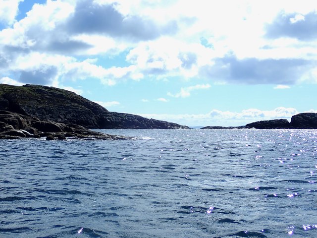
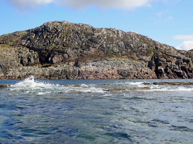
Eilean a' Chalmain Images

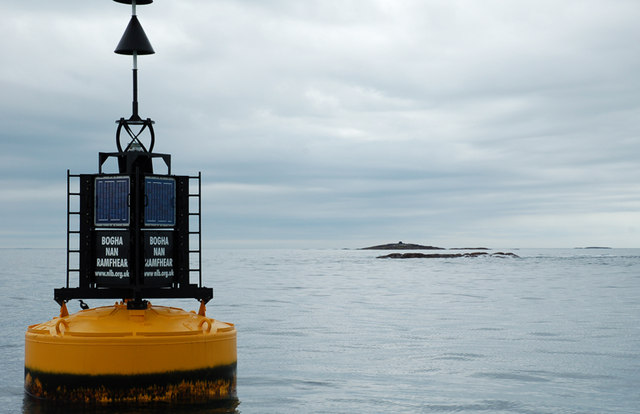
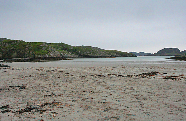
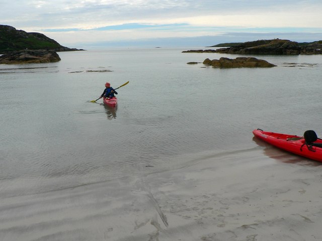
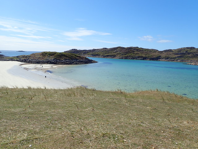
Images are sourced within 2km of 56.273134/-6.3501677 or Grid Reference NM3017. Thanks to Geograph Open Source API. All images are credited.

Unnamed skerry south of Erraid With a metre or so of swell, the waves were breaking well over the south side of this skerry as we approached. So much so that on our side, water was pouring down through a gap like a waterfall. We reckoned a plastic river boat would be the only way to paddle that, and it would require a degree of foolhardiness well in excess of that available in our group. Even landing on such a rock in a fibreglass boat would be a bit more adventure than we'd care to undertake...
Unnamed skerry south of Erraid
With a metre or so of swell, the waves were breaking well over the south side of this skerry as we approached. So much so that on our side, water was pouring down through a gap like a waterfall. We reckoned a plastic river boat would be the only way to paddle that, and it would require a degree of foolhardiness well in excess of that available in our group. Even landing on such a rock in a fibreglass boat would be a bit more adventure than we'd care to undertake...
Hunkered down on the Ross of Mull
Channel between Eilean Dubh and Ross of Mull
Ross of Mull - another perfect bay! There are countless bays like this along the Ross of Mull - havens for sea kayakers wanting to get away from it all.
Ross of Mull - another perfect bay!
There are countless bays like this along the Ross of Mull - havens for sea kayakers wanting to get away from it all.
Anchorage in Bagh a Chnoic Mhaoileanaich Taken from the slopes of Erraid looking east
Anchorage in Bagh a Chnoic Mhaoileanaich
Taken from the slopes of Erraid looking east
Beach near Knockvologan The beach and several small offshore islands near Knockvologan on the Ross of Mull.
Beach near Knockvologan
The beach and several small offshore islands near Knockvologan on the Ross of Mull.
Detail of granite at Knockvologan Granite at Knockvologan beach - this alkali-granite, approximately 414 million years old, is composed of potassium-rich orthoclase feldspar, and smaller amounts of plagioclase feldspar, together with quartz and biotite mica. At Knockvologan, the granite contains a darker material called tonalite, an igneous rock which was formed at the same time as the granite.
Detail of granite at Knockvologan
Granite at Knockvologan beach - this alkali-granite, approximately 414 million years old, is composed of potassium-rich orthoclase feldspar, and smaller amounts of plagioclase feldspar, together with quartz and biotite mica. At Knockvologan, the granite contains a darker material called tonalite, an igneous rock which was formed at the same time as the granite.
Woodland on the Ross of Mull Gnarled trees at Torr Mor Chonairst on the Ross of Mull.
Woodland on the Ross of Mull
Gnarled trees at Torr Mor Chonairst on the Ross of Mull.
Bogha Nan Ramfhear north cardinal buoy Bogha Nan Ramfhear is awash to the right of the north cardinal buoy, 56° 15.700' North, 006° 20.370' West.  Ruadh Sgeir, in the background, lies about 1km to the SSW.
Bogha Nan Ramfhear north cardinal buoy
Bogha Nan Ramfhear is awash to the right of the north cardinal buoy, 56° 15.700' North, 006° 20.370' West. Ruadh Sgeir, in the background, lies about 1km to the SSW.
Beach at Knockvologan Looking south from where the track from Knockvologan reaches the beach. The steep-sided hummock in the distance is Eilean Dubh, the 'dark island', and the twin knolls to its left, in the distance, are Eilean a' Chalmain.
Beach at Knockvologan
Looking south from where the track from Knockvologan reaches the beach. The steep-sided hummock in the distance is Eilean Dubh, the 'dark island', and the twin knolls to its left, in the distance, are Eilean a' Chalmain.
Looking out to  the bay and some small islands just off a beach at Port nan Ron The Bay and small islands viewed from a beach located at Port nan Ron, Ross of Mull
Looking out to the bay and some small islands just off a beach at Port nan Ron
The Bay and small islands viewed from a beach located at Port nan Ron, Ross of Mull
Triangulation pillar, Àird Mòr, Ross of Mull, Isle of Mull Looking towards Eilean na Seamair to the left and the Ross of Mull and Erraid to the right.
Triangulation pillar, Àird Mòr, Ross of Mull, Isle of Mull
Looking towards Eilean na Seamair to the left and the Ross of Mull and Erraid to the right.
Losing to the tide at Knockvologan
Bàgh a' Chnoic Mhaoileanaich The views here are superlative.  Crystal clear shallow water turning dark blue towards the horizon, white pristine sand.  Fascinating rock with rich texture.  And hardly any other people to be found.
Bàgh a' Chnoic Mhaoileanaich
The views here are superlative. Crystal clear shallow water turning dark blue towards the horizon, white pristine sand. Fascinating rock with rich texture. And hardly any other people to be found.
Eilean a' Chalmain Eilean a' Chalmain from the cockpit of my kayak.  

This rocky island is home to a few seals and plenty of birds.
Eilean a' Chalmain
Eilean a' Chalmain from the cockpit of my kayak. This rocky island is home to a few seals and plenty of birds.
Channel between some of the rocks that comprise Eilean a' Chalmain Eilean a' Chalmain is made up of a number of rocks, this is a channel between two of them.
Channel between some of the rocks that comprise Eilean a' Chalmain
Eilean a' Chalmain is made up of a number of rocks, this is a channel between two of them.
Eilean a' Chalmain Taken as I worked my way around Eilean a' Chalmain by kayak.
Eilean a' Chalmain
Taken as I worked my way around Eilean a' Chalmain by kayak.
Eilean a' Chalmain
Eilean a' Chalmain
Show me another place!

Eilean a' Chalmain is located at Grid Ref: NM3017 (Lat: 56.273134, Lng: -6.3501677)

Unitary Authority: Argyll and Bute

Police Authority: Argyll and West Dunbartonshire

What 3 Words

///optimally.eventful.bronzer. Near Fionnphort, Argyll & Bute

Related Wikis

Erraid

Erraid (Scottish Gaelic: Eilean Earraid) is a tidal island approximately one mile (two kilometres) square located in the Inner Hebrides of Scotland. It...

Aridhglas

Aridhglas is a village on the Ross of Mull, Isle of Mull in Argyll and Bute, Scotland. == References ==

Ross of Mull

The Ross of Mull (Scottish Gaelic: An Ros Mhuileach) is the largest peninsula of the Isle of Mull, about 28 kilometres (17 mi) long, and makes up the south...

Torran Rocks

The Torran Rocks are a group of small islands and skerries located between the islands of Mull and Colonsay in Scotland. == Geography and geology == The...

Nearby Amenities

Located within 500m of 56.273134,-6.3501677
Source: PGS
Lat/Long: 56.2731452/-6.3472122
Source: PGS
Lat/Long: 56.2727641/-6.3482028
Source: PGS
Lat/Long: 56.2730318/-6.3474746
Source: PGS
Lat/Long: 56.2728181/-6.3480387
Source: PGS
Lat/Long: 56.2724503/-6.3485468
Source: PGS
Lat/Long: 56.2717536/-6.3491125
Source: PGS
Lat/Long: 56.2717062/-6.3491921
Source: PGS
Lat/Long: 56.2720877/-6.3508531
Source: PGS
Lat/Long: 56.2719509/-6.3506314
Source: PGS
Lat/Long: 56.2722304/-6.3511957
Source: PGS
Lat/Long: 56.2724226/-6.3520006
Source: PGS
Lat/Long: 56.2727016/-6.3524669
Source: PGS
Lat/Long: 56.2733646/-6.3554844
Source: PGS
Lat/Long: 56.2733812/-6.3556567
Source: PGS
Lat/Long: 56.273419/-6.3558046
Source: PGS
Lat/Long: 56.2735818/-6.3561511
Source: PGS
Lat/Long: 56.2739916/-6.3561714
Source: PGS
Lat/Long: 56.2739461/-6.356234
Source: PGS
Lat/Long: 56.2738886/-6.3562706
Source: PGS
Lat/Long: 56.2745664/-6.3556554
Source: PGS
Lat/Long: 56.2746731/-6.3553463
Source: PGS
Lat/Long: 56.2747768/-6.3538288
Source: PGS
Lat/Long: 56.2749592/-6.3528392
Source: PGS
Lat/Long: 56.2751643/-6.351911
Source: PGS
Lat/Long: 56.2753861/-6.3515511
Source: PGS
Lat/Long: 56.275445/-6.3511071
Source: PGS
Lat/Long: 56.2753338/-6.3492639
Source: PGS
Lat/Long: 56.2754557/-6.3486774
Source: PGS
Lat/Long: 56.2754594/-6.3483955
Source: PGS
Lat/Long: 56.2751857/-6.3463895
Source: PGS
Lat/Long: 56.2749089/-6.3458031
Source: PGS
Lat/Long: 56.274619/-6.3451386
Source: PGS
Lat/Long: 56.2744074/-6.3449511
Source: PGS
Lat/Long: 56.2740999/-6.3448856
Source: PGS
Lat/Long: 56.2739754/-6.3447798
Source: PGS
Lat/Long: 56.2739138/-6.3447471
Source: PGS
Lat/Long: 56.2737498/-6.3447718
Source: PGS
Lat/Long: 56.273694/-6.3448381
Source: PGS
Lat/Long: 56.2738269/-6.3447393
Source: PGS
Lat/Long: 56.2736408/-6.3450441
Source: PGS
Lat/Long: 56.2738139/-6.3455788
Source: PGS
Lat/Long: 56.2733742/-6.3454104
Source: PGS
Lat/Long: 56.2733274/-6.345448
The data included in this document is from www.openstreetmap.org. The data is made available under ODbL.

Have you been to Eilean a' Chalmain?

Leave your review of Eilean a' Chalmain below (or comments, questions and feedback).