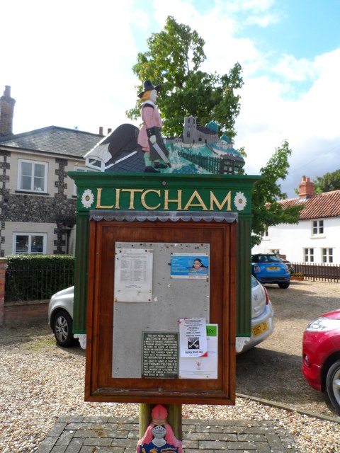
Litcham

Settlement in Norfolk Breckland

England

Litcham

Bare trees and field boundary hedge
Bare trees and field boundary hedge Credit: Evelyn Simak

Litcham is a small village located in the county of Norfolk, in the eastern part of England. It is situated approximately 30 miles west of the city of Norwich and has a population of around 1,200 residents.

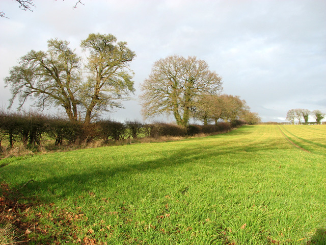
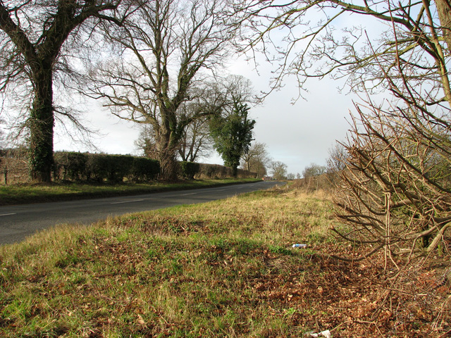
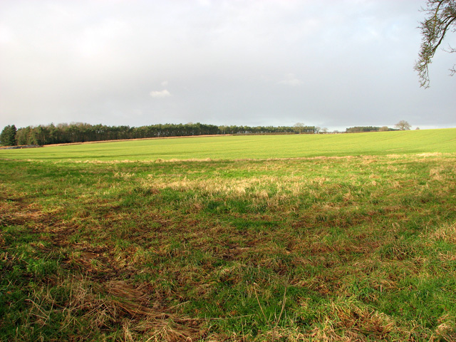
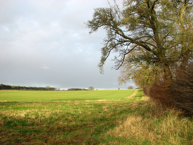
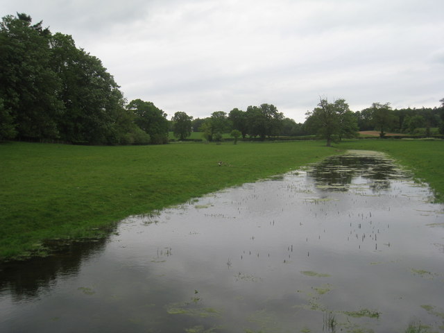
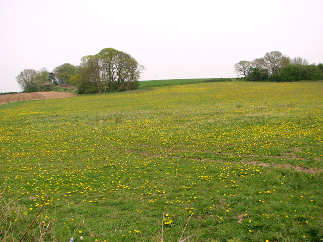
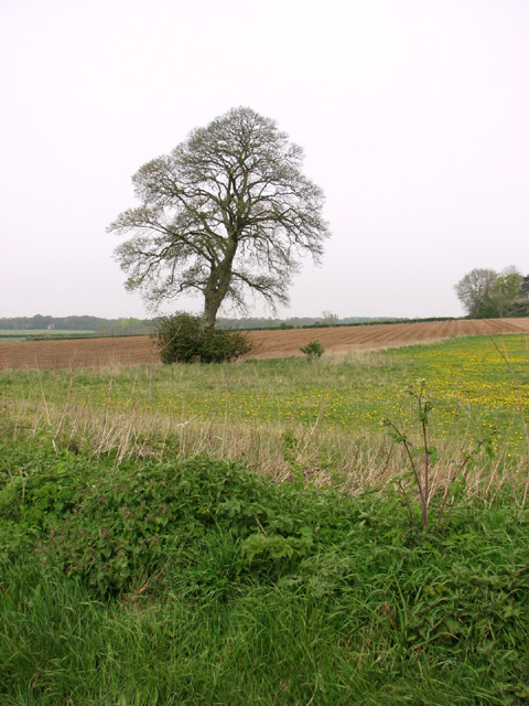
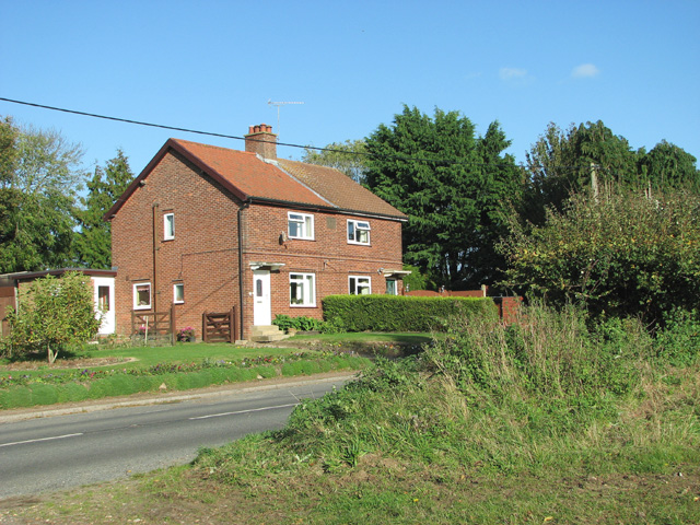
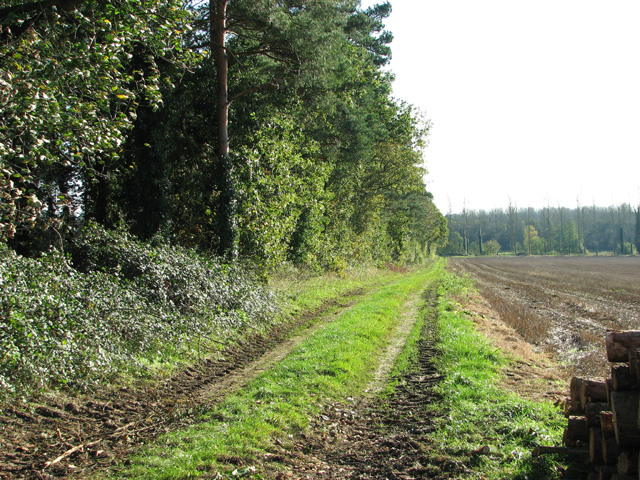
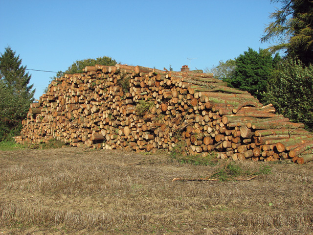
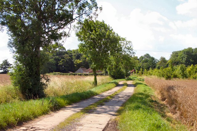
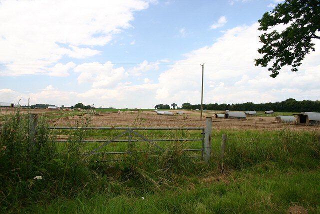
The village is known for its picturesque countryside setting, with rolling green hills and charming rural landscapes. Litcham is surrounded by agricultural fields, providing an idyllic backdrop for those seeking a peaceful and quiet environment.

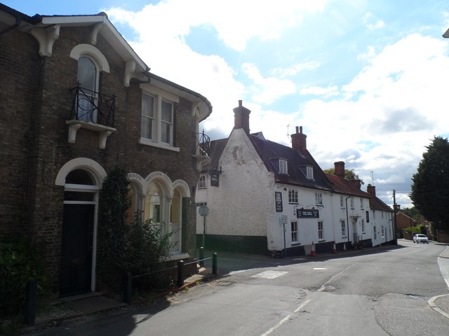
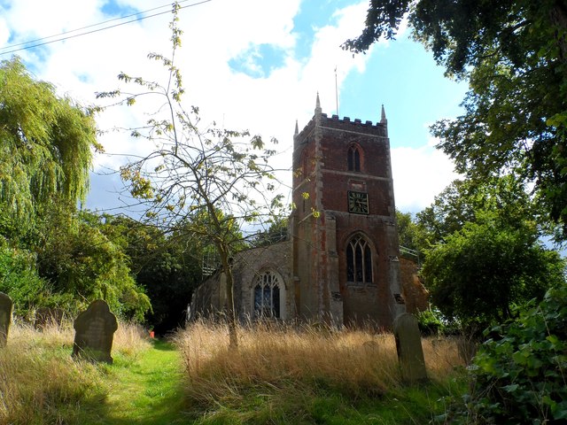
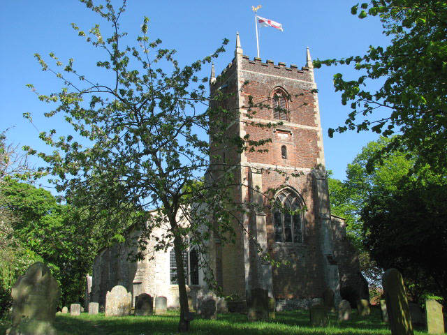
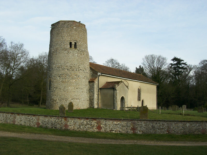
Litcham has a rich history, dating back to the Anglo-Saxon era. The village features several historic buildings, including the 14th-century All Saints Church, which is renowned for its impressive architectural design. The village also boasts a traditional village green, where locals and visitors can enjoy recreational activities or simply relax and take in the scenery.

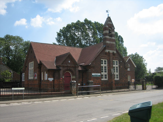
In terms of amenities, Litcham offers a range of services to its residents. The village has a primary school, a village hall, and a local pub, providing a sense of community and meeting places for locals. Additionally, there are several small businesses and shops that cater to the everyday needs of the village's inhabitants.

Litcham is also a popular tourist destination, attracting visitors who are drawn to its natural beauty and historical significance. The village offers opportunities for outdoor activities such as hiking, cycling, and birdwatching, with its proximity to the Norfolk countryside and nature reserves.

Overall, Litcham is a charming village that showcases the quintessential English countryside, making it an appealing place to live or visit for those seeking tranquility and a connection to history.

If you have any feedback on the listing, please let us know in the comments section below.

Litcham Images

Images are sourced within 2km of 52.725754/0.787558 or Grid Reference TF8817. Thanks to Geograph Open Source API. All images are credited.

Bare trees and field boundary hedge
View west along the B1145
Cultivated field in January sunshine
Field boundary north of the B1145
Copse in field north of the B1145 road
Entrance into a field north of the B1145
The upper end of Broad Water Part of an artificial lake.
The upper end of Broad Water
Part of an artificial lake.
Woodland lane at East Lexham Three-Cornered Plantation on the left, Gardener's Plantation on the right.
Woodland lane at East Lexham
Three-Cornered Plantation on the left, Gardener's Plantation on the right.
Dandelions in meadow beside Watery Lane
Tree growing on field boundary
Church Street, Litcham The shop on the corner was built around 1860, see <span class="nowrap"><a title="http://www.britishlistedbuildings.co.uk/en-220431-1-tittleshall-road-litcham-norfolk" rel="nofollow ugc noopener" href="http://www.britishlistedbuildings.co.uk/en-220431-1-tittleshall-road-litcham-norfolk">Link</a><img style="margin-left:2px;" alt="External link" title="External link - shift click to open in new window" src="https://s1.geograph.org.uk/img/external.png" width="10" height="10"/></span>. Bull pub on the other side of the junction dates from the C17 with C18 stables, see <span class="nowrap"><a title="http://www.britishlistedbuildings.co.uk/en-220427-the-bull-inn-litcham-norfolk" rel="nofollow ugc noopener" href="http://www.britishlistedbuildings.co.uk/en-220427-the-bull-inn-litcham-norfolk">Link</a><img style="margin-left:2px;" alt="External link" title="External link - shift click to open in new window" src="https://s1.geograph.org.uk/img/external.png" width="10" height="10"/></span>
Church Street, Litcham
The shop on the corner was built around 1860, see LinkExternal link. Bull pub on the other side of the junction dates from the C17 with C18 stables, see LinkExternal link
All Saints' church, Litcham The church was consecrated in 1412. The brick tower is a little later and bears a datestone of 1669. The church was restored and reseated in 1850.
All Saints' church, Litcham
The church was consecrated in 1412. The brick tower is a little later and bears a datestone of 1669. The church was restored and reseated in 1850.
Litcham, village sign and notice board The sign shows a leather tanner at work, Matthew Halcott. Leather tanning was an important industry in Litcham in the Elizabethan era.by the C15.

The plaque at the bottom of the notice board reads:

"The top panel shows Matthew Halcott, a master tanner standing by a tanning board, tanning knife in hand. He lived at priory farm, an ardent royalist he built the church tower in 1668 as a thanksgiving for the restoration of Charles II.

The coat of arms is that of Sir Thomas Felton K.C. the last resident Lord of the Manor of Litcham. He fought at Crecy & Poitiers and died in 1381."

The sign is in the old market square. The market was granted its charter by Edward I but by 1836 it had ceased to function.
Litcham, village sign and notice board
The sign shows a leather tanner at work, Matthew Halcott. Leather tanning was an important industry in Litcham in the Elizabethan era.by the C15. The plaque at the bottom of the notice board reads: "The top panel shows Matthew Halcott, a master tanner standing by a tanning board, tanning knife in hand. He lived at priory farm, an ardent royalist he built the church tower in 1668 as a thanksgiving for the restoration of Charles II. The coat of arms is that of Sir Thomas Felton K.C. the last resident Lord of the Manor of Litcham. He fought at Crecy & Poitiers and died in 1381." The sign is in the old market square. The market was granted its charter by Edward I but by 1836 it had ceased to function.
Cottages beside Lexham Road
Farm track past Priory Belt
Stubble field west of Priory Belt
Trees in hedge beside Lexham Road
A stack of pine logs on a field's edge
Show me another place!

Litcham is located at Grid Ref: TF8817 (Lat: 52.725754, Lng: 0.787558)

Administrative County: Norfolk

District: Breckland

Police Authority: Norfolk

What 3 Words

///fuel.songbird.aimless. Near Necton, Norfolk

Related Wikis

Litcham

Litcham is a village and civil parish in the English county of Norfolk. It is situated some 10 km (6.2 mi) north-east of the town of Swaffham and 40 km...

Litcham School

Litcham School is a mixed all-through school located in the village of Litcham in the English county of Norfolk. It has around 640 pupils aged 4–16 (Years...
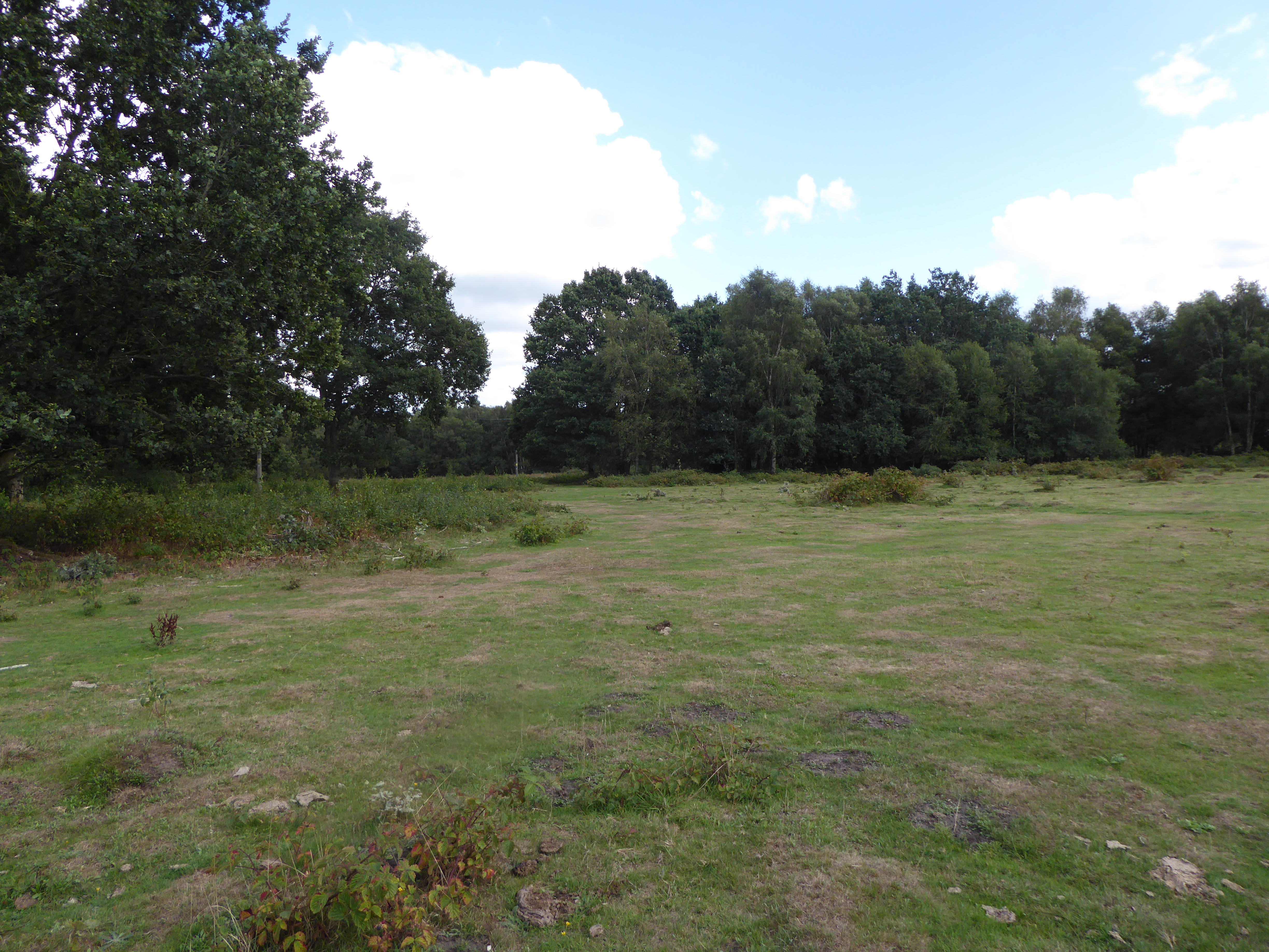
Litcham Common

Litcham Common is a 24.9-hectare (62-acre) Local Nature Reserve in Norfolk. It is owned by Neil Foster, Lexham Estate, and managed by Norfolk County...

Kempstone

Kempstone is a village situated in the Breckland District of Norfolk and covers an area of 331 hectares (1.3 square miles) with an estimated population...

East Lexham

East Lexham is a village and former civil parish, now in the parish of Lexham, in the Breckland district, in the English county of Norfolk. It is 7.7 miles...

Lexham

Lexham is a parish consisting of the twin villages of East Lexham and West Lexham situated in the Breckland District of Norfolk and covers an area of 9...

Grenstein

Grenstein, also known as Gramston or Greynston, was until approximately the 16th century a village in the English county of Norfolk, between Mileham and...

Beeston, Norfolk

Beeston is a village in the county of Norfolk, England, in the civil parish of Beeston with Bittering , west of East Dereham and south of Fakenham. It...

Nearby Amenities

Located within 500m of 52.725754,0.787558
Litcham
Place: village
Lat/Long: 52.7241096/0.7932797
Tittleshall Road, adj
Naptan AtcoCode: 2900L071
Naptan Bearing: N
Naptan BusStopType: CUS
Naptan CommonName: Tittleshall Road
Naptan Indicator: adj
Naptan Landmark: Tittleshall Road
Naptan Locality: Litcham
Naptan NaptanCode: nfodawja
Naptan ShortCommonName: Tittleshall Road
Naptan Street: Tittleshall Road
Naptan Verified: no
Source: naptan_import
Lat/Long: 52.7253036/0.7916653
Bus Stop
Church Street, adj
Naptan AtcoCode: 2900L073
Naptan Bearing: SE
Naptan CommonName: Church Street
Naptan Indicator: adj
Naptan Landmark: Church Hall
Naptan Locality: Litcham
Naptan NaptanCode: nfodawjd
Naptan ShortCommonName: Church Street
Naptan Street: Church Street
Naptan Verified: no
Source: naptan_import
Lat/Long: 52.7236496/0.7920187
Back Street, opp
Naptan AtcoCode: 2900L074
Naptan Bearing: SW
Naptan BusStopType: CUS
Naptan CommonName: Back Street
Naptan Indicator: opp
Naptan Landmark: Point House
Naptan Locality: Litcham
Naptan NaptanCode: nfodawjg
Naptan ShortCommonName: Back Street
Naptan Street: Back Street
Naptan Verified: no
Source: naptan_import
Lat/Long: 52.7240784/0.7909946
Church Street, opp
Naptan AtcoCode: 2900L076
Naptan Bearing: NW
Naptan BusStopType: CUS
Naptan CommonName: Church Street
Naptan Indicator: opp
Naptan Landmark: Church Hall
Naptan Locality: Litcham
Naptan NaptanCode: nfodawjp
Naptan ShortCommonName: Church Street
Naptan Street: Church Street
Naptan Verified: no
Source: naptan_import
Lat/Long: 52.7231691/0.7925657
Back Street, adj
Naptan AtcoCode: 2900L077
Naptan Bearing: NE
Naptan BusStopType: CUS
Naptan CommonName: Back Street
Naptan Indicator: adj
Naptan Landmark: os Point House
Naptan Locality: Litcham
Naptan NaptanCode: nfodawjt
Naptan ShortCommonName: Back Street
Naptan Street: Back Street
Naptan Verified: no
Source: naptan_import
Lat/Long: 52.724115/0.7909673
Pound Lane, adj
Naptan AtcoCode: 2900L078
Naptan Bearing: NW
Naptan BusStopType: CUS
Naptan CommonName: Pound Lane
Naptan Indicator: adj
Naptan Landmark: Litcham Primary School
Naptan Locality: Litcham
Naptan NaptanCode: nfodawjw
Naptan ShortCommonName: Pound Lane
Naptan Street: Pound Lane
Naptan Verified: no
Source: naptan_import
Lat/Long: 52.727107/0.7861075
Power: pole
Lat/Long: 52.7271407/0.7880866
Power: pole
Lat/Long: 52.7217572/0.7848251
Power: pole
Lat/Long: 52.7292719/0.7892936
Power: pole
Lat/Long: 52.7228717/0.7856458
Power: pole
Lat/Long: 52.7282096/0.7886982
Power: pole
Lat/Long: 52.7244052/0.7865417
Waste Basket
Waste: dog_excrement
Lat/Long: 52.7239967/0.7912265
Waste Basket
Lat/Long: 52.7240454/0.7914518
Bench
Backrest: yes
Colour: green
Material: metal
Lat/Long: 52.7240332/0.7913526
Entrance: main
Lat/Long: 52.7245109/0.7924779
Post Office
Litcham Post Office
Addr Postcode: PE32 2NS
Branch: Litcham
Brand: Post Office
Brand Wikidata: Q1783168
Check Date: 2020-02-20
Contact Website: https://www.postoffice.co.uk/branch-finder/0871311/litcham
Opening Hours: Mo-Tu,Th-Sa 08:00-19:00; We 08:00-16:00; Su,PH 09:00-13:00
Ref Pol Id: 953
Lat/Long: 52.7230126/0.7925917
Waste Basket
Lat/Long: 52.7231607/0.7926367
Telephone
Defibrillator
Booth: K6
Colour: red
Covered: booth
Defibrillator Location: inside old red phone box, Church Street, Litcham
Emergency: defibrillator
Listed Status: Grade II
Man Made: telephone_box
Old Phone: +44 1328 701211
Ref GB The Circuit: 509B7A51-2BC1-43B2-AFD1-B03800894557
Lat/Long: 52.7231811/0.7926041
Entrance: main
Lat/Long: 52.7235052/0.7927277
Historic: memorial
Memorial: war_memorial
Lat/Long: 52.7233356/0.792798
Entrance: yes
Lat/Long: 52.7235279/0.7926386
Give Way
Lat/Long: 52.7243274/0.7912262
Stop
Lat/Long: 52.7241471/0.7913927
Stop
Lat/Long: 52.7241942/0.7914716
Give Way
Lat/Long: 52.7257577/0.7875073
Post Box
Post Box Type: wall
Royal Cypher: GR
Royal Cypher Wikidata: Q33102273
Lat/Long: 52.723027/0.7927905
Information: map
Tourism: information
Lat/Long: 52.7230475/0.7927643
Barrier: cycle_barrier
Bicycle: yes
Lat/Long: 52.7237691/0.7904374
Give Way
Lat/Long: 52.7236175/0.7894767
Give Way
Lat/Long: 52.7235094/0.7894392
Give Way
Lat/Long: 52.7236914/0.7905141
The data included in this document is from www.openstreetmap.org. The data is made available under ODbL.

Have you been to Litcham?

Leave your review of Litcham below (or comments, questions and feedback).