Eilean Tomulam

Island in Argyllshire

Scotland

Eilean Tomulam

Low tide at the west end of Crossapol Bay Crossapol Bay is yet another of Coll's lovely sandy bays - about 2Km wide and there will probably only be you on it!
Low tide at the west end of Crossapol Bay Credit: Gordon Brown

Eilean Tomulam is a small, uninhabited island located off the west coast of Scotland in Argyllshire. The island is part of the Inner Hebrides archipelago and is situated in the Sound of Mull, between the mainland and the Isle of Mull.

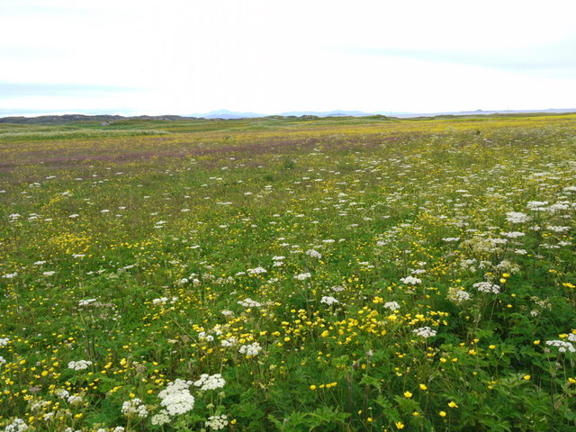
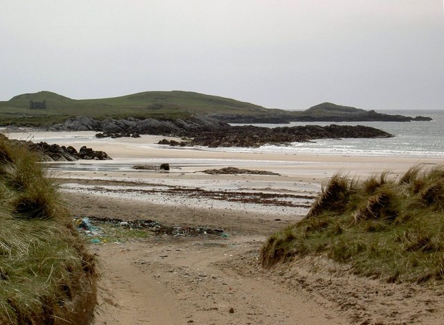
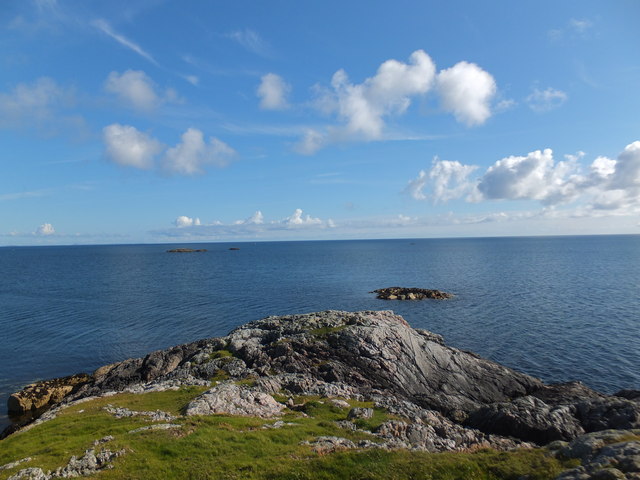
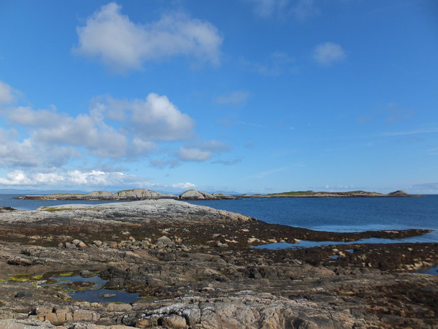
Covering an area of approximately 12 hectares, Eilean Tomulam is characterized by its rugged and rocky terrain, with steep cliffs rising from the sea. The island is mostly covered in heather, grasses, and other vegetation, creating a picturesque landscape.

Despite its small size, Eilean Tomulam is home to a variety of wildlife, including seabirds like puffins, gulls, and razorbills that nest on the cliffs. The surrounding waters are also rich in marine life, with seals and dolphins often spotted in the area.

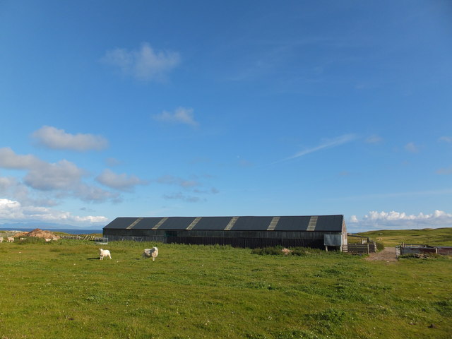
Access to Eilean Tomulam is primarily by boat, as there are no permanent structures or facilities on the island. Visitors can enjoy the scenic beauty of the island and its surrounding waters, making it a popular spot for boating, fishing, and wildlife watching.

The island's remote location and tranquil atmosphere make it an ideal place for those seeking solitude and a connection with nature. It offers a unique opportunity to experience the unspoiled beauty of the western Scottish coast and immerse oneself in the rich biodiversity of the region.

If you have any feedback on the listing, please let us know in the comments section below.

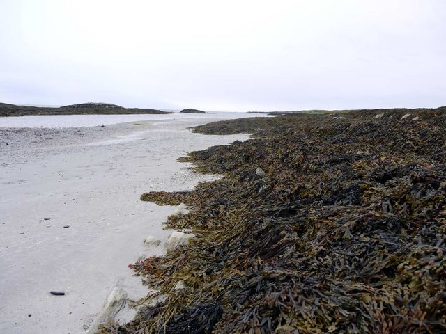
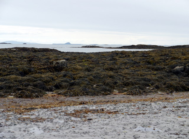
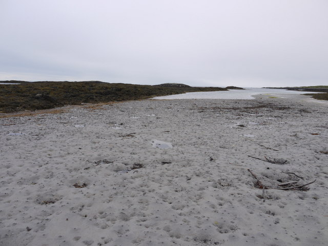
Eilean Tomulam Images

Images are sourced within 2km of 56.572743/-6.6477805 or Grid Reference NM1451. Thanks to Geograph Open Source API. All images are credited.

Low tide at the west end of Crossapol Bay Crossapol Bay is yet another of Coll's lovely sandy bays - about 2Km wide and there will probably only be you on it!
Low tide at the west end of Crossapol Bay
Crossapol Bay is yet another of Coll's lovely sandy bays - about 2Km wide and there will probably only be you on it!
Low tide at the west end of Crossapol Bay The central island in the distance is Bac Mor, better known as Dutchman's Cap.
Low tide at the west end of Crossapol Bay
The central island in the distance is Bac Mor, better known as Dutchman's Cap.
Low tide at the west end of Crossapol Bay
Low tide patterns at Traigh Gharbh
Low tide at Traigh Gharbh The house at Crossapol just showing in the distance.
Low tide at Traigh Gharbh
The house at Crossapol just showing in the distance.
There's a corncrake in there somewhere! Coll's machair in full bloom, and the haunting rasp of the corncrake calling.  It's in there somewhere but this elusive bird cannot be seen in the long vegetation.  The island of Bac Mor (Dutchman's Cap) in the right distance.
There's a corncrake in there somewhere!
Coll's machair in full bloom, and the haunting rasp of the corncrake calling. It's in there somewhere but this elusive bird cannot be seen in the long vegetation. The island of Bac Mor (Dutchman's Cap) in the right distance.
Traigh Chrossapol
Traigh Chrossapol
Tràigh Chrossapol
Tràigh Chrossapol
Sign Near Sgeir Dhubh The sign near Sgeir Dhubh with a great view of Crossapol Bay says 4.5 km to Calgary Point.
Sign Near Sgeir Dhubh
The sign near Sgeir Dhubh with a great view of Crossapol Bay says 4.5 km to Calgary Point.
A View Over The Sand Dunes A view over the sand dune in the general direction of Calgary Point with Crossapol Bay visible in the upper left of the photo.
A View Over The Sand Dunes
A view over the sand dune in the general direction of Calgary Point with Crossapol Bay visible in the upper left of the photo.
Rocky outcrop on Eilean Tomulam
Looking over to Soa
Looking over to Soa
Standing stone by Breachacha
Tràigh Chrossapol
Tràigh Chrossapol
Maclean Burial Ground, Isle of Coll According to the RCAHMS Canmore website, this small burial-enclosure of the MacLean family standing above the east shore of Crossapol Bay was commissioned by Alexander Maclean, 15th of Coll in 1835 on the death of his wife. He, his wife and a family friend were all interred here.
Maclean Burial Ground, Isle of Coll
According to the RCAHMS Canmore website, this small burial-enclosure of the MacLean family standing above the east shore of Crossapol Bay was commissioned by Alexander Maclean, 15th of Coll in 1835 on the death of his wife. He, his wife and a family friend were all interred here.
Farm building at Ardnish, Isle of Coll
Coll - Nature Reserve - Dunes and path The path seen in this photo is from the Car Park to Crossapol Bay - though in this image looking back in the former's direction. The grassy sand dunes seen ahead here rise to as much as 50m (164').
Coll - Nature Reserve - Dunes and path
The path seen in this photo is from the Car Park to Crossapol Bay - though in this image looking back in the former's direction. The grassy sand dunes seen ahead here rise to as much as 50m (164').
Coll - Breachacha - Standing Stone Situated 1km (0.6 miles) SW of Breachacha Castle on the eastern side of the track to Crossapol Bay, stands to a height of c. 1.5m with cross section of c. 1m x 0.6m
It has a rounded top and leans at about 12°
Coll - Breachacha - Standing Stone
Situated 1km (0.6 miles) SW of Breachacha Castle on the eastern side of the track to Crossapol Bay, stands to a height of c. 1.5m with cross section of c. 1m x 0.6m It has a rounded top and leans at about 12°
Show me another place!

Eilean Tomulam is located at Grid Ref: NM1451 (Lat: 56.572743, Lng: -6.6477805)

Unitary Authority: Argyll and Bute

Police Authority: Argyll and West Dunbartonshire

What 3 Words

///enforced.redouble.magazines. Near Arinagour, Argyll & Bute

Related Wikis

Breachacha crannog

The Breachacha crannog is a crannog located near Loch Breachacha, on the Inner Hebridean island of Coll. The crannog is recognised in the United Kingdom...

Breachacha Castle

Breachacha Castle (also spelled Breacachadh) is either of two structures on the shore of Loch Breachacha, on the Inner Hebridean island of Coll, Scotland...

Coll Airport

Coll Island Airport (IATA: COL, ICAO: EGEL) (Scottish Gaelic: Port-adhair Cholla) is located 5 NM (9.3 km; 5.8 mi) west southwest of Arinagour on the island...

Gunna, Scotland

Gunna (Gaelic: Gunnaigh) is an island in the Inner Hebrides of Scotland. == Geography and geology == Gunna lies between Coll and Tiree, closer to Coll...

Nearby Amenities

Located within 500m of 56.572743,-6.6477805
Natural: rock
Source: OS7
Tidal: yes
Lat/Long: 56.5714168/-6.6483706
Natural: rock
Source: OS7
Tidal: yes
Lat/Long: 56.5692738/-6.6426211
Natural: rock
Source: OS7
Tidal: yes
Lat/Long: 56.5717424/-6.6416383
Natural: rock
Source: OS7
Tidal: yes
Lat/Long: 56.5707658/-6.641196
Glac Shilisteir
Place: locality
Lat/Long: 56.5753965/-6.6438757
The data included in this document is from www.openstreetmap.org. The data is made available under ODbL.

Have you been to Eilean Tomulam?

Leave your review of Eilean Tomulam below (or comments, questions and feedback).