Eilean Odhar

Island in Argyllshire

Scotland

Eilean Odhar

Rocks at the east end of Feall Bay
Rocks at the east end of Feall Bay Credit: Gordon Brown

Eilean Odhar is a small island located in Argyllshire, Scotland. Situated in the Firth of Lorn, it is part of the Inner Hebrides archipelago. The island covers an area of approximately 10 hectares and is known for its stunning natural beauty.

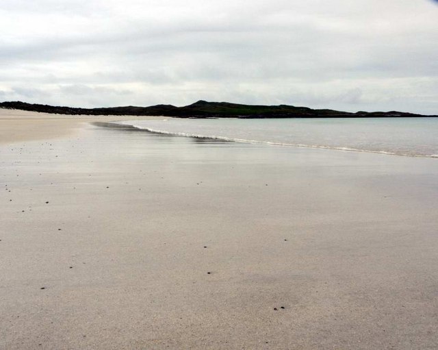
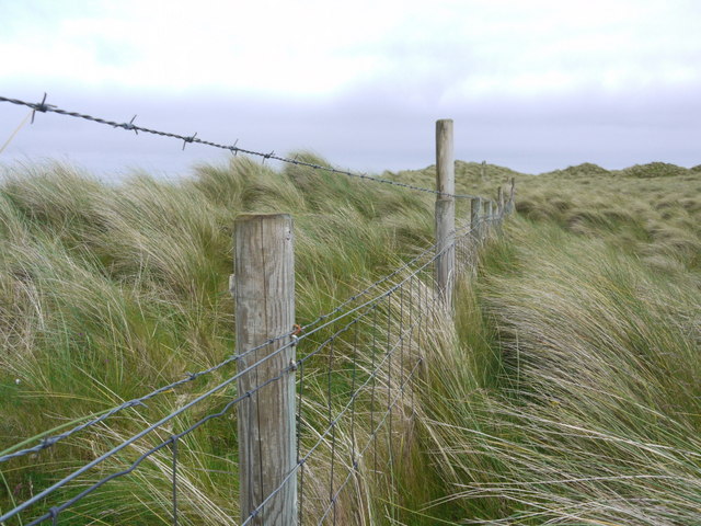
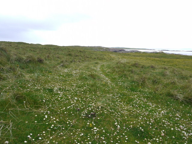
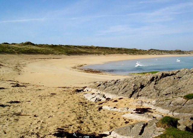
Eilean Odhar is characterized by its rugged coastline, with steep cliffs and rocky outcrops. The island is largely uninhabited, although it is home to a small colony of seabirds, including gannets and puffins. The surrounding waters are teeming with marine life, making it a popular spot for diving and snorkeling.

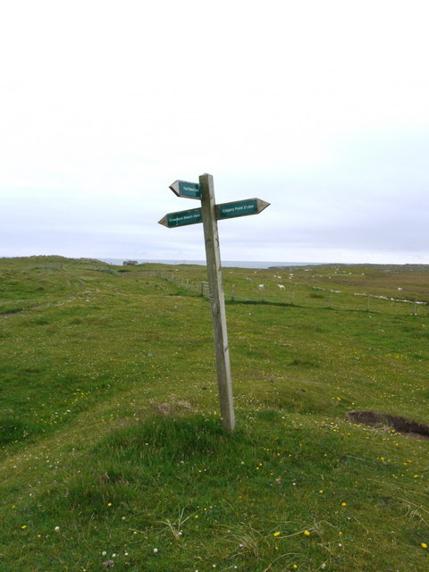
The island is accessible by boat, with regular ferry services operating from nearby ports. Visitors can enjoy walking along the island's trails, which offer breathtaking views of the surrounding landscape. Eilean Odhar is also a popular destination for wildlife enthusiasts, who can spot seals and otters along the shoreline.

The island has a rich history, with archaeological sites dating back to the Neolithic period. Ruins of ancient settlements and burial cairns can still be seen on the island. In addition, Eilean Odhar was once the site of a medieval chapel, which served as a place of worship for the local community.

Overall, Eilean Odhar is a peaceful and picturesque island, offering visitors a glimpse into Scotland's natural and historical heritage. Whether it's exploring the rugged coastline, observing wildlife, or immersing oneself in the island's rich history, Eilean Odhar has something to offer for everyone.

If you have any feedback on the listing, please let us know in the comments section below.

Eilean Odhar Images

Images are sourced within 2km of 56.600258/-6.6784981 or Grid Reference NM1255. Thanks to Geograph Open Source API. All images are credited.

Rocks at the east end of Feall Bay
Traigh Feall
Traigh Feall
Unfriendly fence We had walked from Calgary Point round to Feall Bay but got on the wrong side of this fence - not simple to cross with its wire-netting and two strands of barbed wire!
Unfriendly fence
We had walked from Calgary Point round to Feall Bay but got on the wrong side of this fence - not simple to cross with its wire-netting and two strands of barbed wire!
Trio of orchids All part of the joy of the Coll machairs.
Trio of orchids
All part of the joy of the Coll machairs.
Machair blossoms near Port Mine
The path to Calgary Point There is a faint waymarked (occasionally!) path all the way from the car park at Crossapol, via Feall Bay, to Calgary Point.
The path to Calgary Point
There is a faint waymarked (occasionally!) path all the way from the car park at Crossapol, via Feall Bay, to Calgary Point.
Footpath sign on Coll Left to Crossapol Beach, right to Calgary Point and behind the photographer to Feall Beach.  There is waymarking on the path to Calgary Point but it is a little spasmodic (June 2011).
Footpath sign on Coll
Left to Crossapol Beach, right to Calgary Point and behind the photographer to Feall Beach. There is waymarking on the path to Calgary Point but it is a little spasmodic (June 2011).
Low tide patterns at Traigh Gharbh
Feall Bay A 'busy' day at the south end of Coll
Feall Bay
A 'busy' day at the south end of Coll
Feall Beach
Feall Beach
Ben Feall A lovely spot on a sunny morning with Iain Brown and Martin Richardson after Calgary Point.
Name: Ben Feall
Hill number: 10480
Height: 66m / 217ft
Parent (Ma/M): none
Area: 17F: Coll and Tiree
Class: 0
Grid ref: NM 14525 54867
Summit feature: boulder
Drop: 54m
Col: 12m  NM147546
Ben Feall
A lovely spot on a sunny morning with Iain Brown and Martin Richardson after Calgary Point. Name: Ben Feall Hill number: 10480 Height: 66m / 217ft Parent (Ma/M): none Area: 17F: Coll and Tiree Class: 0 Grid ref: NM 14525 54867 Summit feature: boulder Drop: 54m Col: 12m NM147546
A Lamb On The Edge A lamb on the edge of the TuMP Ben Feall on the Isle of Coll.
A Lamb On The Edge
A lamb on the edge of the TuMP Ben Feall on the Isle of Coll.
Sand Dunes Sand dunes near Feall Bay our next destination after Calgary Point.
Sand Dunes
Sand dunes near Feall Bay our next destination after Calgary Point.
Edge Of Feall Beach The rocky coastline at the western edge of Feall Beach.
Edge Of Feall Beach
The rocky coastline at the western edge of Feall Beach.
Sign Near Sgeir Dhubh The sign near Sgeir Dhubh with a great view of Crossapol Bay says 4.5 km to Calgary Point.
Sign Near Sgeir Dhubh
The sign near Sgeir Dhubh with a great view of Crossapol Bay says 4.5 km to Calgary Point.
Tràigh Feall, Isle of Coll
Grassland west of Tràigh Feall, Isle of Coll
Coll - Traigh Feall The sands of Traigh Feall (Feall Beach) with the waters of Feall Bay washing ashore. Several people were enjoying the surf - but sensibly wearing wetsuits.
Coll - Traigh Feall
The sands of Traigh Feall (Feall Beach) with the waters of Feall Bay washing ashore. Several people were enjoying the surf - but sensibly wearing wetsuits.
Show me another place!

Eilean Odhar is located at Grid Ref: NM1255 (Lat: 56.600258, Lng: -6.6784981)

Unitary Authority: Argyll and Bute

Police Authority: Argyll and West Dunbartonshire

What 3 Words

///breakaway.porch.marching. Near Arinagour, Argyll & Bute

Nearby Locations

Eilean Odhar

Related Wikis

Dùn Beic

Dùn Beic is a dun located on the Inner Hebridean island of Coll. It is located at grid reference NM15495644 and is thought to date to between 1000 BCE...

Breachacha Castle

Breachacha Castle (also spelled Breacachadh) is either of two structures on the shore of Loch Breachacha, on the Inner Hebridean island of Coll, Scotland...

Breachacha crannog

The Breachacha crannog is a crannog located near Loch Breachacha, on the Inner Hebridean island of Coll. The crannog is recognised in the United Kingdom...

Coll Airport

Coll Island Airport (IATA: COL, ICAO: EGEL) (Scottish Gaelic: Port-adhair Cholla) is located 5 NM (9.3 km; 5.8 mi) west southwest of Arinagour on the island...

Nearby Amenities

Located within 500m of 56.600258,-6.6784981
Natural: rock
Source: OS7
Tidal: yes
Lat/Long: 56.6010108/-6.6790366
Natural: rock
Source: OS7
Tidal: yes
Lat/Long: 56.5977382/-6.6765692
Natural: rock
Source: OS7
Tidal: yes
Lat/Long: 56.5981654/-6.6776342
Natural: rock
Source: OS7
Tidal: yes
Lat/Long: 56.5978183/-6.6781667
Natural: rock
Source: OS7
Tidal: yes
Lat/Long: 56.5981388/-6.6786992
Natural: rock
Source: OS7
Tidal: yes
Lat/Long: 56.5977916/-6.6794737
Natural: rock
Source: OS7
Tidal: yes
Lat/Long: 56.5973643/-6.6787476
The data included in this document is from www.openstreetmap.org. The data is made available under ODbL.

Have you been to Eilean Odhar?

Leave your review of Eilean Odhar below (or comments, questions and feedback).