Cleit a' Stac

Island in Ross-shire

Scotland

Cleit a' Stac

Stac an Tùill of Bearasaigh Returning from Seanna Chnoc on our way to Bostadh, the most interesting route seemed to be to thread the Caolas Stac an Tùill on the west side of Bearasaigh. This 43m high stack is prominent in the view from Bostadh, and is scarcely less in height than the island of Bearasaigh itself (58m). However, there are other skerries (off to the right of the view) providing some shelter here, so the swell as we came into the channel was quite a bit less than it had been earlier in our trip, and towards the southeastern end, the water was almost calm.
Stac an Tùill of Bearasaigh Credit: Andy Waddington

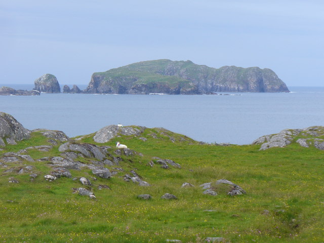
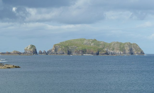
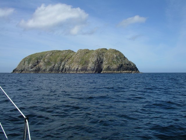
Cleit a' Stac is a small uninhabited island located off the coast of Ross-shire, Scotland. It is situated in the North Atlantic Ocean, approximately 2.5 kilometers northwest of the mainland. The island measures just 300 meters in length and 150 meters in width, making it relatively small in size.

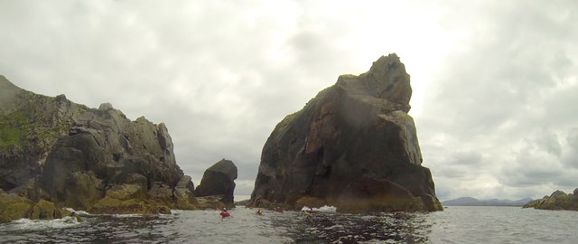
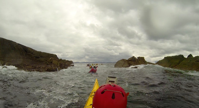
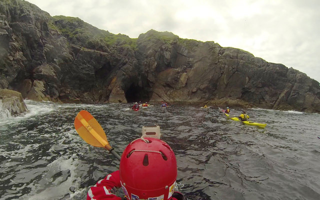
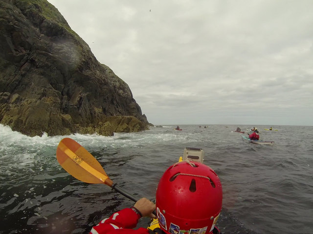
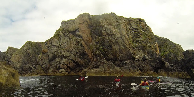
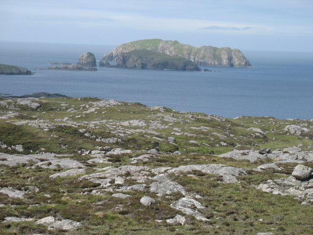
The landscape of Cleit a' Stac is characterized by rugged, rocky terrain, with steep cliffs rising up to 30 meters above sea level. The island is covered in thick vegetation, primarily consisting of grasses, shrubs, and some scattered trees. It provides a habitat for various bird species, including gulls, puffins, and cormorants.

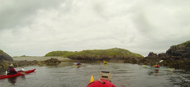
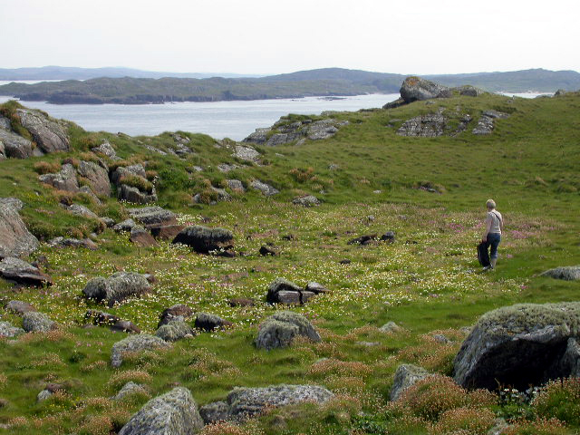
Access to Cleit a' Stac is primarily by boat, as there are no bridges or causeways connecting it to the mainland. The island is a popular destination for birdwatchers and nature enthusiasts, who visit to observe the diverse birdlife and enjoy the tranquil surroundings.

While Cleit a' Stac does not have any permanent human residents, it does hold historical significance. There are remnants of ancient structures, including a small stone building believed to have been used by fishermen or hermits in the past.

Overall, Cleit a' Stac offers visitors a unique experience to explore a remote, natural island with stunning coastal views and abundant wildlife. It is a place of tranquility and natural beauty, attracting those seeking a break from the bustling mainland.

If you have any feedback on the listing, please let us know in the comments section below.

Cleit a' Stac Images

Images are sourced within 2km of 58.275575/-6.9162588 or Grid Reference NB1142. Thanks to Geograph Open Source API. All images are credited.
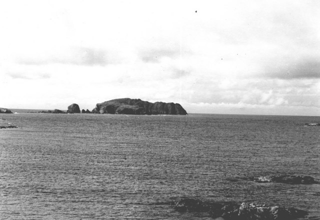
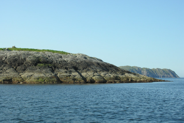
Stac an Tùill of Bearasaigh Returning from Seanna Chnoc on our way to Bostadh, the most interesting route seemed to be to thread the Caolas Stac an Tùill on the west side of Bearasaigh. This 43m high stack is prominent in the view from Bostadh, and is scarcely less in height than the island of Bearasaigh itself (58m). However, there are other skerries (off to the right of the view) providing some shelter here, so the swell as we came into the channel was quite a bit less than it had been earlier in our trip, and towards the southeastern end, the water was almost calm.
Stac an Tùill of Bearasaigh
Returning from Seanna Chnoc on our way to Bostadh, the most interesting route seemed to be to thread the Caolas Stac an Tùill on the west side of Bearasaigh. This 43m high stack is prominent in the view from Bostadh, and is scarcely less in height than the island of Bearasaigh itself (58m). However, there are other skerries (off to the right of the view) providing some shelter here, so the swell as we came into the channel was quite a bit less than it had been earlier in our trip, and towards the southeastern end, the water was almost calm.
Threading the channel past Flodaigh On our return from Seanna Chnoc via Bearasaigh, we'd just passed Sgeir nan Saoidhean and were now skirting the west side of Flodaigh (which offered more interesting paddling than the east side in the prevailing weather). Sea kayakers cannot resist narrow channels between skerries, especially with a bit of swell, and this was almost the last bit of excitement in our trip as we headed into more sheltered waters on our last day of a week exploring islands, stacks and sea caves.
Threading the channel past Flodaigh
On our return from Seanna Chnoc via Bearasaigh, we'd just passed Sgeir nan Saoidhean and were now skirting the west side of Flodaigh (which offered more interesting paddling than the east side in the prevailing weather). Sea kayakers cannot resist narrow channels between skerries, especially with a bit of swell, and this was almost the last bit of excitement in our trip as we headed into more sheltered waters on our last day of a week exploring islands, stacks and sea caves.
Heading into a cave on the north side of Seanna Chnoc Seanna Chnoc was the northernmost island of our trip out from Bostadh. There are at least four caves in the cliffs of the island, though the one we looked into on the south coast did not go very far. The one here proved to extend further under the cliffs than any of the others, though still not beyond the realms of daylight. Being set back into a deep cove on the north coast, this one had very little swell for such a location, as today's weather was bringing the wind and waves from the southwest.
Heading into a cave on the north side of Seanna Chnoc
Seanna Chnoc was the northernmost island of our trip out from Bostadh. There are at least four caves in the cliffs of the island, though the one we looked into on the south coast did not go very far. The one here proved to extend further under the cliffs than any of the others, though still not beyond the realms of daylight. Being set back into a deep cove on the north coast, this one had very little swell for such a location, as today's weather was bringing the wind and waves from the southwest.
The extreme eastern tip of Seanna Chnoc On this, the more sheltered end of Seanna Chnoc, we could paddle within a few metres of the rocks at the start of our circumnavigation. The sea caves of the northern coast were also easy to enter today - only the western side was a bit more exciting. This was the northernmost island of our day exploring skerries, coves and caves, out from Bostadh on Great Bernera.
The extreme eastern tip of Seanna Chnoc
On this, the more sheltered end of Seanna Chnoc, we could paddle within a few metres of the rocks at the start of our circumnavigation. The sea caves of the northern coast were also easy to enter today - only the western side was a bit more exciting. This was the northernmost island of our day exploring skerries, coves and caves, out from Bostadh on Great Bernera.
In the shelter of Stac an Tùill at Bearasaigh On our return from Seanna Chnoc, we passed close west of Bearasiagh, threading the gap between it and Stac an Tùill, to enter this sheltered lagoon. This was part of a day trip (a bit over ten miles, not counting all the excursions in and out of the indented coastlines), starting from and returning to Bostadh, exploring the cliffs, coves and sea caves of several of the small rocky islands north of Great Bernera, made interesting by wind and swell from the southwest.
In the shelter of Stac an Tùill at Bearasaigh
On our return from Seanna Chnoc, we passed close west of Bearasiagh, threading the gap between it and Stac an Tùill, to enter this sheltered lagoon. This was part of a day trip (a bit over ten miles, not counting all the excursions in and out of the indented coastlines), starting from and returning to Bostadh, exploring the cliffs, coves and sea caves of several of the small rocky islands north of Great Bernera, made interesting by wind and swell from the southwest.
Paddling over reefs on the south end of Flodaigh Towards the end of a day trip out from Bostadh on Great Bernera, exploring the cliffs, coves and sea caves of several of the small islands, we skirted down the west side of Flodaigh and then threaded our way through shallow and quite sheltered water between Flodaigh and Tamna (joined at low tide) before the final short crossing back to our starting point.
Paddling over reefs on the south end of Flodaigh
Towards the end of a day trip out from Bostadh on Great Bernera, exploring the cliffs, coves and sea caves of several of the small islands, we skirted down the west side of Flodaigh and then threaded our way through shallow and quite sheltered water between Flodaigh and Tamna (joined at low tide) before the final short crossing back to our starting point.
Bearasaigh and Seanna Chnoc Two small islands off the north-west tip of Great Bernera / Bearnaraigh.
<span class="nowrap"><a title="http://www.uigandbernera.com/" rel="nofollow ugc noopener" href="http://www.uigandbernera.com/">Link</a><img style="margin-left:2px;" alt="External link" title="External link - shift click to open in new window" src="https://s1.geograph.org.uk/img/external.png" width="10" height="10"/></span> - Smaller, closer, Bearasaigh partly obscure Seanna Chnoc.
Bearasaigh and Seanna Chnoc
Two small islands off the north-west tip of Great Bernera / Bearnaraigh. LinkExternal link - Smaller, closer, Bearasaigh partly obscure Seanna Chnoc.
Bearasaigh in front of Seanna Chnoc Bearasaigh is a small island rising to 58m (190ft) and lies about a mile and three quarters (2.75km) off the coast of Bostadh from where this shot was taken. Behind Bearasaigh (about 500m or so beyond it) is the larger, lumpier island of Seanna Chnoc which rises to 94m (308ft). You can see the top of Bearasaigh slanting down from left to right about half way down the more distant island and extending slightly more than half-way along its length (again from left to right)
The even lumpier little islet to Bearasaigh's left is Stac an Tùill (see <a href="https://www.geograph.org.uk/photo/2646870">NB1142 : Stac an Tùill</a>)
Apparently Bearasaigh was once used as a pirate's hideout, and there are suggestions that the depression in the island's flat top was a man-made reservoir to collect drinking water.
Bearasaigh in front of Seanna Chnoc
Bearasaigh is a small island rising to 58m (190ft) and lies about a mile and three quarters (2.75km) off the coast of Bostadh from where this shot was taken. Behind Bearasaigh (about 500m or so beyond it) is the larger, lumpier island of Seanna Chnoc which rises to 94m (308ft). You can see the top of Bearasaigh slanting down from left to right about half way down the more distant island and extending slightly more than half-way along its length (again from left to right) The even lumpier little islet to Bearasaigh's left is Stac an Tùill (see NB1142 : Stac an Tùill) Apparently Bearasaigh was once used as a pirate's hideout, and there are suggestions that the depression in the island's flat top was a man-made reservoir to collect drinking water.
Stac an Tùill This remarkably lumpy little stack is Stac an Tùill, it lies immediately to the southwest of Bearasaigh (<a href="https://www.geograph.org.uk/photo/2646866">NB1242 : Bearasaigh in front of Seanna Chnoc</a>). I can't find a definitive height for it, but as Bearasaigh's highest point is 58m I would estimate that Stac an Tùill achieves about 40m (c. 130ft)
[Edit] The latest OS map gives a height of 43m
Stac an Tùill
This remarkably lumpy little stack is Stac an Tùill, it lies immediately to the southwest of Bearasaigh (NB1242 : Bearasaigh in front of Seanna Chnoc). I can't find a definitive height for it, but as Bearasaigh's highest point is 58m I would estimate that Stac an Tùill achieves about 40m (c. 130ft) [Edit] The latest OS map gives a height of 43m
Bearasaigh and Seanna Chnoc Bearasaigh (58m) is the nearer island, with Seanna Chnoc (about 93m) in the sunshine beyond (in square <a href="https://www.geograph.org.uk/gridref/NB1143">NB1143</a>. Stac an Tuill is the rounded lump to the west (left) of Bearasaigh: it is in square <a href="https://www.geograph.org.uk/gridref/NB1142">NB1142</a>. A small part of Flodaigh (one of the many Flodaighs!) is at the extreme left.
This photo is taken from the northern top (82m) of Middle Shalaval. I have submitted it because this makes it clear that photos such as <a href="https://www.geograph.org.uk/photo/1965130">NB1143 : Seanna Chnoc (Seana Bheinn) behind Bearasaigh</a> do in fact show both Bearasaigh and Seanna Chnoc.
Bearasaigh and Seanna Chnoc
Bearasaigh (58m) is the nearer island, with Seanna Chnoc (about 93m) in the sunshine beyond (in square NB1143. Stac an Tuill is the rounded lump to the west (left) of Bearasaigh: it is in square NB1142. A small part of Flodaigh (one of the many Flodaighs!) is at the extreme left. This photo is taken from the northern top (82m) of Middle Shalaval. I have submitted it because this makes it clear that photos such as NB1143 : Seanna Chnoc (Seana Bheinn) behind Bearasaigh do in fact show both Bearasaigh and Seanna Chnoc.
Seanna Bheinn agus Bearasaigh Seanna Bheinn (or the Old Hill) is the correct name for the far away island.  It is NOT Seanna Chnoc as the OS has strangely re-named it.  The nearer island Berisay was the last refuge of the Macleods of Lewis where they held out in a three year maritime siege against the Mackenzies.
Seanna Bheinn agus Bearasaigh
Seanna Bheinn (or the Old Hill) is the correct name for the far away island. It is NOT Seanna Chnoc as the OS has strangely re-named it. The nearer island Berisay was the last refuge of the Macleods of Lewis where they held out in a three year maritime siege against the Mackenzies.
Berisay Approaching the only landing place on the small island of Berisay.
Berisay
Approaching the only landing place on the small island of Berisay.
Berisay Lush vegetation and rocky outcrops on the flat top of the island of Berisay, which in the early 17th century supported a band of outlaws led by Neil Macleod.  The depression seen is believed to have been an artificial loch design to collect fresh water.
Berisay
Lush vegetation and rocky outcrops on the flat top of the island of Berisay, which in the early 17th century supported a band of outlaws led by Neil Macleod. The depression seen is believed to have been an artificial loch design to collect fresh water.
Bearsaigh and  Seanna Chnoc from Bosta Beach
Bearsaigh and Seanna Chnoc from Bosta Beach
Seanna Chnoc or Old  Hill One of the prominent land marks for the mariner on the West Coast of Lewis
Bartholomew's half inch map shows it as Seann Bheinn or Old Hill.
Seanna Chnoc or Old Hill
One of the prominent land marks for the mariner on the West Coast of Lewis Bartholomew's half inch map shows it as Seann Bheinn or Old Hill.
Seanna Chnoc and Bearasaigh The Old Hill (left), a prominent landmark from both land and sea. The outermost of the Loch Ròg islands and skerries and just under 100m.  The small neighbouring rock is Stac nam Balg, the lower island is Bearasaigh.
View from just off Gallan Head.
Seanna Chnoc and Bearasaigh
The Old Hill (left), a prominent landmark from both land and sea. The outermost of the Loch Ròg islands and skerries and just under 100m. The small neighbouring rock is Stac nam Balg, the lower island is Bearasaigh. View from just off Gallan Head.
Hairsgeir, An Caolas This low lying skerry is composed of Lewisian Gneiss.
Hairsgeir, An Caolas
This low lying skerry is composed of Lewisian Gneiss.
Hairsgeir, Isle of Lewis Low lying Hairsgeir is composed of Lewisian Gneiss. Bearasaigh can be seen in the right-hand distance.
Hairsgeir, Isle of Lewis
Low lying Hairsgeir is composed of Lewisian Gneiss. Bearasaigh can be seen in the right-hand distance.
Show me another place!

Cleit a' Stac is located at Grid Ref: NB1142 (Lat: 58.275575, Lng: -6.9162588)

Unitary Authority: Na h-Eileanan an Iar

Police Authority: Highlands and Islands

What 3 Words

///footsteps.panicking.crackles. Near Carloway, Na h-Eileanan Siar

Related Wikis

Bearasaigh

Bearasaigh or Bearasay (and sometimes Berisay) is an islet in outer Loch Ròg, Lewis, Scotland. During the late 16th and early 17th centuries it was used...

Seanna Chnoc

Seanna Chnoc (English: "old hill"), correctly known as Seana Bheinn is an islet in outer Loch Ròg, Lewis, Scotland. It lies north west of Great Bernera...

Flodaigh (Outer Loch Ròg)

Flodaigh is an islet in outer Loch Ròg, Lewis, Scotland. It lies north west of Great Bernera and Little Bernera, south of Bearasaigh and Seanna Chnoc and...

Campaigh

Campaigh or Campay is a steep and rocky islet in outer Loch Ròg, Lewis, Scotland that lies north of Cealasaigh and Little Bernera. A huge natural arch...

Cealasaigh

Cealasaigh or Kealasay is an islet in outer Loch Ròg, Lewis, Scotland that lies north of Traigh Mhór on Little Bernera and south of Campaigh. To the west...

Little Bernera

Little Bernera (Scottish Gaelic: Beàrnaraigh Beag) is a small island situated off the west coast of the Isle of Lewis in the Outer Hebrides.Little Bernera...

Bernera Riot

The Bernera Riot occurred in 1874, on the island of Great Bernera, in Scotland in response to the Highland Clearances. The use of the term 'Bernera Riot...

Pabaigh Mòr

Pabay Mòr or Pabaigh Mòr is an uninhabited island in the Outer Hebrides of Scotland. == History == The island's name comes from papey, an Old Norse name...

Have you been to Cleit a' Stac?

Leave your review of Cleit a' Stac below (or comments, questions and feedback).