Liscard

Settlement in Cheshire

England

Liscard

Graffiti Gallery - underneath Junction 1 M53
Graffiti Gallery - underneath Junction 1 M53 Credit: Colin Park

Liscard is a small residential area located in the Metropolitan Borough of Wirral, Cheshire, England. Situated on the Wirral Peninsula, it is bordered by Wallasey to the north, Seacombe to the east, and Poulton to the south. Liscard is approximately 3 miles west of the town center of Birkenhead and 5 miles northeast of Liverpool city center.

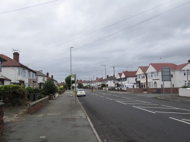
Once a bustling village, Liscard has transformed into a predominantly residential area with a mix of terraced and semi-detached houses. The area offers a range of amenities, including several supermarkets, local shops, cafes, and restaurants. Liscard also boasts a vibrant shopping district centered around Seaview Road, which hosts a variety of independent stores and larger retail chains.

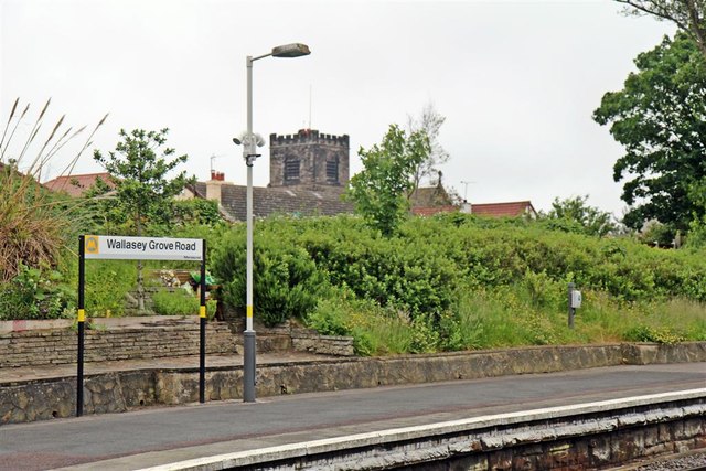
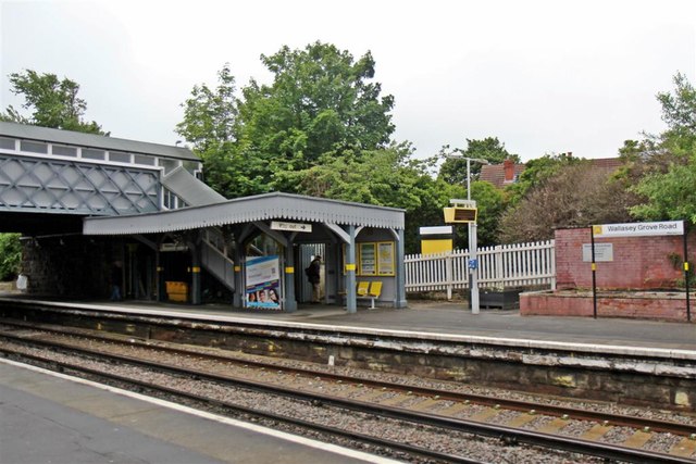
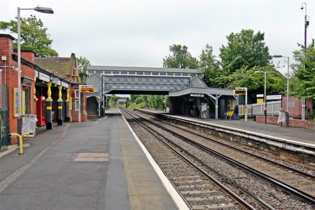
The area is well-served by public transport with frequent bus services connecting Liscard to nearby towns and cities. The Liscard and Poulton railway stations provide easy access to Liverpool and other destinations via the Wirral Line.

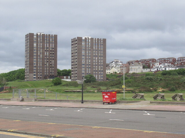
Liscard is also home to several parks and green spaces, including Central Park, which offers a peaceful retreat for residents and visitors alike. Additionally, the nearby coastline provides opportunities for outdoor activities such as walking and cycling.

With its close proximity to Liverpool and the stunning coastline of the Wirral Peninsula, Liscard offers a desirable location for those seeking a quiet residential area within easy reach of larger urban centers and natural beauty.

If you have any feedback on the listing, please let us know in the comments section below.

Liscard Images

Images are sourced within 2km of 53.421508/-3.051063 or Grid Reference SJ3092. Thanks to Geograph Open Source API. All images are credited.

Graffiti Gallery - underneath Junction 1 M53
Leaning into St Hilary Brow – 1970 Wallasey Corporation bus 12 was one of the first production batch of Leyland Atlanteans, built in 1958.

This is one of a series of views featuring buses in the 60s, 70s, and 80s. <a title="https://www.geograph.org.uk/search.php?i=137652761" href="https://www.geograph.org.uk/search.php?i=137652761">Link</a>
Leaning into St Hilary Brow – 1970
Wallasey Corporation bus 12 was one of the first production batch of Leyland Atlanteans, built in 1958. This is one of a series of views featuring buses in the 60s, 70s, and 80s. Link
Bayswater Road, Wallasey
The Cliff, New Brighton Flats with a view.  Between the towers and sea there is a large area of undeveloped links.
The Cliff, New Brighton
Flats with a view. Between the towers and sea there is a large area of undeveloped links.
Best picnic spot on Bidston Moss Best bench and viewpoint on Bidston Moss.
Llandudno and the Carneddau in the frame.
Best picnic spot on Bidston Moss
Best bench and viewpoint on Bidston Moss. Llandudno and the Carneddau in the frame.
Kingsway Tunnel Approach near Bidston Moss
Birkenhead North Railway Station
Cast iron work at Birkenhead North Railway Station
The Original Wallasey Grammar School This cottage in Breck Road was erected as Wallasey Grammar school from 1799 replacing the original school set up in St Hilary's Parish Church which had been in existence since 1656. The school was transferred to a new premises in St George's Road in 1864 and from 1873 the school was based in Withens Lane in a building that later became a college of further education. The school moved to Birkett Lane in Leasowe in 1967 and later became known as Wallasey School. This original school building was later converted into a house. Grammar Schools were set up in the 15th century to provide free education to poor children and were generally founded by philanthropists, charitable organisations and guilds.
The Original Wallasey Grammar School
This cottage in Breck Road was erected as Wallasey Grammar school from 1799 replacing the original school set up in St Hilary's Parish Church which had been in existence since 1656. The school was transferred to a new premises in St George's Road in 1864 and from 1873 the school was based in Withens Lane in a building that later became a college of further education. The school moved to Birkett Lane in Leasowe in 1967 and later became known as Wallasey School. This original school building was later converted into a house. Grammar Schools were set up in the 15th century to provide free education to poor children and were generally founded by philanthropists, charitable organisations and guilds.
A pair of pigeons, Birkenhead North Station The railway station name board, situated at the Bidston-end of the island platform, provides a welcome perch.
A pair of pigeons, Birkenhead North Station
The railway station name board, situated at the Bidston-end of the island platform, provides a welcome perch.
Stabling point, Birkenhead North TMD 507027 is parked in one of the stabling roads, next to the railway depot.
Stabling point, Birkenhead North TMD
507027 is parked in one of the stabling roads, next to the railway depot.
Footbridge, Bidston Moss Nature Reserve Viewed from the train to New Brighton, this footbridge goes over the railway to the nature reserve. The nature reserve was formerly part of Bidston Tip, before a programme of urban regeneration.
Footbridge, Bidston Moss Nature Reserve
Viewed from the train to New Brighton, this footbridge goes over the railway to the nature reserve. The nature reserve was formerly part of Bidston Tip, before a programme of urban regeneration.
Leasowe Road, Wallasey Village Viewed from a train on the railway bridge, just before arriving at Wallasey Village station.
Leasowe Road, Wallasey Village
Viewed from a train on the railway bridge, just before arriving at Wallasey Village station.
Wallasey Grove Road Railway Station, Wallasey St. Nicholas' Church is visible in the background.
Wallasey Grove Road Railway Station, Wallasey
St. Nicholas' Church is visible in the background.
Footbridge and canopy, Wallasey Grove Road Railway Station Situated on the New Brighton-bound platform.
Footbridge and canopy, Wallasey Grove Road Railway Station
Situated on the New Brighton-bound platform.
Towards New Brighton, Wallasey Grove Road Railway Station
Both platforms, Wallasey Grove Road Railway Station The footbridge, which is also a road bridge, allows Groveland Road to go over the railway tracks. Behind that, is a further road bridge for Green Lane.
Both platforms, Wallasey Grove Road Railway Station
The footbridge, which is also a road bridge, allows Groveland Road to go over the railway tracks. Behind that, is a further road bridge for Green Lane.
Signal and road bridge, Wallasey Viewed from the end of the Liverpool-bound platform at Wallasey Grove Road railway station, signal ML604R is in front of Green Lane road bridge. Behind the road bridge, Wallasey Village station is in view.
Signal and road bridge, Wallasey
Viewed from the end of the Liverpool-bound platform at Wallasey Grove Road railway station, signal ML604R is in front of Green Lane road bridge. Behind the road bridge, Wallasey Village station is in view.
Show me another place!

Liscard is located at Grid Ref: SJ3092 (Lat: 53.421508, Lng: -3.051063)

Unitary Authority: Wirral

Police Authority: Merseyside

What 3 Words

///thanks.fortunate.groom. Near Wallasey, Merseyside

Nearby Locations

Liscard

Related Wikis

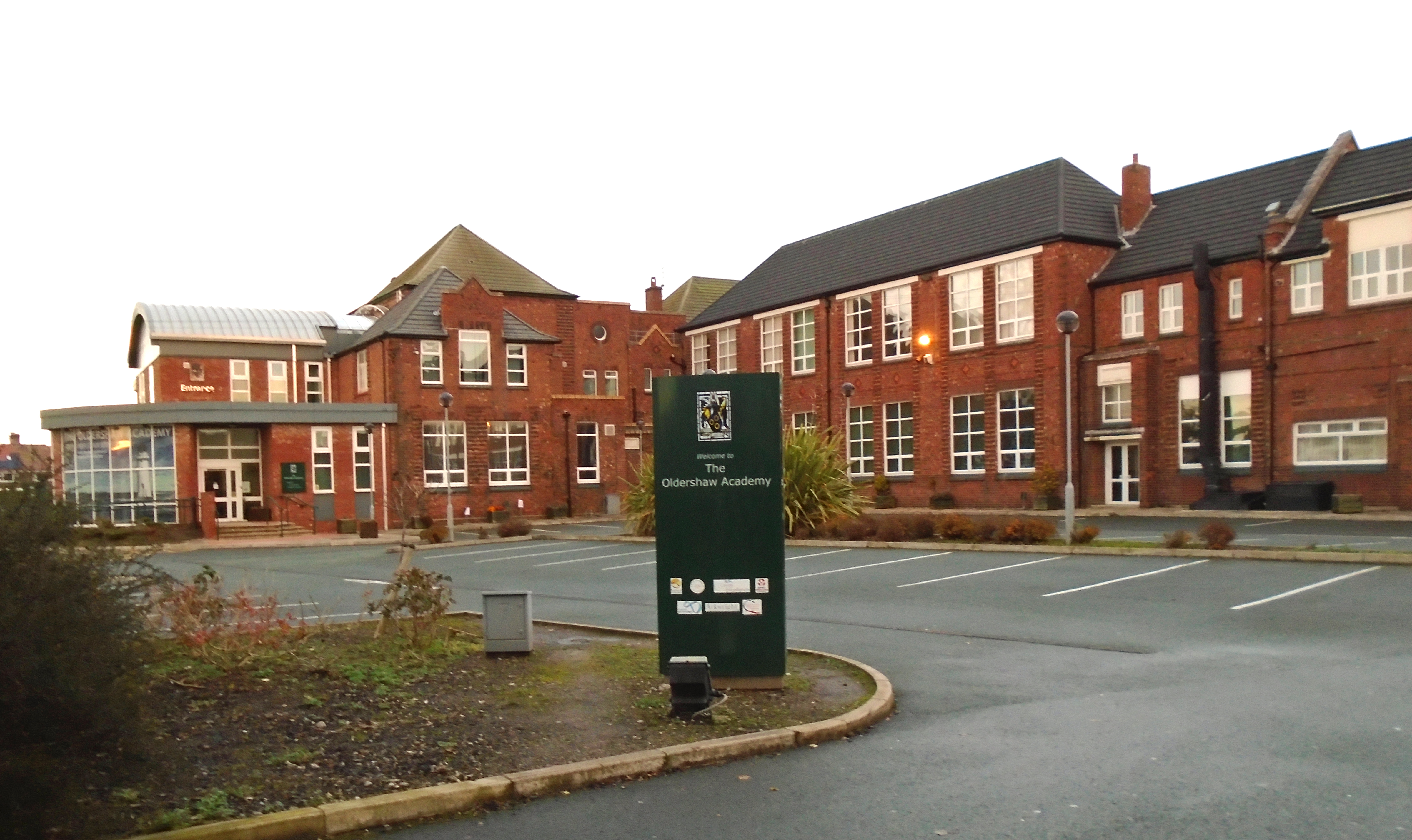
The Oldershaw Academy

Oldershaw Academy is a secondary school located in the Liscard area of Wallasey, England, and is a specialist Business and Enterprise College. == History... ==

Liscard

Liscard is an area of the town of Wallasey, in the Metropolitan Borough of Wirral, Merseyside, England. The most centrally located of Wallasey's townships...

St Alban's Church, Wallasey

St Alban's Church, is in Mill Lane, Liscard, Wallasey, Wirral, Merseyside, England. It is an active Roman Catholic church in the diocese of Shrewsbury...

St Hilary's Church, Wallasey

St Hilary's Church is in the town of Wallasey, Wirral, Merseyside, England. It consists of a church built in 1858–59 and the separate tower of a former...

Nearby Amenities

Located within 500m of 53.421508,-3.051063
Liscard
Is In: Wallasey, Wirral, Merseyside, England, UK
Place: suburb
Source: npe
Wikidata: Q6558683
Lat/Long: 53.4212306/-3.0458163
Traffic Signals
Lat/Long: 53.4195501/-3.0506132
Stop
Direction: backward
Lat/Long: 53.4194057/-3.0548413
Turning Circle
Lat/Long: 53.4187738/-3.0534619
Turning Circle
Lat/Long: 53.4199628/-3.0518306
Turning Circle
Lat/Long: 53.4230106/-3.0544146
Turning Circle
Lat/Long: 53.4216159/-3.0502652
Bus Stop
WALLASEY ROAD/KNARESBOROUGH ROAD
Bus: yes
Naptan AtcoCode: 2800S21019A
Naptan Bearing: E
Naptan CommonName: WALLASEY ROAD/KNARESBOROUGH ROAD
Naptan Indicator: WALLASEY ROAD/MARLOWE ROAD
Naptan Landmark: OPP KNARESBOROUGH ROAD O/S SHOP 196
Naptan NaptanCode: meramdwd
Naptan Notes: No Notes
Naptan ShortCommonName: Batesons PO
Naptan Street: WALLASEY ROAD
Naptan Verified: no
Public Transport: platform
Source: naptan_import
Lat/Long: 53.4194981/-3.0560047
Bus Stop
WALLASEY ROAD/LORETTO ROAD
Bus: yes
Naptan AtcoCode: 2800S21019B
Naptan Bearing: W
Naptan CommonName: WALLASEY ROAD/LORETTO ROAD
Naptan Indicator: WALLASEY ROAD/MARLOWE ROAD
Naptan Landmark: OPP LORETTO ROAD O/S 189
Naptan NaptanCode: meramdwg
Naptan Notes: No Notes
Naptan ShortCommonName: Batesons PO
Naptan Street: WALLASEY ROAD
Naptan Verified: no
Public Transport: platform
Source: naptan_import
Lat/Long: 53.4193771/-3.0564681
Bus Stop
TORRINGTON ROAD/ERIC ROAD
Bus: yes
Naptan AtcoCode: 2800S21034A
Naptan Bearing: S
Naptan CommonName: TORRINGTON ROAD/ERIC ROAD
Naptan Indicator: TORRINGTON ROAD/MARLOWE ROAD
Naptan Landmark: OPP MARLOWE RD UNITED REFORM CHURCH
Naptan NaptanCode: meramgmj
Naptan Notes: No Notes
Naptan ShortCommonName: Eric Rd
Naptan Street: TORRINGTON ROAD
Naptan Verified: no
Public Transport: platform
Source: naptan_import
Lat/Long: 53.4172665/-3.0501412
Bus Stop
TORRINGTON ROAD/MARLOW ROAD
Bus: yes
Naptan AtcoCode: 2800S21034B
Naptan Bearing: N
Naptan CommonName: TORRINGTON ROAD/MARLOW ROAD
Naptan Indicator: TORRINGTON ROAD/MARLOW ROAD
Naptan Landmark: OPP ERICK RD O/S MARLOWE ROAD URC
Naptan NaptanCode: meramgmp
Naptan Notes: No Notes
Naptan ShortCommonName: Trgton Rd/Marlow Rd
Naptan Street: TORRINGTON ROAD
Naptan Verified: no
Public Transport: platform
Source: naptan_import
Lat/Long: 53.4177136/-3.050408
Bus Stop
BELVIDERE ROAD/BROADWAY AVENUE
Bus: yes
Naptan AtcoCode: 2800S23056A
Naptan Bearing: SE
Naptan CommonName: BELVIDERE ROAD/BROADWAY AVENUE
Naptan Indicator: BELVIDERE ROAD/BROADWAY AVENUE
Naptan Landmark: O/S 102 NR BROADWAY
Naptan NaptanCode: merapdwj
Naptan Notes: No Notes
Naptan ShortCommonName: Belvidere Rd
Naptan Street: BELVIDERE ROAD
Naptan Verified: no
Public Transport: platform
Source: naptan_import
Lat/Long: 53.4234828/-3.0536805
Bus Stop
BROADWAY AVE/SHREWSBURY ROAD
Bus: yes
Naptan AtcoCode: 2800S23086A
Naptan Bearing: W
Naptan CommonName: BROADWAY AVE/SHREWSBURY ROAD
Naptan Indicator: BROADWAY AVENUE- O/S 20
Naptan Landmark: BROADWAY AVE/SHREWSBURY ROAD
Naptan NaptanCode: mergmapw
Naptan Notes: No Notes
Naptan ShortCommonName: Broadway Av
Naptan Street: BROADWAY AVENUE
Naptan Verified: no
Public Transport: platform
Source: naptan_import
Lat/Long: 53.422471/-3.0583206
Bus Stop
LISCARD VILLAGE/WALLASEY ROAD STOP A
Bus: yes
Naptan AtcoCode: 2800S24003A
Naptan Bearing: NE
Naptan CommonName: LISCARD VILLAGE/WALLASEY ROAD STOP A
Naptan Indicator: WALLASEY ROAD/SEAVIEW ROAD
Naptan Landmark: O/S SHOP 11 CORONATION BUILDINGS
Naptan NaptanCode: merapgma
Naptan Notes: No Notes
Naptan ShortCommonName: Liscard Village - A
Naptan Street: WALLASEY ROAD
Naptan Verified: no
Public Transport: platform
Source: naptan_import
Lat/Long: 53.4198877/-3.0464589
Bus Stop
LISCARD VILLAGE/WALLASEY ROAD STOP B
Bus: yes
Naptan AtcoCode: 2800S24003B
Naptan Bearing: NE
Naptan CommonName: LISCARD VILLAGE/WALLASEY ROAD STOP B
Naptan Indicator: WALLASEY ROAD/SEAVIEW ROAD
Naptan Landmark: O/S SHOP 9 CORONATION BUILDINGS - FAMOUS ARMY ST
Naptan NaptanCode: merapgmd
Naptan Notes: No Notes
Naptan ShortCommonName: Liscard Village B
Naptan Street: WALLASEY ROAD
Naptan Verified: no
Public Transport: platform
Source: naptan_import
Lat/Long: 53.4199613/-3.0462651
Bus Stop
LISCARD VILLAGE/WALLASEY ROAD STOP C
Bus: yes
Naptan AtcoCode: 2800S24003C
Naptan Bearing: SW
Naptan CommonName: LISCARD VILLAGE/WALLASEY ROAD STOP C
Naptan Indicator: WALLASEY ROAD/SEAVIEW ROAD
Naptan Landmark: O/S 5 CORONATION BUILDINGS
Naptan NaptanCode: merapgmg
Naptan Notes: No Notes
Naptan ShortCommonName: Liscard Village C
Naptan Street: WALLASEY ROAD
Naptan Verified: no
Public Transport: platform
Source: naptan_import
Lat/Long: 53.4200631/-3.0459365
Bus Stop
LISCARD VILLAGE/ST ALBANS ROAD STOP H
Bus: yes
Naptan AtcoCode: 2800S24003D
Naptan Bearing: NW
Naptan CommonName: LISCARD VILLAGE/ST ALBANS ROAD STOP H
Naptan Indicator: ST ALBANS ROAD/WALLASEY ROAD
Naptan Landmark: O/S SCHOOL PLAYGROUND FURTHEST FROM WALLASEY RO
Naptan NaptanCode: merapgmj
Naptan Notes: No Notes
Naptan ShortCommonName: Liscard Village - H
Naptan Street: ST ALBANS ROAD
Naptan Verified: no
Public Transport: platform
Source: naptan_import
Lat/Long: 53.418948/-3.0459844
Bus Stop
LISCARD VILLAGE/ST ALBANS ROAD STOP J
Bus: yes
Naptan AtcoCode: 2800S24003E
Naptan Bearing: NW
Naptan CommonName: LISCARD VILLAGE/ST ALBANS ROAD STOP J
Naptan Indicator: ST ALBANS ROAD/WALLASEY ROAD
Naptan Landmark: O/S SCHOOL OPP DSS DOMINICK HOUSE MIDDLE STOP
Naptan NaptanCode: merapgmp
Naptan Notes: No Notes
Naptan ShortCommonName: Liscard Village J
Naptan Street: ST ALBANS ROAD
Naptan Verified: no
Public Transport: platform
Source: naptan_import
Lat/Long: 53.4190543/-3.0461676
Bus Stop
LISCARD VILLAGE/ST ALBANS ROAD STOP K
Bus: yes
Naptan AtcoCode: 2800S24003F
Naptan Bearing: NW
Naptan CommonName: LISCARD VILLAGE/ST ALBANS ROAD STOP K
Naptan Indicator: ST ALBANS ROAD/WALLASEY ROAD
Naptan Landmark: O/S SCHOOL PLAYGROUND STOP NEAREST WALLASEY ROA
Naptan NaptanCode: merapgmt
Naptan Notes: No Notes
Naptan ShortCommonName: Liscard Village K
Naptan Street: ST ALBANS ROAD
Naptan Verified: no
Public Transport: platform
Source: naptan_import
Lat/Long: 53.4191337/-3.046335
Bus Stop
SEAVIEW ROAD/GRASMERE DRIVE
Bus: yes
Naptan AtcoCode: 2800S24004A
Naptan Bearing: NW
Naptan CommonName: SEAVIEW ROAD/GRASMERE DRIVE
Naptan Indicator: SEAVIEW ROAD
Naptan Landmark: O/S FOOTBALL AREA OPP GRASMERE DRIVE
Naptan NaptanCode: merapgmw
Naptan Notes: No Notes
Naptan ShortCommonName: Grassmere Dr
Naptan Street: SEAVIEW ROAD
Naptan Verified: no
Public Transport: platform
Source: naptan_import
Lat/Long: 53.4243506/-3.0480283
Bus Stop
SEAVIEW ROAD/MASSEY PARK
Bus: yes
Naptan AtcoCode: 2800S24004B
Naptan Bearing: SE
Naptan CommonName: SEAVIEW ROAD/MASSEY PARK
Naptan Indicator: SEAVIEW ROAD
Naptan Landmark: O/S 136
Naptan NaptanCode: merapgpa
Naptan Notes: No Notes
Naptan ShortCommonName: Massey Park
Naptan Street: SEAVIEW ROAD
Naptan Verified: no
Public Transport: platform
Source: naptan_import
Lat/Long: 53.4241925/-3.047603
Bus Stop
TORRINGTON ROAD/WALLASEY ROAD STAND A
Bus: yes
Naptan AtcoCode: 2800S24005A
Naptan Bearing: S
Naptan CommonName: TORRINGTON ROAD/WALLASEY ROAD STAND A
Naptan Indicator: TORRINGTON ROAD/WALLASEY ROAD
Naptan Landmark: STOP NEAREST WALLASEY ROAD
Naptan NaptanCode: merapgpd
Naptan Notes: No Notes
Naptan ShortCommonName: Torrington Rd/Std A
Naptan Street: TORRINGTON ROAD
Naptan Verified: no
Public Transport: platform
Source: naptan_import
Lat/Long: 53.4192597/-3.0504161
Bus Stop
WALLASEY ROAD/TORRINGTON ROAD
Bus: yes
Naptan AtcoCode: 2800S24005B
Naptan Bearing: W
Naptan CommonName: WALLASEY ROAD/TORRINGTON ROAD
Naptan Indicator: WALLASEY ROAD/TORRINGTON ROAD
Naptan Landmark: OPP SHOP 124
Naptan NaptanCode: merapgpg
Naptan Notes: No Notes
Naptan ShortCommonName: Torrington Rd Std B
Naptan Street: WALLASEY ROAD
Naptan Verified: no
Public Transport: platform
Source: naptan_import
Lat/Long: 53.4194694/-3.0510984
Bus Stop
BELVIDERE ROAD/WALLASEY ROAD
Bus: yes
Naptan AtcoCode: 2800S24005C
Naptan Bearing: NW
Naptan CommonName: BELVIDERE ROAD/WALLASEY ROAD
Naptan Indicator: BELVIDERE ROAD/WALLASEY ROAD
Naptan Landmark: NR 1
Naptan NaptanCode: merapgpj
Naptan Notes: No Notes
Naptan ShortCommonName: Belvidere Rd
Naptan Street: BELVIDERE ROAD
Naptan Verified: no
Public Transport: platform
Source: naptan_import
Lat/Long: 53.4198211/-3.0509716
Bus Stop
WALLASEY ROAD/BELVIDERE ROAD STAND A
Bus: yes
Naptan AtcoCode: 2800S24005E
Naptan Bearing: E
Naptan CommonName: WALLASEY ROAD/BELVIDERE ROAD STAND A
Naptan Indicator: WALLASEY ROAD/BELVIDERE ROAD
Naptan Landmark: O/S SHOP 102 (THRESHERS)
Naptan NaptanCode: merapgpm
Naptan Notes: No Notes
Naptan ShortCommonName: Belvidere Rd Std A
Naptan Street: WALLASEY ROAD
Naptan Verified: no
Public Transport: platform
Source: naptan_import
Lat/Long: 53.4196233/-3.0499585
Bus Stop
WALLASEY ROAD/BELVIDERE ROAD STAND B
Bus: yes
Naptan AtcoCode: 2800S24005F
Naptan Bearing: W
Naptan CommonName: WALLASEY ROAD/BELVIDERE ROAD STAND B
Naptan Indicator: WALLASEY ROAD/BELVIDERE ROAD
Naptan Landmark: O/S SHOP 100 (WHITEGATES)
Naptan NaptanCode: merapgpt
Naptan Notes: No Notes
Naptan ShortCommonName: Belvidere Rd Std B
Naptan Street: WALLASEY ROAD
Naptan Verified: no
Public Transport: platform
Source: naptan_import
Lat/Long: 53.4196242/-3.0498532
Bus Stop
TORRINGTON ROAD/WALLASEY ROAD STAND B
Bus: yes
Naptan AtcoCode: 2800S24005G
Naptan Bearing: S
Naptan CommonName: TORRINGTON ROAD/WALLASEY ROAD STAND B
Naptan Indicator: TORRINGTON ROAD/WALLASEY ROAD
Naptan Landmark: OPP 8
Naptan NaptanCode: merapgpw
Naptan Notes: No Notes
Naptan ShortCommonName: Torrington Rd
Naptan Street: TORRINGTON ROAD
Naptan Verified: no
Public Transport: platform
Source: naptan_import
Lat/Long: 53.4191344/-3.0503528
Bus Stop
SEAVIEW ROAD/LISCARD VILLAGE
Bus: yes
Naptan AtcoCode: 2800S24006B
Naptan Bearing: SE
Naptan CommonName: SEAVIEW ROAD/LISCARD VILLAGE
Naptan Indicator: SEAVIEW ROAD/LISCARD VILLAGE
Naptan Landmark: O/S SHOP 16
Naptan NaptanCode: merapgtd
Naptan Notes: No Notes
Naptan ShortCommonName: Wellington Hotel
Naptan Street: SEAVIEW ROAD
Naptan Verified: no
Public Transport: platform
Source: naptan_import
Lat/Long: 53.4208121/-3.0456088
Taxi
Taxi Rank
Addr Street: Wallasey Road
Naptan AtcoCode: 2800TX00152
Naptan CommonName: CHERRY TREE CENTRE
Naptan Indicator: CHERRY TREE CENTRE
Naptan Landmark: CHERRY TREE CENTRE
Naptan Notes: No Notes
Naptan Street: WALLASEY ROAD
Naptan Verified: no
Source: naptan_import
Lat/Long: 53.4198363/-3.0461717
Taxi
LISCARD VILLAGE
Naptan AtcoCode: 2800TX00154
Naptan CommonName: LISCARD VILLAGE
Naptan Indicator: ROYAL OAK HOTEL
Naptan Landmark: LISCARD VILLAGE
Naptan Notes: No Notes
Naptan Street: LISCARD VILLAGE
Naptan Verified: no
Source: naptan_import
Lat/Long: 53.4210022/-3.0444246
Post Box
Description: Victorian postbox CH45 266 by Handyside on Seaview Road near to Thirlmere Drive.
Manufacturer: Andrew Handyside & Company
Operator: Royal Mail
Operator Wikidata: Q638098
Post Box Type: pillar
Ref: CH45 266
Royal Cypher: VR
Royal Cypher Wikidata: Q33102356
Wikimedia Commons: File:Post box near Thirlmere Drive.jpg
Lat/Long: 53.424031/-3.0474737
Post Box
Description: QE II double aperture type C post box CH45 430 and CH45 9430 on Seaview Road opposite Silverlea Avenue- Royal Mail call this "Capitol" although the cinema hasn't been called that for years.
Operator: Royal Mail
Operator Wikidata: Q638098
Post Box Apertures: 2
Post Box Design: type_c
Post Box Type: pillar
Postal Code: CH45
Ref: CH45 430;CH45 9430
Royal Cypher: EIIR
Royal Cypher Wikidata: Q33102113
Wikimedia Commons: File:Post box on Seaview Road, Wallasey.jpg
Lat/Long: 53.4207385/-3.0455555
Mini Roundabout
Direction: clockwise
Lat/Long: 53.4246258/-3.0482409
Crossing
Crossing: traffic_signals
Lat/Long: 53.4212819/-3.0460579
Cycleway: asl
Source: survey
Lat/Long: 53.4195404/-3.0509113
Cycleway: asl
Lat/Long: 53.4197029/-3.0507292
Crossing
Crossing: traffic_signals
Crossing Ref: puffin
Kerb: lowered
Tactile Paving: yes
Lat/Long: 53.4193743/-3.0480883
Traffic Signals
Lat/Long: 53.4195521/-3.0466875
Crossing
Crossing: traffic_signals
Crossing Ref: pelican
Kerb: lowered
Tactile Paving: yes
Lat/Long: 53.4196357/-3.0468231
Crossing
Crossing: traffic_signals
Crossing Ref: pelican
Kerb: lowered
Tactile Paving: yes
Lat/Long: 53.4196682/-3.0467137
Crossing
Crossing: traffic_signals
Crossing Ref: pelican
Kerb: lowered
Tactile Paving: yes
Lat/Long: 53.4197207/-3.0468448
Crossing
Crossing: traffic_signals
Crossing Ref: pelican
Kerb: lowered
Tactile Paving: yes
Lat/Long: 53.4202552/-3.0451406
Crossing
Crossing: traffic_signals
Crossing Ref: pelican
Kerb: lowered
Tactile Paving: yes
Lat/Long: 53.4202321/-3.0453915
Crossing
Crossing: traffic_signals
Crossing Ref: pelican
Kerb: lowered
Tactile Paving: yes
Lat/Long: 53.4203858/-3.0451235
Crossing
Crossing: traffic_signals
Crossing Ref: pelican
Kerb: lowered
Tactile Paving: yes
Lat/Long: 53.4206448/-3.0444518
Crossing
Crossing: traffic_signals
Crossing Ref: pelican
Kerb: lowered
Tactile Paving: yes
Lat/Long: 53.4207132/-3.0445461
Crossing
Crossing: traffic_signals
Crossing Ref: pelican
Kerb: lowered
Tactile Paving: yes
Lat/Long: 53.4207047/-3.0443841
Bank
Barclays
Atm: yes
Brand: Barclays
Brand Wikidata: Q245343
Brand Wikipedia: en:Barclays
Lat/Long: 53.4202393/-3.0446905
Bank
Lloyds Bank
Addr Country: GB
Atm: yes
Brand: Lloyds Bank
Brand Wikidata: Q1152847
Brand Wikipedia: en:Lloyds Bank
Contact Website: https://branches.lloydsbank.com/wallasey/33-liscard-way
Lat/Long: 53.4200029/-3.0450876
Bank
Santander
Atm: yes
Brand: Santander
Brand Wikidata: Q7420065
Brand Wikipedia: en:Santander UK
Lat/Long: 53.420464/-3.0445275
Post Office
Wallasey Post Office
Addr Country: GB
Addr Housenumber: 12
Addr Postcode: CH45 4JW
Addr Street: Liscard Village
Brand: Post Office
Brand Wikidata: Q1783168
Contact Website: https://www.postoffice.co.uk/branch-finder/4464206/wallasey
Ref Pol Id: 17138
Lat/Long: 53.4204192/-3.0445648
Jobcentre Plus
Brand: Jobcentre Plus
Brand Wikidata: Q6206793
Office: employment_agency
Lat/Long: 53.4193138/-3.0460843
Place Of Worship
Hebron Evangelical Church
Religion: christian
Lat/Long: 53.4220579/-3.0439749
Bus Stop
Bus: yes
Public Transport: platform
Lat/Long: 53.4220021/-3.0437179
Community Centre
Liscard Community Centre
Lat/Long: 53.4218769/-3.044244
Bus Stop
BELVIDERE ROAD/MEADWAY
Bus: yes
Naptan AtcoCode: 2800S23056B
Naptan Bearing: NW
Naptan CommonName: BELVIDERE ROAD/MEADWAY
Naptan Indicator: BELVIDERE ROAD/BROADWAY AVENUE
Naptan Landmark: OPP MEADWAY O/S FOOTBALL GROUND OPP 90
Naptan NaptanCode: merapdwm
Naptan Notes: No Notes
Naptan ShortCommonName: Belvidere Rd
Naptan Street: BELVIDERE ROAD
Naptan Verified: no
Public Transport: platform
Source: naptan_import
Lat/Long: 53.4229716/-3.0534373
Pub
The Boot
Addr Housenumber: 55
Addr Postcode: CH44 2AA
Addr Street: Wallasey Road
Contact Facebook: TheBootLiscard
Website: https://whatpub.com/pubs/WIR/093/boot-liscard
Lat/Long: 53.4192369/-3.0486635
Post Box
Description: Off Street (Internal) post box at ASDA, Seaview Road, Liscard.
Operator: Royal Mail
Operator Wikidata: Q638098
Post Box Type: indoor_pillar
Ref: CH45 303
Royal Cypher: EIIR
Royal Cypher Wikidata: Q33102113
Wikimedia Commons: File:Post box inside Asda, Wallasey.jpg
Lat/Long: 53.4249612/-3.0501651
Pub
The Clairville
Addr Country: GB
Addr Housenumber: 48
Addr Postcode: CH45 4NW
Addr Street: Wallasey Road
Brand: Wetherspoon
Brand Wikidata: Q6109362
Brand Wikipedia: en:Wetherspoons
Contact Website: https://www.jdwetherspoon.com/pubs/all-pubs/england/merseyside/the-clairville-wallasey
Fhrs Id: 395153
Source Addr: FHRS Open Data
Wikidata: Q88917395
Lat/Long: 53.4197653/-3.0473019
Pub
Soft Rock
Addr Housenumber: 54-56
Addr Postcode: CH45 4NW
Addr Street: Wallasey Road
Fhrs Id: 505348
Source Addr: FHRS Open Data
Lat/Long: 53.419639/-3.0476345
Fast Food
Papa John's
Addr Housenumber: 52
Addr Postcode: CH45 4NW
Addr Street: Wallasey Road
Brand: Papa John's
Brand Wikidata: Q2759586
Brand Wikipedia: en:Papa John's Pizza
Cuisine: pizza
Fhrs Id: 692475
Source Addr: FHRS Open Data
Takeaway: yes
Website: https://www.papajohns.co.uk/stores/wallasey
Lat/Long: 53.4196742/-3.0475379
Fast Food
KFC
Addr Housename: Coronation Buildings
Addr Housenumber: 14-15
Addr Postcode: CH45 4NE
Addr Street: Wallasey Road
Alt Name: Kentucky Fried Chicken
Brand: KFC
Brand Wikidata: Q524757
Brand Wikipedia: en:KFC
Contact Website: https://www.kfc.co.uk/kfc-near-me/liscard-wallasey-road
Cuisine: chicken
Drive Through: no
Fhrs Id: 395467
Source Addr: FHRS Open Data
Takeaway: yes
Lat/Long: 53.41989/-3.0466608
Fast Food
Subway
Addr Housenumber: 13
Addr Postcode: CH45 4NL
Addr Street: Wallasey Road
Brand: Subway
Brand Wikidata: Q244457
Brand Wikipedia: en:Subway (restaurant)
Contact Website: https://restaurants.subway.com/united-kingdom/en/wallasey/13-wallasey-rd
Cuisine: sandwich
Fhrs Id: 395322
Source Addr: FHRS Open Data
Takeaway: yes
Lat/Long: 53.4199523/-3.0455397
Bank
Halifax
Atm: yes
Brand: Halifax
Brand Wikidata: Q3310164
Brand Wikipedia: en:Halifax (bank)
Lat/Long: 53.4200082/-3.0463604
Bank
Yorkshire Building Society
Atm: no
Brand: Yorkshire Building Society
Brand Wikidata: Q12073381
Lat/Long: 53.4201089/-3.0460654
Bank
NatWest
Atm: yes
Brand: NatWest
Brand Wikidata: Q2740021
Brand Wikipedia: en:NatWest
Website: https://www.natwest.com/search-results/locator/branch.html?sortcode=601316&name=Wallasey%20Precinct
Lat/Long: 53.4195159/-3.0469532
Pub
Dukes Bar & Grill
Addr Housenumber: 1
Addr Postcode: CH45 4QN
Addr Street: Seaview Road
Fhrs Id: 395446
Old Name: Duke of Wellington
Source Addr: FHRS Open Data
Source Name: FHRS Open Data;Bing Streetside
Lat/Long: 53.4202992/-3.0455343
Crossing
Crossing: traffic_signals
Crossing Ref: puffin
Kerb: lowered
Tactile Paving: yes
Lat/Long: 53.4194455/-3.0554026
Crossing
Crossing: traffic_signals
Crossing Ref: pelican
Kerb: lowered
Tactile Paving: yes
Lat/Long: 53.4215772/-3.0438954
Addr Housenumber: 16
Addr Street: Seaview Road
Source: Naptan
Lat/Long: 53.4208537/-3.045499
Addr Housenumber: 194
Addr Postcode: CH44 2AG
Addr Street: Wallasey Road
Source Addr: Post Office Branch Open Data
Lat/Long: 53.4195656/-3.0558893
Addr Housenumber: 196
Addr Street: Wallasey Road
Source: Naptan
Lat/Long: 53.4195526/-3.0560127
Kwik-fit
Addr Postcode: CH45 4LE
Addr Street: Seaview Road
Brand: Kwik Fit
Brand Wikidata: Q958053
Brand Wikipedia: en:Kwik Fit
Shop: car_repair
Source Addr: MoT Testing Stations Open Data
Source Name: MoT Testing Stations Open Data
Lat/Long: 53.4232805/-3.0475278
Tesco Express
Addr Housenumber: 15-17
Addr Postcode: CH45 4JG
Addr Street: Liscard Village
Brand: Tesco Express
Brand Wikidata: Q98456772
Contact Website: https://www.tesco.com/store-locator/wallasey/15-17-liscard-village
Fhrs Id: 395530
Note: occupies about half od building
Shop: convenience
Source: FHRS Open Data
Lat/Long: 53.4209315/-3.0446907
Post Box
Description: QEII type C double aperture post box CH45 432 and CH 9432 outside Wallasey Post Office, Liscard
Operator: Royal Mail
Operator Wikidata: Q638098
Post Box Apertures: 2
Post Box Design: type_c
Post Box Type: pillar
Postal Code: CH45
Ref: CH45 432;CH45 9432
Royal Cypher: EIIR
Royal Cypher Wikidata: Q33102113
Source: survey
Wikimedia Commons: File:Post box at Liscard roundabout.jpg
Lat/Long: 53.420387/-3.0447461
Post Box
Description: George V post box CH45 313 on Belvidere Road, Wallsey; between Halton Road & Bowden Road.
Operator: Royal Mail
Operator Wikidata: Q638098
Post Box Type: pillar
Ref: CH45 313
Royal Cypher: GR
Royal Cypher Wikidata: Q33102273
Source: survey
Wikimedia Commons: File:Post box on Belvidere Road, Wallasey.jpg
Lat/Long: 53.4248955/-3.054746
Hunters
Shop: estate_agent
Lat/Long: 53.4196691/-3.05052
Fast Food
Pizza Farm Direct
Addr Housenumber: 110
Addr Postcode: CH44 2AE
Addr Street: Wallasey Road
Cuisine: pizza
Fhrs Id: 1265926
Source: survey
Source Addr: FHRS Open Data
Website: https://www.pizzafarmdirect.com/
Lat/Long: 53.4196651/-3.0504301
Crossing
Crossing: traffic_signals
Kerb: lowered
Tactile Paving: yes
Lat/Long: 53.4195429/-3.0508601
Crossing
Crossing: traffic_signals
Kerb: lowered
Tactile Paving: yes
Lat/Long: 53.4196848/-3.0507168
Jones & Chapman
Addr Housenumber: 108
Addr Postcode: CH44 2AE
Addr Street: Wallasey Road
Brand: Jones & Chapman
Brand Wikidata: Q81858007
Office: estate_agent
Lat/Long: 53.4196651/-3.050351
Belvidere Auto Services Ltd
Shop: car_repair
Lat/Long: 53.4198953/-3.0506729
Wirral Gas
Addr Housenumber: 106
Addr Postcode: CH44 2AE
Addr Street: Wallasey Road
Shop: yes
Lat/Long: 53.4196763/-3.0502477
Stage
Addr Housenumber: 102-104
Addr Postcode: CH44 2AE
Addr Street: Wallasey Road
Dance Teaching: yes
Leisure: dance
Lat/Long: 53.4197043/-3.0500922
Harper & Wood
Addr Housenumber: 100
Addr Postcode: CH44 2AE
Addr Street: Wallasey Road
Office: estate_agent
Lat/Long: 53.4197227/-3.0498896
Veterinary
Broadway Veterinar Surgey
Lat/Long: 53.4195712/-3.0526805
Post Box
Description: Victorian post box CH44 193 by Handyside on Wallasey Road near to Newlands Drive and Westwood Grove
Manufacturer: Andrew Handyside & Company
Operator: Royal Mail
Operator Wikidata: Q638098
Post Box Type: pillar
Ref: CH44 193
Royal Cypher: VR
Royal Cypher Wikidata: Q33102356
Wikimedia Commons: File:Post box on Wallasey Road.jpg
Lat/Long: 53.4195285/-3.0522439
Generator Method: photovoltaic
Generator Output Electricity: yes
Generator Source: solar
Generator Type: solar_photovoltaic_panel
Location: roof
Power: generator
Source: survey
Lat/Long: 53.4251128/-3.0548294
John Nuthall
Addr Housenumber: 156
Addr Street: Belvidere Road
Shop: hairdresser
Source: survey
Source Addr: interpolation
Lat/Long: 53.4251687/-3.0548659
Addr Housenumber: 158
Addr Street: Belvidere Road
Source Addr: survey
Lat/Long: 53.4252887/-3.0549557
Addr Housenumber: 154
Addr Street: Belvidere Road
Source Addr: survey
Lat/Long: 53.4251172/-3.0548068
Generator Method: photovoltaic
Generator Output Electricity: yes
Generator Source: solar
Generator Type: solar_photovoltaic_panel
Location: roof
Power: generator
Source: survey
Lat/Long: 53.4214131/-3.0570107
Direction: SSE
Generator Method: photovoltaic
Generator Output Electricity: yes
Generator Solar Modules: 12
Generator Source: solar
Generator Type: solar_photovoltaic_panel
Location: roof
Power: generator
Source: survey
Lat/Long: 53.4210537/-3.0585113
Generator Method: photovoltaic
Generator Output Electricity: yes
Generator Source: solar
Generator Type: solar_photovoltaic_panel
Location: roof
Power: generator
Lat/Long: 53.4196842/-3.0489685
Direction: 235
Generator Method: photovoltaic
Generator Output Electricity: yes
Generator Solar Modules: 8
Generator Source: solar
Generator Type: solar_photovoltaic_panel
Location: roof
Power: generator
Lat/Long: 53.4198521/-3.0526485
Generator Method: photovoltaic
Generator Output Electricity: yes
Generator Source: solar
Generator Type: solar_photovoltaic_panel
Location: roof
Power: generator
Source: survey
Lat/Long: 53.4228265/-3.05141
Generator Method: photovoltaic
Generator Orientation: WSW
Generator Output Electricity: yes
Generator Solar Modules: 8
Generator Source: solar
Generator Type: solar_photovoltaic_panel
Location: roof
Power: generator
Source: survey
Lat/Long: 53.4228265/-3.0514154
Generator Method: photovoltaic
Generator Orientation: WSW
Generator Output Electricity: yes
Generator Solar Modules: 8
Generator Source: solar
Generator Type: solar_photovoltaic_panel
Location: roof
Power: generator
Source: survey
Lat/Long: 53.4228612/-3.0523937
Pharmacy
Asda
Brand: Asda
Brand Wikidata: Q297410
Brand Wikipedia: en:Asda
Contact Phone: +44 151 691 6718
Contact Website: https://storelocator.asda.com/north-west/wallasey/sea-view-road/pharmacy
Fixme: Location not accurate
Healthcare: pharmacy
Operator: Asda Stores Ltd
Lat/Long: 53.424635/-3.0501115
Post Box
Manufacturer: Carron Company
Operator: Royal Mail
Operator Wikidata: Q638098
Post Box Apertures: 2
Post Box Design: type_c
Post Box Type: pillar
Ref: CH45 61
Royal Cypher: EIIR
Royal Cypher Wikidata: Q33102113
Wikimedia Commons: File:Post box near Cecil Road.jpg
Lat/Long: 53.4194515/-3.0474797
Post Box
Description: A little further up from CH45 430, this metered mail (Franked Mail only) post box is CH45 4300.
Operator: Royal Mail
Operator Wikidata: Q638098
Post Box Type: meter
Ref: CH45 4300
Royal Cypher: no
Wikimedia Commons: File:FMO post box on Seaview Road.jpg
Lat/Long: 53.4208655/-3.0456439
Post Box
Description: QE II post box CH44 294 on Wallasey Road outside Wallasey Road post office.
Operator: Royal Mail
Operator Wikidata: Q638098
Post Box Type: pillar
Ref: CH44 294
Royal Cypher: EIIR
Royal Cypher Wikidata: Q33102113
Wikimedia Commons: File:Post box at Wallasey Road Post Office.jpg
Lat/Long: 53.4194751/-3.0558504
Direction: SSE
Generator Method: photovoltaic
Generator Output Electricity: yes
Generator Solar Modules: 15
Generator Source: solar
Generator Type: solar_photovoltaic_panel
Location: roof
Power: generator
Lat/Long: 53.4214037/-3.0582937
Generator Method: photovoltaic
Generator Output Electricity: yes
Generator Source: solar
Generator Type: solar_photovoltaic_panel
Location: roof
Power: generator
Lat/Long: 53.4213697/-3.0563437
Direction: 145
Generator Method: photovoltaic
Generator Output Electricity: yes
Generator Solar Modules: 12
Generator Source: solar
Generator Type: solar_photovoltaic_panel
Location: roof
Power: generator
Lat/Long: 53.4256316/-3.0495599
Direction: SE
Generator Method: photovoltaic
Generator Output Electricity: yes
Generator Solar Modules: 10
Generator Source: solar
Generator Type: solar_photovoltaic_panel
Location: roof
Power: generator
Lat/Long: 53.4244434/-3.0522452
Direction: SW
Generator Method: photovoltaic
Generator Output Electricity: yes
Generator Solar Modules: 10
Generator Source: solar
Generator Type: solar_photovoltaic_panel
Location: roof
Power: generator
Lat/Long: 53.4244407/-3.0523165
Direction: SSE
Generator Method: photovoltaic
Generator Output Electricity: yes
Generator Solar Modules: 8
Generator Source: solar
Generator Type: solar_photovoltaic_panel
Location: roof
Power: generator
Source: Bing
Lat/Long: 53.4251362/-3.0547277
Atm
Halifax
Brand: Halifax
Brand Wikidata: Q3310164
Operator: Halifax
Operator Wikidata: Q3310164
Lat/Long: 53.4199416/-3.0463697
Atm
Operator: McColl's...
Lat/Long: 53.4240801/-3.0544215
Atm
Santander
Brand: Santander
Brand Wikidata: Q7420065
Brand Wikipedia: en:Santander UK
Operator: Santander
Operator Wikidata: Q7420065
Lat/Long: 53.4205023/-3.0445652
Atm
Barclays
Brand: Barclays
Brand Wikidata: Q245343
Brand Wikipedia: en:Barclays
Operator: Barclays
Operator Wikidata: Q245343
Lat/Long: 53.4201484/-3.0446593
Atm
Lloyds Bank
Brand: Lloyds Bank
Brand Wikidata: Q1152847
Brand Wikipedia: en:Lloyds Bank
Operator: Lloyds Bank
Operator Wikidata: Q1152847
Lat/Long: 53.4200173/-3.0449112
Atm
Operator: Tesco Express...
Lat/Long: 53.4209332/-3.0445549
Crossing
Crossing: unmarked
Kerb: lowered
Tactile Paving: yes
Lat/Long: 53.4194957/-3.0556388
Crossing
Crossing: unmarked
Kerb: lowered
Tactile Paving: yes
Lat/Long: 53.4195166/-3.0564506
Crossing
Crossing: unmarked
Kerb: lowered
Tactile Paving: yes
Lat/Long: 53.4193641/-3.0548284
Direction: SSE
Generator Method: photovoltaic
Generator Output Electricity: yes
Generator Solar Modules: 6
Generator Source: solar
Generator Type: solar_photovoltaic_panel
Location: roof
Power: generator
Lat/Long: 53.4201907/-3.0500782
Direction: SSE
Generator Method: photovoltaic
Generator Output Electricity: yes
Generator Solar Modules: 10
Generator Source: solar
Generator Type: solar_photovoltaic_panel
Location: roof
Power: generator
Lat/Long: 53.4211305/-3.0496465
Direction: 145
Generator Method: photovoltaic
Generator Output Electricity: yes
Generator Solar Modules: 10
Generator Source: solar
Generator Type: solar_photovoltaic_panel
Location: roof
Power: generator
Lat/Long: 53.4219477/-3.0489136
Direction: SSE
Generator Method: photovoltaic
Generator Output Electricity: yes
Generator Solar Modules: 15
Generator Source: solar
Generator Type: solar_photovoltaic_panel
Location: roof
Power: generator
Lat/Long: 53.4174114/-3.053233
The Flower Boutique
Addr Housenumber: 47
Addr Postcode: CH45 4NN
Addr Street: Wallasey Road
Contact Facebook: flowerboutiquewallasey
Contact Instagram: flowerboutiquewallasey
Email: info@theflowerboutique-wallasey.co.uk
Opening Hours: Mo-Fr 09:00-17:30; Sa 09:00-16:00
Phone: +44 1513469202
Shop: florist
Website: https://www.theflowerboutique-wallasey.co.uk/default.aspx
Lat/Long: 53.4193487/-3.0478243
The data included in this document is from www.openstreetmap.org. The data is made available under ODbL.

Have you been to Liscard?

Leave your review of Liscard below (or comments, questions and feedback).