Fiar Eilean

Island in Inverness-shire

Scotland

Fiar Eilean

Inside Am Bothan Bunkhouse, Leverburgh
Inside Am Bothan Bunkhouse, Leverburgh Credit: Phil Thirkell

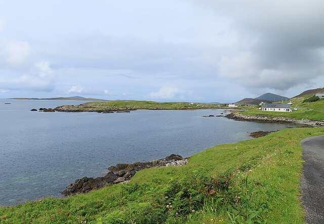
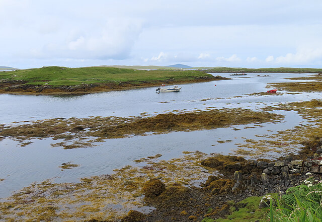
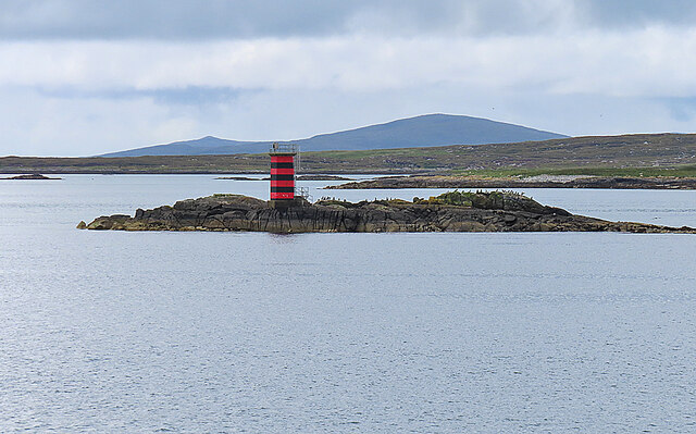
Located on the west coast of Scotland, Fiar Eilean is a picturesque island in Inverness-shire. With a total area of approximately 10 square kilometers, the island is surrounded by the vast waters of the Atlantic Ocean, offering breathtaking views and a serene atmosphere. Fiar Eilean is part of the Inner Hebrides archipelago and is situated a few kilometers off the mainland.

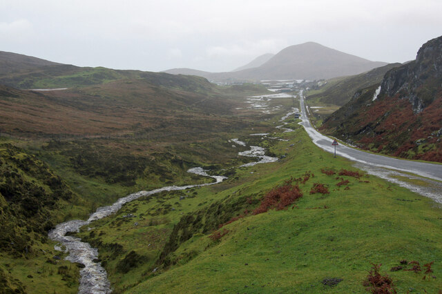
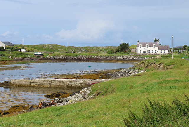
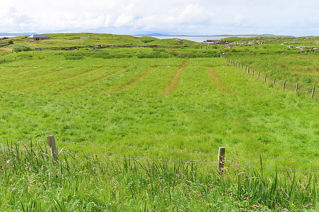
The island boasts stunning natural landscapes, characterized by rugged cliffs, rolling green hills, and pristine sandy beaches. It is home to a diverse range of flora and fauna, making it a haven for nature enthusiasts and birdwatchers. Visitors can spot a variety of bird species, including puffins, guillemots, and razorbills, as well as seals and otters in the surrounding waters.

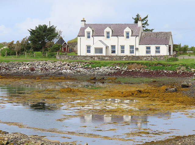
Fiar Eilean has a small population, with only a handful of residents who mainly engage in traditional livelihoods such as fishing and farming. The island offers a peaceful and idyllic lifestyle, away from the hustle and bustle of urban areas. There are no shops or amenities on the island, hence visitors are advised to bring their own supplies.

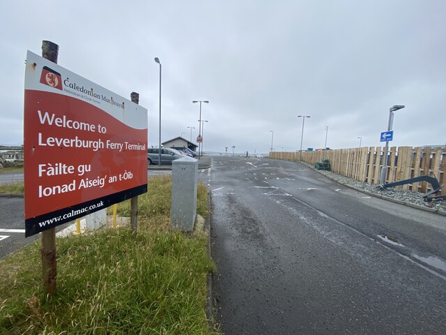
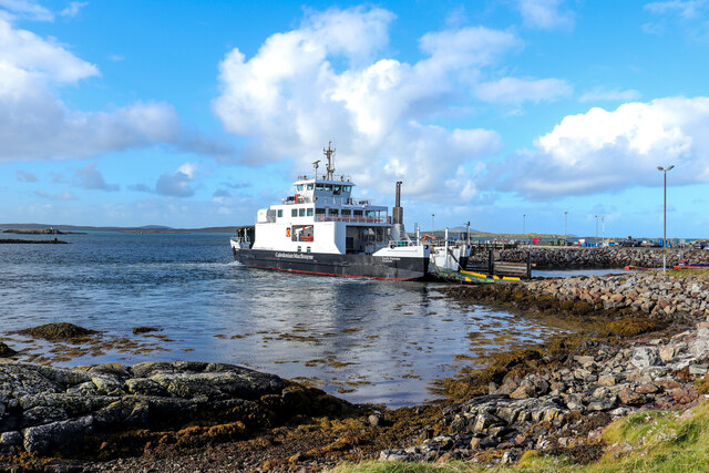
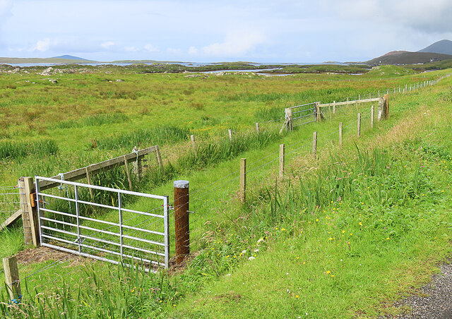
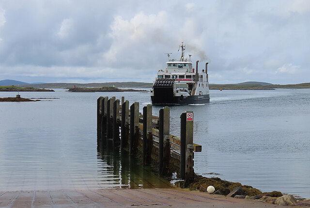
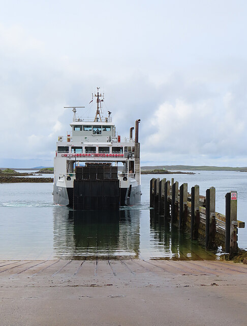
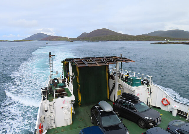
Access to Fiar Eilean is mainly by boat, with regular ferry services operating from nearby ports. The island is also accessible by private vessels. Despite its remote location, Fiar Eilean attracts travelers seeking tranquility and a chance to immerse themselves in the unspoiled beauty of the Scottish coast. Whether it's exploring its stunning landscapes, observing wildlife, or simply enjoying the calmness of the surroundings, Fiar Eilean offers a unique and unforgettable experience for nature lovers and those seeking a peaceful retreat.

If you have any feedback on the listing, please let us know in the comments section below.
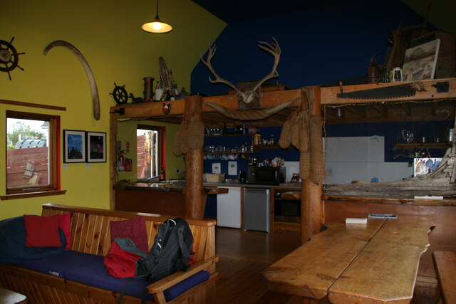
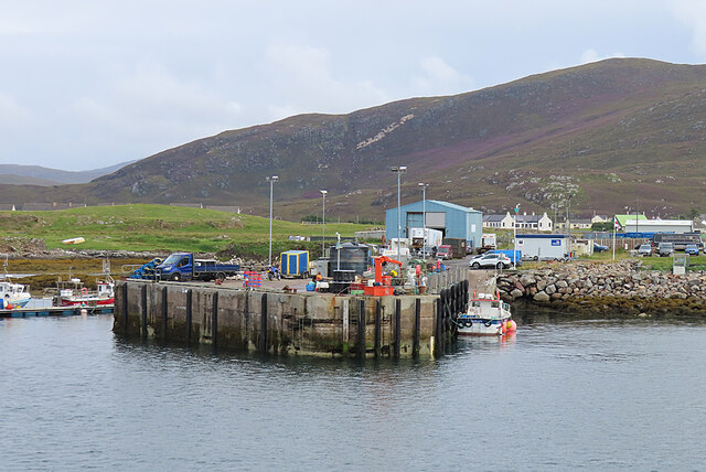
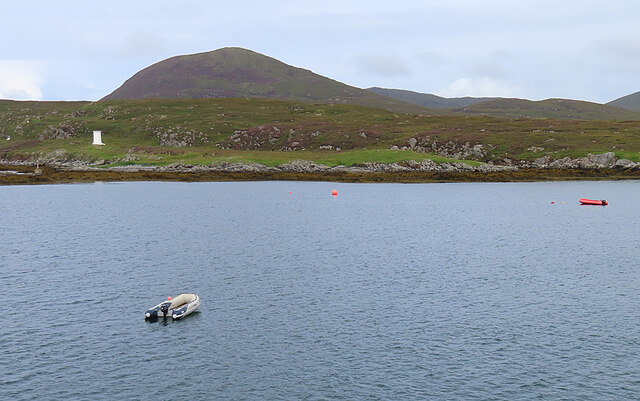
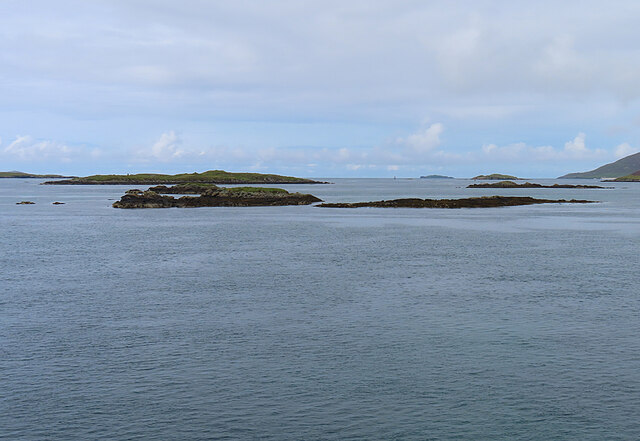
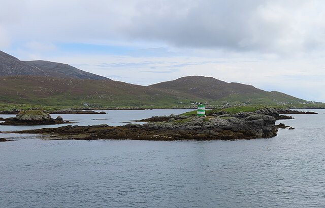
Fiar Eilean Images

Images are sourced within 2km of 57.762532/-7.0226799 or Grid Reference NG0185. Thanks to Geograph Open Source API. All images are credited.

Inside Am Bothan Bunkhouse, Leverburgh
Wet view towards Leverburgh Looking north west down Gleann Shranndabhal on a very wet November morning.
Wet view towards Leverburgh
Looking north west down Gleann Shranndabhal on a very wet November morning.
Leverburgh Ferry Terminal Entrance A sign at the entrance to the Leverburgh Ferry Terminal
Leverburgh Ferry Terminal Entrance
A sign at the entrance to the Leverburgh Ferry Terminal
Leverburgh Ferry Terminal Leverburgh Ferry Terminal, Isle of Harris while Caledonian MacBrayne's Motor Vessel 'Loch Portain' loading up for departure
Leverburgh Ferry Terminal
Leverburgh Ferry Terminal, Isle of Harris while Caledonian MacBrayne's Motor Vessel 'Loch Portain' loading up for departure
Cairminis (Carminish) Bagh Cairminis (Carminish Bay) is well sheltered by Eilean nan Bridianach, which is actually a peninsula rather than an island.
Cairminis (Carminish)
Bagh Cairminis (Carminish Bay) is well sheltered by Eilean nan Bridianach, which is actually a peninsula rather than an island.
Bàgh Chàirminis Carminish Bay is a sheltered tidal inlet, but too shallow to offer safe anchorage to more than a very small boat.
Bàgh Chàirminis
Carminish Bay is a sheltered tidal inlet, but too shallow to offer safe anchorage to more than a very small boat.
Reflections The house at the head of Bàgh Chàirminis (Carminish Bay) is reflected in the mirror-like water.
Reflections
The house at the head of Bàgh Chàirminis (Carminish Bay) is reflected in the mirror-like water.
Field Access It may be that the end of the access road here is sometimes used to pen livestock.
Field Access
It may be that the end of the access road here is sometimes used to pen livestock.
Old Lazybeds The parallel lines in this field are the remains of lazybeds. These are raised beds which are separated by ditches to assist in draining the land. They can be found all over the Hebrides, but few are still in regular cultivation.
Old Lazybeds
The parallel lines in this field are the remains of lazybeds. These are raised beds which are separated by ditches to assist in draining the land. They can be found all over the Hebrides, but few are still in regular cultivation.
Near Càirminis I think the nearest island is Eilean Chàirminis (Carminish Island).
Near Càirminis
I think the nearest island is Eilean Chàirminis (Carminish Island).
MV 'Lochportain' approaching Leverburgh MV 'Lochportain' operates the shuttle ferry between Leverburgh in Harris and Berneray.
MV 'Lochportain' approaching Leverburgh
MV 'Lochportain' operates the shuttle ferry between Leverburgh in Harris and Berneray.
Docking at Leverburgh MV 'Lochportain' has just completed the crossing of the Sound of Harris from Berneray.
Docking at Leverburgh
MV 'Lochportain' has just completed the crossing of the Sound of Harris from Berneray.
Leverburgh Pier This is the pier used by various commercial enterprises, a short distance from the ferry pier.
Leverburgh Pier
This is the pier used by various commercial enterprises, a short distance from the ferry pier.
Rubh' an Losaid The small headland north of Leverburgh Harbour.
Rubh' an Losaid
The small headland north of Leverburgh Harbour.
Sgeir Mhic Coma The closest skerries are Sgeir Mhic Coma, and Sgeir an Arbhair is a little further away, and to the right.
Sgeir Mhic Coma
The closest skerries are Sgeir Mhic Coma, and Sgeir an Arbhair is a little further away, and to the right.
Eilean a' Charnain The islet with the green-and-white striped beacon is just outside this grid square.
Eilean a' Charnain
The islet with the green-and-white striped beacon is just outside this grid square.
Dubh Sgeir This small skerry with its red-and-black striped beacon is also popular with seabirds.
Dubh Sgeir
This small skerry with its red-and-black striped beacon is also popular with seabirds.
M V 'Lochportain' The stern of MV 'Lochportain', looking back towards Harris.
M V 'Lochportain'
The stern of MV 'Lochportain', looking back towards Harris.
Show me another place!

Fiar Eilean is located at Grid Ref: NG0185 (Lat: 57.762532, Lng: -7.0226799)

Unitary Authority: Na h-Eileanan an Iar

Police Authority: Highlands and Islands

What 3 Words

///angle.confusion.attic. Near Leverburgh, Na h-Eileanan Siar

Related Wikis

Outer Hebrides

The Outer Hebrides ( HEB-rid-eez) or Western Isles (Scottish Gaelic: na h-Eileanan Siar [nə ˈhelanən ˈʃiəɾ] , na h-Eileanan an Iar [nə ˈhelanən əɲ ˈiəɾ...

Leverburgh

Leverburgh (Scottish Gaelic: An t-Òb [ən̪ˠ ˈt̪ɔːp]) is the second largest village, after Tarbert, in Harris in the Outer Hebrides of Scotland. Leverburgh...

Roineabhal

Roineabhal is a hill in Harris, in the Western Isles of Scotland. The granite on the summit plateau of the mountain is anorthosite, and is similar in composition...

Ensay (Outer Hebrides)

Ensay (Gaelic Easaigh) is a currently unpopulated and privately owned island in the Outer Hebrides of Scotland. The island lies in the Sound of Harris...

Nearby Amenities

Located within 500m of 57.762532,-7.0226799
Ferry Terminal
Lat/Long: 57.7666359/-7.0250608
Passing Place
Lat/Long: 57.762303/-7.0155385
Barrier: cattle_grid
Source: survey
Lat/Long: 57.7614019/-7.0148326
Leisure: slipway
Lat/Long: 57.7658768/-7.0229459
Covered: no
Leisure: picnic_table
Lat/Long: 57.766836/-7.02411
Covered: no
Leisure: picnic_table
Lat/Long: 57.7668546/-7.0241301
Barrier: cattle_grid
Lat/Long: 57.7667102/-7.0206807
Access: customers
Entrance: yes
Lat/Long: 57.7668401/-7.0240206
Entrance: yes
Lat/Long: 57.761412/-7.014608
Material: wood
Power: pole
Lat/Long: 57.7623426/-7.0147359
Material: wood
Power: pole
Lat/Long: 57.7631238/-7.0156746
Material: wood
Power: pole
Lat/Long: 57.7632712/-7.0158544
Material: wood
Power: pole
Lat/Long: 57.7636718/-7.0163559
Material: wood
Power: pole
Lat/Long: 57.7641639/-7.0169487
Material: wood
Power: pole
Lat/Long: 57.7645469/-7.0177815
Material: wood
Power: pole
Lat/Long: 57.764899/-7.0180702
Material: wood
Power: pole
Lat/Long: 57.7651915/-7.0187833
Power: pole
Lat/Long: 57.7656461/-7.019124
Material: wood
Power: pole
Lat/Long: 57.7650867/-7.0171123
Material: wood
Power: pole
Lat/Long: 57.765825/-7.0172142
Material: wood
Power: pole
Lat/Long: 57.7666804/-7.0209892
Barrier: cattle_grid
Lat/Long: 57.7650187/-7.0191546
Passing Place
Lat/Long: 57.7644226/-7.0181711
Barrier: cattle_grid
Lat/Long: 57.7654673/-7.0198282
Barrier: cattle_grid
Lat/Long: 57.7656125/-7.0200087
Power: pole
Lat/Long: 57.7642152/-7.0175218
Power: pole
Lat/Long: 57.7664082/-7.0227793
Power: pole
Lat/Long: 57.7659646/-7.0215935
Power: pole
Lat/Long: 57.7655193/-7.0203815
Power: pole
Lat/Long: 57.7652246/-7.0196517
Material: wood
Power: pole
Lat/Long: 57.7653443/-7.018035
Power: pole
Lat/Long: 57.7659081/-7.0200499
Power: pole
Lat/Long: 57.7660864/-7.0210598
Power: pole
Lat/Long: 57.7653163/-7.0191231
Power: pole
Lat/Long: 57.7669595/-7.0233371
Barrier: cattle_grid
Lat/Long: 57.766356/-7.0209808
Power: pole
Lat/Long: 57.7657206/-7.0193874
Street Lamp
Lamp Mount: straight_mast
Lamp Type: electric
Lat/Long: 57.766871/-7.0243414
Street Lamp
Lamp Mount: straight_mast
Lamp Type: electric
Lat/Long: 57.7667258/-7.0246298
The data included in this document is from www.openstreetmap.org. The data is made available under ODbL.

Have you been to Fiar Eilean?

Leave your review of Fiar Eilean below (or comments, questions and feedback).