Carraig nan Gillean

Island in Argyllshire

Scotland

Carraig nan Gillean

Rinn Thorbhais By following the sheep tracks you can just make it into the grid square, and then you reach a very bracing location.  Well on windy day like this it is. The sheep line on the rocks above looking on interestedly!
Rinn Thorbhais Credit: Roger McLachlan

Carraig nan Gillean is a small and picturesque island located in Argyllshire, Scotland. Situated off the west coast of the mainland, the island is part of the Inner Hebrides. With a total land area of approximately 0.5 square kilometers, it is a relatively small landmass.

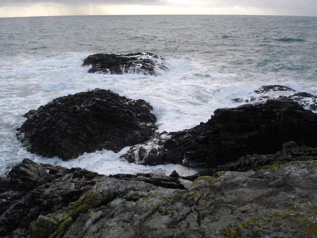
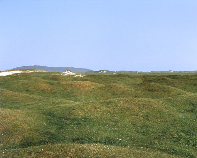
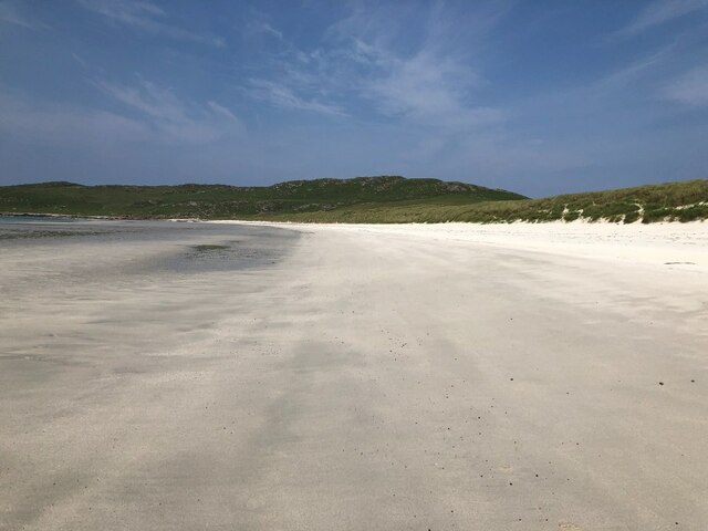
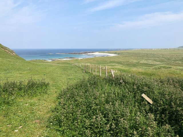
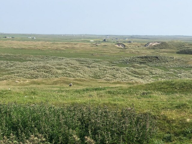
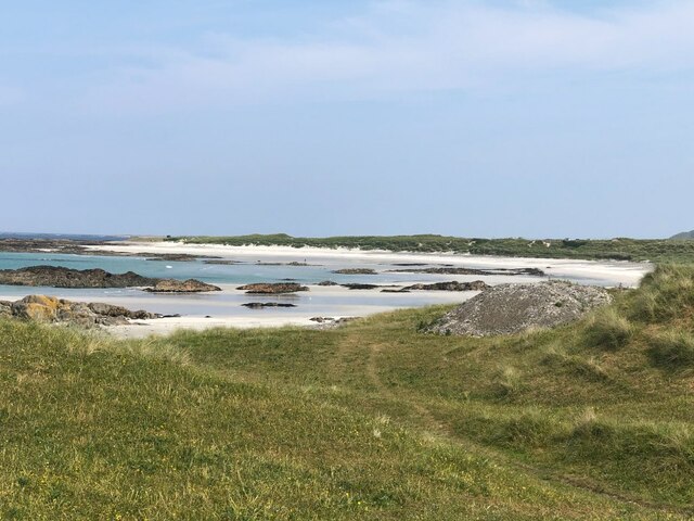
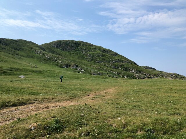
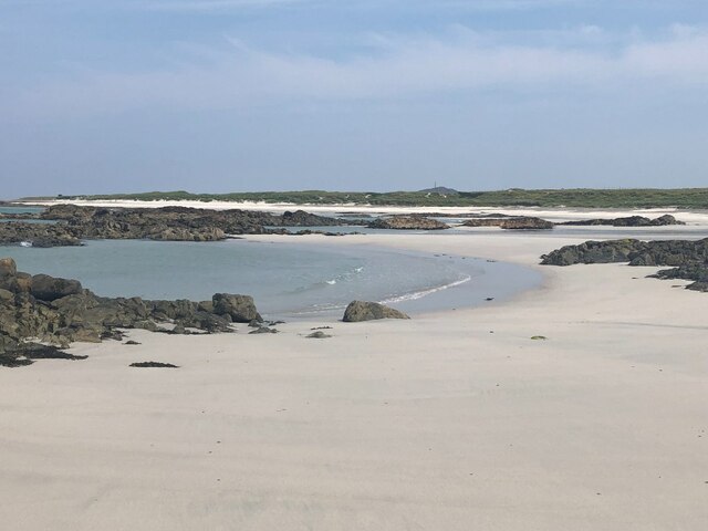
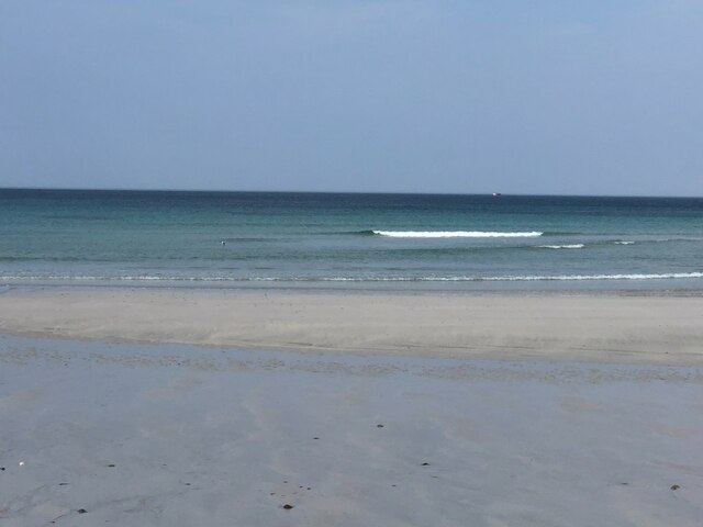
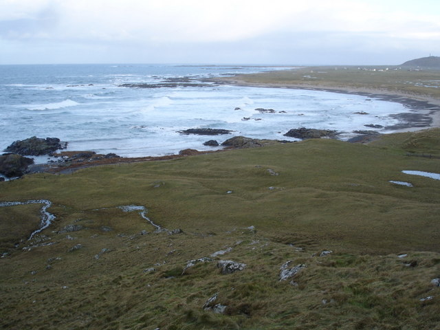
The island is characterized by its rugged and rocky terrain, with steep cliffs and rocky shores. It is known for its stunning natural beauty, with breathtaking views of the surrounding sea and nearby islands. The landscape is adorned with lush greenery, including heather-covered hills and scattered trees.

Carraig nan Gillean is home to a diverse range of wildlife, including various bird species and marine life. It is a popular spot for birdwatching enthusiasts, who can observe species such as puffins, guillemots, and razorbills nesting in the cliffs. The waters surrounding the island are also abundant with marine life, making it an ideal location for snorkeling and diving.

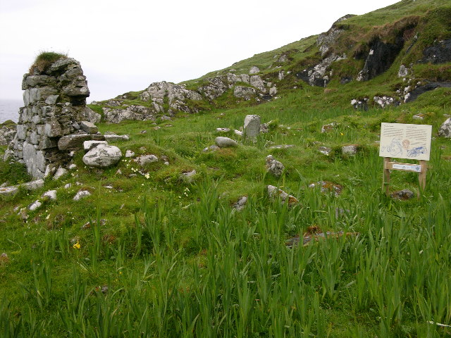
Despite its small size, Carraig nan Gillean has a rich history. It is believed to have been inhabited since prehistoric times, with evidence of ancient settlements and burial sites. The island has also played a role in more recent history, particularly during the Viking era when it served as a strategic outpost.

Today, Carraig nan Gillean remains a tranquil and untouched destination. It attracts visitors seeking a peaceful retreat, away from the hustle and bustle of urban life. Whether it's exploring the rugged landscape, observing wildlife, or simply enjoying the serenity of the surroundings, the island offers a unique and unforgettable experience for nature lovers and history enthusiasts alike.

If you have any feedback on the listing, please let us know in the comments section below.

Carraig nan Gillean Images

Images are sourced within 2km of 56.456352/-6.9803132 or Grid Reference NL9340. Thanks to Geograph Open Source API. All images are credited.

Rinn Thorbhais By following the sheep tracks you can just make it into the grid square, and then you reach a very bracing location.  Well on windy day like this it is. The sheep line on the rocks above looking on interestedly!
Rinn Thorbhais
By following the sheep tracks you can just make it into the grid square, and then you reach a very bracing location. Well on windy day like this it is. The sheep line on the rocks above looking on interestedly!
Grassy Dunes In the centre of an extensive area of sand dunes. Carnan Mor in the background with the radar station just visible.
From a print, date approximate.
Grassy Dunes
In the centre of an extensive area of sand dunes. Carnan Mor in the background with the radar station just visible. From a print, date approximate.
Tràigh Bhì A celebrated beach on the south west corner of Tiree.
Tràigh Bhì
A celebrated beach on the south west corner of Tiree.
Tràigh Bhì A celebrated beach on the south west corner of Tiree.
Tràigh Bhì
A celebrated beach on the south west corner of Tiree.
Fence above Tràigh nan Gilean Grazings on Beinn Ceann a' Mhara.
Fence above Tràigh nan Gilean
Grazings on Beinn Ceann a' Mhara.
Dunes, Barrapol A big area of cattle grazed sand dunes, southwest Tiree.
Dunes, Barrapol
A big area of cattle grazed sand dunes, southwest Tiree.
Gate, Tràigh nan Gilean A way through the barbed wire cattle fences. From here it is an easy walk over to Tràigh Bhì.
Gate, Tràigh nan Gilean
A way through the barbed wire cattle fences. From here it is an easy walk over to Tràigh Bhì.
Tràigh nan Gilean
Tràigh nan Gilean
Beinn Ceann a' Mhara The hilly southwest corner of Tiree.
Beinn Ceann a' Mhara
The hilly southwest corner of Tiree.
Tràigh nan Gilean, Tiree
Balephuil Bay from Carnan Mor, Tiree The village of Balephuil is on the left, and beyond the bay is Ceann a' Mhara. After that, the broad Atlantic. Carnan Mor or Ben Hynish, 141m, is the highest point of Tiree.
Balephuil Bay from Carnan Mor, Tiree
The village of Balephuil is on the left, and beyond the bay is Ceann a' Mhara. After that, the broad Atlantic. Carnan Mor or Ben Hynish, 141m, is the highest point of Tiree.
Patrick's Temple, nr. Balephuil, Isle of Tiree Ruins of a small, post 7th century chapel on the coastal track from the western end of Balephuil Bay.
Patrick's Temple, nr. Balephuil, Isle of Tiree
Ruins of a small, post 7th century chapel on the coastal track from the western end of Balephuil Bay.
Balephuil Beach from the west
Tràigh nan Gilean A pretty fresh wind was blowing, having said that only a breeze compared to a few days later.
Tràigh nan Gilean
A pretty fresh wind was blowing, having said that only a breeze compared to a few days later.
Tràigh nan Gilean Bay The bay does not have a name on the map.  Taken from near the Dun that I couldn't identify for certain.
Tràigh nan Gilean Bay
The bay does not have a name on the map. Taken from near the Dun that I couldn't identify for certain.
Dunes That what is says on the map.  A golf course waiting to happen, just dig through the grass and you have a bunker.  Cattle grazing in the area, and Ceann a' Mhara just visible in the background.
Dunes
That what is says on the map. A golf course waiting to happen, just dig through the grass and you have a bunker. Cattle grazing in the area, and Ceann a' Mhara just visible in the background.
Beinn Ceann a' Mhara across Tràigh nan Gilean
Show me another place!

Carraig nan Gillean is located at Grid Ref: NL9340 (Lat: 56.456352, Lng: -6.9803132)

Unitary Authority: Argyll and Bute

Police Authority: Argyll and West Dunbartonshire

What 3 Words

///hooks.outermost.reserve. Near Scarinish, Argyll & Bute

Related Wikis

Mannal

Mannal is a coastal hamlet on the west side of Hynish Bay, on the island of Tiree, Scotland. The township of Mannal lies on the southwest corner of Tiree...

Tiree Music Festival

Tiree Music Festival is a Scottish folk music festival held annually on the Island of Tiree in the Inner Hebrides. The festival was founded in 2010 by...

Tiree Airport

Tiree Airport (Scottish Gaelic: Port-adhair Thiriodh) (IATA: TRE, ICAO: EGPU) is located 2.5 nautical miles (4.6 km; 2.9 mi) north northeast of Balemartine...

Nearby Amenities

Located within 500m of 56.456352,-6.9803132
Natural: cave_entrance
Lat/Long: 56.4526712/-6.9769327
Natural: cave_entrance
Lat/Long: 56.4558659/-6.9791709
Natural: cave_entrance
Lat/Long: 56.4573101/-6.9798782
Natural: cave_entrance
Lat/Long: 56.4601185/-6.9788354
Man Made: cairn
Material: stone
Lat/Long: 56.4584825/-6.9789333
Ceann a' Bharra
Alt Name: Ceann a' Mhara
Natural: cape
Lat/Long: 56.4569362/-6.9740998
The data included in this document is from www.openstreetmap.org. The data is made available under ODbL.

Have you been to Carraig nan Gillean?

Leave your review of Carraig nan Gillean below (or comments, questions and feedback).