Baker

Island in Cornwall

England

Baker

Great Bay panorama On of the most beautiful spots on the islands.
Great Bay panorama Credit: David Lally

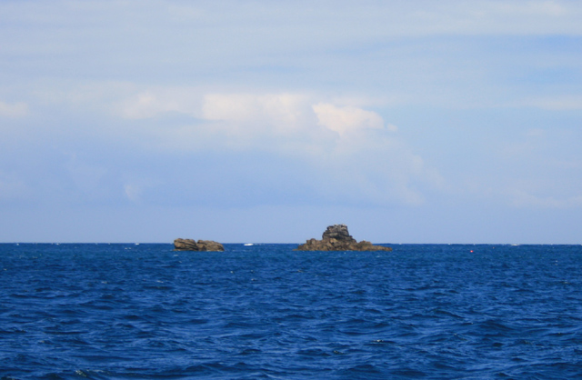
Baker Island is a small, uninhabited island located in the Atlantic Ocean, approximately 3,100 kilometers west of the coast of Cornwall, England. It is part of the Isles of Scilly, an archipelago that forms an administrative unit of Cornwall. The island is situated about 45 kilometers southwest of Land's End, the westernmost point of mainland Britain.

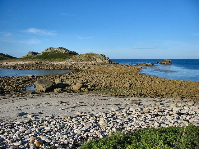
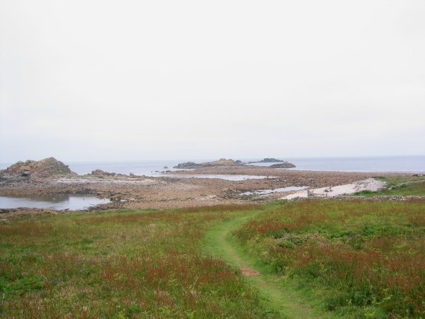
Baker Island is characterized by its rugged and rocky terrain, with steep cliffs rising from the surrounding sea. It has a total land area of around 0.3 hectares, making it one of the smallest islands in the Isles of Scilly. The island's coastline is dotted with numerous caves and rock formations, adding to its natural beauty.

Due to its remote location and lack of human habitation, Baker Island is primarily known for its rich biodiversity. It serves as an important breeding ground for various seabird species, including puffins, razorbills, and guillemots. The surrounding waters are also home to a diverse range of marine life, making it a popular spot for diving and snorkeling enthusiasts.

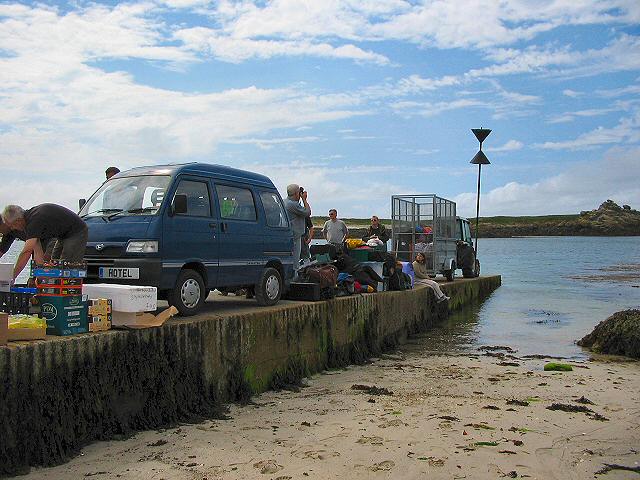
Access to Baker Island is restricted to protect its fragile ecosystem, and there are no facilities or amenities available on the island. However, it can be admired from a distance during boat trips or viewed from nearby vantage points along the coast of Cornwall. The island's untouched natural beauty and abundant wildlife make it a significant part of the Cornwall's natural heritage.

If you have any feedback on the listing, please let us know in the comments section below.
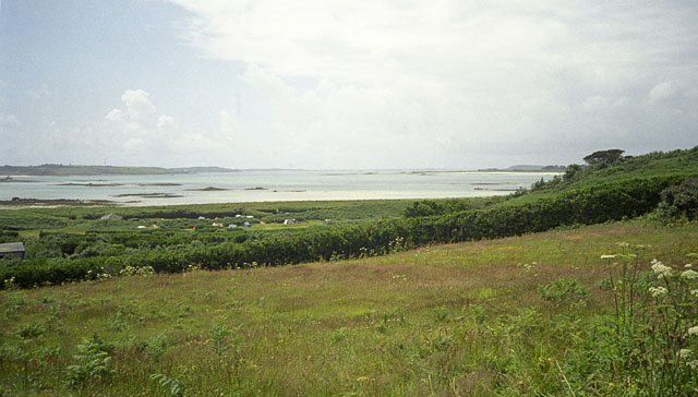
Baker Images

Images are sourced within 2km of 49.98141/-6.2892247 or Grid Reference SV9217. Thanks to Geograph Open Source API. All images are credited.

Great Bay panorama On of the most beautiful spots on the islands.
Great Bay panorama
On of the most beautiful spots on the islands.
St Martins The beautiful St Martin's Bay
St Martins
The beautiful St Martin's Bay
Lower Town, St. Martin's Looking SW, Tresco in distance
Lower Town, St. Martin's
Looking SW, Tresco in distance
St Martin's - Scillies The high street of Middle Town, St Martin's.
St Martin's - Scillies
The high street of Middle Town, St Martin's.
Looking out from gardens of Seven Stones pub View looking south from the pub
Looking out from gardens of Seven Stones pub
View looking south from the pub
St Martin's coastal path, looking towards Great Bay
St Martin's bay from Scilly point This is a beautiful beach of white sand.
St Martin's bay from Scilly point
This is a beautiful beach of white sand.
The tidal causeway to White Island, Scilly White Island is a part of St Martin's. This is the only land based way onto the island.
The tidal causeway to White Island, Scilly
White Island is a part of St Martin's. This is the only land based way onto the island.
Lower Town quay, St Martin's - Scilly A small quay - but very well used for loading and unloading all the things that are essential for island life.
Lower Town quay, St Martin's - Scilly
A small quay - but very well used for loading and unloading all the things that are essential for island life.
The northern tip of St Martin's at low water.
Sandcastle on Great Bay, St Martins, Isles of Scilly As we came upon it in the morning the neap tide must have left it unscathed from the day before!
Sandcastle on Great Bay, St Martins, Isles of Scilly
As we came upon it in the morning the neap tide must have left it unscathed from the day before!
White Island viewed from Top Rock, St Martins, Isles of Scilly White Island is attached to St Martins except at high tide.
White Island viewed from Top Rock, St Martins, Isles of Scilly
White Island is attached to St Martins except at high tide.
His 'n' Hers Regulars down the Seven Stone Inn on St Martin's, Isles of Scilly.
His 'n' Hers
Regulars down the Seven Stone Inn on St Martin's, Isles of Scilly.
Black Rock From just North of Tean.
Black Rock
From just North of Tean.
Scilly Point Looking towards St Martin's Bay.
Scilly Point
Looking towards St Martin's Bay.
Embryo sand dunes, Great Par Beach, St Martin's, Scilly Great Par Beach is one of the finest beaches on Scilly. If you believe the Scilly boatmen, it came second in the 'Best Beach in Britain' award, only failing first place because there was no car park! There is a large dune system behind the beach and this photo shows an embryo dune, where sand is trapped amongst the stems of Marram Grass. The green mound on the upper right is White Island <a href="https://www.geograph.org.uk/gridref/SV9217">SV9217</a>, with Top Rock Hill just to the left of it.
Embryo sand dunes, Great Par Beach, St Martin's, Scilly
Great Par Beach is one of the finest beaches on Scilly. If you believe the Scilly boatmen, it came second in the 'Best Beach in Britain' award, only failing first place because there was no car park! There is a large dune system behind the beach and this photo shows an embryo dune, where sand is trapped amongst the stems of Marram Grass. The green mound on the upper right is White Island SV9217, with Top Rock Hill just to the left of it.
Pernagie Isle, off St Martin's, Scilly Pernagie Isle is a small rocky islet just to the west of White Island, and off the north coast of St Martin's. At low tide, it is joined to White Island by rocks.
Pernagie Isle, off St Martin's, Scilly
Pernagie Isle is a small rocky islet just to the west of White Island, and off the north coast of St Martin's. At low tide, it is joined to White Island by rocks.
St Martins Campsite from the road above The campsite on St Martins lies between Higher Town and Middle Town. This view was taken from the road along the island. The island in the left background is St Mary's and that just visible in the left horizon is Tresco.
St Martins Campsite from the road above
The campsite on St Martins lies between Higher Town and Middle Town. This view was taken from the road along the island. The island in the left background is St Mary's and that just visible in the left horizon is Tresco.
Show me another place!

Baker is located at Grid Ref: SV9217 (Lat: 49.98141, Lng: -6.2892247)

Division: Isles of Scilly

Unitary Authority: Isles of Scilly

Police Authority: Devon and Cornwall

What 3 Words

///inflamed.posed.rams. Near St Martin's, Isles of Scilly

Related Wikis

White Island, Isles of Scilly

White Island (Cornish: Ar Nor, "facing the mainland" or Enys Wynn "white island" ) is one of the larger unpopulated islands of the Isles of Scilly, part...

Middle Town, St Martin's

Middle Town (Cornish: Tregres) is a small settlement on the island of St Martin's in the Isles of Scilly, England. It is situated slightly inland, approximately...

St Martin's, Isles of Scilly

St Martin's (Cornish: Brechiek, lit. 'dappled island') is the northernmost populated island of the Isles of Scilly, England, United Kingdom. It has an...

Lower Town, Isles of Scilly

Lower Town (Cornish: Trewoles) is the westernmost settlement on the island of St Martin's in the Isles of Scilly, England. One of the island's two quays...

Nearby Amenities

Located within 500m of 49.98141,-6.2892247
Natural: peak
Lat/Long: 49.9794697/-6.2924304
Natural: peak
Lat/Long: 49.9793939/-6.2947263
The data included in this document is from www.openstreetmap.org. The data is made available under ODbL.

Have you been to Baker?

Leave your review of Baker below (or comments, questions and feedback).