St Martin's

Island in Cornwall

England

St Martin's

A track on eastern St Martin’s The track runs uphill from the eastern end of Higher Town Bay to the Chapel Down and the Daymark.
A track on eastern St Martin’s Credit: David Lally

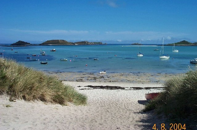
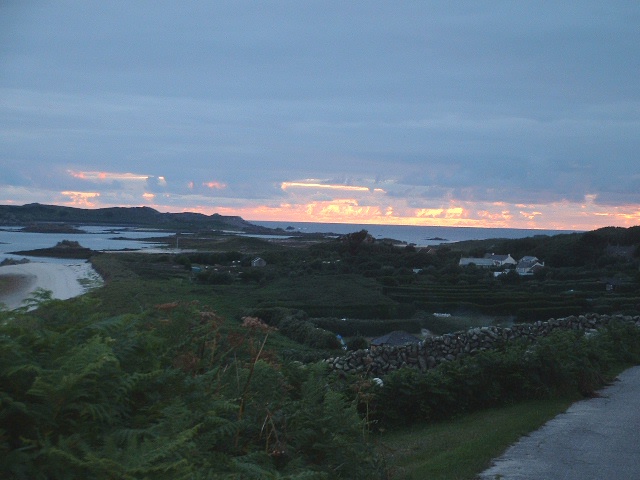
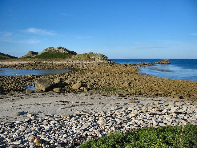
St Martin's is a picturesque island located in the Isles of Scilly archipelago, off the southwestern coast of Cornwall, England. With a land area of about 237 hectares, it is the third largest of the inhabited islands in the group. The island boasts stunning white sandy beaches, crystal-clear turquoise waters, and lush green landscapes, making it a popular destination for tourists and nature lovers alike.

St Martin's has a small resident population of around 120 people, who rely predominantly on tourism and farming for their livelihoods. The island is known for its tranquil and unspoiled ambiance, providing a peaceful retreat for visitors seeking relaxation and a close connection with nature.

The island offers a variety of outdoor activities, including scenic walks along the coastal paths, birdwatching, and water sports such as kayaking and snorkeling. The picturesque Daymark Tower, a prominent landmark on St Martin's, provides breathtaking views of the surrounding islands and the Atlantic Ocean.

St Martin's has a charming village center, where visitors can find accommodation options, quaint shops, and locally-run cafes and restaurants. Fresh seafood is a specialty on the island, with many establishments offering delicious dishes made from locally caught fish and shellfish.

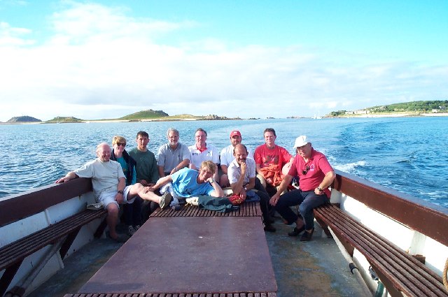
Transportation around the island is mainly on foot or by bicycle, as cars are restricted to residents only. Regular boat services connect St Martin's to other islands in the archipelago, as well as the mainland of Cornwall.

Overall, St Martin's is a hidden gem that offers a tranquil and idyllic escape, with its stunning natural beauty and a close-knit community that welcomes visitors with open arms.

If you have any feedback on the listing, please let us know in the comments section below.
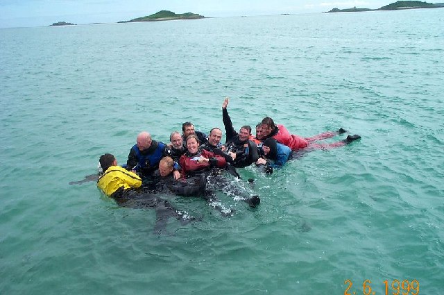
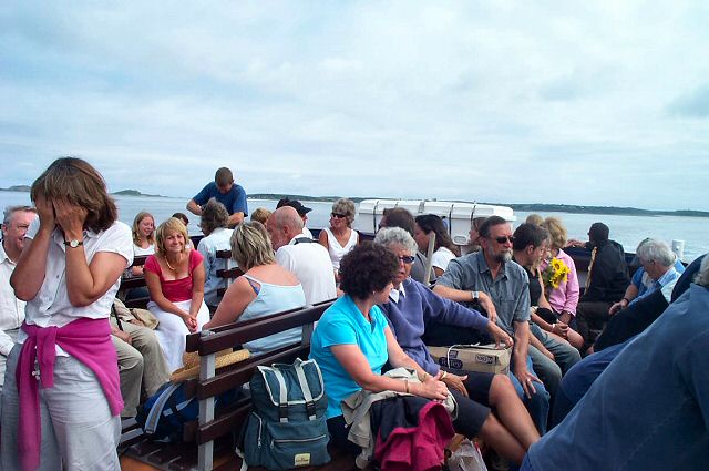
St Martin's Images

Images are sourced within 2km of 49.96492/-6.2952055 or Grid Reference SV9216. Thanks to Geograph Open Source API. All images are credited.

A track on eastern St Martin’s The track runs uphill from the eastern end of Higher Town Bay to the Chapel Down and the Daymark.
A track on eastern St Martin’s
The track runs uphill from the eastern end of Higher Town Bay to the Chapel Down and the Daymark.
Lower Town Quay The smaller of the two quays on St Martin’s. The larger quay at Higher Town is the one used for freight deliveries, but is inaccessible at a low tide.

The island behind is the uninhabited Tean (pronounced tea-an).
Lower Town Quay
The smaller of the two quays on St Martin’s. The larger quay at Higher Town is the one used for freight deliveries, but is inaccessible at a low tide. The island behind is the uninhabited Tean (pronounced tea-an).
Great Bay panorama On of the most beautiful spots on the islands.
Great Bay panorama
On of the most beautiful spots on the islands.
Higher Town Bay
Higher Town Bay
St Martins The beautiful St Martin's Bay
St Martins
The beautiful St Martin's Bay
St Martin's Divers at Higher Town bay
St Martin's
Divers at Higher Town bay
St Martin's Higher Town Bay
St Martin's
Higher Town Bay
Island hopping Crossing from St Martin's to St Mary's on the island ferry.
Island hopping
Crossing from St Martin's to St Mary's on the island ferry.
Lower Town, St. Martin's Looking SW, Tresco in distance
Lower Town, St. Martin's
Looking SW, Tresco in distance
Middle Town - St Martin's, Scilly The westerly view from Middle Town. Tresco on the horizon.
Middle Town - St Martin's, Scilly
The westerly view from Middle Town. Tresco on the horizon.
St Martin's Ferry - Scillies Passengers on the St Martin - St Mary ferry boat. Many of these will be returning from a week's stay on St Martin's.
St Martin's Ferry - Scillies
Passengers on the St Martin - St Mary ferry boat. Many of these will be returning from a week's stay on St Martin's.
St Martin's - Scillies The high street of Middle Town, St Martin's.
St Martin's - Scillies
The high street of Middle Town, St Martin's.
Sunset on St Martins looking westward
Higher Town on St Martins Looking East
Looking out from gardens of Seven Stones pub View looking south from the pub
Looking out from gardens of Seven Stones pub
View looking south from the pub
St Martin's coastal path, looking towards Great Bay
St Martin's bay from Scilly point This is a beautiful beach of white sand.
St Martin's bay from Scilly point
This is a beautiful beach of white sand.
The tidal causeway to White Island, Scilly White Island is a part of St Martin's. This is the only land based way onto the island.
The tidal causeway to White Island, Scilly
White Island is a part of St Martin's. This is the only land based way onto the island.
Show me another place!

St Martin's is located at Grid Ref: SV9216 (Lat: 49.96492, Lng: -6.2952055)

Division: Isles of Scilly

Unitary Authority: Isles of Scilly

Police Authority: Devon and Cornwall

What 3 Words

///trembles.schooling.chuckling. Near St Martin's, Isles of Scilly

Related Wikis

Middle Town, St Martin's

Middle Town (Cornish: Tregres) is a small settlement on the island of St Martin's in the Isles of Scilly, England. It is situated slightly inland, approximately...

St Martin's, Isles of Scilly

St Martin's (Cornish: Brechiek, lit. 'dappled island') is the northernmost populated island of the Isles of Scilly, England, United Kingdom. It has an...

Lower Town, Isles of Scilly

Lower Town (Cornish: Trewoles) is the westernmost settlement on the island of St Martin's in the Isles of Scilly, England. One of the island's two quays...

St Martin's Church, St Martin's

St Martin's Church, St Martin's is a Grade II listed parish church in the Church of England located in St Martin's, Isles of Scilly, UK. == History... ==

Nearby Amenities

Located within 500m of 49.96492,-6.2952055
Middletown
Place: hamlet
Wikidata: Q6841632
Lat/Long: 49.9661574/-6.2953994
Tinkler's Hill
Natural: peak
Lat/Long: 49.9677439/-6.3002919
Source: PGS
Lat/Long: 49.9623908/-6.2911642
Source: PGS
Lat/Long: 49.9621772/-6.2904406
Source: PGS
Lat/Long: 49.9682881/-6.2907659
Source: PGS
Lat/Long: 49.9679931/-6.290601
Source: PGS
Lat/Long: 49.9672551/-6.2900797
Source: PGS
Lat/Long: 49.9662143/-6.2888528
Source: PGS
Lat/Long: 49.9626869/-6.2933937
Source: PGS
Lat/Long: 49.9643146/-6.3012896
Source: PGS
Lat/Long: 49.9639219/-6.2952267
Source: PGS
Lat/Long: 49.9634868/-6.294156
Source: PGS
Lat/Long: 49.9640719/-6.2961956
Source: PGS
Lat/Long: 49.9641238/-6.2977866
Source: PGS
Lat/Long: 49.9643212/-6.2996593
Source: PGS
Lat/Long: 49.9628497/-6.2939601
Source: PGS
Lat/Long: 49.963083/-6.294032
Lower Town
Name Kw: Trewoles
Place: village
Wikidata: Q6693875
Lat/Long: 49.9658215/-6.3019184
Pub
Seven Stones
Addr Country: GB
Addr Hamlet: St Mary's
Addr Housename: Seven Stones Inn
Addr Postcode: TR25 0QW
Addr State: Isles Of Scilly
Addr Suburb: Lower Town
Email: sevenstonesinn@gmail.com
Fhrs Id: 780844
Phone: +44 1720 423777
Website: https://www.visitislesofscilly.com/food-drink/places-eat-drink/st-martins/seven-stones-inn
Lat/Long: 49.9663992/-6.3010705
Telephone
Booth: K6
Covered: booth
Phone: +44 1720 422413
Lat/Long: 49.9659294/-6.2951972
The Plains
Place: locality
Lat/Long: 49.9664813/-6.2918113
Bicycle Parking
Lat/Long: 49.9642445/-6.2903685
Toilets
Lat/Long: 49.9643481/-6.2904222
Seamark Beacon Special Purpose Colour: yellow
Seamark Beacon Special Purpose Shape: pile
Seamark Type: beacon_special_purpose
Lat/Long: 49.9644449/-6.3012815
The data included in this document is from www.openstreetmap.org. The data is made available under ODbL.

Have you been to St Martin's?

Leave your review of St Martin's below (or comments, questions and feedback).