Eilean Fada

Island in Inverness-shire

Scotland

Eilean Fada

Eaval (Eabhal) from Burabhal, North Uist Eaval, 347m, is the highest point on North Uist. Loch Obasaraigh, seen here, is a major obstacle to the ascent of Eaval, and there are basically two routes: a very awkward one from the south-west*, and this one from the north. This starts at Saighdinis <a href="https://www.geograph.org.uk/gridref/NF8863">NF8863</a> and involves a long sweep round the east side of the loch, passing Burabhal on the way. Climbing Burabhal, 141m, is an optional extra! Once the hill is reached, at the extreme left of this photo, things become easier and the ridge can be followed to the top.

* For an indication of the problems, see my <a href="https://www.geograph.org.uk/photo/2538382">NF8960 : Eaval summit, looking to the south-west cairn</a>. Imagine trying to thread your way through all those lochans, without even the benefit of a view from above!
Eaval (Eabhal) from Burabhal, North Uist Credit: Michael Earnshaw

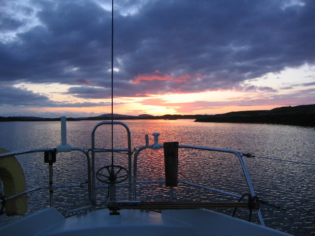
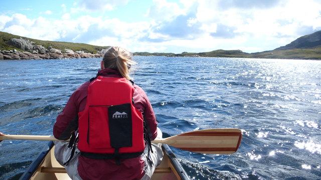
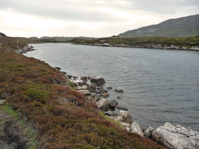
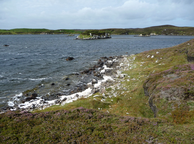
Eilean Fada is a small island located in the Loch Eil in Inverness-shire, Scotland. Also known as the "Long Island," it is situated approximately 7 miles northeast of Fort William and covers an area of around 30 acres. The island is accessible by boat and is a popular destination for tourists and nature enthusiasts.

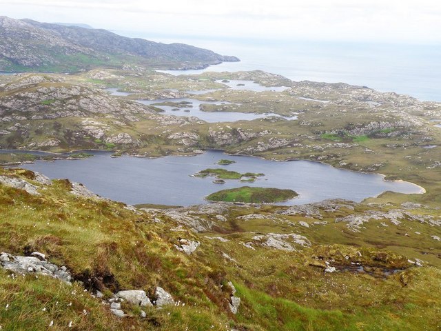
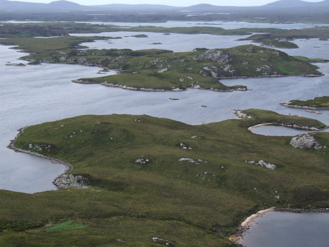
Eilean Fada is characterized by its stunning natural beauty, with picturesque landscapes and breathtaking views of the surrounding mountains and water. The island is covered in lush greenery and has a diverse range of flora and fauna. Visitors can explore the island's rugged terrain, which offers opportunities for hiking and wildlife spotting.

One of the main attractions on Eilean Fada is the ruin of a medieval castle, which was once an important defensive structure. The castle dates back to the 13th century and provides a glimpse into the island's rich history. Exploring the castle ruins allows visitors to imagine what life would have been like in ancient times.

The island is also home to a variety of bird species, making it a haven for birdwatchers. The peaceful and tranquil environment of Eilean Fada provides an ideal habitat for these birds, and visitors can observe them in their natural habitat.

Overall, Eilean Fada offers a unique and idyllic escape from the bustling cities and a chance to immerse oneself in the natural beauty and history of the Scottish Highlands.

If you have any feedback on the listing, please let us know in the comments section below.

Eilean Fada Images

Images are sourced within 2km of 57.539318/-7.1938251 or Grid Reference NF8961. Thanks to Geograph Open Source API. All images are credited.
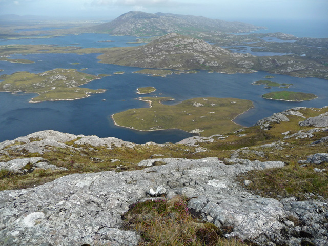
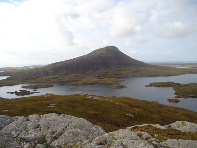
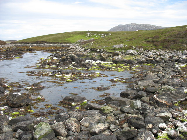
Eaval (Eabhal) from Burabhal, North Uist Eaval, 347m, is the highest point on North Uist. Loch Obasaraigh, seen here, is a major obstacle to the ascent of Eaval, and there are basically two routes: a very awkward one from the south-west*, and this one from the north. This starts at Saighdinis <a href="https://www.geograph.org.uk/gridref/NF8863">NF8863</a> and involves a long sweep round the east side of the loch, passing Burabhal on the way. Climbing Burabhal, 141m, is an optional extra! Once the hill is reached, at the extreme left of this photo, things become easier and the ridge can be followed to the top.

* For an indication of the problems, see my <a href="https://www.geograph.org.uk/photo/2538382">NF8960 : Eaval summit, looking to the south-west cairn</a>. Imagine trying to thread your way through all those lochans, without even the benefit of a view from above!
Eaval (Eabhal) from Burabhal, North Uist
Eaval, 347m, is the highest point on North Uist. Loch Obasaraigh, seen here, is a major obstacle to the ascent of Eaval, and there are basically two routes: a very awkward one from the south-west*, and this one from the north. This starts at Saighdinis NF8863 and involves a long sweep round the east side of the loch, passing Burabhal on the way. Climbing Burabhal, 141m, is an optional extra! Once the hill is reached, at the extreme left of this photo, things become easier and the ridge can be followed to the top. * For an indication of the problems, see my NF8960 : Eaval summit, looking to the south-west cairn. Imagine trying to thread your way through all those lochans, without even the benefit of a view from above!
Sculpture at the end of the road One of the sculptures at the end of the road. Literally at the very end of the road along Loch Euphort.
Sculpture at the end of the road
One of the sculptures at the end of the road. Literally at the very end of the road along Loch Euphort.
A high col through the Eabhal ridge
View NW from the slopes of Burabhal Loch Obasaraigh is to the left.
View NW from the slopes of Burabhal
Loch Obasaraigh is to the left.
Anchorage in Loch Eyport
East end of Loch Obasaraigh, looking to Burabhal The bay at the E end of Loch Obasaraigh with the top of Burabhal clearly visible.  A quick an easy way into the hill of Eaval with the use of the canoe.  The spit of land in the background is clearly visible on the map.
East end of Loch Obasaraigh, looking to Burabhal
The bay at the E end of Loch Obasaraigh with the top of Burabhal clearly visible. A quick an easy way into the hill of Eaval with the use of the canoe. The spit of land in the background is clearly visible on the map.
South side of the island Eilean Leathann Canoeing into Eaval we passed South of the island Eilean Leathann, which you see off the persons left shoulder.  The ridge of Eaval in the distance
South side of the island Eilean Leathann
Canoeing into Eaval we passed South of the island Eilean Leathann, which you see off the persons left shoulder. The ridge of Eaval in the distance
View from Eaval Towards the western end of Loch Obasaraigh, with Burrival on the left
View from Eaval
Towards the western end of Loch Obasaraigh, with Burrival on the left
Eileann Leathan from Eabhal
East end of Loch Obasaraigh From the path below Burabhal. The land to the right is one of the smaller of the islands in the loch. The lower slopes of Eabhal are in the distance.
East end of Loch Obasaraigh
From the path below Burabhal. The land to the right is one of the smaller of the islands in the loch. The lower slopes of Eabhal are in the distance.
Eastern slope of Eabhal Looking out from the exposed rocks of Eabhal across Loch Obasaraigh and its islands to Burribhal and Li a Deas.
Eastern slope of Eabhal
Looking out from the exposed rocks of Eabhal across Loch Obasaraigh and its islands to Burribhal and Li a Deas.
Loch Obasaraigh A prolonged fresh southerly wind is creating spume from the loch and blowing it onto the northern shores.
Loch Obasaraigh
A prolonged fresh southerly wind is creating spume from the loch and blowing it onto the northern shores.
Beach at the south east of Loch Obasaraigh Course sand generated by the large body of wind agitated fresh water.
Beach at the south east of Loch Obasaraigh
Course sand generated by the large body of wind agitated fresh water.
Camel Rock
Camel Rock
Loch Obasaraigh Eaval, the highest point on North Uist, is the hill on the far side of the loch. Although the route to the hill is indirect (to the left [east] of the loch as seen here), this is the best approach if you wish to climb Eaval.
Loch Obasaraigh
Eaval, the highest point on North Uist, is the hill on the far side of the loch. Although the route to the hill is indirect (to the left [east] of the loch as seen here), this is the best approach if you wish to climb Eaval.
Stepping stones at the outlet from Loch Obasaraigh In order to climb Eaval <a href="https://www.geograph.org.uk/gridref/NF8960">NF8960</a> by the simplest (though not easy!) route, it is necessary to cross the outflow from Loch Obasaraigh. The map labels this as 'stepping stones', but it is really a rough stone causeway. I think it would need a very high tide, or a lot of water in the loch (it is a big loch with a quite small catchment area) to make this crossing difficult.
To be honest, it is difficult to tell whether this photo is in NF8962 or NF8963. My GPS recorded the northings as 62992 and so I have entered this as in NF8962.
Stepping stones at the outlet from Loch Obasaraigh
In order to climb Eaval NF8960 by the simplest (though not easy!) route, it is necessary to cross the outflow from Loch Obasaraigh. The map labels this as 'stepping stones', but it is really a rough stone causeway. I think it would need a very high tide, or a lot of water in the loch (it is a big loch with a quite small catchment area) to make this crossing difficult. To be honest, it is difficult to tell whether this photo is in NF8962 or NF8963. My GPS recorded the northings as 62992 and so I have entered this as in NF8962.
The outflow to Loch Euphort at Clachan Bhiurabhal Clearly taken at low tide.
The outflow to Loch Euphort at Clachan Bhiurabhal
Clearly taken at low tide.
The Roadends Community Sculpture Project This plaque at Locheport explains the sculpture project.
The Roadends Community Sculpture Project
This plaque at Locheport explains the sculpture project.
Show me another place!

Eilean Fada is located at Grid Ref: NF8961 (Lat: 57.539318, Lng: -7.1938251)

Unitary Authority: Na h-Eileanan an Iar

Police Authority: Highlands and Islands

What 3 Words

///audio.recording.desks. Near Lochmaddy, Na h-Eileanan Siar

Nearby Locations

Eilean Fada

Related Wikis

Fraoch-Eilean

Fraoch-eilean is a small island with an uncertain population north of Benbecula in the Outer Hebrides of Scotland. It is about 55 hectares (140 acres...

Flodaigh Mòr

Flodaigh Mòr (or Floddaymore) is an uninhabited island in the Outer Hebrides of Scotland. == Geography and geology == Flodaigh Mòr lies east of North Uist...

Grimsay

Grimsay (Scottish Gaelic: Griomasaigh) is a tidal island in the Outer Hebrides of Scotland. == Geography == Grimsay is the largest of the low-lying stepping...

Baile Glas

Baile Glas or Ballaglasa (Scottish Gaelic: Am Baile Glas) is a settlement on Grimsay in the Outer Hebrides, Scotland. Ballaglasa is within the parish of...

Have you been to Eilean Fada?

Leave your review of Eilean Fada below (or comments, questions and feedback).