Màitheigh Riabhach

Island in Inverness-shire

Scotland

Màitheigh Riabhach

Màithidh Riabhach One of many low-lying islands along the east side of the Long Isle.
Màithidh Riabhach Credit: Toby Speight

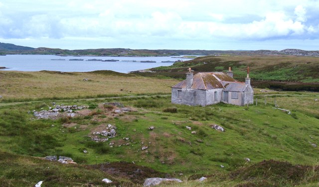
Màitheigh Riabhach is a small island located off the west coast of Scotland, specifically in Inverness-shire. It is known for its picturesque landscapes and tranquil atmosphere, making it an ideal destination for nature lovers and those seeking a peaceful retreat.

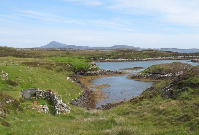
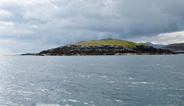
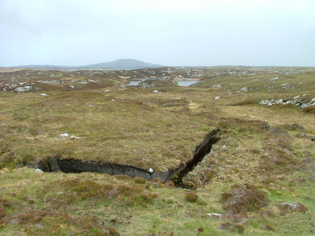
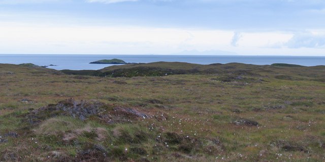
Covering an area of approximately 5 square kilometers, Màitheigh Riabhach is characterized by its rugged coastline, adorned with towering cliffs and hidden coves. The island boasts a diverse range of flora and fauna, including rare wildflowers and various bird species, making it a haven for wildlife enthusiasts and birdwatchers.

Access to Màitheigh Riabhach is mainly by boat, as the island does not have any bridges or causeways connecting it to the mainland. Visitors can enjoy a scenic boat ride, taking in the stunning views of the surrounding sea and landscape.

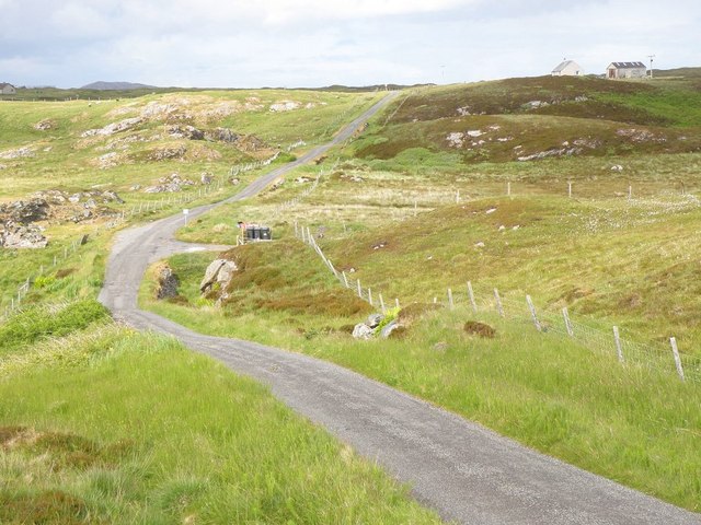
The island offers various outdoor activities for visitors to enjoy, such as hiking, fishing, and wildlife spotting. There are several walking paths and trails that lead to different parts of the island, providing opportunities to explore its natural beauty and discover hidden gems.

For those interested in history, Màitheigh Riabhach is home to ancient ruins and archaeological sites, offering glimpses into its past. These include ancient stone circles and burial grounds, providing insights into the island's early inhabitants and their way of life.

Overall, Màitheigh Riabhach is a captivating island that offers a unique blend of natural beauty, wildlife, and historical significance. Whether you are seeking solitude, adventure, or a deeper understanding of Scotland's rich heritage, this island is sure to leave a lasting impression.

If you have any feedback on the listing, please let us know in the comments section below.

Màitheigh Riabhach Images

Images are sourced within 2km of 57.433216/-7.2008844 or Grid Reference NF8850. Thanks to Geograph Open Source API. All images are credited.
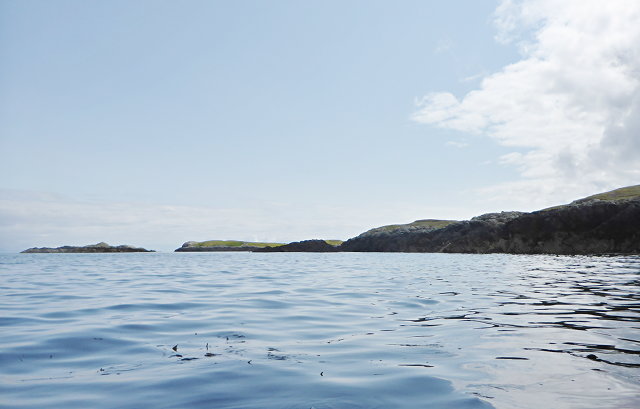
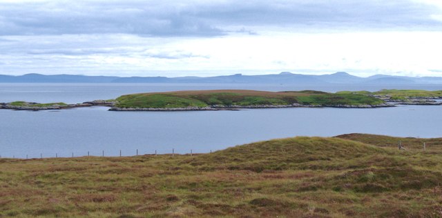
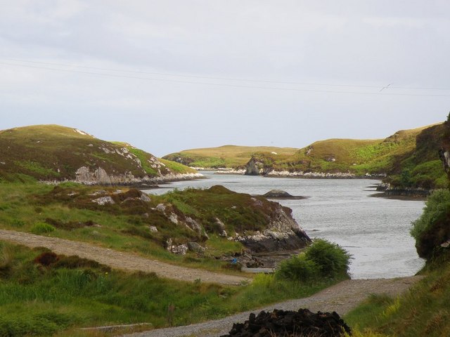
Màithidh Riabhach One of many low-lying islands along the east side of the Long Isle.
Màithidh Riabhach
One of many low-lying islands along the east side of the Long Isle.
Sheepfold and tidal inlet Close by the bothy that I photographed in 2012, the sheepfold is marked on the OS map.The tidal inlet leads out to a channel between 'mainland' Benbecula and Orasaigh, one of many tidal islands of that name around the west coasts of Scotland.
Sheepfold and tidal inlet
Close by the bothy that I photographed in 2012, the sheepfold is marked on the OS map.The tidal inlet leads out to a channel between 'mainland' Benbecula and Orasaigh, one of many tidal islands of that name around the west coasts of Scotland.
Oystercatcher on a tidal rock east of Màithidh Glas
Greanamul Deas
Greanamul Deas
Eastern end of Rairnis
Crofts on the east side of Benbecula This is almost at the end of the little road that winds its way across moors and by both sea and freshwater lochs to eventually reach Uisgeabhagh. A newer croft house to the left contrasts with an old single storey house to the right, no longer lived in and most likely doomed to slow decay.
Crofts on the east side of Benbecula
This is almost at the end of the little road that winds its way across moors and by both sea and freshwater lochs to eventually reach Uisgeabhagh. A newer croft house to the left contrasts with an old single storey house to the right, no longer lived in and most likely doomed to slow decay.
Disused bothy by the shore A track leads from the road end past a house and down to the shore opposite the small island of Orasaigh Uisgeabheag. This tin roofed bothy is not yet falling into ruin.
Disused bothy by the shore
A track leads from the road end past a house and down to the shore opposite the small island of Orasaigh Uisgeabheag. This tin roofed bothy is not yet falling into ruin.
Offshore skerry near Uiseabhagh The view offshore from a remote stretch of the Benbecula coastline. The skerry is unnamed on the map, whilst the coastline of Skye is visible in the distance [right].
Offshore skerry near Uiseabhagh
The view offshore from a remote stretch of the Benbecula coastline. The skerry is unnamed on the map, whilst the coastline of Skye is visible in the distance [right].
Maithidh Riabhach from Benbecula Small offshore island that straddles 4 grid squares to the east of Benbecula. Looking east across the island towards the coast of Skye where the flat topped McLeod's Tables are visible.
Maithidh Riabhach from Benbecula
Small offshore island that straddles 4 grid squares to the east of Benbecula. Looking east across the island towards the coast of Skye where the flat topped McLeod's Tables are visible.
Peat Bank Loch na Beiste in the background.
Peat Bank
Loch na Beiste in the background.
Minor road near Creagastrom Minor road as it passes Buaile Rairnis
Minor road near Creagastrom
Minor road as it passes Buaile Rairnis
Loch Meanarbhagh A small sea loch by Buaile Rairnis
Loch Meanarbhagh
A small sea loch by Buaile Rairnis
An unexciting patch of boggy moorland There may be some interesting coastal scenery on the east side of this grid square, but the trek across a squelchy moor is just too much. The coast is visible here, as are one or two offshire islets. The moor appears to have been worked for peat in the past, and is full of wet patches.
An unexciting patch of boggy moorland
There may be some interesting coastal scenery on the east side of this grid square, but the trek across a squelchy moor is just too much. The coast is visible here, as are one or two offshire islets. The moor appears to have been worked for peat in the past, and is full of wet patches.
Roadend at  Uisgeabhagh A lonely crofting settlement on the east side of Benbecula.
Roadend at Uisgeabhagh
A lonely crofting settlement on the east side of Benbecula.
Show me another place!

Màitheigh Riabhach is located at Grid Ref: NF8850 (Lat: 57.433216, Lng: -7.2008844)

Unitary Authority: Na h-Eileanan an Iar

Police Authority: Highlands and Islands

What 3 Words

///electric.heartened.pushy. Near Balivanich, Na h-Eileanan Siar

Nearby Locations

Màitheigh Riabhach

Related Wikis

Eileanan Chearabhaigh

Eileanan Chearabhaigh is a collection of small uninhabited tidal islands off the south east coast of Benbecula in the Outer Hebrides of Scotland. The English...

Wiay, Outer Hebrides

Wiay (Scottish Gaelic: Bhuia or Fuidheigh) is an uninhabited island in the Outer Hebrides. It lies south-east of Benbecula and measures approximately...

Grimsay (South East Benbecula)

Grimsay, south east of Benbecula is a tidal island of the Outer Hebrides. It is connected to Benbecula by a causeway which carries the B891. In the 2001...

Ronay

Ronay (Scottish Gaelic: Rònaigh) is an island in the Outer Hebrides of Scotland, which lies a short distance off the east coast of Grimsay. == Geography... ==

Nearby Amenities

Located within 500m of 57.433216,-7.2008844
Created By: dmgroom_coastlines
Lat/Long: 57.4335/-7.19292
Created By: dmgroom_coastlines
Lat/Long: 57.43376/-7.1929
Created By: dmgroom_coastlines
Lat/Long: 57.43251/-7.19534
Created By: dmgroom_coastlines
Lat/Long: 57.43277/-7.19533
Created By: dmgroom_coastlines
Lat/Long: 57.43277/-7.19485
Created By: dmgroom_coastlines
Lat/Long: 57.43251/-7.19487
Created By: dmgroom_coastlines
Lat/Long: 57.43202/-7.19679
Created By: dmgroom_coastlines
Lat/Long: 57.43228/-7.19678
Created By: dmgroom_coastlines
Lat/Long: 57.4324/-7.19646
Created By: dmgroom_coastlines
Lat/Long: 57.43266/-7.19676
Created By: dmgroom_coastlines
Lat/Long: 57.43267/-7.19723
Created By: dmgroom_coastlines
Lat/Long: 57.43255/-7.19748
Created By: dmgroom_coastlines
Lat/Long: 57.43204/-7.19774
Created By: dmgroom_coastlines
Lat/Long: 57.43205/-7.19869
Created By: dmgroom_coastlines
Lat/Long: 57.43307/-7.19864
Created By: dmgroom_coastlines
Lat/Long: 57.43295/-7.19912
Created By: dmgroom_coastlines
Lat/Long: 57.43285/-7.20055
Created By: dmgroom_coastlines
Lat/Long: 57.43259/-7.20032
Created By: dmgroom_coastlines
Lat/Long: 57.43232/-7.19986
Created By: dmgroom_coastlines
Lat/Long: 57.43206/-7.19963
Created By: dmgroom_coastlines
Lat/Long: 57.4322/-7.20058
Created By: dmgroom_coastlines
Lat/Long: 57.43234/-7.20081
Created By: dmgroom_coastlines
Lat/Long: 57.43285/-7.20102
Created By: dmgroom_coastlines
Lat/Long: 57.43287/-7.20244
Created By: dmgroom_coastlines
Lat/Long: 57.43441/-7.20237
Created By: dmgroom_coastlines
Lat/Long: 57.43429/-7.20332
Created By: dmgroom_coastlines
Lat/Long: 57.43417/-7.2038
Created By: dmgroom_coastlines
Lat/Long: 57.43469/-7.20402
Created By: dmgroom_coastlines
Lat/Long: 57.43494/-7.20424
Created By: dmgroom_coastlines
Lat/Long: 57.43493/-7.20329
Created By: dmgroom_coastlines
Lat/Long: 57.43545/-7.20351
Created By: dmgroom_coastlines
Lat/Long: 57.43596/-7.20372
Created By: dmgroom_coastlines
Lat/Long: 57.43608/-7.20276
Created By: dmgroom_coastlines
Lat/Long: 57.43606/-7.20181
Created By: dmgroom_coastlines
Lat/Long: 57.43606/-7.20134
Created By: dmgroom_coastlines
Lat/Long: 57.43617/-7.20038
Created By: dmgroom_coastlines
Lat/Long: 57.43592/-7.2004
Created By: dmgroom_coastlines
Lat/Long: 57.43592/-7.20087
Created By: dmgroom_coastlines
Lat/Long: 57.43568/-7.20088
Created By: dmgroom_coastlines
Lat/Long: 57.43552/-7.19994
Created By: dmgroom_coastlines
Lat/Long: 57.43526/-7.199
Created By: dmgroom_coastlines
Lat/Long: 57.43499/-7.19807
Created By: dmgroom_coastlines
Lat/Long: 57.43472/-7.19761
Created By: dmgroom_coastlines
Lat/Long: 57.43458/-7.19666
Created By: dmgroom_coastlines
Lat/Long: 57.43381/-7.1967
Created By: dmgroom_coastlines
Lat/Long: 57.4338/-7.19576
Created By: dmgroom_coastlines
Lat/Long: 57.43354/-7.19553
Created By: dmgroom_coastlines
Lat/Long: 57.43329/-7.19554
Created By: dmgroom_coastlines
Lat/Long: 57.43278/-7.19604
Created By: dmgroom_coastlines
Lat/Long: 57.43261/-7.19612
Created By: dmgroom_coastlines
Lat/Long: 57.43239/-7.19582
Created By: dmgroom_coastlines
Lat/Long: 57.43217/-7.19614
Created By: dmgroom_coastlines
Lat/Long: 57.43202/-7.19631
Created By: dmgroom_coastlines
Lat/Long: 57.43083/-7.194
Created By: dmgroom_coastlines
Lat/Long: 57.43073/-7.19495
Created By: dmgroom_coastlines
Lat/Long: 57.43123/-7.19469
Created By: dmgroom_coastlines
Lat/Long: 57.43148/-7.19445
Created By: dmgroom_coastlines
Lat/Long: 57.43162/-7.19538
Created By: dmgroom_coastlines
Lat/Long: 57.43175/-7.19562
Created By: dmgroom_coastlines
Lat/Long: 57.43201/-7.19584
Created By: dmgroom_coastlines
Lat/Long: 57.43213/-7.19536
Created By: dmgroom_coastlines
Lat/Long: 57.43212/-7.19489
Created By: dmgroom_coastlines
Lat/Long: 57.43198/-7.19394
Created By: dmgroom_coastlines
Lat/Long: 57.43249/-7.19392
Created By: dmgroom_coastlines
Lat/Long: 57.43248/-7.19297
Created By: dmgroom_coastlines
Lat/Long: 57.43171/-7.19301
The data included in this document is from www.openstreetmap.org. The data is made available under ODbL.

Have you been to Màitheigh Riabhach?

Leave your review of Màitheigh Riabhach below (or comments, questions and feedback).