Cuidhnis

Island in Inverness-shire

Scotland

Cuidhnis

Young King Canute Young boy looking towards Pabbay from Northton beach.
Young King Canute Credit: Charles Kearton

Cuidhnis, located in Inverness-shire, is a picturesque island situated off the northwest coast of Scotland. It is one of the many stunning islands that make up the Inner Hebrides archipelago. With a land area of approximately 1.5 square miles, Cuidhnis is a relatively small island, but it is rich in natural beauty and history.

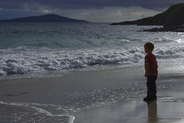
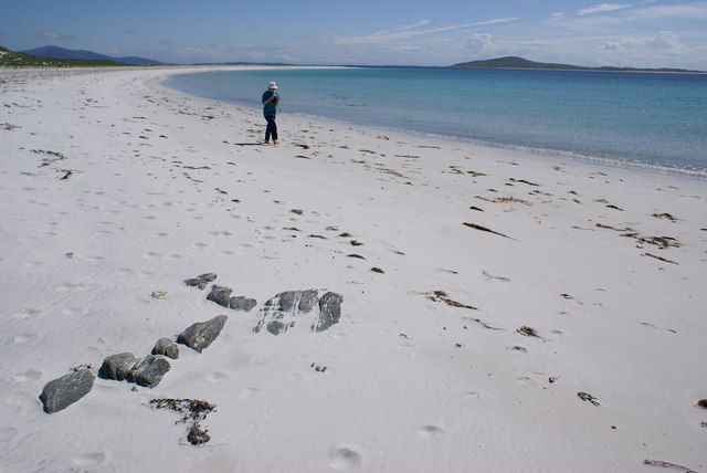
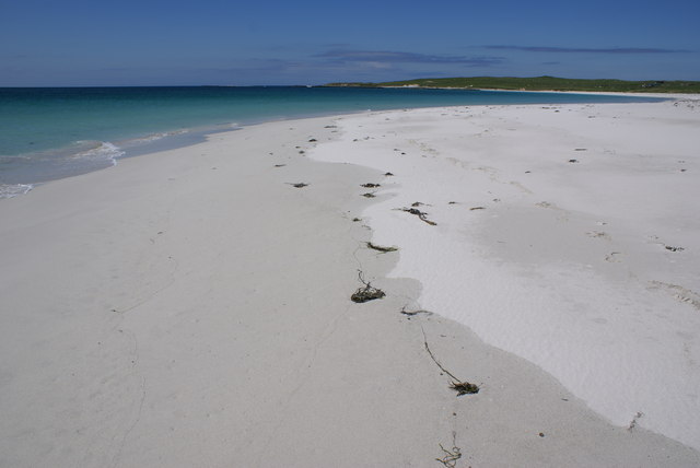
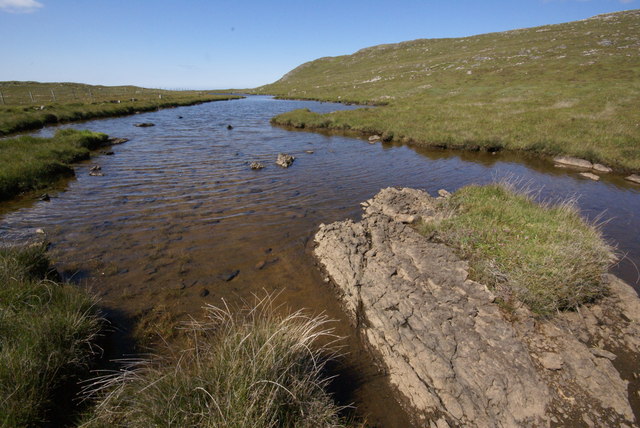
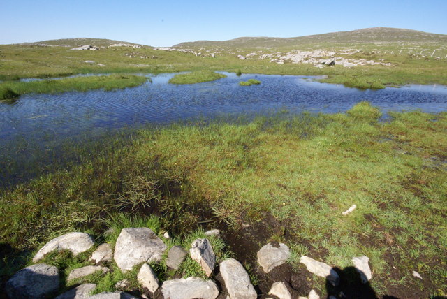
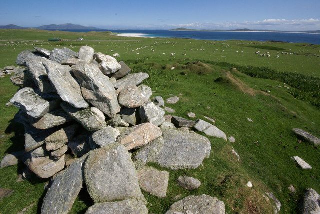
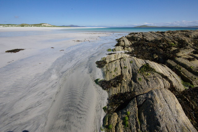
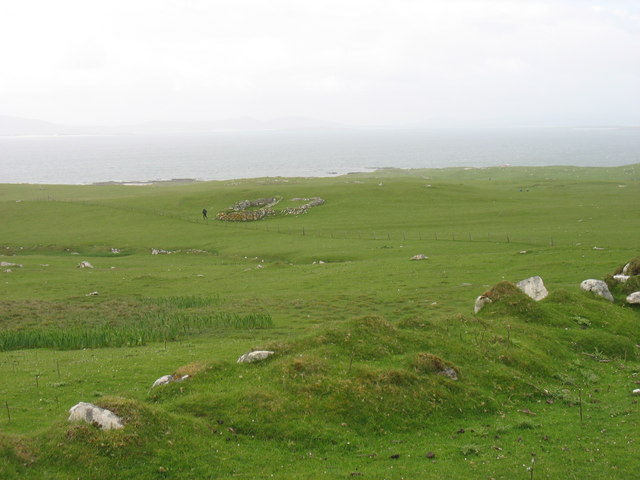
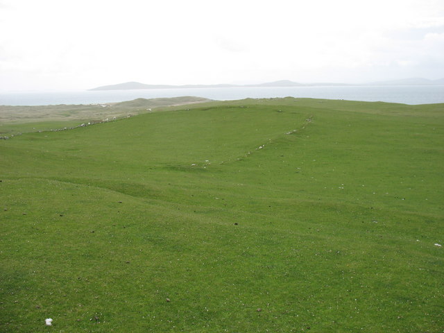
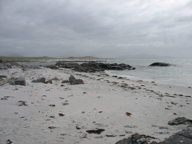
The island is characterized by its rugged terrain, consisting of rolling hills, rocky cliffs, and pristine sandy beaches. The landscape is dotted with heather, wildflowers, and scattered pockets of native woodland. Cuidhnis offers breathtaking views of the surrounding clear blue waters of the Atlantic Ocean and the neighboring islands.

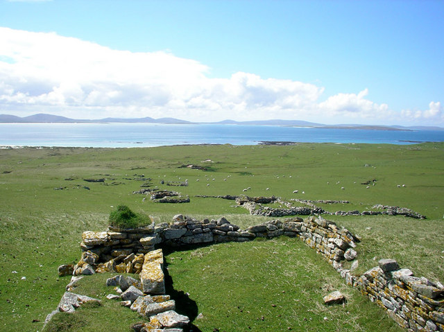
Despite its remote location, Cuidhnis has a long history of human settlement. Evidence of ancient stone structures, burial sites, and standing stones can be found on the island, hinting at its past inhabitants. Today, Cuidhnis is primarily used for agriculture and grazing, with a small number of residents who live there year-round.

Visitors to Cuidhnis can enjoy a range of outdoor activities. The island offers excellent opportunities for hiking, birdwatching, and fishing. Its secluded beaches are perfect for leisurely walks and picnics, while the surrounding waters are popular among kayakers and sailors.

Access to Cuidhnis is by boat or ferry from the mainland, and there are limited accommodation options available for those wishing to stay overnight. The island's tranquility and unspoiled natural beauty make it a popular destination for nature lovers and those seeking a peaceful retreat away from the hustle and bustle of modern life.

If you have any feedback on the listing, please let us know in the comments section below.

Cuidhnis Images

Images are sourced within 2km of 57.757612/-7.2483004 or Grid Reference NF8786. Thanks to Geograph Open Source API. All images are credited.

Young King Canute Young boy looking towards Pabbay from Northton beach.
Young King Canute
Young boy looking towards Pabbay from Northton beach.
Baile Lingay The ruins of Baile Lingay on the isle of Pabbay. The village was cleared of its people in 1843.
Baile Lingay
The ruins of Baile Lingay on the isle of Pabbay. The village was cleared of its people in 1843.
Pabbay Beach Scene Beinn Shleibhe on Berneray is seen on the right skyline
Pabbay Beach Scene
Beinn Shleibhe on Berneray is seen on the right skyline
An Corran, Pabbay Pabbay's southern beaches are stunning
An Corran, Pabbay
Pabbay's southern beaches are stunning
Loch Heddal More Pabbay's largest freshwater loch
Loch Heddal More
Pabbay's largest freshwater loch
Pabbay - unnamed lochan The small hill of Meahall shows top right.
Pabbay - unnamed lochan
The small hill of Meahall shows top right.
Baile Na Ceal, Pabbay This area was the main of four small townships on Pabbay in the 17th Century.  Today visiting shepherds stay in the house above the cairn.
Baile Na Ceal, Pabbay
This area was the main of four small townships on Pabbay in the 17th Century. Today visiting shepherds stay in the house above the cairn.
Rubha Thaltois, Pabbay Haltosh Point borders the stunning beaches on Pabbay
Rubha Thaltois, Pabbay
Haltosh Point borders the stunning beaches on Pabbay
A former settlement on Pabbay Pabbay is a now uninhabited island at the west end of the Sound of Harris.
A former settlement on Pabbay
Pabbay is a now uninhabited island at the west end of the Sound of Harris.
Pabbay - an old field boundary The southern slopes of Pabbay show much evidence of habitation and agriculture in days gone by.
The island in the distance (on the left) is Berneray.
Pabbay - an old field boundary
The southern slopes of Pabbay show much evidence of habitation and agriculture in days gone by. The island in the distance (on the left) is Berneray.
Pabbay shore Near this spot is the best place to land on Pabbay. Though even that is not easy in anything other than calm conditions!
Pabbay shore
Near this spot is the best place to land on Pabbay. Though even that is not easy in anything other than calm conditions!
Show me another place!

Cuidhnis is located at Grid Ref: NF8786 (Lat: 57.757612, Lng: -7.2483004)

Unitary Authority: Na h-Eileanan an Iar

Police Authority: Highlands and Islands

What 3 Words

///modem.card.ended. Near Leverburgh, Na h-Eileanan Siar

Nearby Locations

Cuidhnis

Related Wikis

Pabbay, Harris

Pabbay (Scottish Gaelic: Pabaigh) is an uninhabited island in the Outer Hebrides of Scotland which lies in the Sound of Harris between Harris and North...

Shillay

Shillay (Scottish Gaelic: Siolaigh) is an uninhabited island which lies 2 km north of Pabbay in the Outer Hebrides of Scotland. The name is derived from...

Boreray, North Uist

Boreray (Scottish Gaelic: Boraraigh) is an island with a single croft, lying 2 kilometres (1.2 mi) north of North Uist in the Outer Hebrides of Scotland...

Berneray (North Uist)

Berneray (Scottish Gaelic: Beàrnaraigh na Hearadh) is an island and community in the Sound of Harris, Scotland. It is one of fifteen inhabited islands...

Nearby Amenities

Located within 500m of 57.757612,-7.2483004
Source: PGS
Lat/Long: 57.7592432/-7.2449939
Source: PGS
Lat/Long: 57.7597532/-7.2449639
Source: PGS
Lat/Long: 57.7597432/-7.2440039
Source: PGS
Lat/Long: 57.7594932/-7.2440239
Source: PGS
Lat/Long: 57.7594932/-7.2445039
Source: PGS
Lat/Long: 57.7592432/-7.2445139
Source: PGS
Lat/Long: 57.7594908/-7.2412306
Source: PGS
Lat/Long: 57.7597537/-7.2417058
Source: PGS
Lat/Long: 57.7597639/-7.2426665
Source: PGS
Lat/Long: 57.7596526/-7.2436473
Source: PGS
Lat/Long: 57.7601683/-7.2438597
Source: PGS
Lat/Long: 57.7602998/-7.2441023
Source: PGS
Lat/Long: 57.7604616/-7.2455483
Source: PGS
Lat/Long: 57.7609672/-7.245518
Source: PGS
Lat/Long: 57.761129/-7.2474494
Source: PGS
Lat/Long: 57.7617964/-7.2486324
Source: PGS
Lat/Long: 57.756793/-7.2486566
Source: PGS
Lat/Long: 57.756793/-7.2491366
Source: PGS
Lat/Long: 57.756923/-7.2493666
Source: PGS
Lat/Long: 57.757173/-7.2493566
Source: PGS
Lat/Long: 57.757433/-7.2493466
Source: PGS
Lat/Long: 57.757563/-7.2495766
Source: PGS
Lat/Long: 57.757703/-7.2500466
Source: PGS
Lat/Long: 57.757943/-7.2500366
Source: PGS
Lat/Long: 57.758073/-7.2495566
Source: PGS
Lat/Long: 57.758323/-7.2490666
Source: PGS
Lat/Long: 57.758313/-7.2485866
Source: PGS
Lat/Long: 57.758053/-7.2481166
Source: PGS
Lat/Long: 57.757903/-7.2462066
Source: PGS
Lat/Long: 57.757653/-7.2464566
Source: PGS
Lat/Long: 57.757143/-7.2467266
Source: PGS
Lat/Long: 57.757023/-7.2476866
The data included in this document is from www.openstreetmap.org. The data is made available under ODbL.

Have you been to Cuidhnis?

Leave your review of Cuidhnis below (or comments, questions and feedback).