Muncoy

Island in Cornwall

England

Muncoy

The south end of Annet From St Agnes.
The south end of Annet Credit: Andrew Abbott

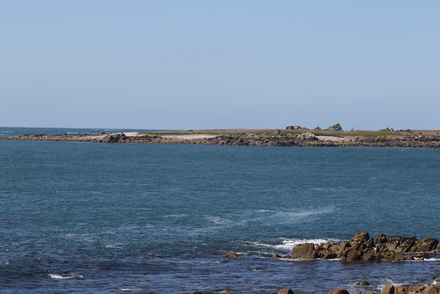
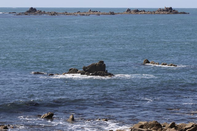
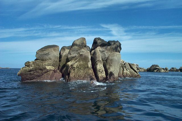
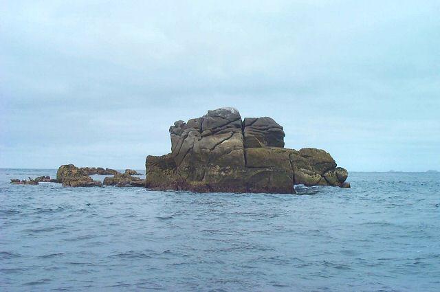
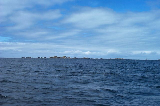
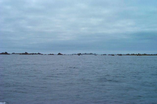
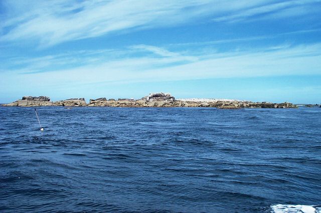
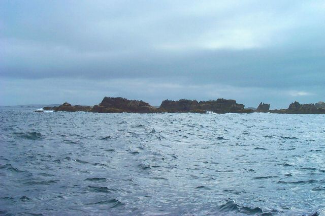
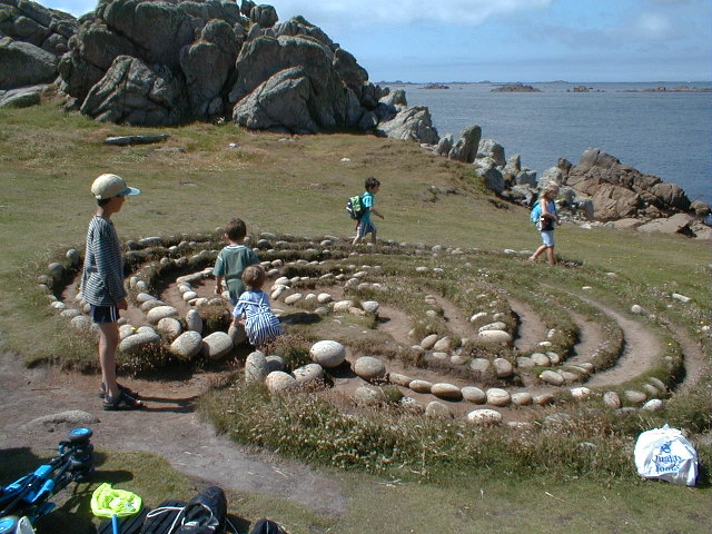
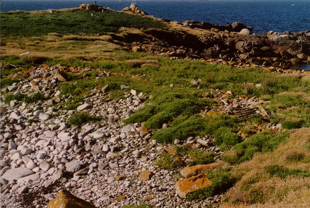
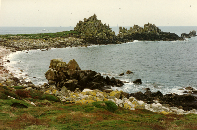
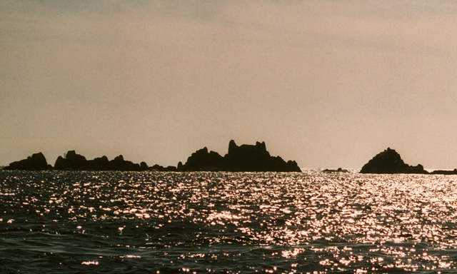
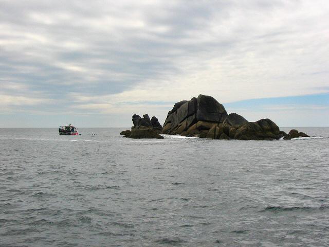
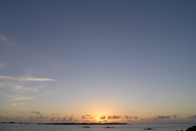
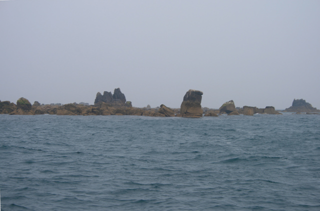
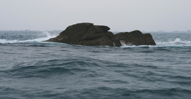
Muncoy is a small island located off the coast of Cornwall, England. It is known for its rugged coastline, sandy beaches, and picturesque landscapes. The island is only accessible by boat, making it a secluded and peaceful retreat for visitors looking to escape the hustle and bustle of city life.

Muncoy is home to a small population of residents who live in quaint cottages scattered throughout the island. The main industry on the island is fishing, with locals relying on the abundant sea life for sustenance.

Visitors to Muncoy can enjoy a variety of outdoor activities, from hiking along the cliffs to swimming in the crystal-clear waters. The island is also a popular spot for birdwatching, with a variety of seabirds and other wildlife calling Muncoy home.

Overall, Muncoy offers a tranquil and serene escape for those looking to immerse themselves in the natural beauty of Cornwall. With its stunning landscapes and peaceful atmosphere, it is the perfect destination for nature lovers and those seeking a quiet getaway.

If you have any feedback on the listing, please let us know in the comments section below.

Muncoy Images

Images are sourced within 2km of 49.878563/-6.3756966 or Grid Reference SV8506. Thanks to Geograph Open Source API. All images are credited.

The south end of Annet From St Agnes.
The south end of Annet
From St Agnes.
Carnew Rock From Carnew Point.
Carnew Rock
From Carnew Point.
Trenemene - Scilly One of the granite rocks of the Western Rocks of Scilly.
Trenemene - Scilly
One of the granite rocks of the Western Rocks of Scilly.
Gorregan - Scilly Carn Ithen - the most eastern rock of Gorregan, Western Rocks.
Gorregan - Scilly
Carn Ithen - the most eastern rock of Gorregan, Western Rocks.
Western Rocks - Scilly The low lying Western Rocks viewed from Gorregan Neck. These sharp pieces of granite are perfect ship wreckers in a bad, misty sea.
Western Rocks - Scilly
The low lying Western Rocks viewed from Gorregan Neck. These sharp pieces of granite are perfect ship wreckers in a bad, misty sea.
Islands south of Annet - Scilly Lots of sharp, low lying points of granite. One group is aptly called Hellweathers.
Islands south of Annet - Scilly
Lots of sharp, low lying points of granite. One group is aptly called Hellweathers.
Melledgan - Scilly A nature reserve for birds.
Melledgan - Scilly
A nature reserve for birds.
Rags - Scilly One of the isolated granite crags of the Western Rocks. A favourite haunt of cormorants.
Rags - Scilly
One of the isolated granite crags of the Western Rocks. A favourite haunt of cormorants.
The maze near Long Point, St. Agnes
Looking NNE across the narrowest part of Annet, Isles of Scilly
Irishman's Carn, North West Par of Annet, Isles of Scilly Looking SW across the North West Par (or Porth) of Annet, Bishop Rock lighthouse is just visible on the horizon (photo by Nat Legg).
Irishman's Carn, North West Par of Annet, Isles of Scilly
Looking SW across the North West Par (or Porth) of Annet, Bishop Rock lighthouse is just visible on the horizon (photo by Nat Legg).
Old Woman's House, Isles of Scilly Looking WSW across Smith Sound to Old Woman's House and Annet Neck (the gap between the rocks), Bishop Rock lighthouse is just visible behind the rocks to the left of the picture.
Old Woman's House, Isles of Scilly
Looking WSW across Smith Sound to Old Woman's House and Annet Neck (the gap between the rocks), Bishop Rock lighthouse is just visible behind the rocks to the left of the picture.
Trenemene from Gorregan These rocks are on the edge of Scilly. It is very popular with scuba divers.
Trenemene from Gorregan
These rocks are on the edge of Scilly. It is very popular with scuba divers.
Sunset over Annet The Isles of Scilly consist far more of sky and sea than land; here the sun sets over Annet which even from just three quarters of a mile away on Troy Town campsite, St Agnes, is just a thin line.

The Islands are the tips of the most westerly of a series of granite domes which form the most of high ground of the South West peninsula of England.  From the west these are Scilly, The Penwith peninsula (Land's End), Bodmin Moor and Dartmoor.

High Willhays on Dartmoor reaches 621m above sea level  <a href="https://www.geograph.org.uk/photo/7909">SX5889 : High Willhays</a>, but time and the Atlantic Ocean have taken their toll on Scilly and the best that can be managed is around 50m at what used to be called “coastguards” on St Mary's <a href="https://www.geograph.org.uk/photo/72884">SV9112 : Corsican Tower, Telegraph</a>.

Probably due to its exposed position at the south west of the archipelago Annet is the largest of the islands to have never been inhabited and has been designated as a bird sanctuary for many years, it is an important breeding site for the Puffin and Manx Shearwater.  

On a 1:50,000 scale map Annet has just one 10 metre contour. The 1:25,000 scale shows that it does pass 15 metres, still “just a wave above the sea”.
Sunset over Annet
The Isles of Scilly consist far more of sky and sea than land; here the sun sets over Annet which even from just three quarters of a mile away on Troy Town campsite, St Agnes, is just a thin line. The Islands are the tips of the most westerly of a series of granite domes which form the most of high ground of the South West peninsula of England. From the west these are Scilly, The Penwith peninsula (Land's End), Bodmin Moor and Dartmoor. High Willhays on Dartmoor reaches 621m above sea level SX5889 : High Willhays, but time and the Atlantic Ocean have taken their toll on Scilly and the best that can be managed is around 50m at what used to be called “coastguards” on St Mary's SV9112 : Corsican Tower, Telegraph. Probably due to its exposed position at the south west of the archipelago Annet is the largest of the islands to have never been inhabited and has been designated as a bird sanctuary for many years, it is an important breeding site for the Puffin and Manx Shearwater. On a 1:50,000 scale map Annet has just one 10 metre contour. The 1:25,000 scale shows that it does pass 15 metres, still “just a wave above the sea”.
Hellweathers
Hellweathers
Muncoy, from the North West
Muncoy, from the East With the South end of St Agnes just visible on the left horizon.
Muncoy, from the East
With the South end of St Agnes just visible on the left horizon.
Biggal of Gorregan From the East.
Biggal of Gorregan
From the East.
Show me another place!

Muncoy is located at Grid Ref: SV8506 (Lat: 49.878563, Lng: -6.3756966)

Division: Isles of Scilly

Unitary Authority: Isles of Scilly

Police Authority: Devon and Cornwall

What 3 Words

///alas.group.tickles. Near St Agnes, Isles of Scilly

Related Wikis

Thomas W. Lawson (ship)

Thomas W. Lawson was a seven-masted, steel-hulled schooner built for the Pacific trade, but used primarily to haul coal and oil along the East Coast of...

Annet, Isles of Scilly

Annet (Cornish: Anet, lit. 'kittiwake') is the second largest of the fifty or so uninhabited Isles of Scilly, 1 kilometre (0.62 mi) west of St Agnes with...

Rosevear

Rosevear (Cornish: Ros Veur "great promontory") is the largest (0.63 hectares (1.6 acres)) of the group of rocks known as the Western Rocks, Isles of Scilly...

Western Rocks, Isles of Scilly

The Western Rocks (Cornish: Karregi Gorlewen) are a group of uninhabited skerries and rocks in the south–western part of the Isles of Scilly, United Kingdom...

Have you been to Muncoy?

Leave your review of Muncoy below (or comments, questions and feedback).