Dun Aonais

Island in Inverness-shire

Scotland

Dun Aonais

A865 road by Traigh Athmor And another of those square "Passing Place" signs;  I much prefer the diamond shaped ones!
A865 road by Traigh Athmor Credit: Gordon Brown

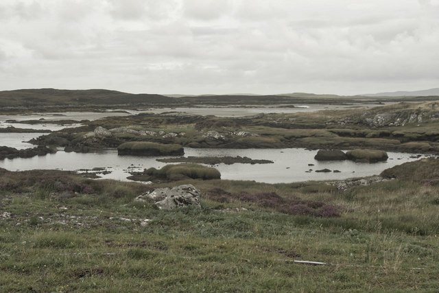
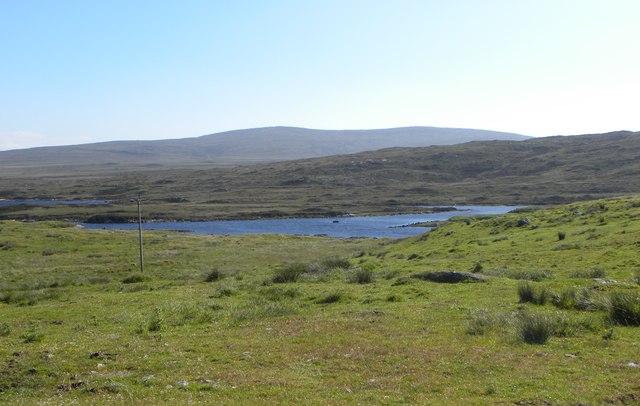
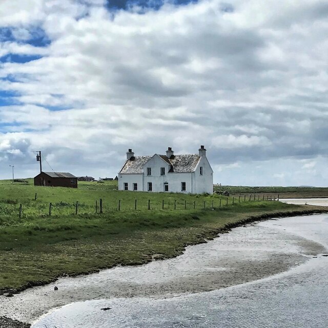
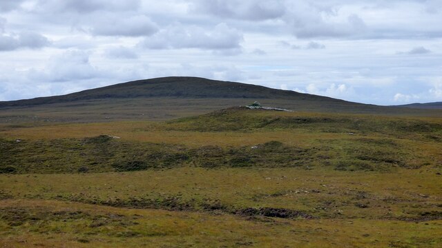
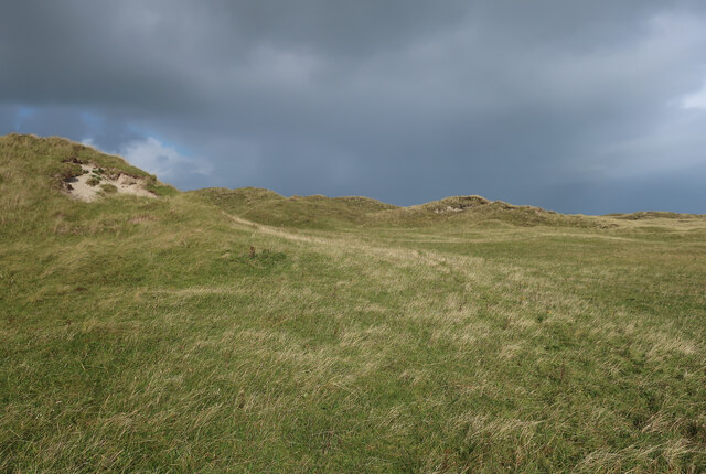
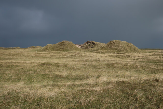
Dun Aonais is a small, uninhabited island located off the coast of Inverness-shire in Scotland. It is part of the Inner Hebrides archipelago and is known for its rugged and picturesque landscape. The island is roughly 1.5 miles long and 0.5 miles wide, with cliffs rising steeply from the sea on all sides.

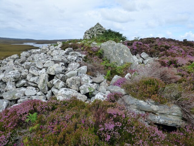
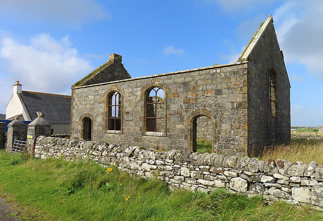
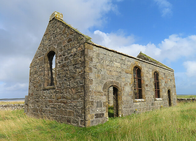
The most prominent feature of Dun Aonais is the ancient hill fort that gives the island its name. The fort is thought to date back to the Iron Age and is surrounded by a series of stone walls and defensive ditches. It offers stunning views of the surrounding sea and mainland.

Despite its small size and lack of permanent residents, Dun Aonais is a popular destination for hikers, birdwatchers, and nature enthusiasts. The island is home to a variety of seabirds, including puffins, gannets, and razorbills. Visitors can also spot seals and dolphins in the surrounding waters.

Access to Dun Aonais is by boat only, with ferries running from nearby ports in Inverness-shire. The island offers a peaceful and remote escape for those looking to explore the natural beauty of the Scottish coast.

If you have any feedback on the listing, please let us know in the comments section below.

Dun Aonais Images

Images are sourced within 2km of 57.644209/-7.2712654 or Grid Reference NF8573. Thanks to Geograph Open Source API. All images are credited.

A865 road by Traigh Athmor And another of those square "Passing Place" signs;  I much prefer the diamond shaped ones!
A865 road by Traigh Athmor
And another of those square "Passing Place" signs; I much prefer the diamond shaped ones!
Traigh Athmor A typical scattering of Outer Hebrides houses above the shore.
Traigh Athmor
A typical scattering of Outer Hebrides houses above the shore.
Sea pinks, North Uist If you're lucky enough to be there at the right time, it's an amazing display.
Sea pinks, North Uist
If you're lucky enough to be there at the right time, it's an amazing display.
Loch nan Geireann
Loch nan Geireann
Low tide, Traigh Athmor The tide runs out a long way here, exposing many hectares of sand.
Low tide, Traigh Athmor
The tide runs out a long way here, exposing many hectares of sand.
View towards Loch nan Geireann A view across rough grassland and bog towards a corner of this irregularly shaped freshwater loch.
View towards Loch nan Geireann
A view across rough grassland and bog towards a corner of this irregularly shaped freshwater loch.
Dun Aonghuis The dun covers the whole of a small island in Loch Aonghais. <span class="nowrap"><a title="https://canmore.org.uk/site/10366/north-uist-loch-aonghais-dun-aonais" rel="nofollow ugc noopener" href="https://canmore.org.uk/site/10366/north-uist-loch-aonghais-dun-aonais">Link</a><img style="margin-left:2px;" alt="External link" title="External link - shift click to open in new window" src="https://s1.geograph.org.uk/img/external.png" width="10" height="10"/></span>
Dun Aonghuis
The dun covers the whole of a small island in Loch Aonghais. LinkExternal link
House near Trumaisgearraidh - view to the W from the B893
Barpa nam Feannag Chambered Long Cairn View of the chamber at the eastern end of the mound <span class="nowrap"><a title="https://www.megalithic.co.uk/article.php?sid=48278" rel="nofollow ugc noopener" href="https://www.megalithic.co.uk/article.php?sid=48278">Link</a><img style="margin-left:2px;" alt="External link" title="External link - shift click to open in new window" src="https://s1.geograph.org.uk/img/external.png" width="10" height="10"/></span>
Barpa nam Feannag Chambered Long Cairn
View of the chamber at the eastern end of the mound LinkExternal link
Barpa nam Feannag Chambered Long Cairn The hill beyond the cairn is Sgealtrabhal <span class="nowrap"><a title="https://www.megalithic.co.uk/article.php?sid=48278" rel="nofollow ugc noopener" href="https://www.megalithic.co.uk/article.php?sid=48278">Link</a><img style="margin-left:2px;" alt="External link" title="External link - shift click to open in new window" src="https://s1.geograph.org.uk/img/external.png" width="10" height="10"/></span>
Barpa nam Feannag Chambered Long Cairn
The hill beyond the cairn is Sgealtrabhal LinkExternal link
Dunes by Tràigh Bhàlaig
Old machinery in the machair
Cattle on the track
Cattle on the track
Cattle on a stubble field
Silage bales, Clachan Sands
Trumaisgearraidh Kirk This kirk, opened in 1829, was one of the Parliamentary kirks associated with Thomas Telford.
Trumaisgearraidh Kirk
This kirk, opened in 1829, was one of the Parliamentary kirks associated with Thomas Telford.
Telford Kirk at Trumisgarry One of the Parliamentary kirks associated with Thomas Telford, built in 1829.
Telford Kirk at Trumisgarry
One of the Parliamentary kirks associated with Thomas Telford, built in 1829.
Show me another place!

Dun Aonais is located at Grid Ref: NF8573 (Lat: 57.644209, Lng: -7.2712654)

Unitary Authority: Na h-Eileanan an Iar

Police Authority: Highlands and Islands

What 3 Words

///chitchat.cubic.runner. Near Lochmaddy, Na h-Eileanan Siar

Nearby Locations

Dun Aonais Loch Aonghais

Related Wikis

Oronsay, Outer Hebrides

Oronsay (Gaelic Orasaigh) is a tidal island off North Uist in the Outer Hebrides. Lying to the north of Vallaquie Strand, the island has been uninhabited...

Na Fir Bhrèige

Na Fir Bhrèige (pronounced [nə fiɾʲ ˈvɾʲeːkʲə]; can be translated from Gaelic into English as "The False Men") is a set of three standing stones on the...

Sollas

Sollas (Scottish Gaelic: Solas) is a small crofting township on the northern coast of the island of North Uist, Scotland. == History == === The Battle... ===

North Uist Machair and Islands

The North Uist Machair and Islands is a protected wetland area in the Outer Hebrides of Scotland. A total of 4,705 hectares comprises seven separate areas...

Nearby Amenities

Located within 500m of 57.644209,-7.2712654
Passing Place
Lat/Long: 57.6474178/-7.2665642
Bus Stop
Ahmore
Bus: yes
Naptan AtcoCode: 6010731501
Naptan Bearing: W
Naptan CommonName: Ahmore
Naptan Indicator: Village
Naptan Landmark: Farm entrance
Naptan NaptanCode: 94723578
Naptan Street: Village
Naptan Verified: no
Public Transport: platform
Source: naptan_import
Lat/Long: 57.6468249/-7.2710587
Passing Place
Lat/Long: 57.6440468/-7.2786005
Passing Place
Lat/Long: 57.6446979/-7.275534
Passing Place
Lat/Long: 57.6455624/-7.2728224
Athmòr
Name En: Ahmore
Name Gd: Athmòr
Place: hamlet
Lat/Long: 57.6466007/-7.2708786
Passing Place
Lat/Long: 57.6468753/-7.2698816
Passing Place
Lat/Long: 57.6448902/-7.2747128
Power: pole
Lat/Long: 57.6464169/-7.2705674
Power: pole
Lat/Long: 57.6466932/-7.2700015
Power: pole
Lat/Long: 57.6468963/-7.268533
Power: pole
Lat/Long: 57.6470786/-7.2673112
Power: pole
Lat/Long: 57.6472487/-7.2660694
Power: pole
Lat/Long: 57.6457782/-7.2719072
Power: pole
Lat/Long: 57.6453102/-7.2728553
Power: pole
Lat/Long: 57.6448322/-7.2738639
Power: pole
Lat/Long: 57.644581/-7.2751138
Power: pole
Lat/Long: 57.6443112/-7.2763905
Power: pole
Lat/Long: 57.6440198/-7.2777356
Power: pole
Lat/Long: 57.6464032/-7.2698311
Power: pole
Lat/Long: 57.6463939/-7.2690814
Power: pole
Lat/Long: 57.646386/-7.2684471
Power: pole
Lat/Long: 57.6466279/-7.2714706
Power: pole
Lat/Long: 57.6467556/-7.2720064
Power: pole
Lat/Long: 57.646831/-7.2723215
Power: pole
Lat/Long: 57.6459963/-7.2746075
Power: pole
Lat/Long: 57.6462762/-7.2738591
Power: pole
Lat/Long: 57.6465705/-7.2730223
Power: pole
Lat/Long: 57.6455542/-7.2758064
Power: pole
Lat/Long: 57.6458063/-7.2751212
The data included in this document is from www.openstreetmap.org. The data is made available under ODbL.

Have you been to Dun Aonais?

Leave your review of Dun Aonais below (or comments, questions and feedback).