Carn Liath

Island in Inverness-shire

Scotland

Carn Liath

Eileanan Stafa
Eileanan Stafa Credit: Toby Speight

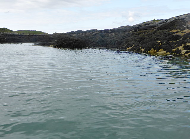
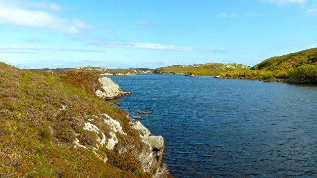
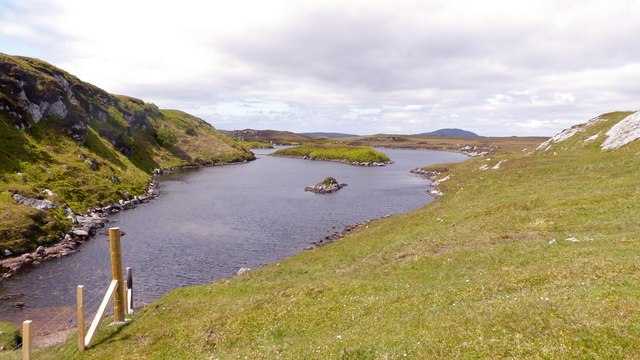
Carn Liath is a small island located off the west coast of Scotland, specifically in the county of Inverness-shire. This picturesque island is situated in the inner Hebrides archipelago, near the larger island of Skye. With a total land area of approximately 0.6 square kilometers, Carn Liath boasts stunning natural beauty and a rich history.

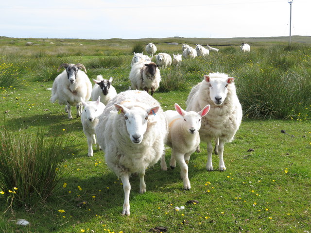
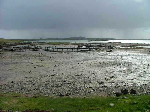
The island is characterized by rugged terrain, with rocky cliffs and grassy slopes dominating its landscape. It offers breathtaking views of the surrounding sea and neighboring islands, making it a popular destination for nature enthusiasts and photographers. The island's name, Carn Liath, translates to "grey cairn," which may refer to the grayish hue of the rocks found on the island.

Historically, Carn Liath has been inhabited for centuries. Evidence of ancient settlements, burial grounds, and even a medieval chapel can still be found on the island today. These remnants provide insights into the island's past and its connection to the broader history of the region.

Despite its small size, Carn Liath attracts visitors who seek tranquility and an escape from the bustling mainland. The island offers opportunities for hiking, birdwatching, and exploring its unique flora and fauna. Additionally, the surrounding waters are ideal for kayaking and sailing, attracting water sports enthusiasts.

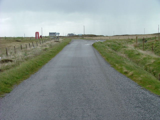
Carn Liath is accessible by boat, with regular ferry services operating from nearby ports. There are no permanent residents on the island, but visitors can find accommodation options on the mainland, within easy reach of this hidden gem of Inverness-shire.

If you have any feedback on the listing, please let us know in the comments section below.

Carn Liath Images

Images are sourced within 2km of 57.412157/-7.2912869 or Grid Reference NF8248. Thanks to Geograph Open Source API. All images are credited.
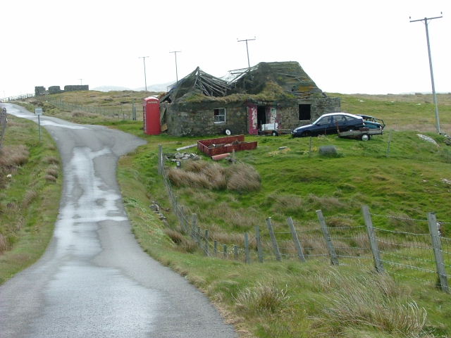
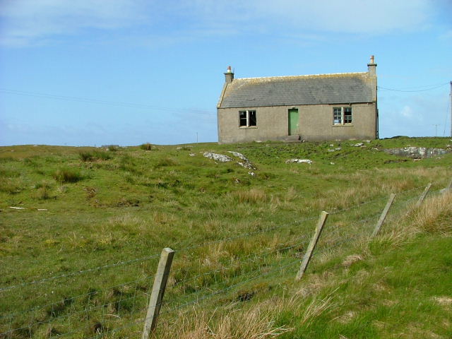
Eileanan Stafa
Eileanan Stafa
Loch Langabhat, Benbecula One of the many long narrow lochs in the area, Langabhat is thirty yards wide in places although it is over two miles long.
Loch Langabhat, Benbecula
One of the many long narrow lochs in the area, Langabhat is thirty yards wide in places although it is over two miles long.
Loch Langabhat, Benbecula The fence was clearly a very recent addition although there wasn't any sign of stock to keep in, or out.
Loch Langabhat, Benbecula
The fence was clearly a very recent addition although there wasn't any sign of stock to keep in, or out.
Ruined croft house, 5-6 Hacklet (Hacleit), in 1995 Looking northeast across upper Loch Chearabhaigh (a sea loch) towards the scattered township of Kilerivagh.

According to local information from Mary Harman in 2018, the house is still there with the mid gable with chimney standing, but the roof is entirely gone. The windows are still clear, and the winnowing hole in the barn at the left hand side of the picture is still there. The telegraph pole behind the house, being redundant is no longer there.

The building probably dates from the 19th century and is Category B listed [<span class="nowrap"><a title="http://portal.historicenvironment.scot/designation/LB18754" rel="nofollow ugc noopener" href="http://portal.historicenvironment.scot/designation/LB18754">Link</a><img style="margin-left:2px;" alt="External link" title="External link - shift click to open in new window" src="https://s1.geograph.org.uk/img/external.png" width="10" height="10"/></span>]. It also appears on the Buildings at Risk Register [<span class="nowrap"><a title="https://www.buildingsatrisk.org.uk/search/keyword/hacklet/event_id/898243/building_name/5-6-hacklet" rel="nofollow ugc noopener" href="https://www.buildingsatrisk.org.uk/search/keyword/hacklet/event_id/898243/building_name/5-6-hacklet">Link</a><img style="margin-left:2px;" alt="External link" title="External link - shift click to open in new window" src="https://s1.geograph.org.uk/img/external.png" width="10" height="10"/></span>].
Ruined croft house, 5-6 Hacklet (Hacleit), in 1995
Looking northeast across upper Loch Chearabhaigh (a sea loch) towards the scattered township of Kilerivagh. According to local information from Mary Harman in 2018, the house is still there with the mid gable with chimney standing, but the roof is entirely gone. The windows are still clear, and the winnowing hole in the barn at the left hand side of the picture is still there. The telegraph pole behind the house, being redundant is no longer there. The building probably dates from the 19th century and is Category B listed [LinkExternal link]. It also appears on the Buildings at Risk Register [LinkExternal link].
Shoreline at Oitir Bheag Half tide, with extensive areas of sand, mud and weed.
Shoreline at Oitir Bheag
Half tide, with extensive areas of sand, mud and weed.
Postbox at the junction A junction of minor roads at Haclait. Stuart Wilding's photo from 2008 shows a telephone kiosk next to the postbox, but that is no longer there - possibly blown away in a Hebridean gale?
Postbox at the junction
A junction of minor roads at Haclait. Stuart Wilding's photo from 2008 shows a telephone kiosk next to the postbox, but that is no longer there - possibly blown away in a Hebridean gale?
The phone box is still standing Two contributors recorded this scene in 2007, but since then the roof of the old croft house has totally collapsed, but at least the telephone box is still standing, though probably rarely used except to shelter from horizontal rain.
The phone box is still standing
Two contributors recorded this scene in 2007, but since then the roof of the old croft house has totally collapsed, but at least the telephone box is still standing, though probably rarely used except to shelter from horizontal rain.
Old blackhouse at Aird Cumhang There are still many of these old turf roofed cottages on the Uists and Benbecula. Many are in a similar state to this one, but others, particularly those near roads and services have been restored as holiday cottages.
Old blackhouse at Aird Cumhang
There are still many of these old turf roofed cottages on the Uists and Benbecula. Many are in a similar state to this one, but others, particularly those near roads and services have been restored as holiday cottages.
Oban a' Bhiora Tight little tidal inlet separating Benbecula from the smaller of the two Grimsay islands.
Oban a' Bhiora
Tight little tidal inlet separating Benbecula from the smaller of the two Grimsay islands.
Friendly faces Rather than running away, the sheep here seem to think that the arrival of a human is good news, or more likely might be bringing food.
Friendly faces
Rather than running away, the sheep here seem to think that the arrival of a human is good news, or more likely might be bringing food.
Road Junction and Telephone box At Haclait.
Road Junction and Telephone box
At Haclait.
Fish Cages On Oitir Bheag.
Fish Cages
On Oitir Bheag.
Dilapidated Crofthouse and Phone Box At Aird Cumhang.
Dilapidated Crofthouse and Phone Box
At Aird Cumhang.
Sheep Fanks At Cill Eireabhagh.
Sheep Fanks
At Cill Eireabhagh.
Moorland at Aird Cumhang With Loch Chill Eireabhaigh.
Moorland at Aird Cumhang
With Loch Chill Eireabhaigh.
Loch an Tairbh at Carnan Aird Fuidheigh A freshwater loch among the many sea lochs.
Loch an Tairbh at Carnan Aird Fuidheigh
A freshwater loch among the many sea lochs.
Moorland and Loch na h-Aibhne Baine Northeast of Creag Ghoraidh, Benbecula.
Moorland and Loch na h-Aibhne Baine
Northeast of Creag Ghoraidh, Benbecula.
Deserted Croft House at Haclait It seems such a shame to see these houses abandoned and left to fall into a ruinous state.
Deserted Croft House at Haclait
It seems such a shame to see these houses abandoned and left to fall into a ruinous state.
Show me another place!

Carn Liath is located at Grid Ref: NF8248 (Lat: 57.412157, Lng: -7.2912869)

Unitary Authority: Na h-Eileanan an Iar

Police Authority: Highlands and Islands

What 3 Words

///bachelor.ocean.highlighted. Near Balivanich, Na h-Eileanan Siar

Related Wikis

Grimsay (South East Benbecula)

Grimsay, south east of Benbecula is a tidal island of the Outer Hebrides. It is connected to Benbecula by a causeway which carries the B891. In the 2001...

Eilean na Cille

Eilean na Cille, south east of Benbecula is an island of the Outer Hebrides connected to Grimsay (South) by a causeway which carries the B891. The road...

Uist

Uist is a group of six islands that are part of the Outer Hebridean Archipelago, which is part of the Outer Hebrides of Scotland. North Uist and South...

Benbecula

Benbecula ( ; Scottish Gaelic: Beinn nam Fadhla or Beinn na Faoghla) is an island of the Outer Hebrides in the Atlantic Ocean off the west coast of Scotland...

Nearby Amenities

Located within 500m of 57.412157,-7.2912869
Passing Place
Lat/Long: 57.4109561/-7.2985006
Passing Place
Lat/Long: 57.4105283/-7.2946871
Passing Place
Lat/Long: 57.4101088/-7.292077
Passing Place
Lat/Long: 57.4097874/-7.2893195
Passing Place
Lat/Long: 57.4148851/-7.2927422
Passing Place
Lat/Long: 57.4137769/-7.2897271
Passing Place
Lat/Long: 57.4134858/-7.2855499
Turning Circle
Lat/Long: 57.409777/-7.287175
Power: pole
Lat/Long: 57.4120803/-7.2836893
Power: pole
Lat/Long: 57.4123234/-7.2851184
Power: pole
Lat/Long: 57.4124888/-7.286128
Power: pole
Lat/Long: 57.4126945/-7.2870095
Power: pole
Lat/Long: 57.4131391/-7.2882595
Power: pole
Lat/Long: 57.4118803/-7.2866249
Power: pole
Lat/Long: 57.4109639/-7.2873995
Power: pole
Lat/Long: 57.4103898/-7.2878481
Power: pole
Lat/Long: 57.4099669/-7.2882049
Power: pole
Lat/Long: 57.4097108/-7.2884011
Power: pole
Lat/Long: 57.409764/-7.2899637
Power: pole
Lat/Long: 57.4098287/-7.2914381
Power: pole
Lat/Long: 57.4099755/-7.2927523
Power: pole
Lat/Long: 57.4100848/-7.2937914
Power: pole
Lat/Long: 57.4102345/-7.2951376
Power: pole
Lat/Long: 57.4103639/-7.2963235
Power: pole
Lat/Long: 57.4105337/-7.2977766
Power: pole
Lat/Long: 57.4106689/-7.2990908
Power: pole
Lat/Long: 57.4093597/-7.2877387
Power: pole
Lat/Long: 57.4088274/-7.2866168
Passing Place
Lat/Long: 57.4156864/-7.2953055
Passing Place
Lat/Long: 57.4136782/-7.2882388
Passing Place
Lat/Long: 57.4130836/-7.283473
Passing Place
Lat/Long: 57.4107609/-7.296831
Passing Place
Lat/Long: 57.4087194/-7.2874557
The data included in this document is from www.openstreetmap.org. The data is made available under ODbL.

Have you been to Carn Liath?

Leave your review of Carn Liath below (or comments, questions and feedback).