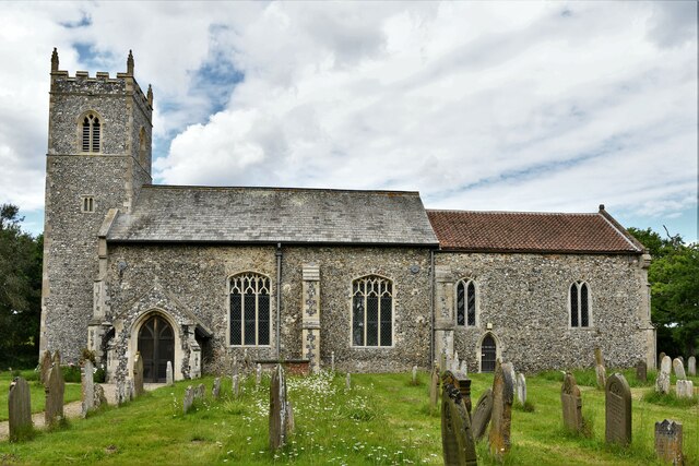
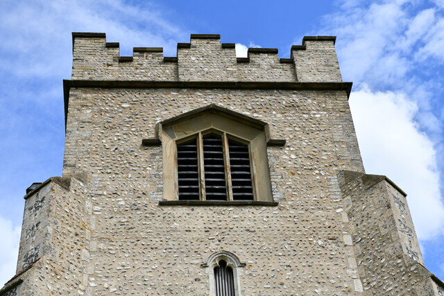
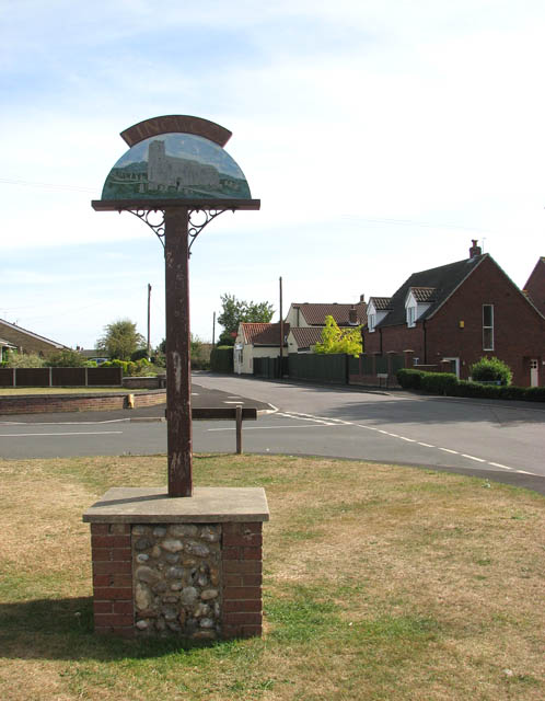
Lingwood

Settlement in Norfolk Broadland

England

Lingwood

Lingwood, Glebe Farm: Crop
Lingwood, Glebe Farm: Crop Credit: Michael Garlick

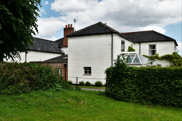
Lingwood is a small village located in the county of Norfolk, England. Situated approximately 10 miles east of Norwich, it falls within the Broadland district. The village covers an area of around 6 square miles and has a population of approximately 1,500 residents.

Lingwood has a rich history, with evidence of human habitation dating back to the Roman times. The village is mentioned in the Domesday Book as "Lingewode," indicating its longstanding presence. The local economy primarily revolves around agriculture, with many residents employed in farming and related industries.

The village is well-connected by road and rail. It lies on the A47 trunk road, providing access to nearby towns and cities, including Great Yarmouth and Norwich. Lingwood railway station, on the Wherry Lines, offers regular train services to Norwich, Lowestoft, and several other destinations.

Lingwood boasts a range of amenities for its residents. These include a primary school, a village hall, a post office, a convenience store, and a pub. The village also has a strong sense of community, with various clubs and societies catering to different interests and age groups.

Surrounded by picturesque countryside, Lingwood offers residents and visitors ample opportunities for outdoor activities such as walking, cycling, and birdwatching. The nearby Broads National Park, a network of rivers and lakes, is a popular destination for boating enthusiasts.

In conclusion, Lingwood is a charming village in Norfolk with a close-knit community, a rich history, and easy access to both urban and rural amenities.

If you have any feedback on the listing, please let us know in the comments section below.
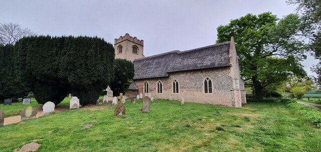
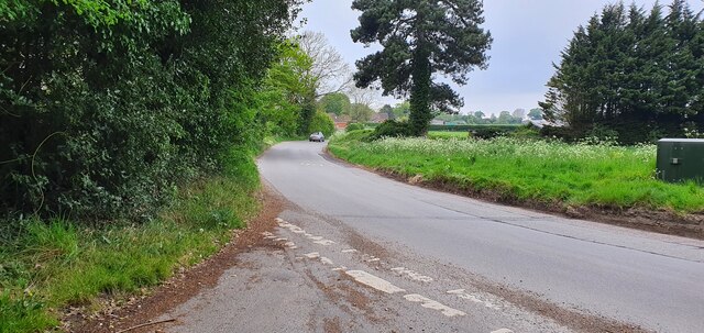
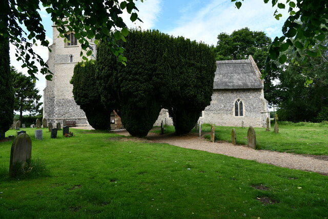
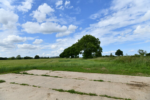
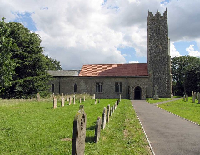
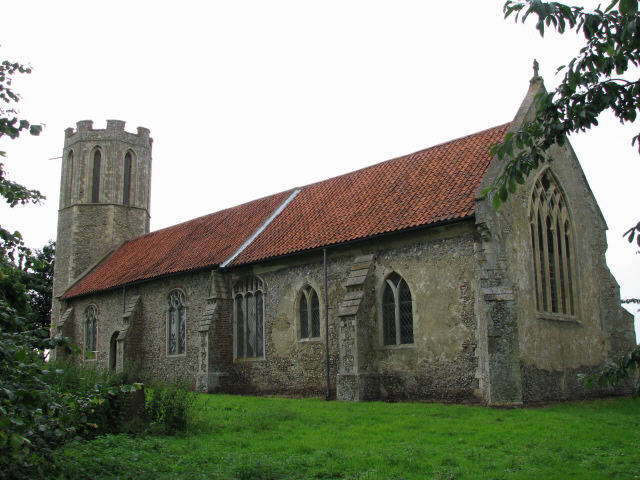
Lingwood Images

Images are sourced within 2km of 52.622757/1.486999 or Grid Reference TG3608. Thanks to Geograph Open Source API. All images are credited.

Lingwood, Glebe Farm: Crop
Lingwood, Elm Road
Lingwood, Elm Road
St Edmund's church, South Burlingham
Junction of South Burlingham Road and Lodge Road
Buckenham: Potato crop occupying a large area 1
Buckenham: Potato crop occupying a large area 2
Strumpshaw: Oakland Mews
Strumpshaw, The Huntsman PH: 41, Norwich Road
South Burlingham, St. Edmund's Church
Blofield: Large hard standing area
Lingwood, St. Peter's Church: Southern aspect
South Burlingham, Church Farm: The farmhouse
South Burlingham, St. Edmund's Church: Norman south doorway
South Burlingham, St. Edmund's Church: Norman south doorway (detail) 1
South Burlingham, St. Edmund's Church: Norman south doorway (detail) 2
South Burlingham, St. Edmund's Church: Norman south doorway (detail) 3
South Burlingham, St. Edmund's Church: Bench mark
South Burlingham, St. Edmund's Church: The tower, western aspect
Show me another place!

Lingwood is located at Grid Ref: TG3608 (Lat: 52.622757, Lng: 1.486999)

Administrative County: Norfolk

District: Broadland

Police Authority: Norfolk

What 3 Words

///cries.teamed.foil. Near Lingwood, Norfolk

Nearby Locations

Lingwood

Related Wikis

Lingwood railway station

Lingwood railway station is on the Wherry Lines in the east of England, serving the village of Lingwood, Norfolk. It is 7 miles 78 chains (12.8 km) down...

Lingwood

Lingwood is a village and former civil parish, 8 miles (13 km) east of Norwich, now in the parish of Lingwood and Burlingham, in the Broadland district...

Lingwood and Burlingham

Lingwood and Burlingham is a civil parish in the English county of Norfolk, comprising the large village of Lingwood together with the smaller villages...

Strumpshaw

Strumpshaw is a village and civil parish in the English county of Norfolk. It is located on the northern bank of the River Yare around 6 miles (9.7 km...

Beighton, Norfolk

Beighton is a village and civil parish in the Broadland district of Norfolk, England, about two miles (3 km) South-West of Acle about 12.8 miles (20.6...

Strumpshaw Hall Steam Museum

The Strumpshaw Hall Steam Museum in Strumpshaw, Norfolk, is home to a collection of traction engines, steam rollers, a showman's engine and a steam wagon...

St Nicholas Church, Buckenham

St Nicholas Church is a redundant Anglican church in the village of Buckenham, Norfolk, England. It is recorded in the National Heritage List for England...

Norwich United F.C.

Norwich United Football Club is a football club based in Blofield, Norfolk, England. Affiliated to the Norfolk County FA, they play at Plantation Park...

Nearby Amenities

Located within 500m of 52.622757,1.486999
Lingwood
Naptan AtcoCode: 9100LGWOOD
Network: National Rail
Network Website: https://www.nationalrail.co.uk/stations/lgd/
Network Wikidata: Q26334
Railway: station
Ref Crs: LGD
Source: NPE
Wheelchair: yes
Wikidata: Q281164
Wikipedia: en:Lingwood railway station
Lat/Long: 52.6220505/1.4896908
Crossing Barrier: double_half
Railway: level_crossing
Lat/Long: 52.6212716/1.4828222
Lingwood
Place: village
Wikidata: Q16572187
Lat/Long: 52.6216034/1.4903726
Lingwood LC
Crossing Barrier: double_half
Mileage: NAY 8m 03ch
Railway: level_crossing
Ref: TG 364 084
Lat/Long: 52.6222983/1.4913085
Bus Stop
Junior School, adj
Naptan AtcoCode: 2900L1612
Naptan Bearing: SE
Naptan BusStopType: CUS
Naptan CommonName: Junior School
Naptan Indicator: adj
Naptan Landmark: Lingwood Junior School
Naptan Locality: Lingwood
Naptan NaptanCode: nfodgawm
Naptan Street: School Road
Naptan Verified: no
Source: naptan_import
Lat/Long: 52.625245/1.490029
Scout Hut, adj
Naptan AtcoCode: 2900L1614
Naptan Bearing: N
Naptan BusStopType: CUS
Naptan CommonName: Scout Hut
Naptan Indicator: adj
Naptan Landmark: Scout Hut
Naptan Locality: Lingwood
Naptan NaptanCode: nfodgawp
Naptan Street: Chapel Road
Naptan Verified: no
Source: naptan_import
Lat/Long: 52.6223723/1.4830241
Bus Stop
Hilary Close, adj
Bench: no
Bin: no
Lit: no
Naptan AtcoCode: 2900L1615
Naptan Bearing: S
Naptan CommonName: Hilary Close
Naptan Indicator: adj
Naptan Landmark: Hilary Close
Naptan Locality: Lingwood
Naptan NaptanCode: nfodgawt
Naptan Street: Station Road
Shelter: no
Source: naptan_import;survey
Tactile Paving: yes
Lat/Long: 52.623424/1.4916215
Hilary Close, opp
Naptan AtcoCode: 2900L1616
Naptan Bearing: N
Naptan BusStopType: CUS
Naptan CommonName: Hilary Close
Naptan Indicator: opp
Naptan Landmark: Kings Head Public House
Naptan Locality: Lingwood
Naptan NaptanCode: nfodgdad
Naptan Street: Station Road
Naptan Verified: no
Source: naptan_import
Lat/Long: 52.6226474/1.4914922
Bus Stop
Village Hall, adj
Naptan AtcoCode: 2900L1617
Naptan Bearing: N
Naptan CommonName: Village Hall
Naptan Indicator: adj
Naptan Landmark: Village Hall
Naptan Locality: Lingwood
Naptan NaptanCode: nfodgdag
Naptan Street: Station Road
Naptan Verified: no
Source: naptan_import
Lat/Long: 52.6191527/1.490135
Village Hall, opp
Naptan AtcoCode: 2900L1618
Naptan Bearing: SW
Naptan BusStopType: CUS
Naptan CommonName: Village Hall
Naptan Indicator: opp
Naptan Landmark: The Green
Naptan Locality: Lingwood
Naptan NaptanCode: nfodgdaj
Naptan Street: Station Road
Naptan Verified: no
Source: naptan_import
Lat/Long: 52.6188651/1.4901269
Bus Stop
Post Office, adj
Bench: no
Bin: no
Lit: no
Naptan AtcoCode: 2900L1619
Naptan Bearing: W
Naptan BusStopType: CUS
Naptan CommonName: Post Office
Naptan Indicator: adj
Naptan Landmark: Post Office
Naptan Locality: Lingwood
Naptan NaptanCode: nfodgdam
Naptan Street: Post Office Road
Naptan Verified: no
Shelter: no
Source: naptan_import
Tactile Paving: no
Lat/Long: 52.6236611/1.4907708
Bus Stop
St. Andrews Footpath, adj
Bus: yes
Naptan AtcoCode: 2900L1620
Naptan Bearing: W
Naptan CommonName: St Andrews Footpath
Naptan Indicator: adj
Naptan Landmark: St Andrews Footpath
Naptan Locality: Lingwood
Naptan NaptanCode: nfodgdap
Naptan Street: Post Office Road
Shelter: yes
Source: naptan_import;survey
Lat/Long: 52.6243388/1.4845736
Scout Hut, opp
Naptan AtcoCode: 2900L1621
Naptan Bearing: S
Naptan BusStopType: CUS
Naptan CommonName: Scout Hut
Naptan Indicator: opp
Naptan Landmark: Scout Hut
Naptan Locality: Lingwood
Naptan NaptanCode: nfodgdat
Naptan Street: Chapel Road
Naptan Verified: no
Source: naptan_import
Lat/Long: 52.6223689/1.4831206
Bus Stop
Homelea Crescent, opp
Naptan AtcoCode: 2900L1622
Naptan Bearing: W
Naptan BusStopType: CUS
Naptan CommonName: Homelea Crescent
Naptan Indicator: opp
Naptan Landmark: Homelea Crescent
Naptan Locality: Lingwood
Naptan NaptanCode: nfodgdaw
Naptan Street: Norwich Road
Naptan Verified: no
Source: naptan_import
Lat/Long: 52.618426/1.4864122
Bus Stop
Junior School, opp
Naptan AtcoCode: 2900L1625
Naptan Bearing: NW
Naptan BusStopType: CUS
Naptan CommonName: Junior School
Naptan Indicator: opp
Naptan Landmark: Junior School
Naptan Locality: Lingwood
Naptan NaptanCode: nfodgdgj
Naptan Street: School Road
Naptan Verified: no
Source: naptan_import
Lat/Long: 52.6252245/1.4899589
Bus Stop
Homelea Crescent, adj
Naptan AtcoCode: 2900L168
Naptan Bearing: E
Naptan CommonName: Homelea Crescent
Naptan Indicator: adj
Naptan Landmark: No 12 Homelea Crescent
Naptan Locality: Lingwood
Naptan NaptanCode: nfodgdja
Naptan Street: Norwich Road
Shelter: yes
Source: naptan_import;survey
Lat/Long: 52.6184612/1.4873086
Crossing
Crossing: unmarked
Tactile Paving: no
Lat/Long: 52.6232422/1.4834519
Give Way
Lat/Long: 52.623248/1.4833057
Turning Circle
Lat/Long: 52.622755/1.4902218
Turning Circle
Lat/Long: 52.6200481/1.4890056
Give Way
Lat/Long: 52.6242427/1.4830314
Passing Place
Lat/Long: 52.6252733/1.4817733
Give Way
Lat/Long: 52.6232211/1.4841895
Turning Circle
Lat/Long: 52.6222385/1.4883603
Barrier: cycle_barrier
Lat/Long: 52.6237357/1.484471
Barrier: cycle_barrier
Lat/Long: 52.6242843/1.484541
Post Box
Collection Times: Mo-Fr 09:00; Sa 07:00
Operator: Royal Mail
Post Box Mounting: pier
Post Box Type: lamp
Ref: NR13 1337D
Royal Cypher: EIIR
Royal Cypher Wikidata: Q33102113
Lat/Long: 52.6230496/1.4833762
Note: Post box used to be in wall of building (former post ofice) at this location. Now removed and wall made good.
Removed Amenity: post_box
Lat/Long: 52.6236968/1.4904348
Lingwood Care Farm
Addr City: Lingwood
Addr Housename: Dairy Farm
Addr Postcode: NR13 4AZ
Addr Street: Station Road
Contact Facebook: https://www.facebook.com/lingwoodcarefarm/
Lat/Long: 52.6216071/1.4927613
Sarah Medler Fitness
Addr City: Lingwood
Addr Housename: Dariy Farm
Addr Postcode: NR13 4AZ
Addr Street: Station Road
Contact Facebook: https://www.facebook.com/SarahMedlerFitness/
Email: sarahmedlerfitness@gmail.com
Leisure: fitness_centre
Sport: personal_training;fitness
Lat/Long: 52.6215697/1.4929338
Location Transition: yes
Power: pole
Lat/Long: 52.6202122/1.4822021
Power: pole
Lat/Long: 52.6200037/1.4812124
Barrier: cycle_barrier
Bicycle: no
Lat/Long: 52.6239531/1.4873521
Barrier: kissing_gate
Material: wood
Lat/Long: 52.6243458/1.483852
Lingwood
Inscription: Erected by Lingwood Residents Association / October 1978 / With the help of local residents & organisations
Man Made: village_sign
Material: wood
Start Date: 2013
Lat/Long: 52.6239285/1.4872344
Give Way
Lat/Long: 52.623923/1.4876574
Crossing
Crossing: unmarked
Lat/Long: 52.6187944/1.4865971
Barrier: cycle_barrier
Bicycle: no
Lat/Long: 52.6205651/1.487289
Give Way
Lat/Long: 52.6193151/1.4869256
Barrier: cycle_barrier
Bicycle: no
Lat/Long: 52.6241586/1.4861511
Cafe
Hug a Mug Cafe
Addr City: Norwich
Addr Postcode: NR13 4AZ
Addr Street: Station Road
Addr Village: Lingwood
Contact Facebook: https://www.facebook.com/hugamugcafelingwood
Contact Instagram: https://www.instagram.com/hugamugcafelingwood/
Fhrs Id: 1607048
Opening Hours: Mo-Th 08:45-15:00; Fr 07:00-12:00; Sa 08:30-12:00
Source Addr: FHRS Open Data
Url: http://www.lingwoodvh.co.uk/hug-a-mug-cafe
Lat/Long: 52.6189301/1.4907909
Entrance: yes
Lat/Long: 52.619013/1.4910373
Entrance: yes
Lat/Long: 52.6190652/1.4910393
Defibrillator
Defibrillator Location: On exterior wall of Lingwood Village Hall and Social Club, to the right and just around the corner from the main entrace facing the car park and multi-use games area.
Emergency: defibrillator
Indoor: no
Ref: CHT-9091
Lat/Long: 52.6189308/1.4906462
Entrance: main
Lat/Long: 52.6189593/1.4906047
Entrance: yes
Lat/Long: 52.61893/1.4908472
Bicycle Parking
Bicycle Parking: stands
Capacity: 14
Lat/Long: 52.6188942/1.4906676
Leisure: fitness_station
Sport: fitness
Lat/Long: 52.6240344/1.4865853
Lingwood Village Green
Board Type: notice
Information: board
Tourism: information
Lat/Long: 52.6240133/1.4870862
Post Box
Collection Times: Mo-Fr 16:15; Sa 10:15
Post Box Design: type_g
Post Box Type: pillar
Ref: NR13 1328
Royal Cypher: EIIR
Royal Cypher Wikidata: Q33102113
Lat/Long: 52.6185403/1.4859413
Crossing
Crossing: unmarked
Tactile Paving: yes
Lat/Long: 52.6192536/1.4902383
Barrier: cycle_barrier
Bicycle: no
Cycle Barrier: double
Cycle Barrier Installation: fixed
Lat/Long: 52.6225558/1.4913461
Waste Basket
Colour: red
Material: plastic
Waste: dog_excrement
Lat/Long: 52.622546/1.4913554
Addr Housenumber: 45
Addr Street: Norwich Road
Lat/Long: 52.6186145/1.4859146
Defibrillator
Defibrillator Location: On exterior wall of Kings Head pub, facing Station Road.
Emergency: defibrillator
Indoor: no
Ref: CHT-13-722
Lat/Long: 52.6228284/1.4913367
Barrier: cycle_barrier
Bicycle: no
Lat/Long: 52.6224239/1.4904985
Beacon
Historic: memorial
Lat/Long: 52.622805/1.4862332
Give Way
Lat/Long: 52.6230242/1.4847008
Give Way
Lat/Long: 52.6185374/1.4853765
Give Way
Lat/Long: 52.6184096/1.4866847
Give Way
Lat/Long: 52.618478/1.486418
Bicycle Parking
Bicycle Parking: stands
Capacity: 6
Colour: black
Covered: yes
Material: metal
Lat/Long: 52.6221949/1.4900569
Stop
Lat/Long: 52.6224914/1.4913277
Recycling
Recycling Glass Bottles: yes
Recycling Type: container
Lat/Long: 52.6187348/1.4901629
Generator Method: photovoltaic
Generator Output Electricity: yes
Generator Source: solar
Generator Type: solar_photovoltaic_panel
Location: roof
Power: generator
Lat/Long: 52.6194195/1.4899584
Crossing
Crossing: unmarked
Tactile Paving: yes
Lat/Long: 52.6190455/1.4900246
Give Way
Lat/Long: 52.6190332/1.4901173
Waste Basket
Colour: red
Material: plastic
Waste: dog_excrement
Lat/Long: 52.619264/1.4902977
Generator Method: photovoltaic
Generator Output Electricity: yes
Generator Source: solar
Generator Type: solar_photovoltaic_panel
Location: roof
Power: generator
Lat/Long: 52.6205452/1.489784
Generator Method: photovoltaic
Generator Output Electricity: yes
Generator Solar Modules: 9
Generator Source: solar
Generator Type: solar_photovoltaic_panel
Location: roof
Power: generator
Lat/Long: 52.6204869/1.4900764
Generator Method: photovoltaic
Generator Output Electricity: yes
Generator Solar Modules: 14
Generator Source: solar
Generator Type: solar_photovoltaic_panel
Location: roof
Power: generator
Lat/Long: 52.619971/1.4901676
Give Way
Lat/Long: 52.6198051/1.4903855
Crossing
Crossing: unmarked
Tactile Paving: yes
Lat/Long: 52.6202123/1.4905825
Location Transition: yes
Power: pole
Lat/Long: 52.6204739/1.4883906
Power: pole
Lat/Long: 52.6207658/1.4924361
Power: pole
Lat/Long: 52.6203791/1.4900724
Power: pole
Lat/Long: 52.6203709/1.4908053
Power: pole
Lat/Long: 52.6203424/1.4906873
Power: pole
Lat/Long: 52.6204157/1.4894615
Give Way
Lat/Long: 52.6206307/1.4906763
Generator Method: photovoltaic
Generator Output Electricity: yes
Generator Solar Modules: 16
Generator Source: solar
Generator Type: solar_photovoltaic_panel
Location: roof
Power: generator
Lat/Long: 52.6212803/1.4900221
Generator Method: thermal
Generator Output Hot Water: yes
Generator Source: solar
Generator Thermal Modules: 2
Generator Type: solar_thermal_collector
Location: roof
Power: generator
Lat/Long: 52.6215372/1.4906323
Generator Method: photovoltaic
Generator Output Electricity: yes
Generator Solar Modules: 12
Generator Source: solar
Generator Type: solar_photovoltaic_panel
Location: roof
Power: generator
Lat/Long: 52.6216508/1.4907047
Power: pole
Lat/Long: 52.6216939/1.4935921
Location Transition: yes
Power: pole
Lat/Long: 52.6227987/1.4934768
Power: pole
Lat/Long: 52.6225822/1.4935049
Generator Method: photovoltaic
Generator Output Electricity: yes
Generator Solar Modules: 16
Generator Source: solar
Generator Type: solar_photovoltaic_panel
Location: roof
Power: generator
Lat/Long: 52.6227572/1.4925401
Crossing
Crossing: unmarked
Tactile Paving: yes
Lat/Long: 52.6218929/1.4911668
Barrier: cycle_barrier
Bicycle: no
Lat/Long: 52.6220364/1.4903208
Waste Basket
Colour: red
Material: plastic
Waste: dog_excrement
Lat/Long: 52.6221633/1.4911754
Barrier: cycle_barrier
Bicycle: no
Lat/Long: 52.6221763/1.4911728
Bench
Backrest: yes
Colour: red
Inscription: no
Material: metal
Seats: 4
Lat/Long: 52.6221435/1.4900653
Phone
Emergency: phone
Ref: Help Point
Lat/Long: 52.6221008/1.4898092
Bench
Backrest: no
Colour: grey
Inscription: no
Material: metal
Seats: 3
Lat/Long: 52.6221269/1.4899755
Bench
Backrest: no
Colour: grey
Inscription: no
Material: metal
Seats: 3
Lat/Long: 52.6221305/1.4899986
Explore the Wherry Lines
Board Type: notice
Information: board
Operator: Greater Anglia
Tourism: information
Lat/Long: 52.6221479/1.4900387
Explore the Bittern Line
Board Type: notice
Information: board
Operator: Greater Anglia
Tourism: information
Lat/Long: 52.6221461/1.4900274
Network route map
Description: Rail map of East England
Information: map
Map Size: region
Map Type: scheme
Operator: Greater Anglia
Tourism: information
Lat/Long: 52.6221563/1.4900904
Bench
Backrest: yes
Colour: brown
Inscription: no
Material: wood
Seats: 3
Lat/Long: 52.6221973/1.4903946
Bench
Backrest: yes
Colour: brown
Inscription: no
Material: wood
Seats: 3
Lat/Long: 52.622181/1.490292
Onward Travel Information
Information: map
Map Size: site
Map Type: scheme
Operator: Greater Anglia
Tourism: information
Lat/Long: 52.6221712/1.4902367
Generator Method: photovoltaic
Generator Output Electricity: yes
Generator Solar Modules: 15
Generator Source: solar
Generator Type: solar_photovoltaic_panel
Location: roof
Power: generator
Lat/Long: 52.6219353/1.490356
Information
Board Type: notice
Description: Network Rail engineering works, terms and train times
Information: board
Operator: Greater Anglia
Tourism: information
Lat/Long: 52.6222262/1.4902159
Vending Machine
Tickets
Operator: Greater Anglia
Vending: public_transport_tickets
Lat/Long: 52.6222419/1.4901917
Parcel Locker
Brand: Amazon
Collection Times: 24/7
Colour: blue
Parcel Mail In: returns_only
Parcel Pickup: yes
Ref: benz
Wheelchair: yes
Lat/Long: 52.622272/1.4902112
Generator Method: photovoltaic
Generator Output Electricity: yes
Generator Solar Modules: 10
Generator Source: solar
Generator Type: solar_photovoltaic_panel
Location: roof
Power: generator
Lat/Long: 52.6235298/1.4912948
Waste Basket
Colour: green
Waste: trash
Lat/Long: 52.6234211/1.4916448
Give Way
Lat/Long: 52.6231472/1.4916663
Give Way
Lat/Long: 52.6239076/1.4919452
Post Box
Collection Times: Mo-Fr 09:00; Sa 07:00
Label Date: 2023-03-30
Operator: Royal Mail
Post Box Mounting: pier
Post Box Type: lamp
Ref: NR13 1330D
Royal Cypher: EIIR
Lat/Long: 52.6238253/1.491781
Bench
Backrest: yes
Colour: black
Inscription: Lest we forget
Material: metal
Seats: 3
Lat/Long: 52.6237781/1.4917421
Waste Basket
Colour: green
Material: plastic
Waste: trash
Lat/Long: 52.6237398/1.4917032
Information: guidepost
Tourism: information
Lat/Long: 52.6236564/1.4918735
Generator Method: photovoltaic
Generator Output Electricity: yes
Generator Solar Modules: 16
Generator Source: solar
Generator Type: solar_photovoltaic_panel
Location: roof
Power: generator
Lat/Long: 52.6237362/1.4926225
Generator Method: photovoltaic
Generator Output Electricity: yes
Generator Source: solar
Generator Type: solar_photovoltaic_panel
Location: roof
Power: generator
Lat/Long: 52.6237423/1.492884
Generator Method: photovoltaic
Generator Output Electricity: yes
Generator Solar Modules: 16
Generator Source: solar
Generator Type: solar_photovoltaic_panel
Location: roof
Power: generator
Lat/Long: 52.6240586/1.4929672
Waste Basket
Colour: green
Material: plastic
Waste: trash
Lat/Long: 52.6236776/1.490757
Give Way
Lat/Long: 52.6236682/1.4917561
Grit Bin
Grit
Colour: yellow
Lat/Long: 52.6238209/1.4898591
Generator Method: photovoltaic
Generator Output Electricity: yes
Generator Solar Modules: 8
Generator Source: solar
Generator Type: solar_photovoltaic_panel
Location: roof
Power: generator
Lat/Long: 52.6239124/1.4901777
Generator Method: photovoltaic
Generator Output Electricity: yes
Generator Solar Modules: 16
Generator Source: solar
Generator Type: solar_photovoltaic_panel
Location: roof
Power: generator
Lat/Long: 52.6239397/1.4899926
Give Way
Lat/Long: 52.6237895/1.489727
Waste Basket
Colour: red
Material: plastic
Waste: dog_excrement
Lat/Long: 52.6239609/1.4873855
Waste Basket
Colour: green
Material: plastic
Waste: trash
Lat/Long: 52.6239609/1.4873949
Bench
Backrest: yes
Colour: light_brown
Inscription: Steve Simpson / March 1953 - March 2011 / The road is long but life is short
Material: wood
Lat/Long: 52.6239466/1.4872199
Generator Method: photovoltaic
Generator Output Electricity: yes
Generator Solar Modules: 10
Generator Source: solar
Generator Type: solar_photovoltaic_panel
Location: roof
Power: generator
Lat/Long: 52.6241164/1.4854469
Generator Method: photovoltaic
Generator Output Electricity: yes
Generator Solar Modules: 14
Generator Source: solar
Generator Type: solar_photovoltaic_panel
Location: roof
Power: generator
Lat/Long: 52.6241038/1.4855522
Power: pole
Lat/Long: 52.6257596/1.4845557
Location Transition: yes
Power: pole
Lat/Long: 52.6250343/1.4882854
Power: pole
Lat/Long: 52.6255048/1.4858432
Power: pole
Transformer: distribution
Lat/Long: 52.6252793/1.4870086
Waste Basket
Colour: red
Material: plastic
Waste: dog_excrement
Lat/Long: 52.6243468/1.4839026
Give Way
Lat/Long: 52.6247532/1.4826399
Man Made: utility_pole
Utility: telecom
Lat/Long: 52.6245401/1.4826728
Man Made: utility_pole
Utility: telecom
Lat/Long: 52.6242613/1.4828552
Information: guidepost
Tourism: information
Lat/Long: 52.6242389/1.4829022
Generator Method: photovoltaic
Generator Output Electricity: yes
Generator Solar Modules: 10
Generator Source: solar
Generator Type: solar_photovoltaic_panel
Location: roof
Power: generator
Lat/Long: 52.6233535/1.4838818
Colour: green
Man Made: cabinet
Operator: BT
Ref: 12
Lat/Long: 52.6230185/1.4833682
Colour: green
Man Made: cabinet
Operator: OpenReach
Lat/Long: 52.6230841/1.4833856
Waste Basket
Colour: green
Waste: dog_excrement
Lat/Long: 52.6230629/1.4833776
Generator Method: photovoltaic
Generator Output Electricity: yes
Generator Solar Modules: 16
Generator Source: solar
Generator Type: solar_photovoltaic_panel
Location: roof
Power: generator
Lat/Long: 52.622504/1.4821639
Location: overground
Location Transition: yes
Power: pole
Transformer: distribution
Lat/Long: 52.6224169/1.4828183
Power: pole
Lat/Long: 52.6260918/1.4827962
Location Transition: yes
Power: pole
Lat/Long: 52.62525/1.4826339
Generator Method: photovoltaic
Generator Output Electricity: yes
Generator Solar Modules: 16
Generator Source: solar
Generator Type: solar_photovoltaic_panel
Location: roof
Power: generator
Lat/Long: 52.6237675/1.4834473
Generator Method: photovoltaic
Generator Output Electricity: yes
Generator Solar Modules: 28
Generator Source: solar
Generator Type: solar_photovoltaic_panel
Location: roof
Power: generator
Lat/Long: 52.6229449/1.4829122
Generator Method: photovoltaic
Generator Output Electricity: yes
Generator Source: solar
Generator Type: solar_photovoltaic_panel
Location: roof
Power: generator
Lat/Long: 52.6231455/1.4825106
Generator Method: photovoltaic
Generator Output Electricity: yes
Generator Solar Modules: 4
Generator Source: solar
Generator Type: solar_photovoltaic_panel
Location: roof
Power: generator
Lat/Long: 52.6231887/1.4810112
Playground: slide
Lat/Long: 52.623726/1.4864333
Location: outdoor
Operator: UK Power Networks
Power: transformer
Lat/Long: 52.6230667/1.4923784
The data included in this document is from www.openstreetmap.org. The data is made available under ODbL.

Have you been to Lingwood?

Leave your review of Lingwood below (or comments, questions and feedback).