Eilean nan Ceapan

Island in Inverness-shire

Scotland

Eilean nan Ceapan

Causeway near Hebridean Jewellery, Iochdar
Causeway near Hebridean Jewellery, Iochdar Credit: Hugh Venables

Eilean nan Ceapan is a small uninhabited island located in Inverness-shire, Scotland. Situated in the Inner Hebrides, it lies in the Sound of Mull, approximately 4 kilometers west of the Isle of Mull. The name "Eilean nan Ceapan" translates from Scottish Gaelic to "Island of the Baskets."

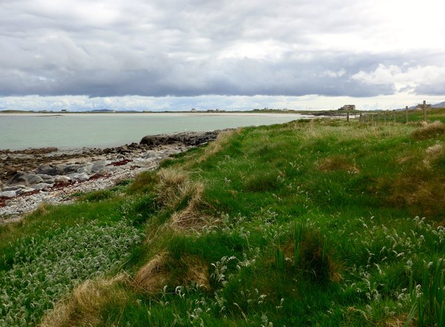
Covering an area of around 10 hectares, Eilean nan Ceapan is characterized by its rocky terrain, rugged coastline, and diverse wildlife. The island is known for its distinctive basalt columns, which were formed by volcanic activity millions of years ago. These columns create a unique and picturesque landscape, attracting visitors who enjoy geology and photography.

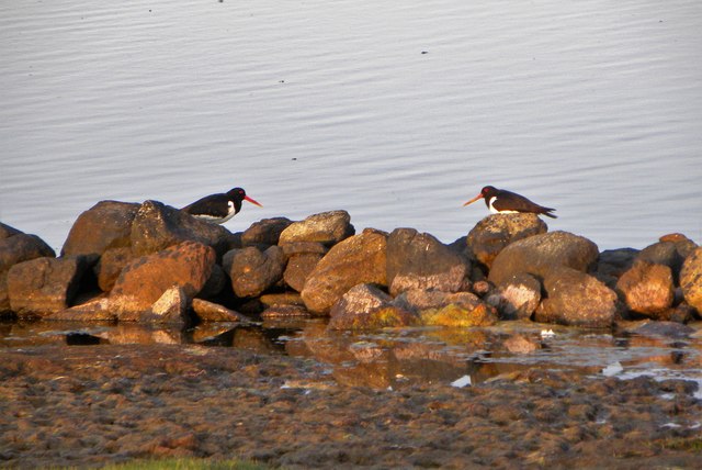
Despite being uninhabited, Eilean nan Ceapan offers a haven for a wide variety of bird species. The island is home to nesting populations of puffins, razorbills, guillemots, and kittiwakes, making it a popular spot for birdwatching enthusiasts. Seals can also be spotted in the surrounding waters, adding to the island's natural beauty.

Access to Eilean nan Ceapan can be challenging, as there are no regular boat services to the island. However, it is possible to arrange private boat trips or join guided tours from nearby Mull. Visitors should note that as an uninhabited island, there are no facilities or amenities available, so proper preparation and respect for the environment are necessary.

Overall, Eilean nan Ceapan offers a unique opportunity to experience the raw beauty and tranquility of the Scottish wilderness, making it a must-visit destination for nature lovers and adventure seekers.

If you have any feedback on the listing, please let us know in the comments section below.

Eilean nan Ceapan Images

Images are sourced within 2km of 57.385756/-7.3902886 or Grid Reference NF7645. Thanks to Geograph Open Source API. All images are credited.
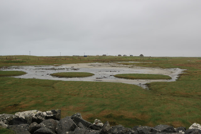
Causeway near Hebridean Jewellery, Iochdar
New house at Iochdar
Saltmarsh near Balgarva
Sands at Iochdar A flat horizon and a large sky.
Sands at Iochdar
A flat horizon and a large sky.
Inside Hebridean Jewellery A fine cafe as well as a good shop to examine a wide range of local authentic crafts.
Inside Hebridean Jewellery
A fine cafe as well as a good shop to examine a wide range of local authentic crafts.
Crossing the sand to Gualan A group with a dog enjoying the fine weather.
Crossing the sand to Gualan
A group with a dog enjoying the fine weather.
Bagh a Tuath Translation - North Bay.  There are so many wonderful beaches in the Hebrides that frequently they are simply named for how they face - west, north, east or south.
Bagh a Tuath
Translation - North Bay. There are so many wonderful beaches in the Hebrides that frequently they are simply named for how they face - west, north, east or south.
The coast at Ardivachar
Houses at Kilaulay It looks as though perhaps a cattle feeder has been positioned then removed to make the circular pattern in the grass.
Houses at Kilaulay
It looks as though perhaps a cattle feeder has been positioned then removed to make the circular pattern in the grass.
Looking across Bagh a Tuath In English, 'North Bay'.

The houses are at Kilaulay.
Looking across Bagh a Tuath
In English, 'North Bay'. The houses are at Kilaulay.
Coastal protection near Iochdar And just along from Hebridean Jewellery - worth a visit, if only for the café.
Coastal protection near Iochdar
And just along from Hebridean Jewellery - worth a visit, if only for the café.
Oystercatchers at Loch Bi You are never far from the loud piping calls of oystercatchers on the Uists. These two appeared to be having a chat on the edge of Loch Bi.
Oystercatchers at Loch Bi
You are never far from the loud piping calls of oystercatchers on the Uists. These two appeared to be having a chat on the edge of Loch Bi.
Evening light, Loch Bi One curious feature here is the line of stones just offshore and shown on the OS map as a boundary. One would hardly consider this as a wall.
Evening light, Loch Bi
One curious feature here is the line of stones just offshore and shown on the OS map as a boundary. One would hardly consider this as a wall.
Across a corner of Loch Bi Loch Bi is an extensive area of brackish water extending across much of the northern end of South Uist and almost cutting it in half. This view is across one small inlet towards houses at Lochdar.
Across a corner of Loch Bi
Loch Bi is an extensive area of brackish water extending across much of the northern end of South Uist and almost cutting it in half. This view is across one small inlet towards houses at Lochdar.
View across Loch an t-Saile Looking south east across this small loch towards the catholic church of St Michael the Archangel, which is the oldest church on the island.
View across Loch an t-Saile
Looking south east across this small loch towards the catholic church of St Michael the Archangel, which is the oldest church on the island.
Ruins near Loch Bi This was intended as a bold plan to reach an 'unbagged' square [NF7744], but it was a plan that failed, the man with the camera not being tenacious enough to progress further in trainers. There's plenty of wet ground even before the loch [just visible left] is reached, and this contributor even declined the loan of wellies as offered at the local croft. This ruined cottage was far enough.
Ruins near Loch Bi
This was intended as a bold plan to reach an 'unbagged' square [NF7744], but it was a plan that failed, the man with the camera not being tenacious enough to progress further in trainers. There's plenty of wet ground even before the loch [just visible left] is reached, and this contributor even declined the loan of wellies as offered at the local croft. This ruined cottage was far enough.
A Shrine St Mary Shrine at Clachan, Iochdar, South Uist.
Eabhal on North Uist in the background.
A Shrine
St Mary Shrine at Clachan, Iochdar, South Uist. Eabhal on North Uist in the background.
Dunes at Baile Gharbhaidh Grassy sand dunes beside the south end of Gualan island during a howling gale.
<span class="nowrap"><a title="http://www.visithebrides.com/islands/suist/" rel="nofollow ugc noopener" href="http://www.visithebrides.com/islands/suist/">Link</a><img style="margin-left:2px;" alt="External link" title="External link - shift click to open in new window" src="https://s1.geograph.org.uk/img/external.png" width="10" height="10"/></span>
Dunes at Baile Gharbhaidh
Grassy sand dunes beside the south end of Gualan island during a howling gale. LinkExternal link
Show me another place!

Eilean nan Ceapan is located at Grid Ref: NF7645 (Lat: 57.385756, Lng: -7.3902886)

Unitary Authority: Na h-Eileanan an Iar

Police Authority: Highlands and Islands

What 3 Words

///employer.appoints.bribing. Near Balivanich, Na h-Eileanan Siar

Related Wikis

Kilaulay

Kilaulay (Scottish Gaelic: Cill Amhlaigh / Cill Amhlaidh ) is a crofting township on the island of South Uist, in the Outer Hebrides of Scotland. Kilaulay...

Balgarva

Balgarva (Scottish Gaelic: Baile Gharbhaidh) is a crofting settlement on South Uist in the Outer Hebrides, Scotland. Balgarva is within the parish of South...

Iochdar

Iochdar (Scottish Gaelic: An t-Ìochdair), also spelled Eochar, is a hamlet and community on the west coast of the island of South Uist, in the Outer Hebrides...

Loch Bee

Loch Bì, sometimes anglicised as Loch Bee, is the largest loch on the island of South Uist in the Outer Hebrides of Scotland. It lies at the northern end...

Nearby Amenities

Located within 500m of 57.385756,-7.3902886
Our Lady of the Isles (miniture statue)
Historic: monument
Lat/Long: 57.3877101/-7.3966907
Àird Choinnich
Name En: Ardkenneth
Name Gd: Àird Choinnich
Place: isolated_dwelling
Lat/Long: 57.3885302/-7.3965345
Power: pole
Lat/Long: 57.3858628/-7.3976355
Power: pole
Lat/Long: 57.3867858/-7.396694
Power: pole
Lat/Long: 57.3872464/-7.3962102
Power: pole
Lat/Long: 57.3876732/-7.3957703
Power: pole
Lat/Long: 57.3879508/-7.3954753
Power: pole
Lat/Long: 57.3886186/-7.3947967
Power: pole
Lat/Long: 57.3890826/-7.394338
Power: pole
Lat/Long: 57.3895886/-7.3938177
Power: pole
Lat/Long: 57.3852874/-7.3982282
The data included in this document is from www.openstreetmap.org. The data is made available under ODbL.

Have you been to Eilean nan Ceapan?

Leave your review of Eilean nan Ceapan below (or comments, questions and feedback).