Mynydd Epynt
Range Of Mountains, Range Of Hills in Brecknockshire
Wales
Mynydd Epynt
Mynydd Epynt, located in Brecknockshire, Wales, is a range of mountains and hills that stretches across an area of approximately 100 square kilometers. It lies to the east of the Cambrian Mountains and is known for its rugged and diverse landscape.
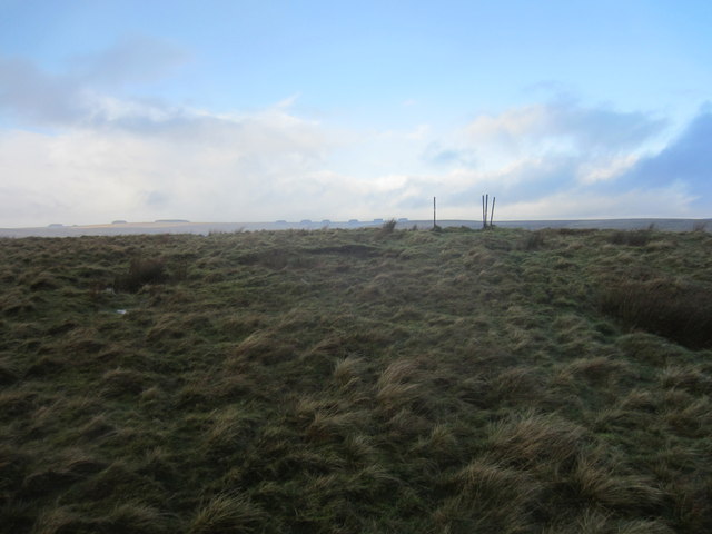
The range is characterized by its rolling hills, deep valleys, and open moorlands, offering breathtaking views of the surrounding countryside. The highest peak in Mynydd Epynt, Fan Fawr, stands at an elevation of 734 meters, providing hikers and climbers with a challenging but rewarding ascent.
Mynydd Epynt is rich in natural beauty and biodiversity. The area is home to a variety of flora and fauna, including heather, gorse, and bilberry, as well as numerous bird species such as red kites and buzzards. The range also boasts several streams and rivers, which contribute to the overall charm of the landscape.
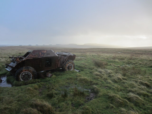
The history of Mynydd Epynt is deeply intertwined with human activity. The area was once inhabited by Celtic tribes and later became an important Roman military site. During World War II, the British Army established a training ground on the range which remains in use to this day.
Today, Mynydd Epynt attracts outdoor enthusiasts, nature lovers, and history buffs alike. The range offers a range of recreational activities, including hiking, mountain biking, and birdwatching. It also provides a peaceful retreat for those seeking solitude and tranquility in nature's embrace.
Overall, Mynydd Epynt is a captivating destination that showcases the beauty of the Welsh countryside, with its stunning landscapes, rich history, and abundant wildlife.
If you have any feedback on the listing, please let us know in the comments section below.
Mynydd Epynt Images
Images are sourced within 2km of 52.077182/-3.5209412 or Grid Reference SN9543. Thanks to Geograph Open Source API. All images are credited.

Mynydd Epynt is located at Grid Ref: SN9543 (Lat: 52.077182, Lng: -3.5209412)
Unitary Authority: Powys
Police Authority: Dyfed Powys
Also known as: Mount Eppynt
What 3 Words
///blaring.overused.formed. Near Llwyn-Madoc, Powys
Nearby Locations
Related Wikis

Mynydd Epynt
Mynydd Epynt (Welsh: [ˈmənɨð ˈɛpɨnt]) is a former community and upland area in Powys, Wales. The Ministry of Defence controversially evicted the community...

Sennybridge Training Area
The Sennybridge Training Area (SENTA) is a UK Ministry of Defence military training area near the village of Sennybridge in Powys, Wales. It consists...

Epynt Way
The Epynt Way is a long-distance path created by the Ministry of Defence in 2004 around the perimeter of its 'Sennybridge Training Area (SENTA)' and artillery...

Llangammarch railway station
Llangammarch railway station serves the village of Llangammarch Wells in Powys, Wales. Situated near the centre of the village, the station is on the Heart...
Have you been to Mynydd Epynt?
Leave your review of Mynydd Epynt below (or comments, questions and feedback).