Bran Hills

Range Of Mountains, Range Of Hills in Leicestershire Melton

England

Bran Hills

St Thomas of Canterbury Church and graveyard There is an Ordnance Survey benchmark <a href="https://www.geograph.org.uk/photo/3977389">SK6917 : Benchmark on St Thomas of Canterbury Church</a> on the buttress on the right hand corner of the tower: the mark levelled at 70.409m above Newlyn Datum was verified in 1962
St Thomas of Canterbury Church and graveyard Credit: Roger Templeman

Bran Hills is a range of hills located in Leicestershire, England. Situated approximately 10 miles northeast of Leicester, the hills are part of the larger Charnwood Forest. Although often referred to as a range of mountains, they are more accurately categorized as a range of hills due to their moderate elevation.

The Bran Hills span an area of about 20 square miles and reach a maximum height of 912 feet at Bardon Hill, which is the highest point in Leicestershire. The hills are predominantly composed of Precambrian igneous rocks, including granite and volcanic rocks, which were formed around 600 million years ago.

Covered in dense woodlands and heathland, the Bran Hills offer a picturesque and diverse landscape. The area is home to a variety of plant and animal species, including oak, beech, and birch trees, as well as deer, foxes, and various bird species. Several nature reserves and country parks, such as the Bardon Hill and Swithland Reservoir, are found within the hills, providing opportunities for outdoor activities and wildlife observation.

The Bran Hills have a rich history, with evidence of human activity dating back to the prehistoric era. The hills were once a significant source of granite, which was quarried extensively for construction purposes. Remnants of old quarries and mining operations can still be seen in some areas.

Overall, Bran Hills in Leicestershire offer a beautiful natural environment, rich biodiversity, and a glimpse into the region's geological and historical past.

If you have any feedback on the listing, please let us know in the comments section below.
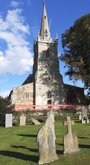
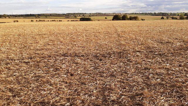
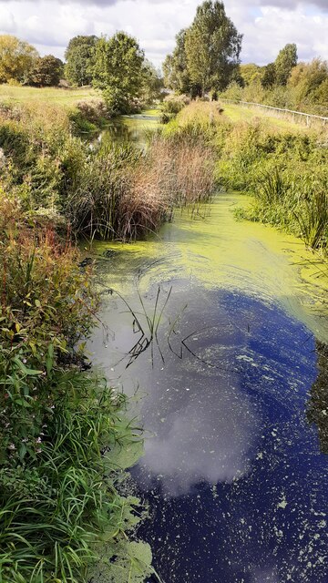
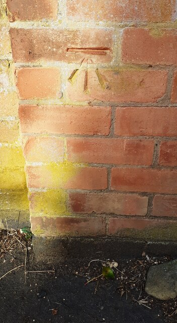
Bran Hills Images

Images are sourced within 2km of 52.743642/-0.95186245 or Grid Reference SK7016. Thanks to Geograph Open Source API. All images are credited.

St Thomas of Canterbury Church and graveyard There is an Ordnance Survey benchmark <a href="https://www.geograph.org.uk/photo/3977389">SK6917 : Benchmark on St Thomas of Canterbury Church</a> on the buttress on the right hand corner of the tower: the mark levelled at 70.409m above Newlyn Datum was verified in 1962
St Thomas of Canterbury Church and graveyard
There is an Ordnance Survey benchmark SK6917 : Benchmark on St Thomas of Canterbury Church on the buttress on the right hand corner of the tower: the mark levelled at 70.409m above Newlyn Datum was verified in 1962
Footpath heading south through ploughed field south of A607
River Wreake NE of Frisby on the Wreake
Footbridge over disused canal north of Frisby on the Wreake Ordnance Survey documents indicate that a rivet benchmark levelled at 64.785m above Newlyn Datum was verified in 1962 on the near end of the right hand bridge parapet
Footbridge over disused canal north of Frisby on the Wreake
Ordnance Survey documents indicate that a rivet benchmark levelled at 64.785m above Newlyn Datum was verified in 1962 on the near end of the right hand bridge parapet
Level crossing at Frisby on the Wreake for railway towards Melton Mowbray
Frisby signal box at east end of Washstones Lane
Frisby signal box and Washstones Lane level crossing
Church of St Thomas of Canterbury
Benchmark on pier of wall of cemetery on west side of Mill Lane Ordnance Survey cut mark benchmark levelled at 69.708m above Newlyn Datum verified 1962
Benchmark on pier of wall of cemetery on west side of Mill Lane
Ordnance Survey cut mark benchmark levelled at 69.708m above Newlyn Datum verified 1962
Eastern boundary wall of cemetery on Mill Lane There is an Ordnance Survey benchmark <a href="https://www.geograph.org.uk/photo/7324272">SK6917 : Benchmark on pier of wall of cemetery on west side of Mill Lane</a> on the right hand wall pier
Eastern boundary wall of cemetery on Mill Lane
There is an Ordnance Survey benchmark SK6917 : Benchmark on pier of wall of cemetery on west side of Mill Lane on the right hand wall pier
Thatched house with roof held with tyres on west side of Rotherby Lane
Benchmark on base of Stump Cross Ordnance Survey cut mark benchmark levelled at 105.607m above Newlyn Datum verified 1962
Benchmark on base of Stump Cross
Ordnance Survey cut mark benchmark levelled at 105.607m above Newlyn Datum verified 1962
Stump Cross on NW side of Leicester Road (A607) near junction with footpath Stump Cross takes the form of a socket stone and a shaft, both
of which are medieval in date with modern repairs.
The socket stone is roughly 0.8m square in section at the base and the corners
are moulded and chamfered so that the top of the stone is octagonal in
section. Set into the centre of the socket stone is the shaft, approximately
0.3m square in section at the base rising through chamfered corners in fluted
section to a height of 1.1m. Towards the top of the shaft are a series of
small holes, two visible on each face, and the top itself has been rounded off
and has a hole through the centre of the shaft. The full height of the cross
is 1.46m. 
There is an Ordnance Survey benchmark <a href="https://www.geograph.org.uk/photo/7324299">SK6917 : Benchmark on base of Stump Cross</a> on the road face of the socket stone.
The cross has Milestone Society National ID: LEMT_FRI02
Stump Cross on NW side of Leicester Road (A607) near junction with footpath
Stump Cross takes the form of a socket stone and a shaft, both of which are medieval in date with modern repairs. The socket stone is roughly 0.8m square in section at the base and the corners are moulded and chamfered so that the top of the stone is octagonal in section. Set into the centre of the socket stone is the shaft, approximately 0.3m square in section at the base rising through chamfered corners in fluted section to a height of 1.1m. Towards the top of the shaft are a series of small holes, two visible on each face, and the top itself has been rounded off and has a hole through the centre of the shaft. The full height of the cross is 1.46m. There is an Ordnance Survey benchmark SK6917 : Benchmark on base of Stump Cross on the road face of the socket stone. The cross has Milestone Society National ID: LEMT_FRI02
Benchmark on the garage attached to #28 Great Lane Ordnance Survey cut mark benchmark levelled at 88.682m above Newlyn Datum verified 1962
Benchmark on the garage attached to #28 Great Lane
Ordnance Survey cut mark benchmark levelled at 88.682m above Newlyn Datum verified 1962
#28 Great Lane There is an Ordnance Survey benchmark <a href="https://www.geograph.org.uk/photo/7324453">SK6917 : Benchmark on the garage attached to #28 Great Lane</a> on the left hand side of the house garage at its front corner
#28 Great Lane
There is an Ordnance Survey benchmark SK6917 : Benchmark on the garage attached to #28 Great Lane on the left hand side of the house garage at its front corner
A welcoming sight The Bell Inn in Frisby on the Wreake, a community run pub.
A welcoming sight
The Bell Inn in Frisby on the Wreake, a community run pub.
The Limes An early 19th century house, and grade II listed - see <span class="nowrap"><a title="https://historicengland.org.uk/listing/the-list/list-entry/1061264?section=official-list-entry" rel="nofollow ugc noopener" href="https://historicengland.org.uk/listing/the-list/list-entry/1061264?section=official-list-entry">Link</a><img style="margin-left:2px;" alt="External link" title="External link - shift click to open in new window" src="https://s1.geograph.org.uk/img/external.png" width="10" height="10"/></span> .
The Limes
An early 19th century house, and grade II listed - see LinkExternal link .
Market Cross A scheduled ancient monument and listed too, this is the Village Cross or Market Cross.  In 1981 it was moved a few yards from the middle of the adjacent road junction..

See <span class="nowrap"><a title="https://historicengland.org.uk/listing/the-list/list-entry/1015209?section=official-list-entry" rel="nofollow ugc noopener" href="https://historicengland.org.uk/listing/the-list/list-entry/1015209?section=official-list-entry">Link</a><img style="margin-left:2px;" alt="External link" title="External link - shift click to open in new window" src="https://s1.geograph.org.uk/img/external.png" width="10" height="10"/></span> and <span class="nowrap"><a title="https://historicengland.org.uk/listing/the-list/list-entry/1307615" rel="nofollow ugc noopener" href="https://historicengland.org.uk/listing/the-list/list-entry/1307615">Link</a><img style="margin-left:2px;" alt="External link" title="External link - shift click to open in new window" src="https://s1.geograph.org.uk/img/external.png" width="10" height="10"/></span> for details
Market Cross
A scheduled ancient monument and listed too, this is the Village Cross or Market Cross. In 1981 it was moved a few yards from the middle of the adjacent road junction.. See LinkExternal link and LinkExternal link for details
Show me another place!

Bran Hills is located at Grid Ref: SK7016 (Lat: 52.743642, Lng: -0.95186245)

Administrative County: Leicestershire

District: Melton

Police Authority: Leicestershire

What 3 Words

///logo.worry.distorts. Near Asfordby, Leicestershire

Nearby Locations

Bran Hills

Related Wikis

Frisby and Kirby

Frisby and Kirby, formerly just Frisby is a former civil parish in the Melton district, in the county of Leicestershire, England. Its principal settlements...

Kirby Bellars

Kirby Bellars is a village and civil parish near Melton Mowbray in Leicestershire, England. The population of the civil parish at the 2011 census was 369...

Asfordby railway station

Asfordby railway station was a station serving the villages of Asfordby and Kirby Bellars in Leicestershire. The station was situated at a level crossing...

Frisby on the Wreake

Frisby on the Wreake is a village and civil parish on the River Wreake about 3.5 miles (5.6 km) west of Melton Mowbray, Leicestershire, England. The 2011...

Kirby Bellars Priory

Kirby Bellars Priory was a small priory of Canons Regular of Saint Augustine in Leicestershire, England. It is now the Church of England Parish Church...

Asfordby

Asfordby is a village and civil parish in the Melton district of Leicestershire, to the west of Melton Mowbray on the A6006 road. The village is north...

Frisby railway station

Frisby railway station was a former station serving the village of Frisby on the Wreake in Leicestershire. The station was situated at a level crossing...

Asfordby F.C.

Asfordby Football Club is a football club based in Asfordby, England. They are currently members of the United Counties League Division One and play at...

Nearby Amenities

Located within 500m of 52.743642,-0.95186245
Power: tower
Lat/Long: 52.7459049/-0.9569154
Power: tower
Lat/Long: 52.7398319/-0.9544477
Power: tower
Lat/Long: 52.7427808/-0.9557137
The data included in this document is from www.openstreetmap.org. The data is made available under ODbL.

Have you been to Bran Hills?

Leave your review of Bran Hills below (or comments, questions and feedback).