Hangingstone Hills

Range Of Mountains, Range Of Hills in Leicestershire Charnwood

England

Hangingstone Hills

Broombriggs Farm Country Park The structure on the right is a water service reservoir.
Broombriggs Farm Country Park Credit: Michael Parry

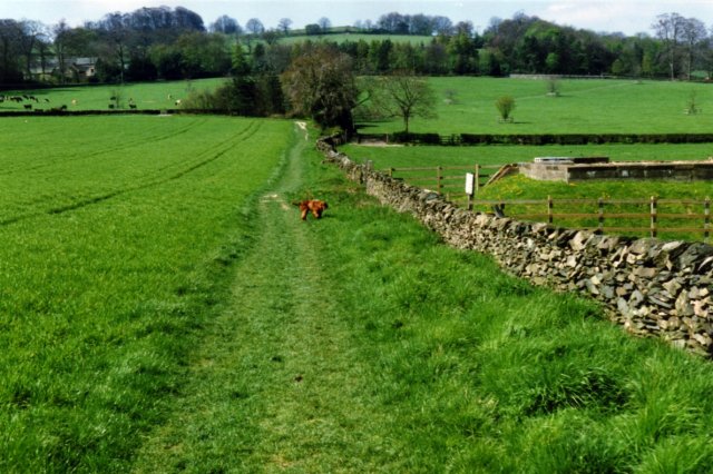
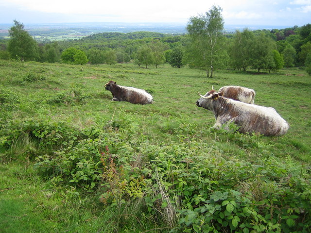
Hangingstone Hills is a range of hills located in Leicestershire, England. Stretching across a vast area, these hills are known for their picturesque landscapes and diverse wildlife. The hills are part of the larger Charnwood Forest and are composed mainly of hard volcanic and metamorphic rocks, which give them a distinct character.

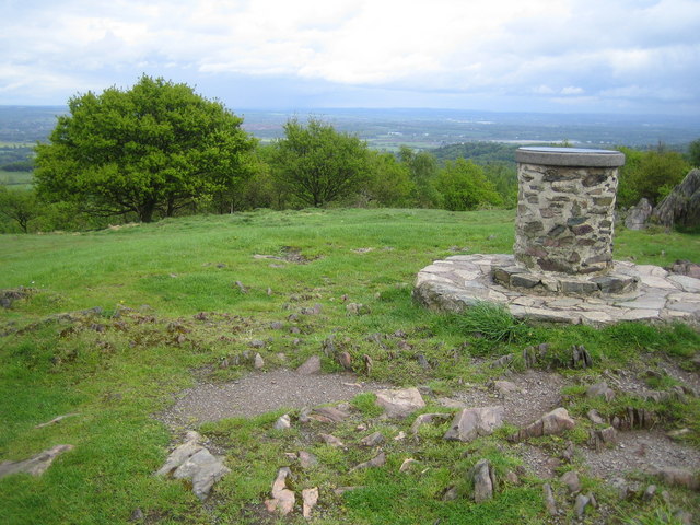
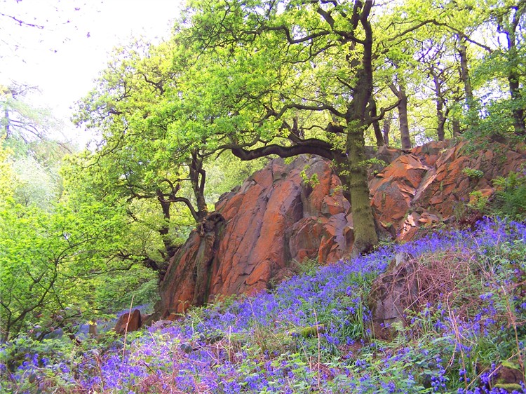
The highest point in the Hangingstone Hills reaches an elevation of 270 meters above sea level, offering breathtaking views of the surrounding countryside. The hills are covered in verdant vegetation, including heather, gorse, and oak trees, creating a beautiful and tranquil environment for visitors to enjoy.

The area is a haven for outdoor enthusiasts, offering a range of activities such as hiking, mountain biking, and birdwatching. There are several well-marked trails that crisscross the hills, providing opportunities for both leisurely walks and more challenging hikes. Wildlife enthusiasts will also be delighted by the presence of various species, including deer, badgers, and a wide variety of bird species.

In addition to its natural beauty, Hangingstone Hills also holds historical significance. The hills are home to ancient archaeological sites, including Iron Age hill forts and burial mounds, which provide insights into the region's rich past.

Overall, Hangingstone Hills is a remarkable destination for nature lovers and history enthusiasts alike. Its stunning landscapes, diverse wildlife, and historical significance make it a must-visit location in Leicestershire.

If you have any feedback on the listing, please let us know in the comments section below.

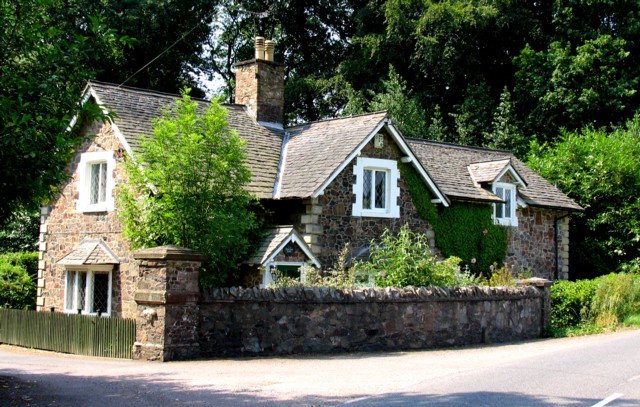
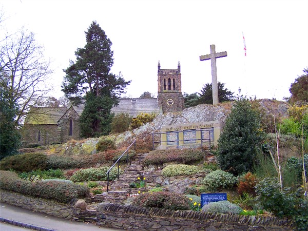
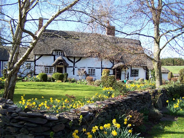
Hangingstone Hills Images

Images are sourced within 2km of 52.732024/-1.2267066 or Grid Reference SK5215. Thanks to Geograph Open Source API. All images are credited.

Broombriggs Farm Country Park The structure on the right is a water service reservoir.
Broombriggs Farm Country Park
The structure on the right is a water service reservoir.
Beaumanor Hall, Woodhouse, Leicestershire Beaumanor Hall, is a stately home in Woodhouse, Leicestershire. It was the headquarters of the War Office Y Group. This group consisted of hundreds of secret listeners, who would intercept enemy signals and send information back to Bletchley Park for decoding. The extensive grounds were covered with huts filled with banks of receivers. There was a huge system of dipoles, and rhombic antennas. The intercepted messages were received by Beaumanor Hall and sent encrypted to Bletchley where they were deciphered and graded on a scale of importance. Beaumanor Hall is situated approx. 3 miles South of Loughborough, and 8 miles North of Leicester. The house and grounds were used as an intercept station during W.W.II, and in 1946 the Ministry of Defence purchased the estate to carry on work of a similar nature during peace time.
In 1974 the Ministry sold out to Leicestershire County Council, and in 1977 the Hall opened as a conference centre for teachers.

<span class="nowrap"><a title="http://www.leics.gov.uk/index/education/community_activities/outdoorlearn/beaumanorhall.htm" rel="nofollow ugc noopener" href="http://www.leics.gov.uk/index/education/community_activities/outdoorlearn/beaumanorhall.htm">Link</a><img style="margin-left:2px;" alt="External link" title="External link - shift click to open in new window" src="https://s1.geograph.org.uk/img/external.png" width="10" height="10"/></span>
Beaumanor Hall, Woodhouse, Leicestershire
Beaumanor Hall, is a stately home in Woodhouse, Leicestershire. It was the headquarters of the War Office Y Group. This group consisted of hundreds of secret listeners, who would intercept enemy signals and send information back to Bletchley Park for decoding. The extensive grounds were covered with huts filled with banks of receivers. There was a huge system of dipoles, and rhombic antennas. The intercepted messages were received by Beaumanor Hall and sent encrypted to Bletchley where they were deciphered and graded on a scale of importance. Beaumanor Hall is situated approx. 3 miles South of Loughborough, and 8 miles North of Leicester. The house and grounds were used as an intercept station during W.W.II, and in 1946 the Ministry of Defence purchased the estate to carry on work of a similar nature during peace time. In 1974 the Ministry sold out to Leicestershire County Council, and in 1977 the Hall opened as a conference centre for teachers. LinkExternal link
Beacon Hill The popular "highest hill" in Leicestershire, it is actually out topped by Bardon Hill, but the lack of quarrying and easy access makes Beacon Hill a favourite, and it is often erroneously given the title in print. The summit is a series of hornstone crags, probably the slipperiest, most easily polished stone ever climbed upon. The surrounding country park is a welcome and expanding island in the keepout sign infested Charnwood Forest.
I used to be lucky to live within running distance of here.
Beacon Hill
The popular "highest hill" in Leicestershire, it is actually out topped by Bardon Hill, but the lack of quarrying and easy access makes Beacon Hill a favourite, and it is often erroneously given the title in print. The summit is a series of hornstone crags, probably the slipperiest, most easily polished stone ever climbed upon. The surrounding country park is a welcome and expanding island in the keepout sign infested Charnwood Forest. I used to be lucky to live within running distance of here.
Outwoods. Mixed woodland just outside Loughborough.  A popular outdoor recreation area.
Outwoods.
Mixed woodland just outside Loughborough. A popular outdoor recreation area.
Woodhouse Eaves A row of stone cottages in Maplewell Road.
Woodhouse Eaves
A row of stone cottages in Maplewell Road.
Spring bluebells in the Outwoods, Loughborough This is at the southern end of the Outwoods, between the Dean's Lane junction and Pocket Gate Farm.
Spring bluebells in the Outwoods, Loughborough
This is at the southern end of the Outwoods, between the Dean's Lane junction and Pocket Gate Farm.
Fields south of Loughborough The Moat House and the southern edge of Loughborough's housing estates are off to the left. Picture taken from the bridleway that leads from Pocket Gate Farm to the Moat House.
Fields south of Loughborough
The Moat House and the southern edge of Loughborough's housing estates are off to the left. Picture taken from the bridleway that leads from Pocket Gate Farm to the Moat House.
Beacon Hill After much fruitless stumbling around on Beacon Hill I think this is the crag shown in Richard Webb's atmospheric photo from May 1994 <a href="https://www.geograph.org.uk/photo/103584">SK5014 : Beacon Hill</a> ! Twelve years on and the trees have grown up and partially blocked the view.
Beacon Hill
After much fruitless stumbling around on Beacon Hill I think this is the crag shown in Richard Webb's atmospheric photo from May 1994 SK5014 : Beacon Hill ! Twelve years on and the trees have grown up and partially blocked the view.
Beacon Hill: Charnwood Triangulation Pillar A passive control station in the Ordnance Survey National GPS Network, its full OS National Grid co-ordinates are Eastings 450936.056, Northings 314808.475! Loughborough is vaguely visible in the haze in the distance.
Beacon Hill: Charnwood Triangulation Pillar
A passive control station in the Ordnance Survey National GPS Network, its full OS National Grid co-ordinates are Eastings 450936.056, Northings 314808.475! Loughborough is vaguely visible in the haze in the distance.
Beacon Hill The eastern slopes of Beacon Hill with oak, silver birch and beech trees prominent, looking down towards Beacon Plantation. The cattle are longhorns, specifically kept here to help manage the heathland environment.
Beacon Hill
The eastern slopes of Beacon Hill with oak, silver birch and beech trees prominent, looking down towards Beacon Plantation. The cattle are longhorns, specifically kept here to help manage the heathland environment.
Beacon Hill toposcope On the eastern end of the Beacon Hill summit, Lincoln is reputedly visible 46 miles or 73 kilometres distant on a clear day...
Beacon Hill toposcope
On the eastern end of the Beacon Hill summit, Lincoln is reputedly visible 46 miles or 73 kilometres distant on a clear day...
Vicary Lane at Woodhouse
Gas substation Notice that this little building with a flat roof is built with stone to comply with local planning guidelines! Ivy too.
Gas substation
Notice that this little building with a flat roof is built with stone to comply with local planning guidelines! Ivy too.
Haddon Way Terraced houses are back!
Haddon Way
Terraced houses are back!
Maplewell Hall Gatehouse Perhaps not a gatehouse exactly but it is a very nice cottage right next to the gate posts at the end of the driveway to Maplewell Hall!
Maplewell Hall Gatehouse
Perhaps not a gatehouse exactly but it is a very nice cottage right next to the gate posts at the end of the driveway to Maplewell Hall!
Field One could almost see the crops ripening in the sunlight!
Field
One could almost see the crops ripening in the sunlight!
Pocket Gate Farm With Loughborough in the distance.
This farm sits on the edge of the Hanging Stone Hills
Pocket Gate Farm
With Loughborough in the distance. This farm sits on the edge of the Hanging Stone Hills
Beacon Hill A popular high point and beauty spot.  Loughborough can be seen in the distance.
Beacon Hill
A popular high point and beauty spot. Loughborough can be seen in the distance.
Show me another place!

Hangingstone Hills is located at Grid Ref: SK5215 (Lat: 52.732024, Lng: -1.2267066)

Administrative County: Leicestershire

District: Charnwood

Police Authority: Leicestershire

What 3 Words

///formation.commuted.petty. Near Quorndon, Leicestershire

Nearby Locations

Hangingstone Hills

Related Wikis

Welbeck Defence Sixth Form College

Welbeck Defence Sixth Form College (stylised as Welbeck – The Defence Sixth Form College), formerly named and often referred to as simply Welbeck College...

Woodhouse Eaves

Woodhouse Eaves is a village in Charnwood Forest, Leicestershire, England. Nearby are the villages of Quorn, Swithland, and Newtown Linford. Breakback...

Beacon Hill, Hangingstone and Outwoods

Beacon Hill, Hangingstone and Outwoods is a 147.5-hectare (364-acre) biological and geological Site of Special Scientific Interest (SSSI) south of Loughborough...

Outwoods, Leicestershire

The Outwoods is a 40 hectares (99 acres) ancient wood and visitor attraction overlooking Loughborough and the Soar Valley in Leicestershire, England. It...

Beacon Hill, Leicestershire

Beacon Hill, near Loughborough, in Leicestershire, England, is a popular country park. It is one of several beacon hills in the United Kingdom. It is part...

Beaumanor Hall

Beaumanor Hall is a stately home with a park in the small village of Woodhouse on the edge of the Charnwood Forest, near the town of Loughborough in Leicestershire...

Woodhouse, Leicestershire

Woodhouse, often known to locals as Old Woodhouse, is a small village and civil parish in the heart of Charnwood, England. The population of the civil...

Felicity's Wood

Felicity's Wood is a woodland in Leicestershire, England, near the village of Woodhouse Eaves. It covers a total area of 8.77 hectares (21.67 acres). It...

Nearby Amenities

Located within 500m of 52.732024,-1.2267066
Toilets
Lat/Long: 52.7282855/-1.2278904
Tourism: picnic_site
Lat/Long: 52.7287435/-1.2298241
Barrier: lift_gate
Motorcar: yes
Motorcycle: yes
Lat/Long: 52.7284942/-1.2285259
Artwork Type: statue
Source: survey
Tourism: artwork
Lat/Long: 52.7279214/-1.2293939
Information: board
Source: survey
Tourism: information
Lat/Long: 52.7282646/-1.2292734
Camera Mount: pole
Camera Type: fixed
Man Made: surveillance
Surveillance: outdoor
Surveillance Type: camera
Surveillance Zone: parking
Lat/Long: 52.727994/-1.228481
Camera Mount: wall
Camera Type: fixed
Man Made: surveillance
Surveillance: outdoor
Surveillance Type: camera
Surveillance Zone: parking
Lat/Long: 52.728448/-1.2284411
Camera Mount: wall
Camera Type: fixed
Man Made: surveillance
Surveillance: outdoor
Surveillance Type: camera
Surveillance Zone: parking
Lat/Long: 52.7284723/-1.2284686
Camera Mount: pole
Camera Type: fixed
Man Made: surveillance
Surveillance: outdoor
Surveillance Type: camera
Surveillance Zone: parking
Lat/Long: 52.7284752/-1.2285591
Camera Mount: pole
Camera Type: fixed
Man Made: surveillance
Surveillance: outdoor
Surveillance Type: camera
Surveillance Zone: parking
Lat/Long: 52.7284274/-1.2284917
Camera Mount: pole
Camera Type: fixed
Man Made: surveillance
Surveillance: outdoor
Surveillance Type: camera
Surveillance Zone: parking
Lat/Long: 52.728449/-1.2285232
Barrier: spikes
Motorcar: yes
Motorcycle: yes
Lat/Long: 52.7285013/-1.2285152
Barrier: spikes
Motorcar: yes
Motorcycle: yes
Lat/Long: 52.7284523/-1.2284834
Barrier: lift_gate
Motorcar: yes
Motorcycle: yes
Lat/Long: 52.7284608/-1.22847
Barrier: toll_booth
Fee: £2.50
Lat/Long: 52.7284672/-1.2284608
Bench
Lat/Long: 52.7297515/-1.2310959
Tourism: picnic_site
Lat/Long: 52.7296183/-1.2310634
Bench
Lat/Long: 52.7310807/-1.2322216
Bench
Lat/Long: 52.7315415/-1.2334238
Tourism: picnic_site
Lat/Long: 52.7286215/-1.2304714
Tourism: picnic_site
Lat/Long: 52.7286426/-1.2303883
Tourism: picnic_site
Lat/Long: 52.7285955/-1.2299953
Tourism: picnic_site
Lat/Long: 52.7286905/-1.2299444
Man Made: water_well
Lat/Long: 52.7331775/-1.2318448
The data included in this document is from www.openstreetmap.org. The data is made available under ODbL.

Have you been to Hangingstone Hills?

Leave your review of Hangingstone Hills below (or comments, questions and feedback).