Braes of Angus

Range Of Mountains, Range Of Hills in Angus

Scotland

Braes of Angus

View through the bridge Picture taken while standing on a rock in the river, at very low water level.
View through the bridge Credit: Aleks Scholz

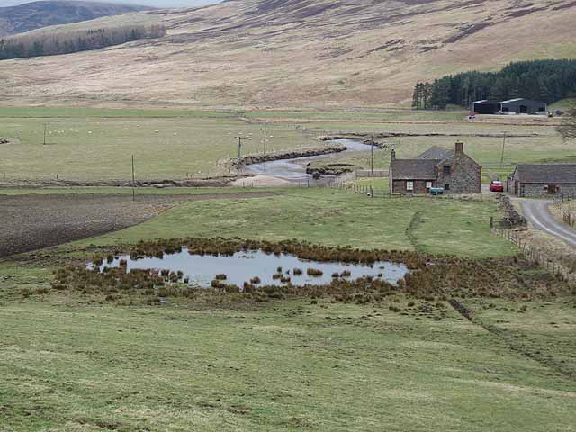
The Braes of Angus is a range of hills located in the county of Angus, Scotland. Stretching across approximately 30 miles, these hills form a prominent feature of the landscape in the region. The Braes of Angus are situated to the south of the Grampian Mountains and to the north of the fertile farmland that characterizes much of Angus.

This range of hills is known for its diverse topography, consisting of rolling slopes, deep valleys, and craggy peaks. The highest point in the Braes of Angus reaches an elevation of around 1,500 feet, offering stunning panoramic views of the surrounding countryside.

The Braes of Angus are home to a variety of flora and fauna, including heather, wildflowers, and several species of birds and mammals. The hills provide an important habitat for wildlife and are often visited by nature enthusiasts and hikers who appreciate the tranquility and beauty of the area.

Historically, the Braes of Angus have played a significant role in the local culture and economy. The hills were used for sheep farming and provided grazing land for livestock. Additionally, the area's forests and woodlands were a valuable source of timber for construction and fuel.

Today, the Braes of Angus continue to be a popular destination for outdoor activities such as hiking, cycling, and wildlife spotting. With its stunning natural scenery and rich biodiversity, the Braes of Angus offer a unique and memorable experience for visitors and locals alike.

If you have any feedback on the listing, please let us know in the comments section below.

Braes of Angus Images

Images are sourced within 2km of 56.781698/-3.0140767 or Grid Reference NO3866. Thanks to Geograph Open Source API. All images are credited.

View through the bridge Picture taken while standing on a rock in the river, at very low water level.
View through the bridge
Picture taken while standing on a rock in the river, at very low water level.
Improved grassland, Glencuilt The improved land surrounding Glencuilt. View towards Craigthran.
Improved grassland, Glencuilt
The improved land surrounding Glencuilt. View towards Craigthran.
Road, Glen Cuilt An estate road which runs up to Craigthran from behind Glencuilt. There are numerous roads here which have yet to make it onto maps, this one is shown.
Road, Glen Cuilt
An estate road which runs up to Craigthran from behind Glencuilt. There are numerous roads here which have yet to make it onto maps, this one is shown.
Estate road under Craigthran The new surface ends here, and the mapped road carries on as a wide path for a bit before a hideously eroded frontal assault on Craigthran.
Estate road under Craigthran
The new surface ends here, and the mapped road carries on as a wide path for a bit before a hideously eroded frontal assault on Craigthran.
Head of Glen Cuilt The moorland gathering grounds of the Burn of Cuilt. It is managed as a grouse moor.
Head of Glen Cuilt
The moorland gathering grounds of the Burn of Cuilt. It is managed as a grouse moor.
Track on Craigthran A hill track and ruined fence on the ridge towards Manywee.
Track on Craigthran
A hill track and ruined fence on the ridge towards Manywee.
Glen Clova from Brocklas Looking north up Glen Clova
Glen Clova from Brocklas
Looking north up Glen Clova
Road to Glencuilt Farm access route from the days when there was a farm at Glencuilt. Now it runs to fields and joins up with the extensive hill road network of Glen Moy.
Road to Glencuilt
Farm access route from the days when there was a farm at Glencuilt. Now it runs to fields and joins up with the extensive hill road network of Glen Moy.
Sheep, Glencuilt Ruined dykes on well drained, improved pasture. A moorland ridge divides the glen from Glen Clova.
Sheep, Glencuilt
Ruined dykes on well drained, improved pasture. A moorland ridge divides the glen from Glen Clova.
Gate between moorland and fields, Glencuilt The gate leads to open moorland, which at first was once improved farmland and is now reverting to rough grazing.
Gate between moorland and fields, Glencuilt
The gate leads to open moorland, which at first was once improved farmland and is now reverting to rough grazing.
New road, Glencuilt A road, not yet on maps, runs over a low moorland ridge to Gella in Glen Clova. <a href="https://www.geograph.org.uk/photo/1743584">NO3765 : Looking towards Gella</a>
New road, Glencuilt
A road, not yet on maps, runs over a low moorland ridge to Gella in Glen Clova. NO3765 : Looking towards Gella
Road climbing out of Glencuilt An estate road heading for Craigthran: this is a view down to the improved farmland in Glenmoy.
Road climbing out of Glencuilt
An estate road heading for Craigthran: this is a view down to the improved farmland in Glenmoy.
Hill track, Craigthran A rough section of track which soon turns into an eroded slog straight up a steep hill.
Hill track, Craigthran
A rough section of track which soon turns into an eroded slog straight up a steep hill.
Grouse butt, Craigthran Well weathered in butt on Craigthran at the head of Glencuilt.
Grouse butt, Craigthran
Well weathered in butt on Craigthran at the head of Glencuilt.
Cairn on Craigthran A cairn overlooking Glen Cuilt. There are distant views of the Sidlaw Hills (and beyond) across Strathmore.
Cairn on Craigthran
A cairn overlooking Glen Cuilt. There are distant views of the Sidlaw Hills (and beyond) across Strathmore.
Track on Craigthran Not a junction but a place where there is some braiding, an old route gets too boggy/eroded so they drive on a newer route.
Track on Craigthran
Not a junction but a place where there is some braiding, an old route gets too boggy/eroded so they drive on a newer route.
Glen Clova Seen from the road on the west bank below Braeminzion Plantation.  A meander in the River South Esk can be seen to the right. The farm  on the far side of the Glen is Whitehillocks <a href="https://www.geograph.org.uk/gridref/NO3667">NO3667</a>.
Glen Clova
Seen from the road on the west bank below Braeminzion Plantation. A meander in the River South Esk can be seen to the right. The farm on the far side of the Glen is Whitehillocks NO3667.
Braeminzion Farm Corner of a farm on the floor of Glen Clova. Whitehillocks Farm <a href="https://www.geograph.org.uk/gridref/NO3667">NO3667</a> can be seen on the far side beyond the meandering River South Esk.
Braeminzion Farm
Corner of a farm on the floor of Glen Clova. Whitehillocks Farm NO3667 can be seen on the far side beyond the meandering River South Esk.
Show me another place!

Braes of Angus is located at Grid Ref: NO3866 (Lat: 56.781698, Lng: -3.0140767)

Unitary Authority: Angus

Police Authority: Tayside

What 3 Words

///professes.clean.hunk. Near Kirriemuir, Angus

Nearby Locations

Braes of Angus

Related Wikis

Mile Hill, Dykehead

There is another Mile Hill nearby which is a MarilynMile Hill is located in Angus, Scotland, 1000 metres west of Dykehead. It is a circular hill rising...

Angus (UK Parliament constituency)

Angus is a county constituency of the House of Commons of the Parliament of the United Kingdom (at Westminster). It elects one Member of Parliament (MP...

Cortachy

Cortachy is a village in Angus, Scotland. It lies in at the mouth of Glen Clova, on the River South Esk, four miles north of Kirriemuir. Nearby lies Cortachy...

Cortachy Castle

Cortachy Castle is a castellated mansion House at Cortachy, Angus, Scotland, some four miles north of Kirriemuir. The present building dates from the 15th...

Have you been to Braes of Angus?

Leave your review of Braes of Angus below (or comments, questions and feedback).