The Braids

Range Of Mountains, Range Of Hills in Midlothian

Scotland

The Braids

Braidburn Valley Park - 1 April 2011 Braidburn Valley Park and the Pentland Hills - more flowers, less snow, and less sun, than on the same date a year ago - <a href="https://www.geograph.org.uk/photo/1780682">NT2469 : Braidburn Valley Park - 1 April 2010</a>.
Braidburn Valley Park - 1 April 2011 Credit: M J Richardson

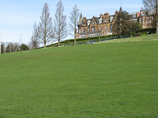
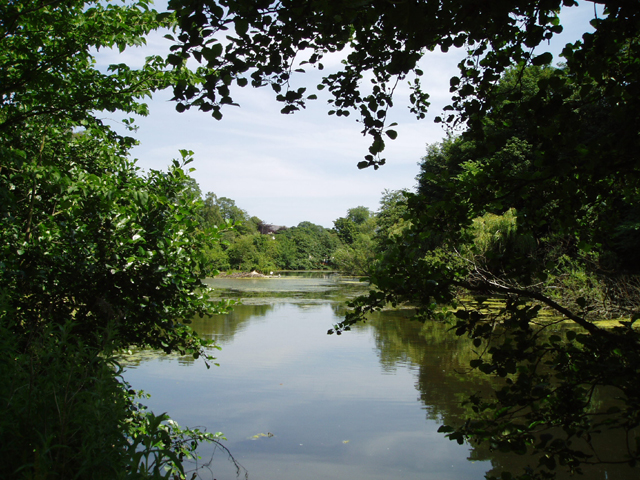
The Braids, located in Midlothian, Scotland, is a range of mountains and hills that offers breathtaking views and a variety of outdoor activities. Stretching across an area of approximately 8 square miles, The Braids is known for its rugged terrain, dense forests, and stunning landscapes.

The range is characterized by its rolling hills, with the highest point reaching an elevation of around 570 meters. The Braids is predominantly covered in heather and grass, creating a picturesque scene that changes in colors with each passing season. The area is also home to a diverse range of wildlife, including red deer, mountain hares, and various bird species.

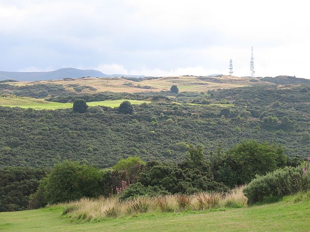
Hiking and walking are popular activities in The Braids, with numerous trails catering to different skill levels. These trails offer visitors the chance to explore the natural beauty of the area, providing opportunities for spotting wildlife and enjoying the tranquility of the surroundings. The range also offers fantastic views of the surrounding countryside, including the Pentland Hills and the city of Edinburgh.

In addition to hiking, The Braids is a popular spot for mountain biking and horse riding. The challenging terrain and scenic routes attract enthusiasts from all over. The range also features several picnic areas and viewpoints, allowing visitors to relax and take in the stunning vistas.

Overall, The Braids in Midlothian is a natural gem, offering a diverse range of outdoor activities and breathtaking landscapes. Whether it's hiking, biking, or simply enjoying the serenity of nature, The Braids provides an unforgettable experience for nature lovers and adventure seekers alike.

If you have any feedback on the listing, please let us know in the comments section below.

The Braids Images

Images are sourced within 2km of 55.914379/-3.1904243 or Grid Reference NT2569. Thanks to Geograph Open Source API. All images are credited.

Braidburn Valley Park - 1 April 2011 Braidburn Valley Park and the Pentland Hills - more flowers, less snow, and less sun, than on the same date a year ago - <a href="https://www.geograph.org.uk/photo/1780682">NT2469 : Braidburn Valley Park - 1 April 2010</a>.
Braidburn Valley Park - 1 April 2011
Braidburn Valley Park and the Pentland Hills - more flowers, less snow, and less sun, than on the same date a year ago - NT2469 : Braidburn Valley Park - 1 April 2010.
Braidburn Valley Park A view looking uphill from the Braidburn towards Comiston Road and The Braid Hills Hotel
Braidburn Valley Park
A view looking uphill from the Braidburn towards Comiston Road and The Braid Hills Hotel
Braidburn Valley Park in June Looking to Swanston and the Pentland Hills. For views from the same spot under different weather conditions see <a href="https://www.geograph.org.uk/photo/1780682">NT2469 : Braidburn Valley Park - 1 April 2010</a> and <a href="https://www.geograph.org.uk/photo/2335248">NT2469 : Braidburn Valley Park - 1 April 2011</a>.
Braidburn Valley Park in June
Looking to Swanston and the Pentland Hills. For views from the same spot under different weather conditions see NT2469 : Braidburn Valley Park - 1 April 2010 and NT2469 : Braidburn Valley Park - 1 April 2011.
Braidburn Valley Park Cherry Trees An avenue planted by the Girl Guides in 1935, part of a trefoil-shaped planting to the east of the Braidburn valley. Now over 70 years old, some are in poor condition and a replacement programme was started in 2008. 80 trees were felled in 2009 and 100 new trees planted in 2010 to commemorate the Centenary of Girl Guiding. Many of the old trees had rot, but wood from some was made into three benches now cited in the park <a href="https://www.geograph.org.uk/photo/2438715">NT2469 : Braidburn Valley Park Cherry Tree Bench</a>.
Braidburn Valley Park Cherry Trees
An avenue planted by the Girl Guides in 1935, part of a trefoil-shaped planting to the east of the Braidburn valley. Now over 70 years old, some are in poor condition and a replacement programme was started in 2008. 80 trees were felled in 2009 and 100 new trees planted in 2010 to commemorate the Centenary of Girl Guiding. Many of the old trees had rot, but wood from some was made into three benches now cited in the park NT2469 : Braidburn Valley Park Cherry Tree Bench.
Braidburn Valley Park Cherry Tree Bench One of three made by Julian Angus, Cousland, Midlothian, out of wood from the 70+-year-old cherry trees planted by Girl Guides in 1935, which are nearing the end of their life and are being replaced <a href="https://www.geograph.org.uk/photo/2438708">NT2469 : Braidburn Valley Park Cherry Trees</a>. I think the two fallen rowans in the background are not the result of vandalism, but the strong winds that caused problems in Edinburgh and eastern Scotland the week before [23 May].
Braidburn Valley Park Cherry Tree Bench
One of three made by Julian Angus, Cousland, Midlothian, out of wood from the 70+-year-old cherry trees planted by Girl Guides in 1935, which are nearing the end of their life and are being replaced NT2469 : Braidburn Valley Park Cherry Trees. I think the two fallen rowans in the background are not the result of vandalism, but the strong winds that caused problems in Edinburgh and eastern Scotland the week before [23 May].
Police box at Braid Hills Approach Presumably surplus to requirements, and rather crumbly in appearance. Not one of Dr Who's.
Somewhat smarter in 2020 after a makeover <a href="https://www.geograph.org.uk/photo/6450168">NT2469 : 'SwimEasy' Police Box Museum, Braid Hills Road</a>.
Police box at Braid Hills Approach
Presumably surplus to requirements, and rather crumbly in appearance. Not one of Dr Who's. Somewhat smarter in 2020 after a makeover NT2469 : 'SwimEasy' Police Box Museum, Braid Hills Road.
Houses on Braid Hills Approach A quiet road just off Braid Hills Road, leading up to the Braid Hills Golf Courses and club houses.
Houses on Braid Hills Approach
A quiet road just off Braid Hills Road, leading up to the Braid Hills Golf Courses and club houses.
Walker on the Braid Hills The same one as seen in <a href="https://www.geograph.org.uk/photo/2180843">NT2569 : Walker on the Braid Hills</a>, from a very similar spot, but 6 months later under somewhat different weather conditions.
Walker on the Braid Hills
The same one as seen in NT2569 : Walker on the Braid Hills, from a very similar spot, but 6 months later under somewhat different weather conditions.
Entrance to the Toby Carvery, Liberton, Edinburgh Formerly known as the Balmwell Country Carvery, but acquired by the Toby Carvery chain in 2011.  The carvery is in a large house originally built in 1806 for a Mr John Simpson. Since being a private home it has been used as a children’s home, a care home and a hotel. The eponymous Balmwell is in the grounds.
Entrance to the Toby Carvery, Liberton, Edinburgh
Formerly known as the Balmwell Country Carvery, but acquired by the Toby Carvery chain in 2011. The carvery is in a large house originally built in 1806 for a Mr John Simpson. Since being a private home it has been used as a children’s home, a care home and a hotel. The eponymous Balmwell is in the grounds.
Arthur's Seat from Liberton Cemetery, Edinburgh
Row of shops, Liberton, Edinburgh
Solar Panels on Buckstone Terrace Not sure what the pay-back time will be for these panels - facing almost due west [260 degrees] does not seem to be the optimum position for efficiency.
Solar Panels on Buckstone Terrace
Not sure what the pay-back time will be for these panels - facing almost due west [260 degrees] does not seem to be the optimum position for efficiency.
Bring out your cardboard! Alternate Wednesdays are red box recycling days on Braid Mount. Cardboard in the box, plastic bottles etc. in a separate bag [but mixed in the collection truck - I wonder why that is?]. Looking almost due north over the Braid Burn valley to Edinburgh Castle, 3.8 km away.
Bring out your cardboard!
Alternate Wednesdays are red box recycling days on Braid Mount. Cardboard in the box, plastic bottles etc. in a separate bag [but mixed in the collection truck - I wonder why that is?]. Looking almost due north over the Braid Burn valley to Edinburgh Castle, 3.8 km away.
Elf Loch A small loch viewed from a small hill on Mortonhall Golf Course.
Elf Loch
A small loch viewed from a small hill on Mortonhall Golf Course.
Earth Stars [Geastrum triplex] Two of a group found by a path leading into the Braid Hills from Braid Road.
Earth Stars [Geastrum triplex]
Two of a group found by a path leading into the Braid Hills from Braid Road.
Earth Stars A general habitat view of a second patch of Geastrum triplex, about 100m east of <a href="https://www.geograph.org.uk/photo/2666815">NT2469 : Earth Stars [Geastrum triplex]</a>. A good collection - eleven fruit bodies are present in this view.
Earth Stars
A general habitat view of a second patch of Geastrum triplex, about 100m east of NT2469 : Earth Stars [Geastrum triplex]. A good collection - eleven fruit bodies are present in this view.
Some large Earth Stars Some of the large group of Geastrum triplex shown at <a href="https://www.geograph.org.uk/photo/2666821">NT2469 : Earth Stars</a>.
Some large Earth Stars
Some of the large group of Geastrum triplex shown at NT2469 : Earth Stars.
Path-side Earth Star A close-up of one of the large group of Geastrum triplex at <a href="https://www.geograph.org.uk/photo/2666821">NT2469 : Earth Stars</a>. The spores are dispersed through the small hole at the top.
Path-side Earth Star
A close-up of one of the large group of Geastrum triplex at NT2469 : Earth Stars. The spores are dispersed through the small hole at the top.
Show me another place!

The Braids is located at Grid Ref: NT2569 (Lat: 55.914379, Lng: -3.1904243)

Unitary Authority: City of Edinburgh

Police Authority: Edinburgh

What 3 Words

///jets.nests.zips. Near Colinton, Edinburgh

Related Wikis

Braid Hills

The Braid Hills form an area towards the south-western edge of Edinburgh, Scotland. The hills themselves are largely open space. Housing in the area is...

Blackford Hill

Blackford Hill 164 metres (538 ft) is a hill in Edinburgh, the capital city of Scotland. It is in the area of Blackford, between Morningside, and the Braid...

Liberton Tower

Liberton Tower is a four-storey, square-plan tower house in the Edinburgh suburb of Liberton, on the east side of the Braid Hills. == History == Located...

Hermitage of Braid

The Hermitage of Braid is an area between the Braid Hills and Blackford Hill. The Braid Burn runs through it. It comprises part of the 60.3-hectare (149...

Royal Observatory, Edinburgh

The Royal Observatory, Edinburgh (ROE) is an astronomical institution located on Blackford Hill in Edinburgh. The site is owned by the Science and Technology...

UK Astronomy Technology Centre

The UK Astronomy Technology Centre (UK ATC) is based at the Royal Observatory in Edinburgh, Scotland, and is part of the Science and Technology Facilities...

FloWaveTT

The FloWave TT ocean energy research facility is designed to test physical scale models of marine renewable energy devices, in a combined wave and current...

Blackford Pond

Blackford Pond is a small, artificial pond in the Blackford area of Edinburgh, Scotland. The pond was created during the Victorian Era in a glacial hollow...

Nearby Amenities

Located within 500m of 55.914379,-3.1904243
The Braids
Ele: 178
Natural: peak
Lat/Long: 55.9156137/-3.1964307
Parking
Access: yes
Fee: no
Parking: street_side
Lat/Long: 55.9171931/-3.1941869
Barrier: yes
Bicycle: yes
Foot: yes
Horse: yes
Material: metal
Motor Vehicle: private
Lat/Long: 55.9172867/-3.1949034
Barrier: kissing_gate
Foot: yes
Lat/Long: 55.9160115/-3.1851809
Waste Basket
Lat/Long: 55.917119/-3.1941115
Waste Basket
Lat/Long: 55.9173019/-3.1948269
Golf: pin
Source: Bing
Lat/Long: 55.9150885/-3.1901872
Golf: pin
Source: Bing
Lat/Long: 55.9141948/-3.1856932
Golf: pin
Source: Bing
Lat/Long: 55.9138453/-3.1840369
Golf: pin
Source: Bing
Lat/Long: 55.9156867/-3.1849569
Golf: pin
Source: Bing
Lat/Long: 55.9161151/-3.1917509
Golf: pin
Source: Bing
Lat/Long: 55.9150794/-3.1951895
Golf: pin
Source: Bing
Lat/Long: 55.9158806/-3.1943607
Golf: pin
Source: Bing
Lat/Long: 55.9144692/-3.1911126
Golf: pin
Source: Bing
Lat/Long: 55.9136439/-3.1870839
Golf: pin
Source: Bing
Lat/Long: 55.9138619/-3.1881702
Golf: pin
Source: Bing
Lat/Long: 55.913931/-3.1918395
Golf: pin
Source: Bing
Lat/Long: 55.9142557/-3.1979281
Golf: pin
Lat/Long: 55.9126112/-3.1920943
Golf: pin
Lat/Long: 55.9123105/-3.189581
Golf: pin
Lat/Long: 55.9117981/-3.189468
Golf: pin
Lat/Long: 55.9126025/-3.1931921
Golf: pin
Lat/Long: 55.9137926/-3.1969963
Golf: pin
Lat/Long: 55.9130869/-3.193795
Golf: pin
Lat/Long: 55.9131138/-3.1889185
Golf: pin
Lat/Long: 55.9122795/-3.1837164
Golf: pin
Lat/Long: 55.9107676/-3.1923753
Golf: pin
Lat/Long: 55.9107788/-3.1947855
The data included in this document is from www.openstreetmap.org. The data is made available under ODbL.

Have you been to The Braids?

Leave your review of The Braids below (or comments, questions and feedback).