Alder Hills

Range Of Mountains, Range Of Hills in Inverness-shire

Scotland

Alder Hills

Summit cairn, Beinn a' Chumhainn The great whaleback slopes of Ben Alder dominate the view to the NE from the cairn.
Summit cairn, Beinn a' Chumhainn Credit: Jim Barton

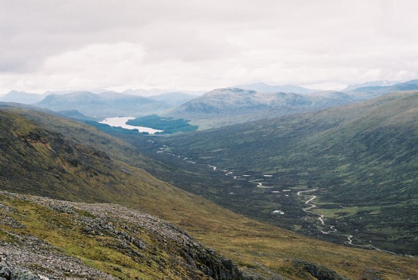
Alder Hills is a range of hills located in the county of Inverness-shire, in the Scottish Highlands. Situated in the western part of the county, the hills form part of the wider range of mountains known as the Grampian Mountains.

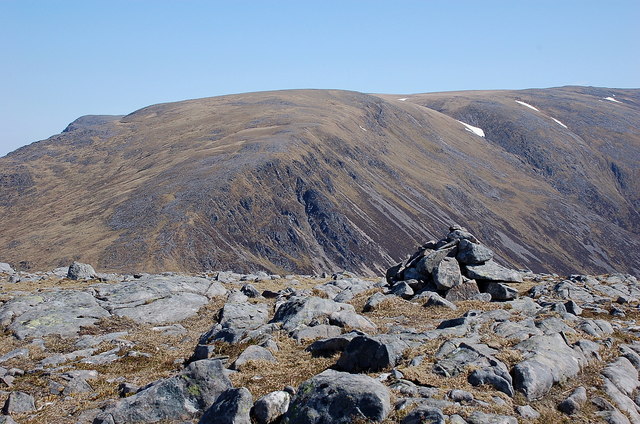
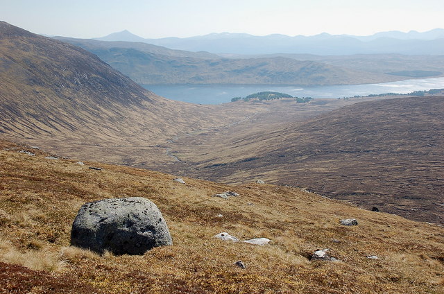
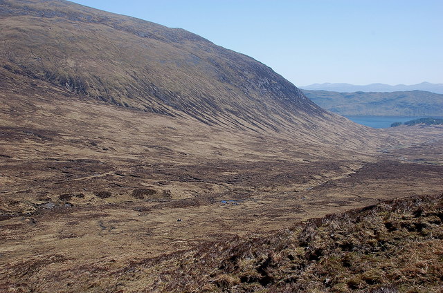
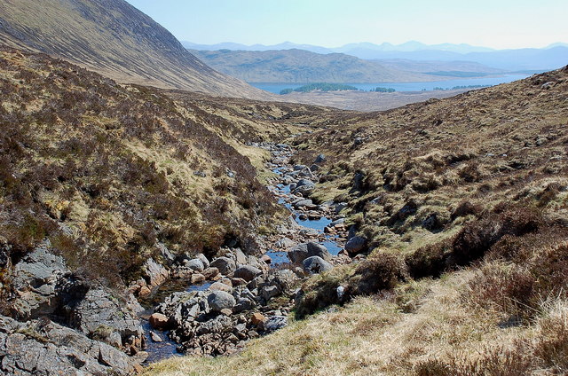
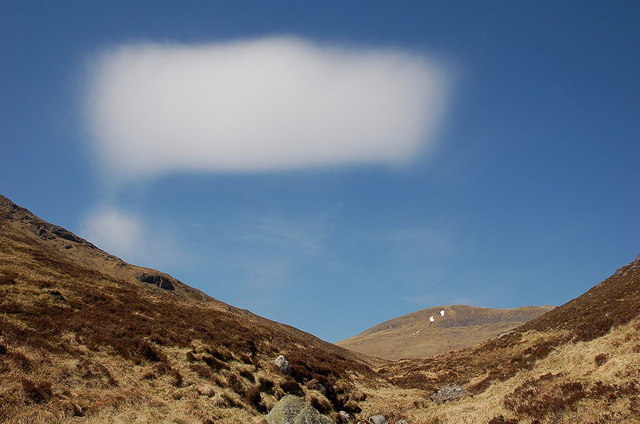
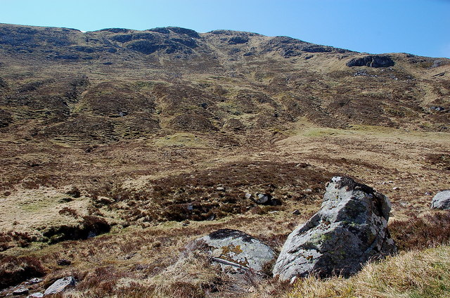
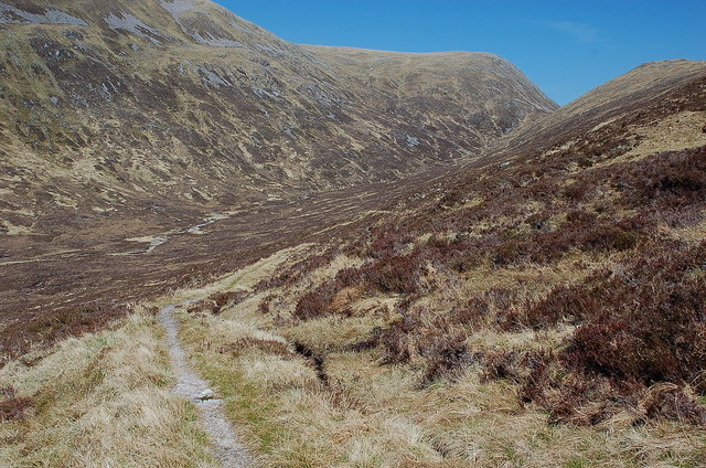
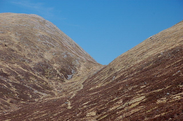
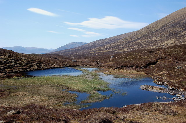
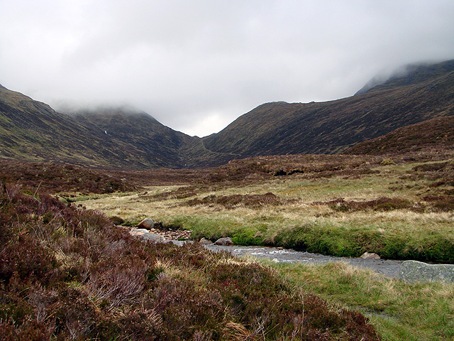
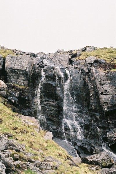
The Alder Hills are characterized by their rugged and majestic appearance, with steep slopes and rocky outcrops. The highest peak in the range is Meall Fuar-mhonaidh, standing at an impressive 699 meters (2,293 feet) above sea level. This summit offers breathtaking panoramic views of the surrounding countryside, including Loch Ness to the southeast and the Great Glen to the southwest.

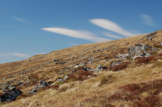
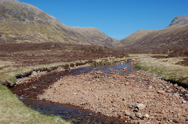
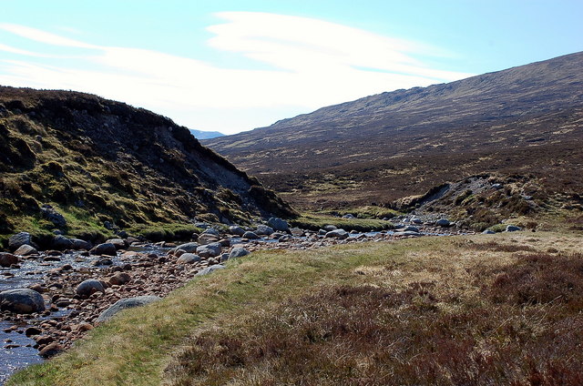
The range is covered in a mix of vegetation, including heather, grasses, and scattered patches of woodland. The hills are also home to a variety of wildlife, such as red deer, mountain hares, and a range of bird species, making it a popular destination for nature enthusiasts and birdwatchers.

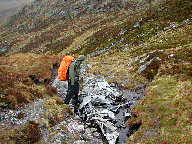
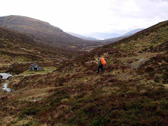
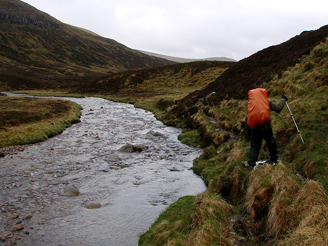
Alder Hills are a popular destination for outdoor activities, including hillwalking, hiking, and mountain biking. Several well-marked trails traverse the range, providing opportunities for both experienced and novice adventurers to explore the rugged landscapes and enjoy the stunning vistas.

The area surrounding Alder Hills is rich in history and folklore, with ancient ruins and standing stones scattered throughout the landscape. It is said to be a place of myth and legend, with tales of giants and mythical creatures adding to the allure of the hills.

In summary, Alder Hills in Inverness-shire offer a scenic and diverse range of hills, providing ample opportunities for outdoor activities and exploration. With its stunning views, abundant wildlife, and rich historical background, Alder Hills are a must-visit for nature lovers and adventure seekers alike.

If you have any feedback on the listing, please let us know in the comments section below.

Alder Hills Images

Images are sourced within 2km of 56.815689/-4.5177138 or Grid Reference NN4672. Thanks to Geograph Open Source API. All images are credited.

Summit cairn, Beinn a' Chumhainn The great whaleback slopes of Ben Alder dominate the view to the NE from the cairn.
Summit cairn, Beinn a' Chumhainn
The great whaleback slopes of Ben Alder dominate the view to the NE from the cairn.
Valley of the Alder Burn Seen from the south side of Beinn a' Chumhainn, down to Loch Ericht with Ben Alder's slopes rising to the left.
Valley of the Alder Burn
Seen from the south side of Beinn a' Chumhainn, down to Loch Ericht with Ben Alder's slopes rising to the left.
Wave clouds above Coire na Cloiche A strong steady SE wind in stable air has produced lenticular (wave) clouds with their characteristic smooth shape. They stay in much the same place, as the wind blows through them.
Wave clouds above Coire na Cloiche
A strong steady SE wind in stable air has produced lenticular (wave) clouds with their characteristic smooth shape. They stay in much the same place, as the wind blows through them.
South side of Ben Alder This side of Ben Alder is not so dramatic as the corries and ridges to the east and north, but the sheer scale is still impressive. The stalkers' path coming up from Benalder Cottage is in view above the burn.
South side of Ben Alder
This side of Ben Alder is not so dramatic as the corries and ridges to the east and north, but the sheer scale is still impressive. The stalkers' path coming up from Benalder Cottage is in view above the burn.
The Alder Burn Quite low here after the dry spell.
The Alder Burn
Quite low here after the dry spell.
An unusual cloud above the Alder Burn A wave cloud taking up a rectangular shape unlike the usual rounded fish-like or 'flying saucer' forms. After half an hour it had changed. Beinn Eibhinn is in the background.
An unusual cloud above the Alder Burn
A wave cloud taking up a rectangular shape unlike the usual rounded fish-like or 'flying saucer' forms. After half an hour it had changed. Beinn Eibhinn is in the background.
Northeast side of Beinn a' Chumhainn The steep side of the hill overlooking the Bealach Cumhann, through which the stalkers' path from Loch Ericht reaches the Bealach Dubh and the route to Culra and Pattack.
Northeast side of Beinn a' Chumhainn
The steep side of the hill overlooking the Bealach Cumhann, through which the stalkers' path from Loch Ericht reaches the Bealach Dubh and the route to Culra and Pattack.
Stalkers' path to the Bealach Dubh The path contours in towards the final slope to the 720m pass through to Culra and Pattack.
Stalkers' path to the Bealach Dubh
The path contours in towards the final slope to the 720m pass through to Culra and Pattack.
Bealach Dubh from the southwest The pass seen from the stalkers' path from Loch Ericht and the Bealach Chumhann.
Bealach Dubh from the southwest
The pass seen from the stalkers' path from Loch Ericht and the Bealach Chumhann.
Lochan near the Uisge Labhair Reflected sky bringing a touch of colour to this lochan amongst the peat hags in the upper reaches of the glen.
Lochan near the Uisge Labhair
Reflected sky bringing a touch of colour to this lochan amongst the peat hags in the upper reaches of the glen.
Uisge Labhair and the Bealach Dubh A path follows the N bank of the burn down to Corrour.
Uisge Labhair and the Bealach Dubh
A path follows the N bank of the burn down to Corrour.
Eroded glacial debris by the Uisge Labhair The burn has cut through banks of stony gravel on either side.
Eroded glacial debris by the Uisge Labhair
The burn has cut through banks of stony gravel on either side.
Aircraft wreckage in the Bealach Dubh See also <a href="https://www.geograph.org.uk/photo/264804">NN4873 : Aircraft wreckage in the Bealach Dubh</a>.
Aircraft wreckage in the Bealach Dubh
Descending from the Bealach Dubh Keeping to the north side of Allt Coire a' Labhair as crossing the river downstream would be a problem after heavy rain. A stone shelter can be seen on the right and Loch Ossian in the distance. The path to Ben Alder is seen upper left.
Descending from the Bealach Dubh
Keeping to the north side of Allt Coire a' Labhair as crossing the river downstream would be a problem after heavy rain. A stone shelter can be seen on the right and Loch Ossian in the distance. The path to Ben Alder is seen upper left.
Walking the path beside Uisge Labhair The river was very full and the path waterlogged after several days of heavy rain.
Walking the path beside Uisge Labhair
The river was very full and the path waterlogged after several days of heavy rain.
A view back towards the Bealach Dubh from beside Uisge Labhair
Uisge Labhair Taking from West slope of Ben Alder
Uisge Labhair
Taking from West slope of Ben Alder
Waterfall at the start of  Allt a' Bhealaich Dhuibh Water from this burn will beat your Volvic mineral water any day. One of the purest water sources in Scotland.
Waterfall at the start of Allt a' Bhealaich Dhuibh
Water from this burn will beat your Volvic mineral water any day. One of the purest water sources in Scotland.
Show me another place!

Alder Hills is located at Grid Ref: NN4672 (Lat: 56.815689, Lng: -4.5177138)

Unitary Authority: Highland

Police Authority: Highlands and Islands

What 3 Words

///fats.ever.elsewhere. Near Pubil, Perth & Kinross

Nearby Locations

Alder Hills

Related Wikis

Aonach Beag (Ben Alder)

Aonach Beag is a 1,116-metre (3,661 ft) mountain in the Highlands of Scotland in the remote area between Loch Ericht and Loch Laggan located about 4 kilometres...

Geal-Chàrn

Geal-Chàrn (Scottish Gaelic: White Peak) is a mountain in the Highlands of Scotland, 14 kilometres North East of Corrour railway station == See also... ==

Lochan a' Garbh Coire

Lochan a' Garbh Coire is a small freshwater loch located below the summit of Ben Alder in the Highlands of Scotland. At over 1,120 m (3,670 ft) above sea...

Ben Alder

Ben Alder (Scottish Gaelic: Beinn Eallair) is the highest mountain in the remote area of the Scottish Highlands between Loch Ericht and Glen Spean. It...

Sgor Gaibhre

Sgor Gaibhre (955 m) is a mountain in the Grampian Mountains of Scotland. It lies on the border of Highland and Perth and Kinross, near Loch Ossian. A...

Beinn Bheoil

Beinn Bheoil (1,019 m) is a mountain in the Grampian Mountains of Scotland, located on the western shore of Loch Ericht in Highland. Taking the form of...

Corrour Lodge

Corrour Lodge is situated at the eastern end of Loch Ossian on the Corrour Estate on Rannoch Moor, Scotland. It is a large modernist residence (also let...

Beinn a' Chlachair

Beinn a' Chlachair (1,087 m) is a mountain in the Grampian Mountains of Scotland. It lies south of Loch Laggan, near the remote hamlet of Kinloch Laggan...

Have you been to Alder Hills?

Leave your review of Alder Hills below (or comments, questions and feedback).