The Red Cuillin

Range Of Mountains, Range Of Hills in Inverness-shire

Scotland

The Red Cuillin

Eas a' Bhradain waterfall
Eas a' Bhradain waterfall Credit: Rod Allday

The requested URL returned error: 429 Too Many Requests

If you have any feedback on the listing, please let us know in the comments section below.

The Red Cuillin Images

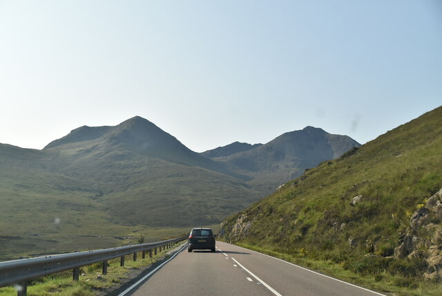
Images are sourced within 2km of 57.259633/-6.0938778 or Grid Reference NG5326. Thanks to Geograph Open Source API. All images are credited.

Eas a' Bhradain waterfall
Allt Coire nam Bruadaran
A dreich day by the Allt Coire nam Bruadaran
Heading into the Coire nam Bruadaran
Allt Màm a' Phobuill
Allt Coire nam Bruadaran towards Loch Ainort
Eas a' Bhradain Waterfall by the A87.
Eas a' Bhradain
Waterfall by the A87.
Shore of Loch Ainort
View south from A87
View south from A87
View south from A87
View south from A87
A87 The A87 runs 99 miles from Invergarry to Uig on the Isle of Skye <a href="https://www.geograph.org.uk/photo/7374675">NG3863 : End of the A87, Uig</a>.
<span class="nowrap"><a title="https://www.sabre-roads.org.uk/wiki/index.php?title=A87" rel="nofollow ugc noopener" href="https://www.sabre-roads.org.uk/wiki/index.php?title=A87">Link</a><img style="margin-left:2px;" alt="External link" title="External link - shift click to open in new window" src="https://s1.geograph.org.uk/img/external.png" width="10" height="10"/></span>
A87
The A87 runs 99 miles from Invergarry to Uig on the Isle of Skye NG3863 : End of the A87, Uig. LinkExternal link
A87 on Skye The A87 runs 99 miles from Invergarry to Uig on the Isle of Skye <a href="https://www.geograph.org.uk/photo/7374675">NG3863 : End of the A87, Uig</a>.
<span class="nowrap"><a title="https://www.sabre-roads.org.uk/wiki/index.php?title=A87" rel="nofollow ugc noopener" href="https://www.sabre-roads.org.uk/wiki/index.php?title=A87">Link</a><img style="margin-left:2px;" alt="External link" title="External link - shift click to open in new window" src="https://s1.geograph.org.uk/img/external.png" width="10" height="10"/></span>
A87 on Skye
The A87 runs 99 miles from Invergarry to Uig on the Isle of Skye NG3863 : End of the A87, Uig. LinkExternal link
A87, southbound The A87 runs 99 miles from Invergarry to Uig on the Isle of Skye <a href="https://www.geograph.org.uk/photo/7374675">NG3863 : End of the A87, Uig</a>.
<span class="nowrap"><a title="https://www.sabre-roads.org.uk/wiki/index.php?title=A87" rel="nofollow ugc noopener" href="https://www.sabre-roads.org.uk/wiki/index.php?title=A87">Link</a><img style="margin-left:2px;" alt="External link" title="External link - shift click to open in new window" src="https://s1.geograph.org.uk/img/external.png" width="10" height="10"/></span>
A87, southbound
The A87 runs 99 miles from Invergarry to Uig on the Isle of Skye NG3863 : End of the A87, Uig. LinkExternal link
A87 to Kyle The A87 runs 99 miles from Invergarry to Uig on the Isle of Skye <a href="https://www.geograph.org.uk/photo/7374675">NG3863 : End of the A87, Uig</a>.
<span class="nowrap"><a title="https://www.sabre-roads.org.uk/wiki/index.php?title=A87" rel="nofollow ugc noopener" href="https://www.sabre-roads.org.uk/wiki/index.php?title=A87">Link</a><img style="margin-left:2px;" alt="External link" title="External link - shift click to open in new window" src="https://s1.geograph.org.uk/img/external.png" width="10" height="10"/></span>
A87 to Kyle
The A87 runs 99 miles from Invergarry to Uig on the Isle of Skye NG3863 : End of the A87, Uig. LinkExternal link
A87, southbound The A87 runs 99 miles from Invergarry to Uig on the Isle of Skye <a href="https://www.geograph.org.uk/photo/7374675">NG3863 : End of the A87, Uig</a>.
<span class="nowrap"><a title="https://www.sabre-roads.org.uk/wiki/index.php?title=A87" rel="nofollow ugc noopener" href="https://www.sabre-roads.org.uk/wiki/index.php?title=A87">Link</a><img style="margin-left:2px;" alt="External link" title="External link - shift click to open in new window" src="https://s1.geograph.org.uk/img/external.png" width="10" height="10"/></span>
A87, southbound
The A87 runs 99 miles from Invergarry to Uig on the Isle of Skye NG3863 : End of the A87, Uig. LinkExternal link
A87, Loch Ainort The A87 runs 99 miles from Invergarry to Uig on the Isle of Skye <a href="https://www.geograph.org.uk/photo/7374675">NG3863 : End of the A87, Uig</a>.
<span class="nowrap"><a title="https://www.sabre-roads.org.uk/wiki/index.php?title=A87" rel="nofollow ugc noopener" href="https://www.sabre-roads.org.uk/wiki/index.php?title=A87">Link</a><img style="margin-left:2px;" alt="External link" title="External link - shift click to open in new window" src="https://s1.geograph.org.uk/img/external.png" width="10" height="10"/></span>
A87, Loch Ainort
The A87 runs 99 miles from Invergarry to Uig on the Isle of Skye NG3863 : End of the A87, Uig. LinkExternal link
Head of Loch Ainort Geocaching is a type of global treasure hunt of people looking for caches, or hidden stashes of objects. Geocaching may also be described as a series of hide-and-seek games, where hiders provide online clues for seekers. Seekers use global positioning system (GPS) devices to find hidden caches
Head of Loch Ainort
Geocaching is a type of global treasure hunt of people looking for caches, or hidden stashes of objects. Geocaching may also be described as a series of hide-and-seek games, where hiders provide online clues for seekers. Seekers use global positioning system (GPS) devices to find hidden caches
Between two corries—A rusty encounter A rusty, lopsided fence atop the high point of Druim Eadar Dà Choire, the ridge that stands proud between two rugged corries — "Coire nam Bruadaran" and "Coire na Seilg," their names evoking mystery. In the far distance, the ridge stretches further, ascending Garbh-bheinn, 'the rough hill.'

For source see ‘OS1/16/3/42 | ScotlandsPlaces’. 2019. Scotlandsplaces.gov.uk <<span class="nowrap"><a title="https://scotlandsplaces.gov.uk/digital-volumes/ordnance-survey-name-books/inverness-shire-os-name-books-1876-1878/inverness-shire-skye-volume-03/42" rel="nofollow ugc noopener" href="https://scotlandsplaces.gov.uk/digital-volumes/ordnance-survey-name-books/inverness-shire-os-name-books-1876-1878/inverness-shire-skye-volume-03/42">Link</a><img style="margin-left:2px;" alt="External link" title="External link - shift click to open in new window" src="https://s1.geograph.org.uk/img/external.png" width="10" height="10"/></span> > [accessed 23 July 2023]
Between two corries—A rusty encounter
A rusty, lopsided fence atop the high point of Druim Eadar Dà Choire, the ridge that stands proud between two rugged corries — "Coire nam Bruadaran" and "Coire na Seilg," their names evoking mystery. In the far distance, the ridge stretches further, ascending Garbh-bheinn, 'the rough hill.' For source see ‘OS1/16/3/42 | ScotlandsPlaces’. 2019. Scotlandsplaces.gov.uk <LinkExternal link > [accessed 23 July 2023]
Show me another place!

The Red Cuillin is located at Grid Ref: NG5326 (Lat: 57.259633, Lng: -6.0938778)

Unitary Authority: Highland

Police Authority: Highlands and Islands

What 3 Words

///solid.consonant.innocence. Near Broadford, Highland

Related Wikis

Eas a' Bhradain

Eas a' Bhradain is a waterfall of Scotland.It is located between Marsco and Loch Ainort on the Allt Coire nam Bruadaran of the island of Skye at grid reference...

Belig

Belig (702 m), is a mountain in the Cuillin mountains of the Isle of Skye. It is located in the centre of the island, northeast of the main Black Cuillin...

Beinn Dearg Mhor (Sligachan)

Beinn Dearg Mhor (731 m), is a mountain in the Red Cuillin mountains of the Isle of Skye. It is located between Loch Ainort and the settlement of Sligachan...

Marsco

Marsco is a peak in the Red Hills on the Isle of Skye in Scotland. It lies on the east of Glen Sligachan, and may be climbed from the right-of-way through...

Nearby Amenities

Located within 500m of 57.259633,-6.0938778
Eas a' Bhradain
Waterway: waterfall
Wikidata: Q5327431
Wikipedia: en:Eas a' Bhradain
Lat/Long: 57.2626426/-6.092605
Tourism: viewpoint
Lat/Long: 57.2635102/-6.090885
The data included in this document is from www.openstreetmap.org. The data is made available under ODbL.

Have you been to The Red Cuillin?

Leave your review of The Red Cuillin below (or comments, questions and feedback).