Vale of Lanherne

Valley in Cornwall

England

Vale of Lanherne

St Mawgan Ford This ford is found beside the school in St Mawgan.
St Mawgan Ford Credit: John Walton

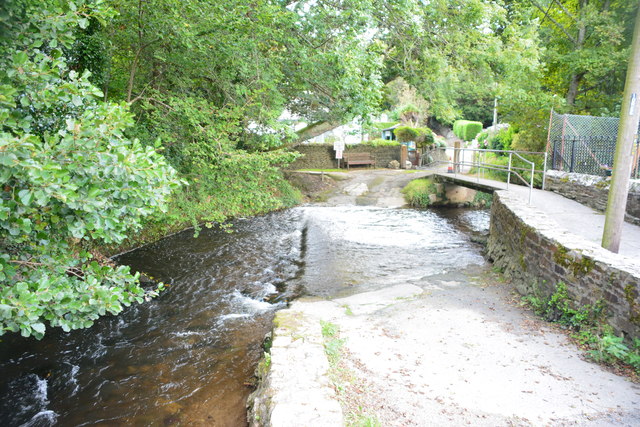
The Vale of Lanherne is a picturesque valley located in Cornwall, England. This beautiful valley is surrounded by rolling hills and lush greenery, creating a peaceful and serene atmosphere for visitors to enjoy. The valley is home to the Lanherne House, a historic manor house built in the 19th century, which adds to the charm of the area.

The Vale of Lanherne is also known for its stunning views and natural beauty, making it a popular destination for hikers and nature enthusiasts. Visitors can explore the many walking trails that wind through the valley, taking in the sights and sounds of the surrounding countryside.

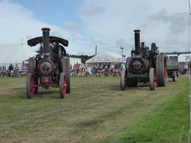
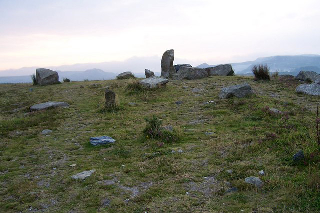
In addition to its natural beauty, the Vale of Lanherne is also steeped in history and culture. The area is dotted with ancient ruins and historic sites, providing a glimpse into Cornwall's rich past.

Overall, the Vale of Lanherne is a hidden gem in Cornwall, offering visitors a chance to escape the hustle and bustle of everyday life and immerse themselves in the beauty of the English countryside.

If you have any feedback on the listing, please let us know in the comments section below.

Vale of Lanherne Images

Images are sourced within 2km of 50.450484/-4.9924877 or Grid Reference SW8765. Thanks to Geograph Open Source API. All images are credited.

St Mawgan Ford This ford is found beside the school in St Mawgan.
St Mawgan Ford
This ford is found beside the school in St Mawgan.
Ford at Polgreen Manor This ford is found at Polgreen Manor.
Ford at Polgreen Manor
This ford is found at Polgreen Manor.
Bolingey Ford This impressive setted ford is found at Bolingey.
Bolingey Ford
This impressive setted ford is found at Bolingey.
Approaching the St Mawgan steam rally A local event that was well attended and big on tractors and cars. There were also a few steam engines although it was not mentioned in the major rally guides.
Approaching the St Mawgan steam rally
A local event that was well attended and big on tractors and cars. There were also a few steam engines although it was not mentioned in the major rally guides.
St Mawgan steam rally - JCB guard of honour The new machines are forming a tunnel for a much older model (c1968) to go through. It was followed by motorcycles. This was part of a well choreographed dancing diggers display.
St Mawgan steam rally - JCB guard of honour
The new machines are forming a tunnel for a much older model (c1968) to go through. It was followed by motorcycles. This was part of a well choreographed dancing diggers display.
St Mawgan steam rally - parade of steam engines In the frame we have AF 3517 a Burrell single crank compound, No. 2909 of 1907 and named Cornishman. This is a class D traction engine of 6 horsepower. On the right is DO 6883 a Ransomes, Sims & Jefferies Ltd traction engine, No. 38088 of 1927 and named Enterprise. This is a 8 horsepower compound weighing 14 tons.
St Mawgan steam rally - parade of steam engines
In the frame we have AF 3517 a Burrell single crank compound, No. 2909 of 1907 and named Cornishman. This is a class D traction engine of 6 horsepower. On the right is DO 6883 a Ransomes, Sims & Jefferies Ltd traction engine, No. 38088 of 1927 and named Enterprise. This is a 8 horsepower compound weighing 14 tons.
Old Wayside Cross - moved to St Mawgan churchyard Bodrean Cross, old head  Langdon MC No. 69 by the churchyard path, in parish of Mawgan in Pydar (Restormel District), beside path between gate and church, in churchyard, on grass among graves.

Grade II listed.
List Entry Number: 1144132 <span class="nowrap"><a title="https://historicengland.org.uk/listing/the-list/list-entry/1144132" rel="nofollow ugc noopener" href="https://historicengland.org.uk/listing/the-list/list-entry/1144132">Link</a><img style="margin-left:2px;" alt="External link" title="External link - shift click to open in new window" src="https://s1.geograph.org.uk/img/external.png" width="10" height="10"/></span>

Surveyed

Milestone Society National ID: CWRE_MAW01
Old Wayside Cross - moved to St Mawgan churchyard
Bodrean Cross, old head Langdon MC No. 69 by the churchyard path, in parish of Mawgan in Pydar (Restormel District), beside path between gate and church, in churchyard, on grass among graves. Grade II listed. List Entry Number: 1144132 LinkExternal link Surveyed Milestone Society National ID: CWRE_MAW01
Old Wayside Cross - moved to St Mawgan churchyard Mawgan Cross, old head and neck, Langdon MC No. 68 by the churchyard path, in parish of Mawgan in Pydar (Restormel District), in churchyard, between path and wall of church tower, among small memorials.

Grade II* listed. 
List Entry Number: 1144129 <span class="nowrap"><a title="https://historicengland.org.uk/listing/the-list/list-entry/1144129" rel="nofollow ugc noopener" href="https://historicengland.org.uk/listing/the-list/list-entry/1144129">Link</a><img style="margin-left:2px;" alt="External link" title="External link - shift click to open in new window" src="https://s1.geograph.org.uk/img/external.png" width="10" height="10"/></span>

Surveyed

Milestone Society National ID: CWRE_MAW02
Old Wayside Cross - moved to St Mawgan churchyard
Mawgan Cross, old head and neck, Langdon MC No. 68 by the churchyard path, in parish of Mawgan in Pydar (Restormel District), in churchyard, between path and wall of church tower, among small memorials. Grade II* listed. List Entry Number: 1144129 LinkExternal link Surveyed Milestone Society National ID: CWRE_MAW02
Direction Sign - Signpost by St Mawgan's churchyard Missing cone finial - Two arms and finial missing; by the UC road, in parish of Mawgan in Pydar (Restormel District), T-junction beside St Mawgan churchyard in village centre, set into wall of churchyard.

Grade II listed.
List Entry Number: 1144133 <span class="nowrap"><a title="https://historicengland.org.uk/listing/the-list/list-entry/1144133" rel="nofollow ugc noopener" href="https://historicengland.org.uk/listing/the-list/list-entry/1144133">Link</a><img style="margin-left:2px;" alt="External link" title="External link - shift click to open in new window" src="https://s1.geograph.org.uk/img/external.png" width="10" height="10"/></span>

Surveyed

Milestone Society National ID: CW_SW8765
Direction Sign - Signpost by St Mawgan's churchyard
Missing cone finial - Two arms and finial missing; by the UC road, in parish of Mawgan in Pydar (Restormel District), T-junction beside St Mawgan churchyard in village centre, set into wall of churchyard. Grade II listed. List Entry Number: 1144133 LinkExternal link Surveyed Milestone Society National ID: CW_SW8765
Direction Sign - Signpost north east of St Mawgan Pyramid spear finial - arm 3 broken and repaired. Double length arms; Cornwall CC iron spear by the UC road, in parish of Mawgan in Pydar (Restormel District), above St Mawgan, on verge at crossroads.

Cornwall & Scilly HER.
HER Number: MCO56654 <span class="nowrap"><a title="https://www.heritagegateway.org.uk/Gateway/Results_Single.aspx?uid=MCO56654&resourceID=1020" rel="nofollow ugc noopener" href="https://www.heritagegateway.org.uk/Gateway/Results_Single.aspx?uid=MCO56654&resourceID=1020">Link</a><img style="margin-left:2px;" alt="External link" title="External link - shift click to open in new window" src="https://s1.geograph.org.uk/img/external.png" width="10" height="10"/></span>

Surveyed

Milestone Society National ID: CW_SW8766
Direction Sign - Signpost north east of St Mawgan
Pyramid spear finial - arm 3 broken and repaired. Double length arms; Cornwall CC iron spear by the UC road, in parish of Mawgan in Pydar (Restormel District), above St Mawgan, on verge at crossroads. Cornwall & Scilly HER. HER Number: MCO56654 LinkExternal link Surveyed Milestone Society National ID: CW_SW8766
Flybe turboprop at Newquay airport A Bombardier Dash 8 aircraft in the Flybe fleet.
Flybe turboprop at Newquay airport
A Bombardier Dash 8 aircraft in the Flybe fleet.
Farmland, St Columb Major Fields to the east of Trembleath Farm.
Farmland, St Columb Major
Fields to the east of Trembleath Farm.
B3276 Turning For Newquay Airport
Historic aircraft at the Cornwall Aviation Heritage Centre
St Mawgan Ford This ford was photographed by my brother in law on a Poldark tour of Cornwall with Tim Ourr of Cornwall Tours. Many thanks to him for his contribution.
St Mawgan Ford
This ford was photographed by my brother in law on a Poldark tour of Cornwall with Tim Ourr of Cornwall Tours. Many thanks to him for his contribution.
Pasture, Mawgan-in-Pydar Beside a footpath to the west of the village making its way towards Trevarrian.
Pasture, Mawgan-in-Pydar
Beside a footpath to the west of the village making its way towards Trevarrian.
Byroad and pasture, Mawgan-in-Pydar The gated road makes its way towards the village from Polgreen.
Byroad and pasture, Mawgan-in-Pydar
The gated road makes its way towards the village from Polgreen.
Pasture, Mawgan-in-Pydar Looking down from the byroad approaching the village from Polgreen.
Pasture, Mawgan-in-Pydar
Looking down from the byroad approaching the village from Polgreen.
Show me another place!

Vale of Lanherne is located at Grid Ref: SW8765 (Lat: 50.450484, Lng: -4.9924877)

Unitary Authority: Cornwall

Police Authority: Devon and Cornwall

Also known as: Vale of Mawgan

What 3 Words

///presuming.conjured.state. Near St Columb Major, Cornwall

Related Wikis

Carloggas

Carloggas is a hamlet in the parish of Mawgan-in-Pydar, Cornwall, England.There is also a hamlet in the parish of St Stephen-in-Brannel called Carloggas...
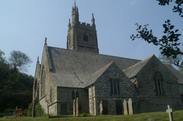
St Mawgan

St Mawgan or St Mawgan in Pydar (Cornish: Lanherne) is a village and civil parish in Cornwall, England, United Kingdom. The population of this parish at...

St Mawgan Monastery

St Mawgan Monastery was a monastery at St Mawgan in Cornwall, UK, originally of Celtic monks and after the Norman Conquest of Cluniac monks. == History... ==

Higher Tolcarne

Higher Tolcarne is a hamlet in Cornwall, England]. It is near St Mawgan; Tolcarne was one of the two Cornish manors of this name recorded in the Domesday...

Nearby Amenities

Located within 500m of 50.450484,-4.9924877
Bus Stop
Carloggas Close
Bus: yes
Naptan AtcoCode: 0800COC31610
Naptan Bearing: NE
Naptan CommonName: Carloggas Close
Naptan Indicator: Opp
Naptan NaptanCode: cordamjd
Naptan Street: Unclassified
Naptan Verified: no
Public Transport: platform
Source: naptan_import
Lat/Long: 50.4493935/-4.9976877
Parking
Lat/Long: 50.453644/-4.996486
Communication Radio: yes
Man Made: mast
Tower Type: communication
Lat/Long: 50.4481016/-4.9942945
Bus Stop
St Mawgan Junction
Bus: yes
Naptan AtcoCode: 0800COA15828
Naptan Bearing: SE
Naptan CommonName: St Mawgan Junction
Naptan Indicator: SE-bound
Naptan NaptanCode: corgjwpa
Naptan Verified: no
Public Transport: platform
Source: naptan;bing
Lat/Long: 50.448211/-4.9970627
Carloggas
Name Kw: Kruglogos
Place: village
Lat/Long: 50.4489057/-4.9989856
Post Box
Collection Times: Mo-Fr 09:00; Sa 07:00; Su off
Operator: Royal Mail
Operator Wikidata: Q638098
Post Box Design: 2010_pattern
Post Box Mounting: pier
Post Box Type: lamp
Ref: TR8 89D
Royal Cypher: EIIR
Royal Cypher Wikidata: Q33102113
Source: survey;aerial imagery
Lat/Long: 50.4492592/-4.9977293
The data included in this document is from www.openstreetmap.org. The data is made available under ODbL.

Have you been to Vale of Lanherne?

Leave your review of Vale of Lanherne below (or comments, questions and feedback).