Vale of Ewyas

Valley in Monmouthshire

Wales

Vale of Ewyas

On Hatterrall Ridge A group of Welsh Mountain Ponies by a pond alongside the Offa's Dike Path on Hatterrall Ridge.
On Hatterrall Ridge Credit: Ian Capper

The requested URL returned error: 429 Too Many Requests

If you have any feedback on the listing, please let us know in the comments section below.

Vale of Ewyas Images

Images are sourced within 2km of 51.96554/-3.0644137 or Grid Reference SO2630. Thanks to Geograph Open Source API. All images are credited.
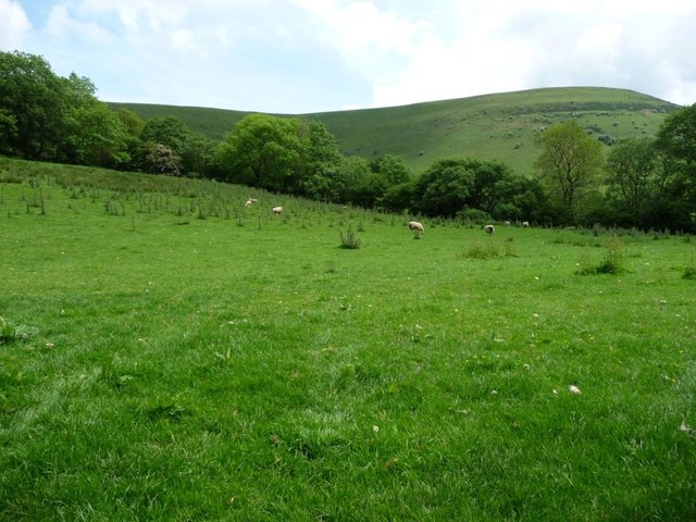
On Hatterrall Ridge A group of Welsh Mountain Ponies by a pond alongside the Offa's Dike Path on Hatterrall Ridge.
On Hatterrall Ridge
A group of Welsh Mountain Ponies by a pond alongside the Offa's Dike Path on Hatterrall Ridge.
On Hatterrall Ridge Moorland on Hatterrall Ridge, with a light dusting of snow in the background on the summit of Chwarel y Fan across the Vale of Ewyas.
On Hatterrall Ridge
Moorland on Hatterrall Ridge, with a light dusting of snow in the background on the summit of Chwarel y Fan across the Vale of Ewyas.
On Hatterrall Ridge Looking along the Offa's Dyke Path on Hatterrall Ridge above Llanthony.
On Hatterrall Ridge
Looking along the Offa's Dyke Path on Hatterrall Ridge above Llanthony.
On Hatterrall Ridge Heather moorland on Hatterrall Ridge above Llanthony.  The dip beyond is the Vale of Ewyas.
On Hatterrall Ridge
Heather moorland on Hatterrall Ridge above Llanthony. The dip beyond is the Vale of Ewyas.
Ordnance Survey Cut Mark This OS cut mark can be found on an outbuilding at New House. It marks a point 250.954m above mean sea level.
Ordnance Survey Cut Mark
This OS cut mark can be found on an outbuilding at New House. It marks a point 250.954m above mean sea level.
Old lane heading south to Llanthony Part of the route from Capel y Ffin to Llanthony on the east bank of Afon Honddu. Used as a bridleway and classed as an 'other route with public access'. Difficult to believe that, within living memory, someone drove a Jaguar down here, from Trevelog to Llanthony.
Old lane heading south to Llanthony
Part of the route from Capel y Ffin to Llanthony on the east bank of Afon Honddu. Used as a bridleway and classed as an 'other route with public access'. Difficult to believe that, within living memory, someone drove a Jaguar down here, from Trevelog to Llanthony.
Sychtre, Nant Honddu / Vale of Ewyas Nant Honddu is the Welsh name of this valley, Ewyas the Norman one. The farm is about 300 metres above sea level, the summit of the ridge above about 670 metres.
Sychtre, Nant Honddu / Vale of Ewyas
Nant Honddu is the Welsh name of this valley, Ewyas the Norman one. The farm is about 300 metres above sea level, the summit of the ridge above about 670 metres.
Nant Honddu / Vale of Ewyas Full of meadows, cattle and sheep.
Nant Honddu / Vale of Ewyas
Full of meadows, cattle and sheep.
Public footpath to Loxidge Climbing eastwards from Broadley Lane on the east bank of Afon Honddu.
Public footpath to Loxidge
Climbing eastwards from Broadley Lane on the east bank of Afon Honddu.
Road with a slice out of it, near Trevelog A small trench has been cut out of the lane, through which water runs down the hillside.
Road with a slice out of it, near Trevelog
A small trench has been cut out of the lane, through which water runs down the hillside.
Public footpath heading east to Trevelog Signposted at the lane, but with little sign of use. The distant barns are at Trevelog.
Public footpath heading east to Trevelog
Signposted at the lane, but with little sign of use. The distant barns are at Trevelog.
Sheep grazing south-east of Ty Hwnt On the eastern slopes of Nant Honddu / Vale of Ewyas.
Sheep grazing south-east of Ty Hwnt
On the eastern slopes of Nant Honddu / Vale of Ewyas.
Nant Honddu, near Ty Hwnt Looking westwards across the valley.
Nant Honddu, near Ty Hwnt
Looking westwards across the valley.
0.4km to the Hay Road Public footpath signpost on the west side of the lane near Ty Hwnt. The 'Hay Road' is the road up Nant Honddu from Llanthony to Hay on Wye.
0.4km to the Hay Road
Public footpath signpost on the west side of the lane near Ty Hwnt. The 'Hay Road' is the road up Nant Honddu from Llanthony to Hay on Wye.
Pompren dros Afon Honddu / Footbridge over Afon Honddu
Track from Dol Alice to Ty Cwm and Nant y Carnau Also a public footpath.
Track from Dol Alice to Ty Cwm and Nant y Carnau
Also a public footpath.
Ty Cwm and Nant y Carnau Houses at the edge of the valley floor, with a side valley behind. The appropriate names might be translated from the Welsh as Valley House and Cairn Valley.
Ty Cwm and Nant y Carnau
Houses at the edge of the valley floor, with a side valley behind. The appropriate names might be translated from the Welsh as Valley House and Cairn Valley.
Sheep grazing near Nant y Carnau With a fine view Nant Honddu [Vale of Ewyas] and Loxidge Tump.
Sheep grazing near Nant y Carnau
With a fine view Nant Honddu [Vale of Ewyas] and Loxidge Tump.
Show me another place!

Vale of Ewyas is located at Grid Ref: SO2630 (Lat: 51.96554, Lng: -3.0644137)

Unitary Authority: Monmouthshire

Police Authority: Gwent

Also known as: Cwm Euas

What 3 Words

///takeovers.them.vast. Near Llanveynoe, Herefordshire

Nearby Locations

Vale of Ewyas Cwm Euas

Related Wikis

Chwarel y Fan

Chwarel y Fan is a peak in the Black Mountains in south-eastern Wales. It is the highest rise on the long ridge which extends southeastwards from Rhos...

Capel-y-ffin

Capel-y-ffin (Welsh for 'chapel of the boundary') is a hamlet near the English-Welsh border, a couple of miles north of Llanthony in Powys, Wales. It lies...

Hatterrall Ridge

The Hatterrall Ridge (sometimes spelled Hatterall) is a ridge in the Black Mountains forming the border between Powys and Monmouthshire in Wales and Herefordshire...

Llanthony Abbey

Llanthony Abbey is a former Anglican monastic institution founded in 1869 by Joseph Leycester Lyne (Father Ignatius), in the Welsh village of Capel-y-ffin...

Related Videos

Family reunion 2018

Capel-y-ffin, Monmouthshire, Wales.

1997 08 04 AS North, Mid & South Wales Tour Day 8

The eighth day of South Dartmoor CTC's epic cycle tour of Wales started at Ystradfellte youth hostel (00:00). We rode to Brecon in ...

1997 08 05 AS North, Mid & South Wales Tour Day 9

The ninth day of South Dartmoor CTC's epic cycle tour of Wales started at Capel-y-Ffin youth hostel (00:00). We rode through ...

Nearby Amenities

Located within 500m of 51.96554,-3.0644137
Passing Place
Lat/Long: 51.9634084/-3.063151
Passing Place
Lat/Long: 51.9658663/-3.0668477
Passing Place
Lat/Long: 51.9666121/-3.0676015
Passing Place
Lat/Long: 51.9643108/-3.0640621
Barrier: stile
Bicycle: no
Foot: yes
Material: wood
Source: survey
Stile: stepover
Lat/Long: 51.9619643/-3.0639495
Barrier: stile
Bicycle: no
Foot: yes
Material: wood
Source: survey
Stile: stepover
Lat/Long: 51.9620764/-3.0641103
Barrier: stile
Bicycle: no
Foot: yes
Material: wood
Source: survey
Stile: stepover
Lat/Long: 51.9630095/-3.062787
Barrier: stile
Bicycle: no
Foot: yes
Material: wood
Stile: stepover
Lat/Long: 51.9617376/-3.0680245
Ford: yes
Source: survey
Lat/Long: 51.9632382/-3.0701903
The data included in this document is from www.openstreetmap.org. The data is made available under ODbL.

Have you been to Vale of Ewyas?

Leave your review of Vale of Ewyas below (or comments, questions and feedback).