Swansea Valley

Valley in Brecknockshire

Wales

Swansea Valley

Alltygrug Cemetery
Alltygrug Cemetery Credit: Adrian Dust

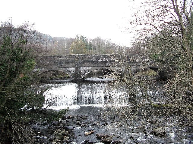
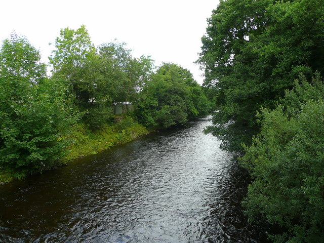
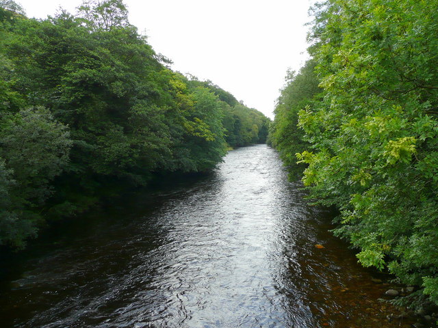
Swansea Valley, located in the county of Brecknockshire, Wales, is a picturesque and historically significant area known for its stunning natural beauty and rich industrial heritage. Situated in the southern part of the Brecon Beacons National Park, the valley stretches for approximately 20 miles, following the course of the River Tawe.

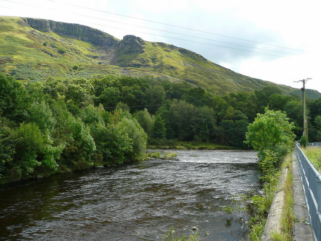
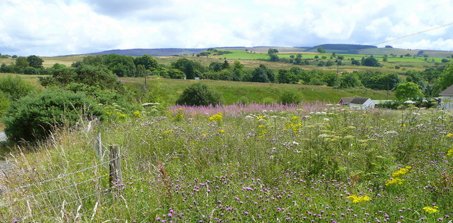
The landscape of Swansea Valley is characterized by rolling hills, deep wooded valleys, and the meandering river, offering breathtaking views and ample opportunities for outdoor activities such as hiking, cycling, and fishing. The area is renowned for its diverse flora and fauna, with several protected sites and nature reserves providing sanctuary to various species of plants and animals.

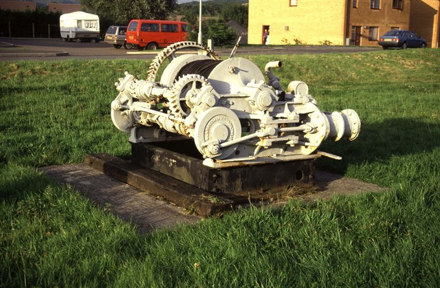
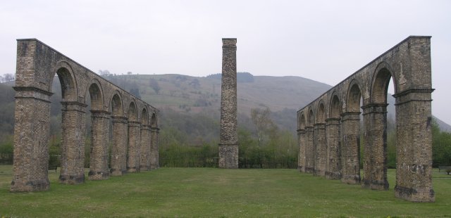
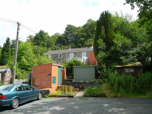
The valley has a long history of coal mining and ironworks, which played a significant role in the Industrial Revolution. The remnants of this industrial heritage can still be seen today in the form of abandoned mines, old railway lines, and historic buildings. The Swansea Valley Railway, once a vital transportation route, is now a popular tourist attraction, offering scenic rides through the valley.

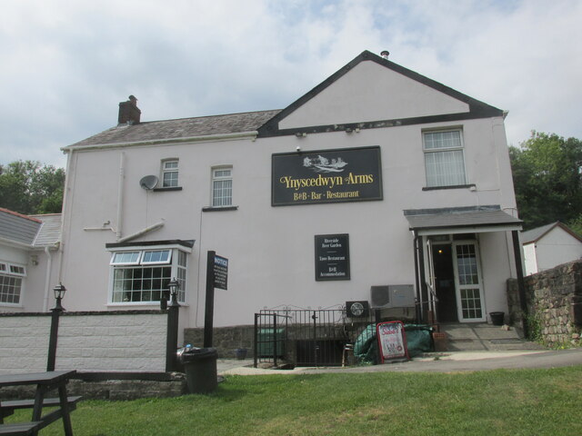
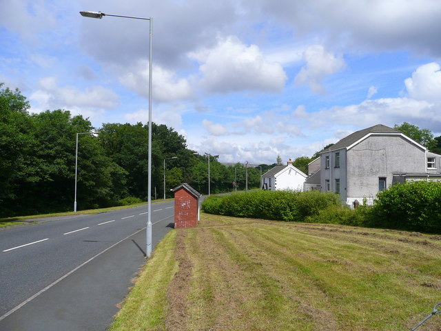
In addition to its natural and industrial attractions, Swansea Valley is home to several charming villages and towns, including Ystradgynlais, Pontardawe, and Clydach. These communities offer a range of amenities such as shops, restaurants, and accommodation options, making them ideal bases for exploring the valley and its surroundings.

Overall, Swansea Valley in Brecknockshire is a captivating destination that seamlessly combines natural beauty, cultural heritage, and recreational opportunities, attracting visitors from near and far.

If you have any feedback on the listing, please let us know in the comments section below.

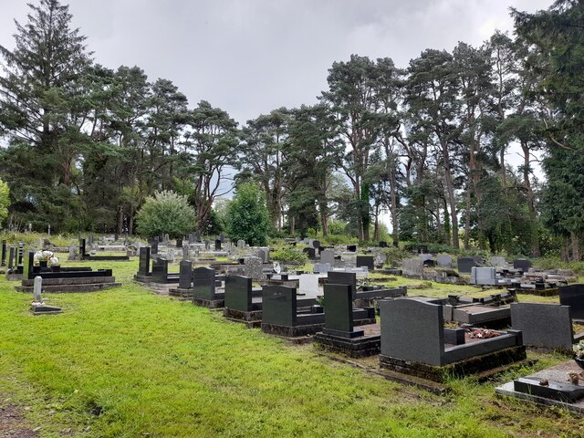
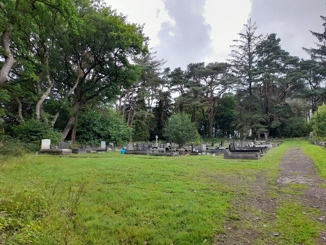
Swansea Valley Images

Images are sourced within 2km of 51.773181/-3.7620868 or Grid Reference SN7809. Thanks to Geograph Open Source API. All images are credited.

Alltygrug Cemetery
Alltygrug Cemetery
Alltygrug Cemetery
Alltygrug Cemetery
The Ynyscedwyn Arms Public house in Ystradgynlais.
The Ynyscedwyn Arms
Public house in Ystradgynlais.
Swansea Canal Aqueduct at Ystalyfera The Ystalyfera aqueduct is reputed to be the first built with waterproof mortar.  The canal has been turned into a cycletrack in Ystalyfera: see <a href="https://www.geograph.org.uk/photo/1482740">SN7709 : On Swansea Canal aqueduct over the Twrch at Gurnos</a>.  The structure was recently renovated at great expense.
The Swansea Canal was constructed by the Swansea Canal Navigation Company between 1794 and 1798, measuring some 16 miles long and running from Swansea to Hen Neuadd Abercraf.
Swansea Canal Aqueduct at Ystalyfera
The Ystalyfera aqueduct is reputed to be the first built with waterproof mortar. The canal has been turned into a cycletrack in Ystalyfera: see SN7709 : On Swansea Canal aqueduct over the Twrch at Gurnos. The structure was recently renovated at great expense. The Swansea Canal was constructed by the Swansea Canal Navigation Company between 1794 and 1798, measuring some 16 miles long and running from Swansea to Hen Neuadd Abercraf.
Steam winch at Ynyscedwyn ironworks The ironworks is represented by preserved arcaded walls and a chimney. This little winch is preserved alongside.
Steam winch at Ynyscedwyn ironworks
The ironworks is represented by preserved arcaded walls and a chimney. This little winch is preserved alongside.
Ynyscedwyn iron works With the many coal mines in the surrounding area, it was only natural for the heavy industry of metal working to go hand in hand.  Here we see the remains of the victorian Ynyscedwyn iron works, which made use of the revolutionary hot blast process.

The arches and chimney stack are all that remain today of a large factory that sprawled across this area.
Ynyscedwyn iron works
With the many coal mines in the surrounding area, it was only natural for the heavy industry of metal working to go hand in hand. Here we see the remains of the victorian Ynyscedwyn iron works, which made use of the revolutionary hot blast process. The arches and chimney stack are all that remain today of a large factory that sprawled across this area.
Wonky Roundabout Built at odd angles.
Wonky Roundabout
Built at odd angles.
Confluence of the Twrch with the Tawe Looking south towards the hillside of Y Darren Widdon.
Confluence of the Twrch with the Tawe
Looking south towards the hillside of Y Darren Widdon.
Flower-rich countryside Undeveloped land at the north end of Rhos Common near Blaen-y-gors.
Flower-rich countryside
Undeveloped land at the north end of Rhos Common near Blaen-y-gors.
Road to Ystradgynlais Here the road is aligned along the track bed of the former Swansea Vale and Neath and Brecon Junction Railway south of the town.
Road to Ystradgynlais
Here the road is aligned along the track bed of the former Swansea Vale and Neath and Brecon Junction Railway south of the town.
Penrhiwvarteg Scout Hostel, Ystradgynlais The 1st Swansea Valley Oak Scouts Group owns and runs this hostel, see; <span class="nowrap"><a title="http://hsmt.info/Penrhiwvarteg%20.pdf" rel="nofollow ugc noopener" href="http://hsmt.info/Penrhiwvarteg%20.pdf">Link</a><img style="margin-left:2px;" alt="External link" title="External link - shift click to open in new window" src="https://s1.geograph.org.uk/img/external.png" width="10" height="10"/></span>
Penrhiwvarteg Scout Hostel, Ystradgynlais
The 1st Swansea Valley Oak Scouts Group owns and runs this hostel, see; LinkExternal link
Track to access land The open land on the watershed between the Tawe and the Dulais river systems is the Twyn Eithinog. 
In the foreground is Rosebay Willowherb, Chamerion angustifolium.
Track to access land
The open land on the watershed between the Tawe and the Dulais river systems is the Twyn Eithinog. In the foreground is Rosebay Willowherb, Chamerion angustifolium.
View to Twyn Eithinog Looking north-east from the Rhos road.
View to Twyn Eithinog
Looking north-east from the Rhos road.
Electricity Sub-station By the Neath road, near Ystradgynlais
Electricity Sub-station
By the Neath road, near Ystradgynlais
Railway Terrace The railway is no more but these cottages still indicate the Swansea Valley Line that is no more.
Railway Terrace
The railway is no more but these cottages still indicate the Swansea Valley Line that is no more.
River Tawe - upstream View north-east from Glan-rhyd Bridge
River Tawe - upstream
View north-east from Glan-rhyd Bridge
Electrical equipment; blue, yellow, red. The significance of the three coloured caps is to identify the phase of the voltages present on the equipment. Electricity on the grid is distributed as three phases. The colours red, yellow and blue identify the three different phases. (New cable colours are now brown, grey and black.)
Thanks to another member for this explanation.
Electrical equipment; blue, yellow, red.
The significance of the three coloured caps is to identify the phase of the voltages present on the equipment. Electricity on the grid is distributed as three phases. The colours red, yellow and blue identify the three different phases. (New cable colours are now brown, grey and black.) Thanks to another member for this explanation.
River Tawe - downstream View south-west from the Glan-rhyd Bridge.
River Tawe - downstream
View south-west from the Glan-rhyd Bridge.
Show me another place!

Swansea Valley is located at Grid Ref: SN7809 (Lat: 51.773181, Lng: -3.7620868)

Unitary Authority: Powys

Police Authority: Dyfed Powys

Also known as: Cwm Tawe

What 3 Words

///novel.librarian.lurching. Near Ystradgynlais, Powys

Related Wikis

Ynyscedwyn Ironworks

Ynyscedwyn Ironworks is an industrial complex located in Ystradgynlais, near Swansea, Wales. Smelting was first established here in seventeenth century...

Ystradgynlais Community Hospital

Ystradgynlais Community Hospital (Welsh: Ysbyty Cymunedol Ystradgynlais) is a health facility in Glanrhyd Road, Ystradgynlais, Powys, Wales. It is managed...

Ystradgynlais railway station

Ystradgynlais railway station served the town of Ystradgynlais in the traditional county of Breconshire, Wales. Opened in 1869 by the Swansea Vale and...

Ystradgynlais

Ystradgynlais (Welsh: [ˌəstradˈɡənlais], English: ) is a town on the River Tawe in southwest Powys, Wales. It is the second-largest town in Powys and...

Nearby Amenities

Located within 500m of 51.773181,-3.7620868
Mini Roundabout
Lat/Long: 51.7737744/-3.761333
Mini Roundabout
Lat/Long: 51.7708923/-3.7648307
Bus Stop
Naptan AtcoCode: 5610AWE90406
Naptan NaptanCode: powjgjp
Lat/Long: 51.7741143/-3.7610571
Heronstone Holiday Retreat
Tourism: chalet
Lat/Long: 51.771283/-3.756345
Clwb Rygbi Ystradgynlais
Addr City: Ystradgynlais
Addr Postcode: SA9 1BH
Addr Street: Heol Ynyscedwyn
Club: sport
Name Cy: Clwb Rygbi Ystradgynlais
Name En: Ystradgynlais RFC
Phone: +44 1639 842 446
Rugby: union
Sport: rugby
Website: https://ystradgynlais.clwbrygbi.cymru/
Wikidata: Q8059808
Wikipedia: en:Ystradgynlais RFC
Lat/Long: 51.7734543/-3.7626658
Pub
Café Chameleon
Lat/Long: 51.7735205/-3.7602811
Waterway: weir
Lat/Long: 51.7723348/-3.7613011
Post Box
Collection Times: Mo-Fr 09:00; Sa 07:00
Post Box Type: lamp
Ref: SA9 616D
Royal Cypher: EIIR
Royal Cypher Wikidata: Q33102113
Lat/Long: 51.7752552/-3.7613165
Barrier: kissing_gate
Foot: yes
Lat/Long: 51.7706541/-3.7604688
Barrier: kissing_gate
Foot: yes
Lat/Long: 51.7706809/-3.7603927
Board Type: history
Description: Abercraf & Coelbren Mining History
Information: board
Tourism: information
Lat/Long: 51.7702167/-3.7608349
Board Type: history
Description: Lower Cwmtwrch Mining History
Information: board
Tourism: information
Lat/Long: 51.7702713/-3.7605675
Board Type: history
Description: Upper Cwmtwrch Mining History
Information: board
Tourism: information
Lat/Long: 51.7702767/-3.7604381
Board Type: history
Description: Penrhos Mining History
Information: board
Tourism: information
Lat/Long: 51.770294/-3.7609643
Board Type: history
Description: Ystradgynlais West Mining History
Information: board
Tourism: information
Lat/Long: 51.7704513/-3.7609893
Board Type: history
Description: Ystradgynlais East Mining History
Information: board
Tourism: information
Lat/Long: 51.7705196/-3.7608981
Historic: memorial
Memorial: plaque
Lat/Long: 51.7705796/-3.7605969
Post Box
Collection Times: Mo-Fr 09:00; Sa 07:00
Post Box Type: lamp
Ref: SA9 619D
Royal Cypher: EIIR
Royal Cypher Wikidata: Q33102113
Lat/Long: 51.7738301/-3.7641553
Noexit: yes
Lat/Long: 51.775171/-3.7599903
Barrier: yes
Lat/Long: 51.7737097/-3.7663716
Direction: SSE
Generator Method: photovoltaic
Generator Output Electricity: yes
Generator Solar Modules: 12
Generator Source: solar
Generator Type: solar_photovoltaic_panel
Location: roof
Power: generator
Lat/Long: 51.7750698/-3.7573678
Direction: 145
Generator Method: photovoltaic
Generator Output Electricity: yes
Generator Solar Modules: 9
Generator Source: solar
Generator Type: solar_photovoltaic_panel
Location: roof
Power: generator
Lat/Long: 51.7772467/-3.7614414
Direction: SSE
Generator Method: photovoltaic
Generator Output Electricity: yes
Generator Solar Modules: 14
Generator Source: solar
Generator Type: solar_photovoltaic_panel
Location: roof
Power: generator
Lat/Long: 51.7729653/-3.7621817
Historic: memorial
Memorial: war_memorial
Lat/Long: 51.7761995/-3.7609421
Direction: 235
Generator Method: photovoltaic
Generator Output Electricity: yes
Generator Solar Modules: 5
Generator Source: solar
Generator Type: solar_photovoltaic_panel
Location: roof
Power: generator
Lat/Long: 51.7772542/-3.7613837
Direction: 195
Generator Method: photovoltaic
Generator Output Electricity: yes
Generator Solar Modules: 12
Generator Source: solar
Generator Type: solar_photovoltaic_panel
Location: roof
Power: generator
Lat/Long: 51.7740744/-3.7619131
Direction: WSW
Generator Method: photovoltaic
Generator Output Electricity: yes
Generator Solar Modules: 17
Generator Source: solar
Generator Type: solar_photovoltaic_panel
Location: roof
Power: generator
Lat/Long: 51.7753063/-3.7614696
Direction: 275
Generator Method: photovoltaic
Generator Output Electricity: yes
Generator Solar Modules: 7
Generator Source: solar
Generator Type: solar_photovoltaic_panel
Location: roof
Power: generator
Lat/Long: 51.7745686/-3.7612697
Direction: E
Generator Method: photovoltaic
Generator Output Electricity: yes
Generator Solar Modules: 5
Generator Source: solar
Generator Type: solar_photovoltaic_panel
Location: roof
Power: generator
Lat/Long: 51.7713328/-3.7605254
Direction: W
Generator Method: photovoltaic
Generator Output Electricity: yes
Generator Solar Modules: 5
Generator Source: solar
Generator Type: solar_photovoltaic_panel
Location: roof
Power: generator
Lat/Long: 51.7713288/-3.7605657
Bus Stop
Glanrhyd, Station Road
Bus: yes
Public Transport: platform
Lat/Long: 51.7728023/-3.7549941
Bus Stop
Glanrhyd, Station Road
Bus: yes
Public Transport: platform
Lat/Long: 51.7727919/-3.7551449
The data included in this document is from www.openstreetmap.org. The data is made available under ODbL.

Have you been to Swansea Valley?

Leave your review of Swansea Valley below (or comments, questions and feedback).