Waterden Bottom

Valley in Norfolk King's Lynn and West Norfolk

England

Waterden Bottom

Old Boundary Marker by All Saints Waterden Church Estate Boundary Marker at Waterden, where the track to All Saints church meets the boundary of the churchyard. South Creake parish. Inscribed BOUNDARY on its top, GLEBE on the left face and L L on the right face. The stone marks the boundary of clergy land and the land of the Earl of Leicester at Holkham Hall. L L may stand for Lord Leicester. See also <a title="https://www.geograph.org.uk/photo/2048222" href="https://www.geograph.org.uk/photo/2048222">Link</a>.

Milestone Society National ID: NO_SCREA01em
Old Boundary Marker by All Saints Waterden Credit: C Haines

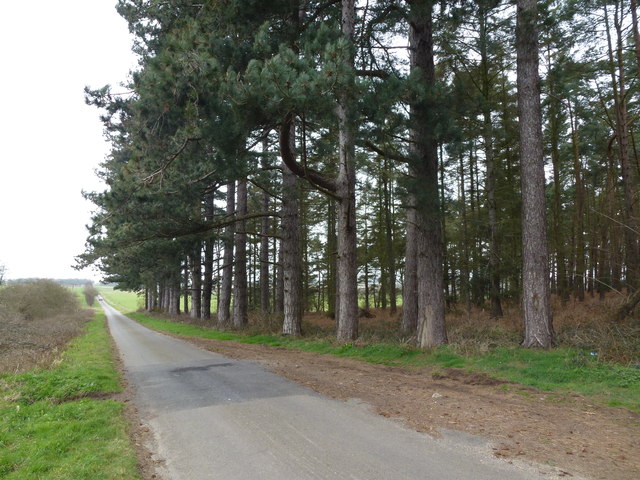
Waterden Bottom is a picturesque valley located in the county of Norfolk, England. Situated near the village of Blakeney, it is nestled within the Norfolk Coast Area of Outstanding Natural Beauty. The valley is known for its stunning natural landscapes and diverse wildlife, making it a popular destination for nature enthusiasts and hikers alike.

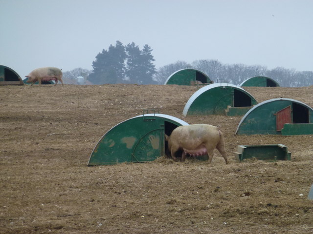
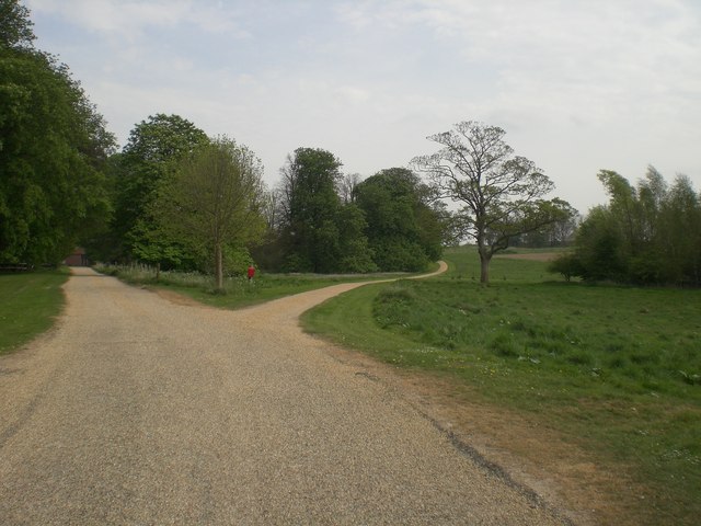
The valley is characterized by its gentle sloping hills, lush green meadows, and meandering streams. The rich biodiversity of the area is evident in the abundance of flora and fauna that call Waterden Bottom home. Visitors can expect to encounter various bird species, such as barn owls and lapwings, as well as small mammals like hares and voles.

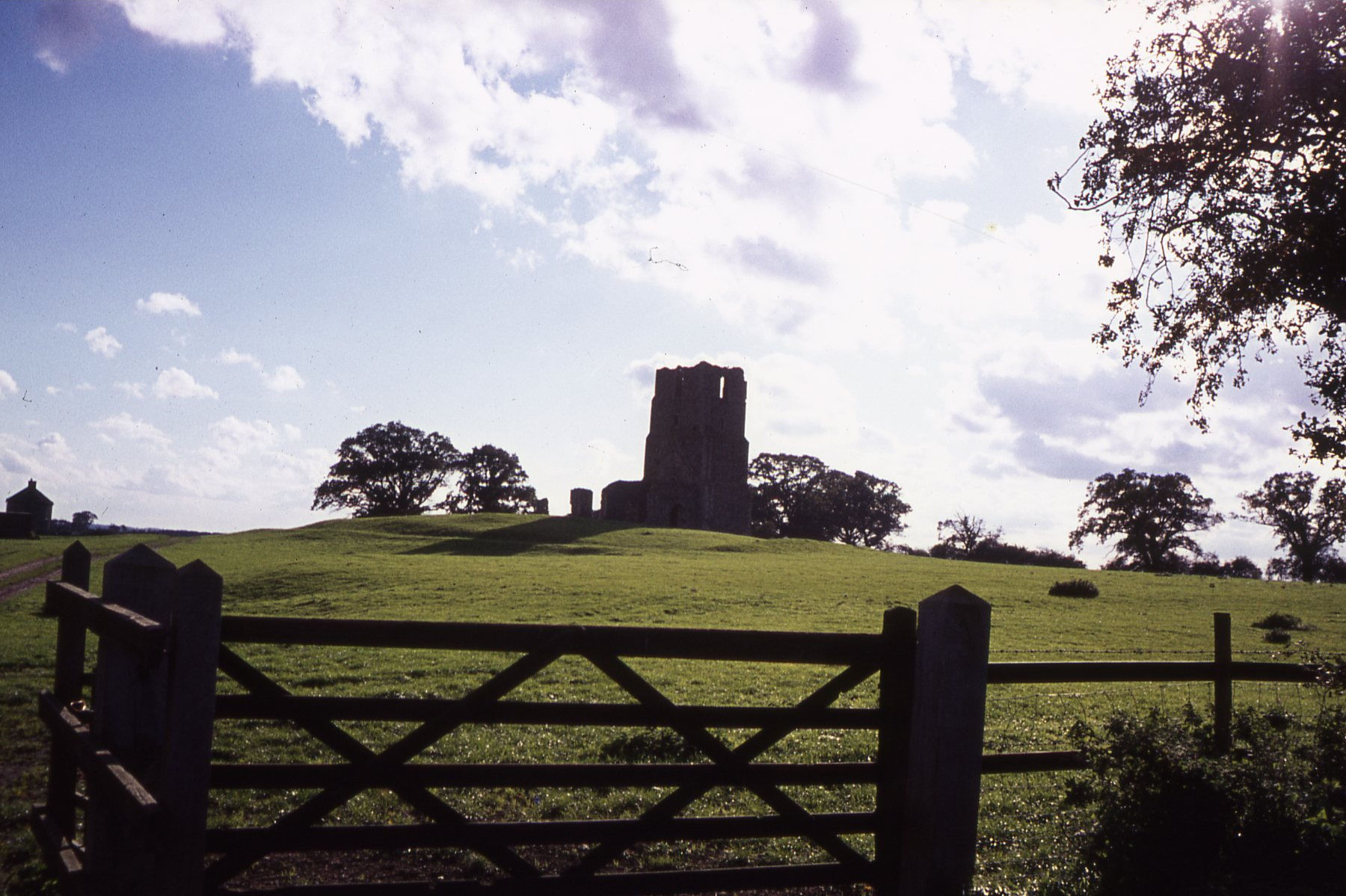
Waterden Bottom is also renowned for its ancient history. The valley is home to several Bronze Age burial mounds, known as barrows, which provide insights into the area's past. These archaeological sites are of great historical significance and offer a glimpse into the lives of the people who once inhabited the region.

For those seeking outdoor activities, the valley offers numerous walking trails, allowing visitors to explore the natural beauty at their own pace. The peaceful and serene atmosphere of Waterden Bottom provides an ideal setting for a leisurely stroll or a picnic amidst the beautiful surroundings.

In conclusion, Waterden Bottom is a captivating valley in Norfolk, offering visitors a chance to immerse themselves in the region's natural beauty and rich history. Whether it's admiring the diverse wildlife, exploring ancient burial mounds, or simply enjoying a peaceful walk, this enchanting valley has something to offer for everyone.

If you have any feedback on the listing, please let us know in the comments section below.

Waterden Bottom Images

Images are sourced within 2km of 52.888146/0.79380458 or Grid Reference TF8835. Thanks to Geograph Open Source API. All images are credited.

Old Boundary Marker by All Saints Waterden Church Estate Boundary Marker at Waterden, where the track to All Saints church meets the boundary of the churchyard. South Creake parish. Inscribed BOUNDARY on its top, GLEBE on the left face and L L on the right face. The stone marks the boundary of clergy land and the land of the Earl of Leicester at Holkham Hall. L L may stand for Lord Leicester. See also <a title="https://www.geograph.org.uk/photo/2048222" href="https://www.geograph.org.uk/photo/2048222">Link</a>.

Milestone Society National ID: NO_SCREA01em
Old Boundary Marker by All Saints Waterden
Church Estate Boundary Marker at Waterden, where the track to All Saints church meets the boundary of the churchyard. South Creake parish. Inscribed BOUNDARY on its top, GLEBE on the left face and L L on the right face. The stone marks the boundary of clergy land and the land of the Earl of Leicester at Holkham Hall. L L may stand for Lord Leicester. See also Link. Milestone Society National ID: NO_SCREA01em
Ford on the River Burn, South Creake This ford is one of four in the village of South Creake just off the B1355 on the River Burn.
Ford on the River Burn, South Creake
This ford is one of four in the village of South Creake just off the B1355 on the River Burn.
The long and winding road Looking down Shepherd's Hill to the east of north Creake
The long and winding road
Looking down Shepherd's Hill to the east of north Creake
Tall pine trees in Norfolk Country lane east of North Creake
Tall pine trees in Norfolk
Country lane east of North Creake
Restricted byway to Whin Close Villa, South Creake
Suckling sow - Free range pigs near South Creake Looking towards Hill Brake Pit from Roman Road
Suckling sow - Free range pigs near South Creake
Looking towards Hill Brake Pit from Roman Road
Mooning pig Free range pig farming near South Creake in Norfolk
Mooning pig
Free range pig farming near South Creake in Norfolk
All Saints' Church in Waterden - view from NW A tiny church in a tiny hamlet with over a thousand years of history
<span class="nowrap"><a title="http://www.norfolkchurches.co.uk/waterden/waterden.htm" rel="nofollow ugc noopener" href="http://www.norfolkchurches.co.uk/waterden/waterden.htm">Link</a><img style="margin-left:2px;" alt="External link" title="External link - shift click to open in new window" src="https://s1.geograph.org.uk/img/external.png" width="10" height="10"/></span>
All Saints' Church in Waterden - view from NW
A tiny church in a tiny hamlet with over a thousand years of history LinkExternal link
All Saints' Church in Waterden - view from east A tiny church in a tiny Norfolk hamlet with over 1,000 years of history
<span class="nowrap"><a title="http://www.norfolkchurches.co.uk/waterden/waterden.htm" rel="nofollow ugc noopener" href="http://www.norfolkchurches.co.uk/waterden/waterden.htm">Link</a><img style="margin-left:2px;" alt="External link" title="External link - shift click to open in new window" src="https://s1.geograph.org.uk/img/external.png" width="10" height="10"/></span>
All Saints' Church in Waterden - view from east
A tiny church in a tiny Norfolk hamlet with over 1,000 years of history LinkExternal link
All Saints' Church in Waterden - view from SW A tiny Norfolk church in a tiny hamlet with over 1,000 years of history
<span class="nowrap"><a title="http://www.norfolkchurches.co.uk/waterden/waterden.htm" rel="nofollow ugc noopener" href="http://www.norfolkchurches.co.uk/waterden/waterden.htm">Link</a><img style="margin-left:2px;" alt="External link" title="External link - shift click to open in new window" src="https://s1.geograph.org.uk/img/external.png" width="10" height="10"/></span>
All Saints' Church in Waterden - view from SW
A tiny Norfolk church in a tiny hamlet with over 1,000 years of history LinkExternal link
All Saints' Church in Waterden - view from SE A tiny church in a tiny Norfolk hamlet with over 1,000 years of history
<span class="nowrap"><a title="http://www.norfolkchurches.co.uk/waterden/waterden.htm" rel="nofollow ugc noopener" href="http://www.norfolkchurches.co.uk/waterden/waterden.htm">Link</a><img style="margin-left:2px;" alt="External link" title="External link - shift click to open in new window" src="https://s1.geograph.org.uk/img/external.png" width="10" height="10"/></span>
All Saints' Church in Waterden - view from SE
A tiny church in a tiny Norfolk hamlet with over 1,000 years of history LinkExternal link
Path to All Saints' Church in Waterden, Norfolk
Country lane near Waterden Farm, Norfolk
Shooting country Between Waterden Farm and North Barsham Farm in Norfolk. A game bird feeder and rough headland give the birds food and cover until they are shot!
Shooting country
Between Waterden Farm and North Barsham Farm in Norfolk. A game bird feeder and rough headland give the birds food and cover until they are shot!
I shot a pheasant (with a camera) Pheasant and feeder in rural Norfolk, between Waterden and North Barsham Farm
I shot a pheasant (with a camera)
Pheasant and feeder in rural Norfolk, between Waterden and North Barsham Farm
Well protected public footpath sign Old tyres protecting a footpath signpost near a field entrance between Waterden and North Barsham Farm in mid Norfolk
Well protected public footpath sign
Old tyres protecting a footpath signpost near a field entrance between Waterden and North Barsham Farm in mid Norfolk
Muddy track to Creake Buildings south of New Holkham The pheasant on the right was hopping about on one leg and could not fly, will that make him a sitting duck when the shooting season starts?
Muddy track to Creake Buildings south of New Holkham
The pheasant on the right was hopping about on one leg and could not fly, will that make him a sitting duck when the shooting season starts?
Road to rural industry near South Creake This pitted uphill track leads to a large industrial area
Road to rural industry near South Creake
This pitted uphill track leads to a large industrial area
Show me another place!

Waterden Bottom is located at Grid Ref: TF8835 (Lat: 52.888146, Lng: 0.79380458)

Administrative County: Norfolk

District: King's Lynn and West Norfolk

Police Authority: Norfolk

What 3 Words

///reveal.worms.colonies. Near Fakenham, Norfolk

Nearby Locations

Waterden Bottom

Related Wikis

Waterden medieval settlement

Waterden medieval settlement is a deserted medieval village in Norfolk, England, about 3 miles (4.8 km) west of Walsingham. It is a Scheduled Monument...

South Creake

South Creake is a village and civil parish in north west Norfolk, England. The village lies 1+1⁄2 miles (2.4 km) south of its twin village of North Creake...

Egmere medieval settlement

Egmere medieval settlement is a deserted medieval village in Norfolk, England, about 2.5 miles (4.0 km) west of Walsingham. It is a Scheduled Monument...

Quarles, Norfolk

Quarles is a hamlet and former civil parish, now in the civil parish of Holkham, in the North Norfolk district, in the county of Norfolk, England. The...

Nearby Amenities

Located within 500m of 52.888146,0.79380458
Fixme: incomplete
Lat/Long: 52.8859383/0.7980377
Power: pole
Lat/Long: 52.888153/0.8008513
Power: pole
Transformer: distribution
Lat/Long: 52.8870137/0.7996416
Entrance: main
Lat/Long: 52.8867598/0.7998031
Entrance: yes
Lat/Long: 52.8866946/0.7997372
Power: pole
Lat/Long: 52.8857545/0.7876508
Power: pole
Lat/Long: 52.8858362/0.7884581
Power: pole
Lat/Long: 52.8858791/0.7893205
Power: pole
Lat/Long: 52.8859058/0.7901399
Power: pole
Lat/Long: 52.8859228/0.7909821
Power: pole
Lat/Long: 52.8859762/0.7918404
Power: pole
Lat/Long: 52.8860531/0.7927376
Power: pole
Lat/Long: 52.8860483/0.7936227
Power: pole
Lat/Long: 52.8860345/0.7944328
Power: pole
Lat/Long: 52.8860216/0.7952254
Power: pole
Lat/Long: 52.8857828/0.7969339
Power: pole
Lat/Long: 52.8857683/0.7977976
Power: pole
Lat/Long: 52.8847931/0.7955553
Power: pole
Lat/Long: 52.8855409/0.7942517
Power: pole
Lat/Long: 52.8862773/0.7929455
Power: pole
Lat/Long: 52.8870897/0.7921435
Power: pole
Lat/Long: 52.8888635/0.7904524
Power: pole
Lat/Long: 52.8898458/0.7895082
Power: pole
Lat/Long: 52.890854/0.7885721
Power: pole
Lat/Long: 52.8838083/0.7951006
The data included in this document is from www.openstreetmap.org. The data is made available under ODbL.

Have you been to Waterden Bottom?

Leave your review of Waterden Bottom below (or comments, questions and feedback).