Dane Bottom

Valley in Cambridgeshire East Cambridgeshire

England

Dane Bottom

Bridle path and farm track This bridle way leads from Woodditton to the B1061 between Dullingham and Newmarket. A sign on the gate behind the camera insists that the land is private and asks users to stick to the public right of way.
Bridle path and farm track Credit: John Sutton

Dane Bottom, located in Cambridgeshire, England, is a picturesque valley renowned for its natural beauty. Situated in the southern part of the county, the area is characterized by rolling hills, lush green meadows, and charming streams that flow through the landscape. The valley is named after the Dane River, which meanders gracefully through the bottom, adding to the serenity of the surroundings.

The region is rich in biodiversity, with diverse flora and fauna found in abundance. The valley's fertile soil supports a variety of plant life, including wildflowers, ancient woodlands, and hedgerows. It serves as a vital habitat for several species of birds, mammals, and insects, making it a popular destination for nature enthusiasts and birdwatchers.

The peaceful ambiance of Dane Bottom attracts visitors seeking tranquility and a break from the bustling cities. It offers numerous recreational activities such as hiking, cycling, and picnicking, making it a perfect spot for outdoor enthusiasts. The well-maintained trails provide opportunities for exploring the valley's stunning scenery, while the river offers options for fishing and boating.

Dane Bottom is also known for its historical significance. The area has witnessed human settlement for centuries, and traces of ancient civilizations can be found in the form of archaeological sites and medieval ruins. These historic remnants add an extra layer of charm to the valley, attracting history buffs and archaeology enthusiasts.

Overall, Dane Bottom, Cambridgeshire, is a haven of natural beauty, offering a tranquil escape from the urbanized world. Its stunning landscapes, abundant wildlife, and rich history make it a must-visit destination for those seeking to immerse themselves in the wonders of the English countryside.

If you have any feedback on the listing, please let us know in the comments section below.
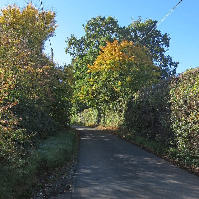
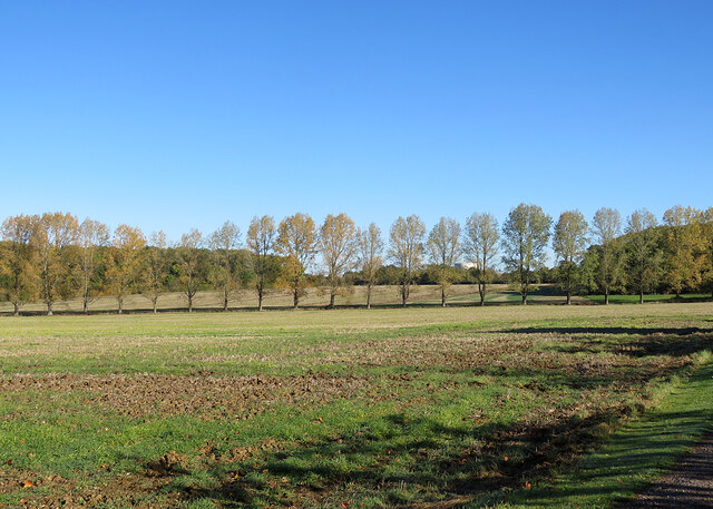
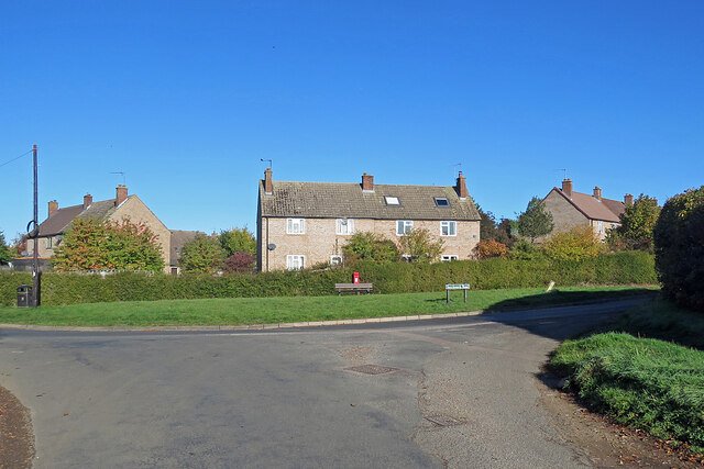
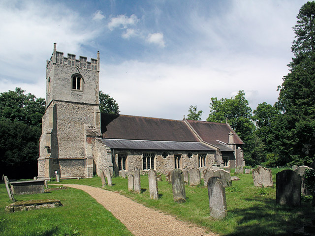
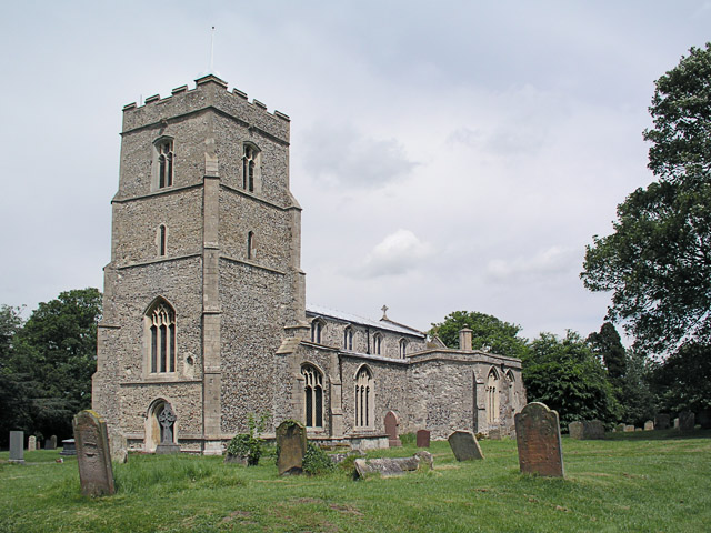
Dane Bottom Images

Images are sourced within 2km of 52.205719/0.41258969 or Grid Reference TL6459. Thanks to Geograph Open Source API. All images are credited.

Bridle path and farm track This bridle way leads from Woodditton to the B1061 between Dullingham and Newmarket. A sign on the gate behind the camera insists that the land is private and asks users to stick to the public right of way.
Bridle path and farm track
This bridle way leads from Woodditton to the B1061 between Dullingham and Newmarket. A sign on the gate behind the camera insists that the land is private and asks users to stick to the public right of way.
Two miles to Newmarket Looking towards Newmarket on Woodditton Road. The crossroad is staggered: Stetchworth and Dullingham to the left, Cheveley to the right (out of the picture).
Two miles to Newmarket
Looking towards Newmarket on Woodditton Road. The crossroad is staggered: Stetchworth and Dullingham to the left, Cheveley to the right (out of the picture).
Light, shade and changing colours A cloudless October morning in the horse-racing country south of Newmarket. This is the single-track dead-end lane to Dullingham Ley and Widgham Green, serving a scattering of houses and a number of stud farms.
Light, shade and changing colours
A cloudless October morning in the horse-racing country south of Newmarket. This is the single-track dead-end lane to Dullingham Ley and Widgham Green, serving a scattering of houses and a number of stud farms.
A fine autumn morning in East Cambridgeshire The road from Woodditton to Stetchworth.
A fine autumn morning in East Cambridgeshire
The road from Woodditton to Stetchworth.
Stetchworth Ley: barns at Ley Farm A mild and cloudless morning in October.
Stetchworth Ley: barns at Ley Farm
A mild and cloudless morning in October.
A line of trees near Stetchworth Ley The trees crossing the picture line a drain. Ditton Green water tower shows in the distance beyond them.
A line of trees near Stetchworth Ley
The trees crossing the picture line a drain. Ditton Green water tower shows in the distance beyond them.
Stetchworth Ley: footpath to Ditton Green The shadowed north-western edge of Great Chitlings Wood is on the right and Little Chitlings Wood in the distance in the centre of the picture.
Stetchworth Ley: footpath to Ditton Green
The shadowed north-western edge of Great Chitlings Wood is on the right and Little Chitlings Wood in the distance in the centre of the picture.
Autumn in East Cambridgeshire The road from Stetchworth Park Farm to Stetchworth on a mild and cloudless October morning.
Autumn in East Cambridgeshire
The road from Stetchworth Park Farm to Stetchworth on a mild and cloudless October morning.
Stetchworth Ley: Round House On the edge of Great Chitlings Wood.
Stetchworth Ley: Round House
On the edge of Great Chitlings Wood.
Towards Charcoals Wood In the gentle hills of East Cambridgeshire on a bright October morning.
Towards Charcoals Wood
In the gentle hills of East Cambridgeshire on a bright October morning.
Signpost near Lower Ley Farm This is where the lane to Stetchworth Ley and Stetchworth Park Farm (no through road) leaves the road from Stetchworth to Woodditton.
Signpost near Lower Ley Farm
This is where the lane to Stetchworth Ley and Stetchworth Park Farm (no through road) leaves the road from Stetchworth to Woodditton.
Stetchworth: flint and pantiles A row of cottages whose Gothick ground-floor window and door reveals suggest they might have been built early in the 19th century.
Stetchworth: flint and pantiles
A row of cottages whose Gothick ground-floor window and door reveals suggest they might have been built early in the 19th century.
Stetchworth: The Marquis of Granby A 19th-century brick pub at the corner of High Street (ahead) and Tea Kettle Lane the road to Dullingham.
Stetchworth: The Marquis of Granby
A 19th-century brick pub at the corner of High Street (ahead) and Tea Kettle Lane the road to Dullingham.
Entering Stetchworth Bright sunlight and deep shadows on a fine October morning. This is where the road from Dullingham meets Mill Lane (left) and Tea Kettle Lane (ahead).
Entering Stetchworth
Bright sunlight and deep shadows on a fine October morning. This is where the road from Dullingham meets Mill Lane (left) and Tea Kettle Lane (ahead).
Down Stetchworth Road Council-built houses between Stetchworth and Dullingham (ahead).
Down Stetchworth Road
Council-built houses between Stetchworth and Dullingham (ahead).
Dullingham: houses on the corner Council-built houses on the sharp corner where the dead-end lane from Dullingham Ley meets Stetchworth Road on the edge of Dullingham.
Dullingham: houses on the corner
Council-built houses on the sharp corner where the dead-end lane from Dullingham Ley meets Stetchworth Road on the edge of Dullingham.
A crossroads near Stetchworth Park The road to the left leads to Dullingham, the one ahead is the road from Stetchworth to Newmarket and the one to the right to Cheveley. The lodge at the entrance to Stetchworth Park is out of the picture on the right.
A crossroads near Stetchworth Park
The road to the left leads to Dullingham, the one ahead is the road from Stetchworth to Newmarket and the one to the right to Cheveley. The lodge at the entrance to Stetchworth Park is out of the picture on the right.
Six miles to Reach on The Devil's Dyke This is the wooded southern section of the Dyke, which ends about a mile behind the camera, near Woodditton.

The Devil's Dyke is the largest and longest of Cambridgeshire's Anglo-Saxon defensive ramparts, which date from the 6th and 7th centuries. It stretches from the edge of the fens at Reach across Newmarket Heath to what was once the edge of impenetrable forest at Woodditton.
Six miles to Reach on The Devil's Dyke
This is the wooded southern section of the Dyke, which ends about a mile behind the camera, near Woodditton. The Devil's Dyke is the largest and longest of Cambridgeshire's Anglo-Saxon defensive ramparts, which date from the 6th and 7th centuries. It stretches from the edge of the fens at Reach across Newmarket Heath to what was once the edge of impenetrable forest at Woodditton.
Show me another place!

Dane Bottom is located at Grid Ref: TL6459 (Lat: 52.205719, Lng: 0.41258969)

Administrative County: Cambridgeshire

District: East Cambridgeshire

Police Authority: Cambridgeshire

What 3 Words

///buzzer.country.winemaker. Near Newmarket, Suffolk

Nearby Locations

Dane Bottom

Related Wikis

Stetchworth

Stetchworth is a small village and civil parish in East Cambridgeshire, England, 3 miles (5 km) to the south of the horse-racing centre of Newmarket and...

Woodditton

Woodditton is a village and civil parish in East Cambridgeshire, England. The other settlements in the parish are Ditton Green, Little Ditton and Saxon...

Dullingham

Dullingham is a small village and civil parish in East Cambridgeshire, England. It is situated 4 miles (6 km) south of Newmarket and 14 miles (23 km) east...
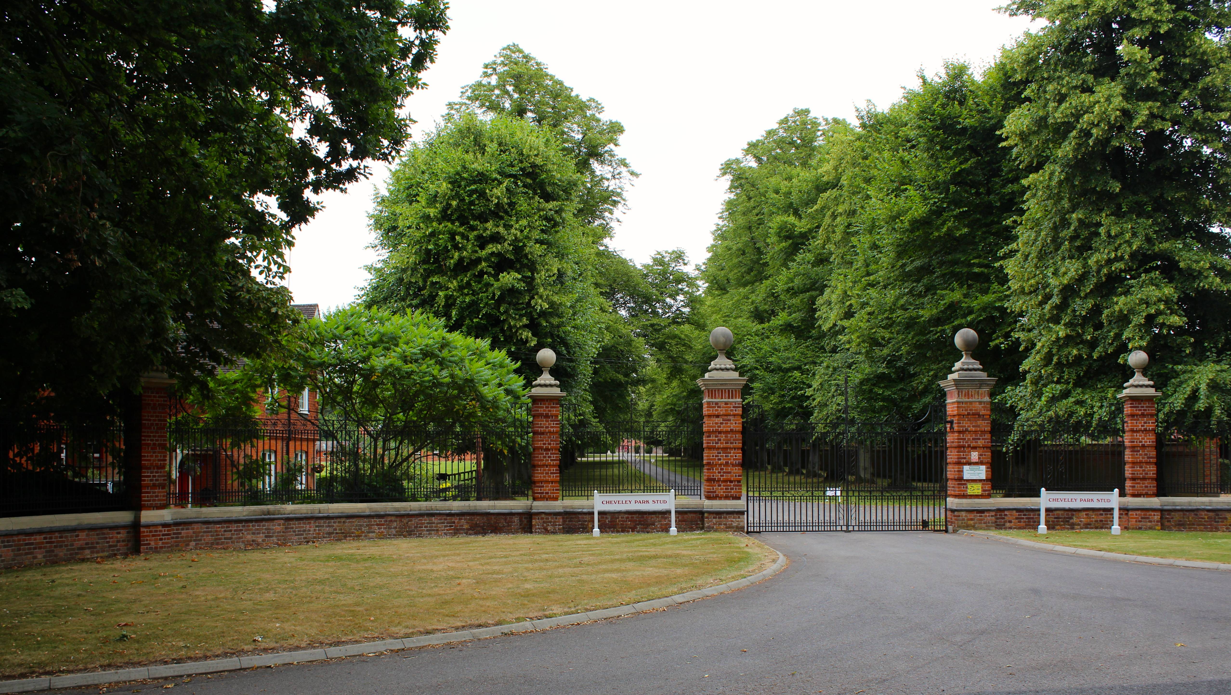
Cheveley Park Stud

Cheveley Park Stud is a thoroughbred racehorse ownership and breeding operation in Newmarket, Suffolk, UK, which has bred and owned many notable horses...

Nearby Amenities

Located within 500m of 52.205719,0.41258969
The data included in this document is from www.openstreetmap.org. The data is made available under ODbL.

Have you been to Dane Bottom?

Leave your review of Dane Bottom below (or comments, questions and feedback).