Lime Bottom

Valley in Sussex Chichester

England

Lime Bottom

River Rother near Midhurst, 1926 Written on the back of this photo is "The edge of the Rother River near Midhurst, Sussex." The river bank shown in <a href="https://www.geograph.org.uk/photo/4650937">SU8921 : Cowdray - The River Rother</a> seems the most likely location. The people in the photo are washing dishes after a picnic.
River Rother near Midhurst, 1926 Credit: John A Hawgood

Lime Bottom is a charming village located in the Sussex Valley region of England. Nestled amidst picturesque rolling hills and lush green countryside, it offers a peaceful and idyllic setting for both residents and visitors. The village is situated approximately 10 miles south of the bustling town of Sussex, providing a perfect escape from the hustle and bustle of urban life.

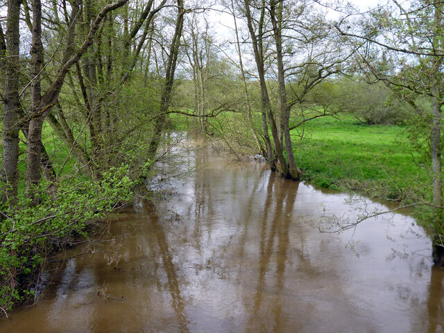
One of the defining features of Lime Bottom is its rich agricultural heritage. The fertile land surrounding the village has been used for centuries for farming and is known for its productive lime-rich soil, hence the name Lime Bottom. The fields are dotted with grazing livestock, and the countryside is adorned with vibrant wildflowers during the spring and summer months.

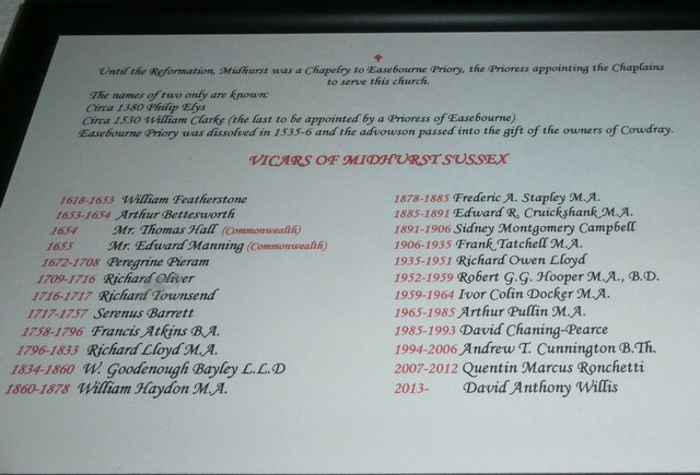
Despite its small size, Lime Bottom boasts a close-knit community that is known for its warmth and friendliness. The village is home to a quaint parish church, which dates back to the 12th century and serves as a focal point for the local community. Additionally, Lime Bottom has a small primary school, providing education for the village's children.

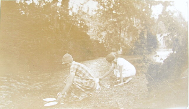
For outdoor enthusiasts, Lime Bottom offers an abundance of activities. The surrounding countryside provides ample opportunities for hiking, cycling, and horseback riding, with numerous trails and bridleways to explore. The nearby Sussex Valley also offers fishing and boating opportunities for those who enjoy spending time on the water.

In summary, Lime Bottom is a charming village in the heart of the Sussex Valley. With its scenic landscapes, agricultural heritage, and strong sense of community, it is a delightful destination for those seeking a peaceful and rural retreat.

If you have any feedback on the listing, please let us know in the comments section below.

Lime Bottom Images

Images are sourced within 2km of 50.995666/-0.71370094 or Grid Reference SU9022. Thanks to Geograph Open Source API. All images are credited.

River Rother near Midhurst, 1926 Written on the back of this photo is "The edge of the Rother River near Midhurst, Sussex." The river bank shown in <a href="https://www.geograph.org.uk/photo/4650937">SU8921 : Cowdray - The River Rother</a> seems the most likely location. The people in the photo are washing dishes after a picnic.
River Rother near Midhurst, 1926
Written on the back of this photo is "The edge of the Rother River near Midhurst, Sussex." The river bank shown in SU8921 : Cowdray - The River Rother seems the most likely location. The people in the photo are washing dishes after a picnic.
Picnic by the Rother near Midhurst, 1926 Location is approximate, caption on photo is "By the Rother near Midhurst", location near <a href="https://www.geograph.org.uk/photo/6925691">SU8921 : River Rother near Midhurst, 1926</a>.
Picnic by the Rother near Midhurst, 1926
Location is approximate, caption on photo is "By the Rother near Midhurst", location near SU8921 : River Rother near Midhurst, 1926.
Old Milestone, A286 Easebourne Dodsley Lane. In the fairly modern periphery wall of Budgenor Lodge, what was the Midhurst Union Workhouse in the 19c. The location is 20m South of its original position in 1895.

Inscription: To / London / 48 Miles / Chichester / 13

Milestone Society National ID: SX_CCMD13
Old Milestone, A286 Easebourne
Dodsley Lane. In the fairly modern periphery wall of Budgenor Lodge, what was the Midhurst Union Workhouse in the 19c. The location is 20m South of its original position in 1895. Inscription: To / London / 48 Miles / Chichester / 13 Milestone Society National ID: SX_CCMD13
Easebourne Priory
Easebourne Priory
Cowdray Farm Shop
Cowdray Farm Shop
Spring flowers in the churchyard (1)
Spring flowers in the churchyard (4)
Spring flowers in the churchyard (5)
Memorial within St Mary Magdalene & St Denys, Midhurst (5) Chaning-Pearce was born in 1938. He studied for ordination at Rochester Theological College and was priested in 1965. After curacies in Bromley and Rustington he was Rector of Slinfold from 1973 to 1983; and the incumbent of Midhurst with Woolbeding from then until his death in 1993.
Memorial within St Mary Magdalene & St Denys, Midhurst (5)
Chaning-Pearce was born in 1938. He studied for ordination at Rochester Theological College and was priested in 1965. After curacies in Bromley and Rustington he was Rector of Slinfold from 1973 to 1983; and the incumbent of Midhurst with Woolbeding from then until his death in 1993.
St Mary Magdalene & St Denys, Midhurst: incumbents Although the church dates to the 13th Century it was a Chapel of Ease for Easebourne until the early 17th century.
St Mary Magdalene & St Denys, Midhurst: incumbents
Although the church dates to the 13th Century it was a Chapel of Ease for Easebourne until the early 17th century.
Banner within St Mary Magdalene & St Denys, Midhurst (II)
Memorial within St Mary Magdalene & St Denys, Midhurst (6) Frederic Anthony Stapley (1830-1907) was educated at Wadham College Oxford and ordained priest in 1854. After curacies in Brighton, Stoke Mandeville and Westminster he was the incumbent at St Nicholas Brighton before coming here.
Memorial within St Mary Magdalene & St Denys, Midhurst (6)
Frederic Anthony Stapley (1830-1907) was educated at Wadham College Oxford and ordained priest in 1854. After curacies in Brighton, Stoke Mandeville and Westminster he was the incumbent at St Nicholas Brighton before coming here.
Memorial within St Mary Magdalene & St Denys, Midhurst (7)
Memorial within St Mary Magdalene & St Denys, Midhurst (8)
River Rother upstream of Ambersham Bridge
Ditch in Rother valley This runs parallel with the river for a considerable distance.
Ditch in Rother valley
This runs parallel with the river for a considerable distance.
Bridleway 3348 towards Heath End Lane The bridleway runs along the parish boundary between Easebourne (right) and Lodsworth.
Bridleway 3348 towards Heath End Lane
The bridleway runs along the parish boundary between Easebourne (right) and Lodsworth.
Bridleway 3348 around Heathend Copse The bridleway runs along the parish boundary between Easebourne (left) and Lodsworth, with the copse on the right.
Bridleway 3348 around Heathend Copse
The bridleway runs along the parish boundary between Easebourne (left) and Lodsworth, with the copse on the right.
Show me another place!

Lime Bottom is located at Grid Ref: SU9022 (Lat: 50.995666, Lng: -0.71370094)

Administrative County: West Sussex

District: Chichester

Police Authority: Sussex

What 3 Words

///rang.guidebook.glove. Near Midhurst, West Sussex

Nearby Locations

Lime Bottom Yew Oval

Related Wikis

Easebourne Priory

Easebourne Priory was a priory in Easebourne, West Sussex, England. The Nativity of the Blessed Virgin Mary was built as an Augustinian nunnery for a prioress...

Easebourne

Easebourne () is a village, Anglican parish and civil parish in the Chichester District of West Sussex, England. It is half a mile (0.8 km) north of Midhurst...

Queen Elizabeth Oak

The Queen Elizabeth Oak is a large sessile oak tree in Cowdray Park near the village of Lodsworth in the Western Weald, West Sussex, England. It lies...

Cowdray Park, West Sussex

The park lies in the South Downs National Park. The estate belongs to Viscount Cowdray, whose family have owned it since 1909. It has a golf course, and...

Nearby Amenities

Located within 500m of 50.995666,-0.71370094
Bus Stop
Reservoir
Bus: yes
Naptan AtcoCode: 4400MO0426
Naptan Bearing: SE
Naptan BusStopType: CUS
Naptan CommonName: Reservoir
Naptan Indicator: adj
Naptan Landmark: Hail & Ride
Naptan NaptanCode: wsxgadat
Naptan Street: A272
Naptan Verified: no
Public Transport: platform
Source: naptan_import
Lat/Long: 50.9911902/-0.7138111
The data included in this document is from www.openstreetmap.org. The data is made available under ODbL.

Have you been to Lime Bottom?

Leave your review of Lime Bottom below (or comments, questions and feedback).