Norton Bottoms
Valley in Lincolnshire North Kesteven
England
Norton Bottoms
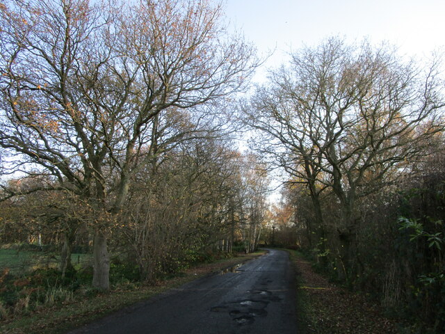
Norton Bottoms is a picturesque valley located in the county of Lincolnshire, England. Situated near the village of Norton Disney, it is a popular destination for nature enthusiasts and outdoor activities. The valley is nestled between rolling hills and offers breathtaking views of the surrounding countryside.
The landscape of Norton Bottoms is characterized by its lush green meadows, dotted with vibrant wildflowers during the spring and summer months. The River Witham flows through the valley, adding to its natural beauty and providing a habitat for various species of wildlife, including water birds and fish.
Visitors to Norton Bottoms can enjoy a range of recreational activities, such as walking, cycling, and picnicking. The area is crisscrossed by a network of footpaths and trails, allowing visitors to explore the valley and its surroundings at their own pace. There are also designated areas for fishing along the riverbank, attracting anglers from near and far.
In addition to its natural attractions, Norton Bottoms is home to a diverse range of plant species, including rare orchids and vibrant wildflowers. The valley is part of a designated Site of Special Scientific Interest (SSSI), recognizing its importance for conservation and biodiversity.
Overall, Norton Bottoms offers a tranquil and idyllic escape for those seeking to immerse themselves in the beauty of the Lincolnshire countryside. Its stunning landscapes, diverse wildlife, and recreational opportunities make it a hidden gem worth exploring for nature lovers and outdoor enthusiasts.
If you have any feedback on the listing, please let us know in the comments section below.
Norton Bottoms Images
Images are sourced within 2km of 53.120245/-0.70752657 or Grid Reference SK8658. Thanks to Geograph Open Source API. All images are credited.


Norton Bottoms is located at Grid Ref: SK8658 (Lat: 53.120245, Lng: -0.70752657)
Administrative County: Lincolnshire
District: North Kesteven
Police Authority: Lincolnshire
What 3 Words
///fuels.punctual.deluded. Near South Collingham, Nottinghamshire
Nearby Locations
Related Wikis

Norton Disney
Norton Disney is a small village and civil parish on the western boundary of the North Kesteven district of Lincolnshire, England. It is situated on the...
Stapleford, Lincolnshire
Stapleford is a village and civil parish in North Kesteven district of Lincolnshire, England, and about 6 miles (10 km) north-east from the town of Newark...

Stapleford Woods
Stapleford Woods form an area of ancient woodland and forest in Stapleford, Lincolnshire, England. The boundary of the ancient woods follows the county...

Brough, Nottinghamshire
Brough is a hamlet in Nottinghamshire, England. == Location == It is located in the Newark and Sherwood District, 5 miles (8 km) to the north of Newark...
Nearby Amenities
Located within 500m of 53.120245,-0.70752657Have you been to Norton Bottoms?
Leave your review of Norton Bottoms below (or comments, questions and feedback).