Bracknells Bottom

Valley in Hampshire Hart

England

Bracknells Bottom

The A30, Hartfordbridge A fairly regular stopping point if you click this spot on my map.
The A30, Hartfordbridge Credit: David Howard

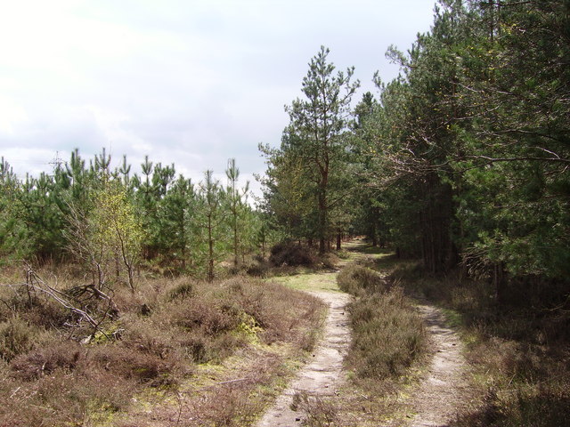
Bracknells Bottom, located in the county of Hampshire, is a picturesque valley renowned for its natural beauty and tranquil atmosphere. Situated in the southern part of the county, the valley is surrounded by rolling hills and dense woodlands, making it an idyllic spot for nature enthusiasts and hikers alike.

The valley is named after the small village of Bracknells Bottom, which lies at its heart. With a population of just over 200 residents, the village exudes a charming rural character, boasting a collection of quaint cottages and a traditional village pub. The residents of Bracknells Bottom take great pride in their close-knit community and actively participate in local events and initiatives.

The valley is also home to a diverse range of wildlife, with numerous species of birds, mammals, and insects inhabiting its lush greenery. Visitors often catch glimpses of deer and rabbits darting through the fields, while the melodious songs of various birds fill the air. The surrounding woodlands provide an ideal habitat for a variety of tree species, including oak, beech, and ash, adding to the valley's natural splendor.

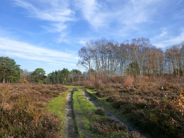
For those seeking outdoor activities, Bracknells Bottom offers an extensive network of footpaths and trails, perfect for exploring the valley's scenic surroundings. The valley is also home to a small river, meandering through its heart, which provides a serene setting for fishing or simply enjoying a peaceful picnic by its banks.

In conclusion, Bracknells Bottom, Hampshire is a hidden gem, offering a tranquil retreat from the hustle and bustle of everyday life. With its stunning natural landscapes, charming village, and abundant wildlife, it is a must-visit destination for nature lovers and those seeking solace in the beauty of the countryside.

If you have any feedback on the listing, please let us know in the comments section below.

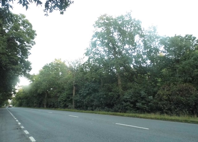
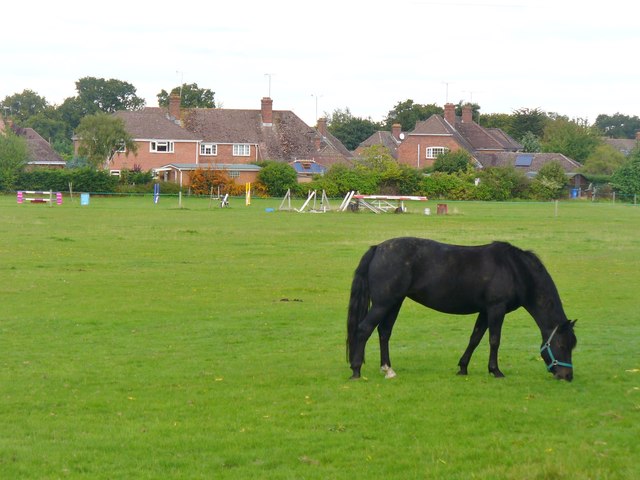
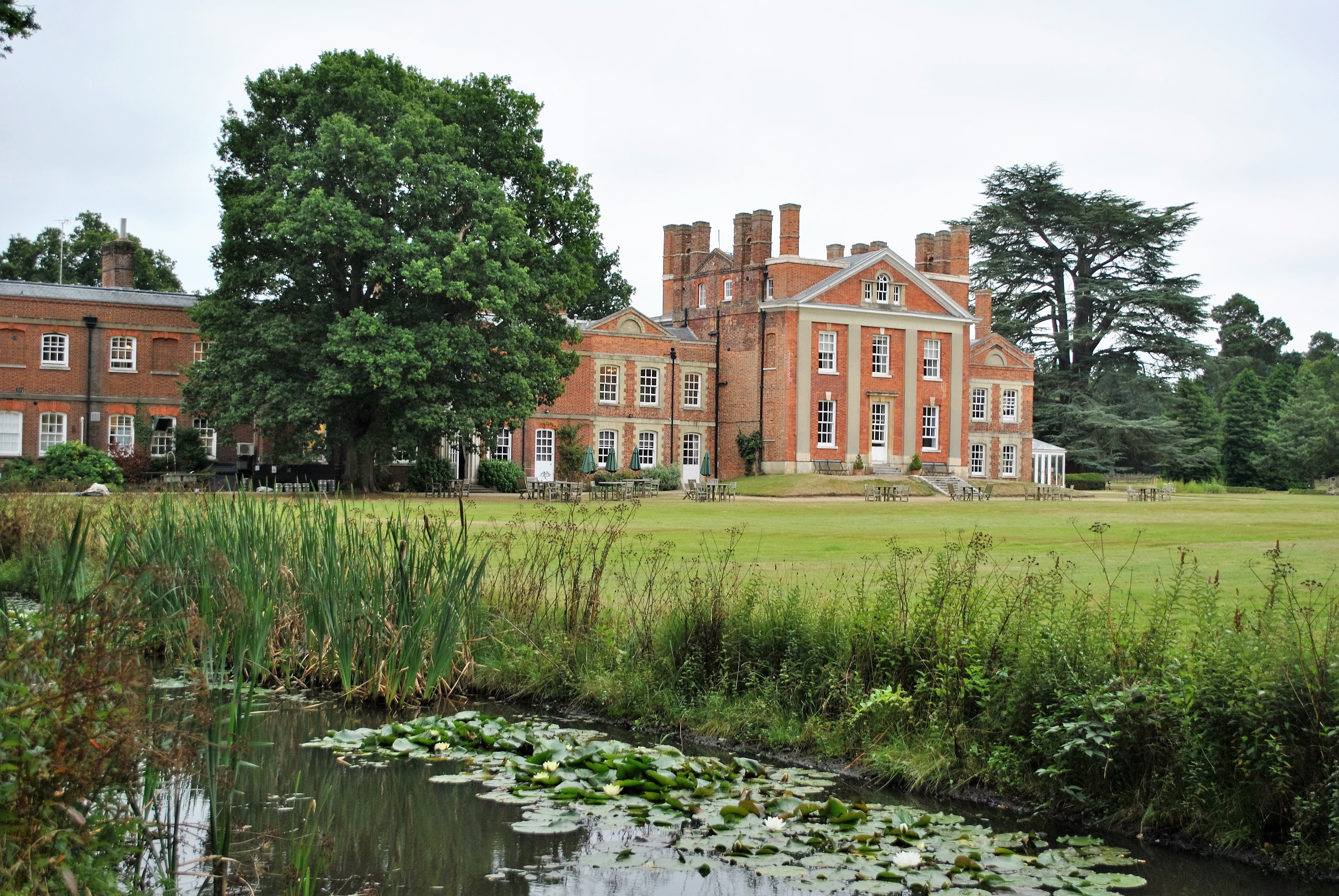
Bracknells Bottom Images

Images are sourced within 2km of 51.334514/-0.87945825 or Grid Reference SU7860. Thanks to Geograph Open Source API. All images are credited.

The A30, Hartfordbridge A fairly regular stopping point if you click this spot on my map.
The A30, Hartfordbridge
A fairly regular stopping point if you click this spot on my map.
View of The Mount
View of The Mount
New water features At the time of submitting this photo, these flooded gravel pits are not shown on the Ordnance Survey maps.
New water features
At the time of submitting this photo, these flooded gravel pits are not shown on the Ordnance Survey maps.
Deep Pit A very deep flooded gravel pit; maybe they are trying to breed the Loch Ness Monster!
Deep Pit
A very deep flooded gravel pit; maybe they are trying to breed the Loch Ness Monster!
Eversley Church St Mary's Church is noted for a former rector, Charles Kingsley, who wrote "The Water Babies". He is buried in the churchyard.
Eversley Church
St Mary's Church is noted for a former rector, Charles Kingsley, who wrote "The Water Babies". He is buried in the churchyard.
Eversley "Horsieculture" in the NE corner of Hampshire.
Eversley
"Horsieculture" in the NE corner of Hampshire.
Warbrook House Historic (1727) manor house at Eversley.
Warbrook House
Historic (1727) manor house at Eversley.
Warbrook House hotel - Mansion, eastern frontage The fine eastern façade of Warbrook House which was originally a country house designed and built by John James of Greenwich for his own use in 1727, and is now a hotel. This façade is effectively the front of the house. The original building was the taller central section (see <a href="https://www.geograph.org.uk/photo/6323593">SU7761 : Warbrook House hotel - The original house</a>) the side wings having been added later (but still I think in the C18th or early C19th).
See shared description below.
Warbrook House hotel - Mansion, eastern frontage
The fine eastern façade of Warbrook House which was originally a country house designed and built by John James of Greenwich for his own use in 1727, and is now a hotel. This façade is effectively the front of the house. The original building was the taller central section (see SU7761 : Warbrook House hotel - The original house) the side wings having been added later (but still I think in the C18th or early C19th). See shared description below.
Warbrook House hotel - The original house This is a view of the central section of the mansion at Warbrook House and is the original 1727 house, the wings either side of it having been added somewhat later. Warbrook House is now a hotel.
For a view of this building with its wings, see <a href="https://www.geograph.org.uk/photo/6323587">SU7761 : Warbrook House hotel - Mansion, eastern frontage</a>
See also shared description below.
Warbrook House hotel - The original house
This is a view of the central section of the mansion at Warbrook House and is the original 1727 house, the wings either side of it having been added somewhat later. Warbrook House is now a hotel. For a view of this building with its wings, see SU7761 : Warbrook House hotel - Mansion, eastern frontage See also shared description below.
Warbrook House hotel - Rear view Taken from its extensive grounds to the west of the hotel looking at the rear elevation of the building.
See shared description below.
Warbrook House hotel - Rear view
Taken from its extensive grounds to the west of the hotel looking at the rear elevation of the building. See shared description below.
Warbrook House hotel - Autumnal tree in the grounds A tree in striking golden autumnal livery in the grounds of Warbrook House hotel. The tree is on the far side of a canal which frames three sides of the lawn immediately to the west of the house, hence the life-belt on a pole bottom right. On this side of the canal in front of the tree can be seen a small dovecote.
See shared description below:
Warbrook House hotel - Autumnal tree in the grounds
A tree in striking golden autumnal livery in the grounds of Warbrook House hotel. The tree is on the far side of a canal which frames three sides of the lawn immediately to the west of the house, hence the life-belt on a pole bottom right. On this side of the canal in front of the tree can be seen a small dovecote. See shared description below:
Warbrook House hotel - Water feature This unusual brick-built water feature is to the south of the hotel. Whether it is supposed to be this flooded I am not sure - but if not then it is serendipitously attractive. Part of the marquee used for weddings and events can be seen on the right. See also <a href="https://www.geograph.org.uk/photo/6323619">SU7761 : Warbrook House hotel - Grounds with water feature</a> for a slightly different view of this same feature.
See also the shared description below:
Warbrook House hotel - Water feature
This unusual brick-built water feature is to the south of the hotel. Whether it is supposed to be this flooded I am not sure - but if not then it is serendipitously attractive. Part of the marquee used for weddings and events can be seen on the right. See also SU7761 : Warbrook House hotel - Grounds with water feature for a slightly different view of this same feature. See also the shared description below:
Warbrook House hotel - Grounds with water feature Looking over <a href="https://www.geograph.org.uk/photo/6323613">SU7761 : Warbrook House hotel - Water feature</a> to the white marquee in the grounds of Warbrook House hotel. Just visible behind this, rather obscured by trees is the spa complex of the hotel.
See shared description below:
Warbrook House hotel - Grounds with water feature
Looking over SU7761 : Warbrook House hotel - Water feature to the white marquee in the grounds of Warbrook House hotel. Just visible behind this, rather obscured by trees is the spa complex of the hotel. See shared description below:
Heathland in November, Castle Bottom NNR Sandy, gravelly terrain, but poorly drained after a long rainy spell.
Heathland in November, Castle Bottom NNR
Sandy, gravelly terrain, but poorly drained after a long rainy spell.
Heathland in November, Castle Bottom NNR (2) Higher ground on the south side of this National Nature Reserve.  Tree species are typical of heathland: silver birch and Scots pine.

Photo taken in one of the brighter spells on a chilly day at the end of November.
Heathland in November, Castle Bottom NNR (2)
Higher ground on the south side of this National Nature Reserve. Tree species are typical of heathland: silver birch and Scots pine. Photo taken in one of the brighter spells on a chilly day at the end of November.
Gravel pit scenery, Eversley Common Much the same view as in: <a title="https://www.geograph.org.uk/photo/4848127" href="https://www.geograph.org.uk/photo/4848127">Link</a>   Although these gravel workings seem to have been abandoned for quite some years, at the time of submitting this item the OS  still mapped this area as conifer plantation.
Gravel pit scenery, Eversley Common
Much the same view as in: Link Although these gravel workings seem to have been abandoned for quite some years, at the time of submitting this item the OS still mapped this area as conifer plantation.
Up Green Junction of Up Green with Chequers Lane
Up Green
Junction of Up Green with Chequers Lane
Path heading to Church Farm Path from Up Green heading to Church Farm
Path heading to Church Farm
Path from Up Green heading to Church Farm
Show me another place!

Bracknells Bottom is located at Grid Ref: SU7860 (Lat: 51.334514, Lng: -0.87945825)

Administrative County: Hampshire

District: Hart

Police Authority: Hampshire

What 3 Words

///admiral.gift.crinkled. Near Eversley, Hampshire

Related Wikis

Eversley

Eversley is a village and civil parish in the Hart district of Hampshire, England. The village is located around 11 miles (18 km) northeast of Basingstoke...

Castle Bottom NNR

Castle Bottom is a British national nature reserve located near Yateley in Hampshire. It is part of Castle Bottom to Yateley and Hawley Commons, which...

Eversley Centre

Eversley Centre is a village in the Hart District of Hampshire, England. Its nearest town is Yateley, approximately 2 miles (2.5 km) away from the village...

Bramshill SSSI

Bramshill is a 673.3-hectare (1,664-acre) biological Site of Special Scientific Interest near Bramshill, northeast of Basingstoke in Hampshire. It is part...

1957 Blackbushe Viking accident

The 1957 Blackbushe Viking accident occurred on 1 May 1957 when an Eagle Aviation twin-engined Vickers VC.1 Viking 1B registered G-AJBO named "John Benbow...

Eversley Manor

Eversley Manor is a manor in Eversley, Hampshire, England. Mentioned in the Domesday Book, in 1669, it was purchased by Sir Andrew Henley of Bramshill...

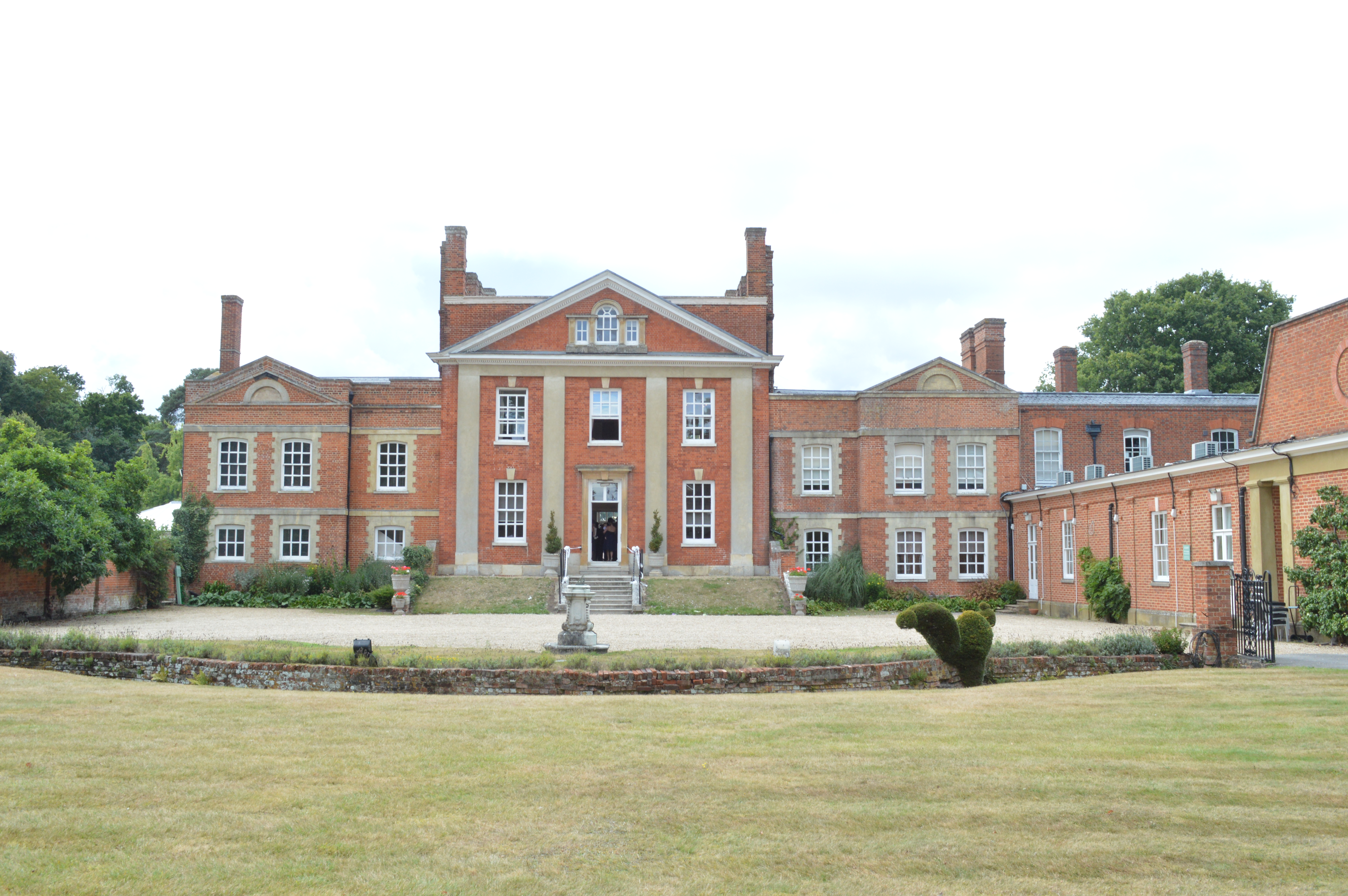
Warbrook House Hotel, Eversley

Warbrook House is a building of historical significance and is listed as Grade I in the English Heritage Register. It was built in 1724 by the architect...

Hartfordbridge

Hartfordbridge is a small village in the Hart District of Hampshire, England. The village sits on the A30 road and is 2 miles (2.5 km) from Hartley Wintney...

Nearby Amenities

Located within 500m of 51.334514,-0.87945825
Wood Farm
Landuse: farm
Note Retag: CS #48756035
Source: OS_OpenData_StreetView
Lat/Long: 51.3376022/-0.8748974
Barrier: debris
Lat/Long: 51.3309263/-0.8794362
Heritage Motor Works
Craft: coachbuilder
Website: https://www.heritagemotorworks.co.uk/
Lat/Long: 51.3353007/-0.8743569
The data included in this document is from www.openstreetmap.org. The data is made available under ODbL.

Have you been to Bracknells Bottom?

Leave your review of Bracknells Bottom below (or comments, questions and feedback).