Buckingham Bottom

Valley in Oxfordshire South Oxfordshire

England

Buckingham Bottom

Working on the Chiltern Way The Chiltern Way is a well used path and this is a particularly steep and muddy section just here.
The path has been excavated and at a guess there are going to be steps made.
Working on the Chiltern Way Credit: Des Blenkinsopp

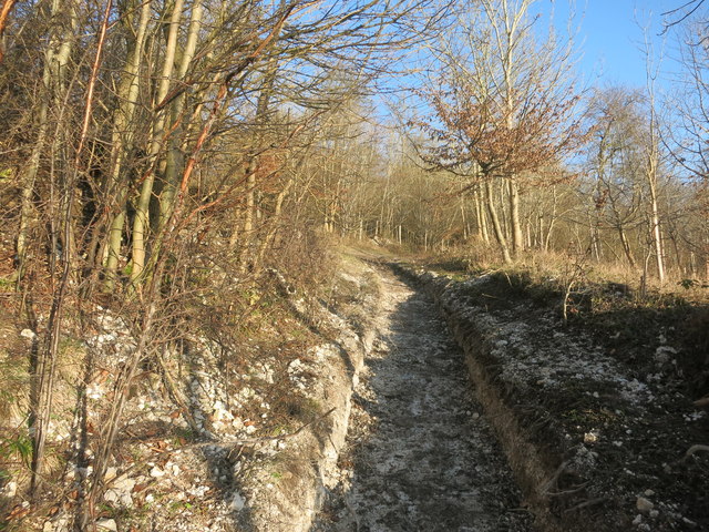
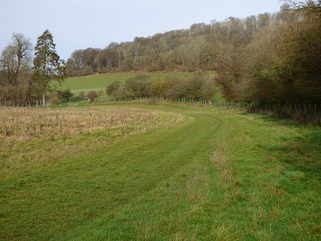
Buckingham Bottom is a scenic valley located in Oxfordshire, England. Situated near the town of Buckingham, this picturesque area is renowned for its natural beauty and tranquil ambiance. The valley is nestled amidst rolling hills and lush green meadows, offering a serene escape from the hustle and bustle of city life.

The landscape of Buckingham Bottom is characterized by its gently sloping terrain and the presence of the River Great Ouse, which meanders through the valley, adding to its charm. The river serves as a focal point for outdoor activities such as fishing, boating, and riverside walks.

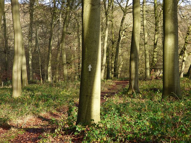
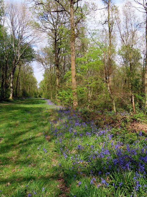
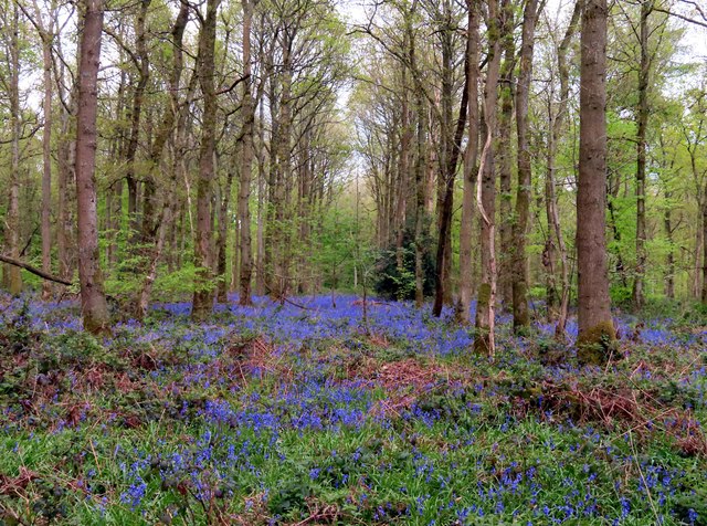
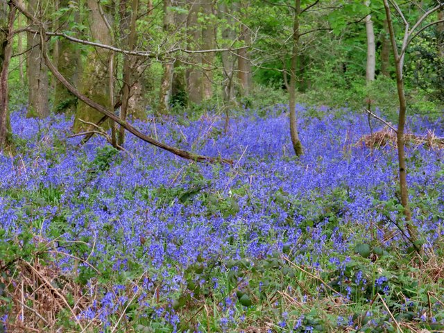
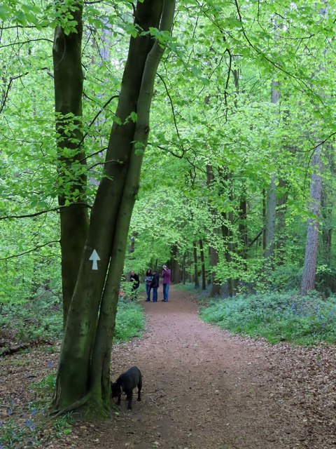
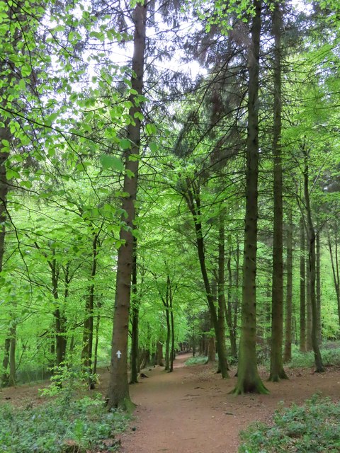
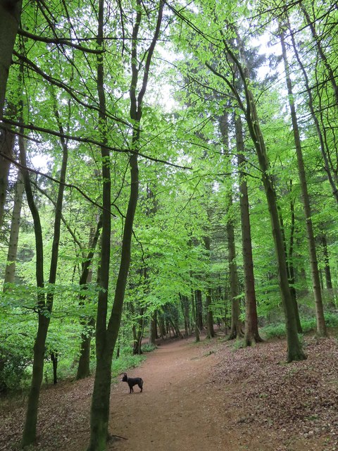
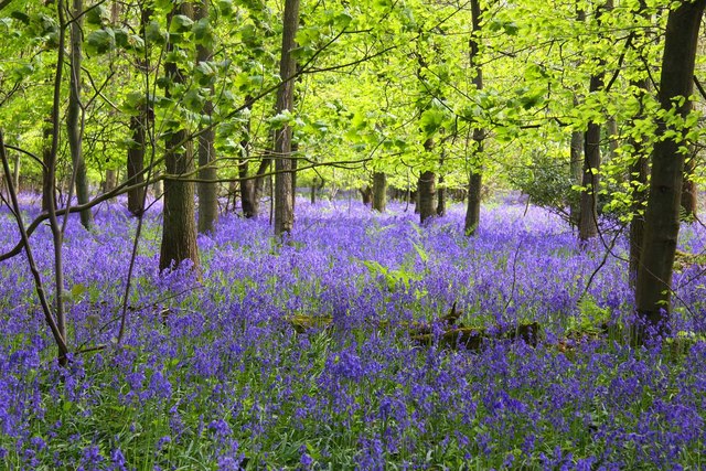
The valley is also home to a diverse range of flora and fauna, making it a haven for nature enthusiasts. The surrounding woodlands and meadows are home to a variety of bird species, including kingfishers, herons, and various songbirds. The valley's fertile soil supports a rich array of plant life, including wildflowers, orchids, and ancient woodland.

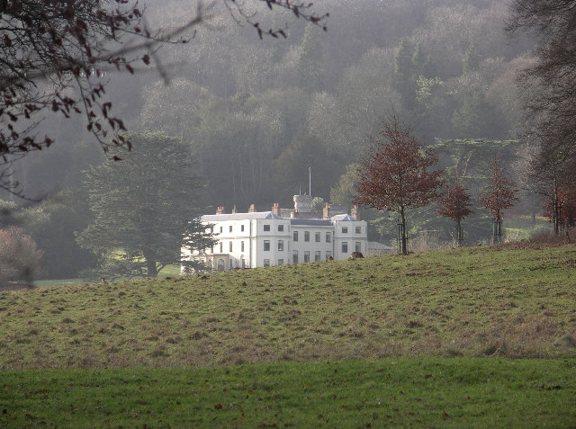
In addition to its natural attractions, Buckingham Bottom boasts a rich historical heritage. The area is dotted with ancient settlements, archaeological sites, and historic landmarks. Visitors can explore the ruins of medieval castles, churches, and manor houses, gaining insight into the region's fascinating past.

Overall, Buckingham Bottom offers a sublime blend of natural beauty, recreational opportunities, and historical significance. Whether one seeks relaxation in the tranquility of the valley or an exploration of its cultural heritage, this idyllic location has something to offer for everyone.

If you have any feedback on the listing, please let us know in the comments section below.

Buckingham Bottom Images

Images are sourced within 2km of 51.638163/-0.94076156 or Grid Reference SU7393. Thanks to Geograph Open Source API. All images are credited.

Working on the Chiltern Way The Chiltern Way is a well used path and this is a particularly steep and muddy section just here.
The path has been excavated and at a guess there are going to be steps made.
Working on the Chiltern Way
The Chiltern Way is a well used path and this is a particularly steep and muddy section just here. The path has been excavated and at a guess there are going to be steps made.
Eatery in the village A roadside hostelry.
Eatery in the village
A roadside hostelry.
Woodland, Shirburn The Chiltern Way amidst beeches in the lower part of Blackmoor Wood on the Wormsley Estate.
Woodland, Shirburn
The Chiltern Way amidst beeches in the lower part of Blackmoor Wood on the Wormsley Estate.
Pasture and woodland, Stokenchurch A bridleway running along a dry valley in the heart of the Wormsley Estate.
Pasture and woodland, Stokenchurch
A bridleway running along a dry valley in the heart of the Wormsley Estate.
Pastoral and wooded countryside, Lewknor On the bridleway climbing from Lower Vicar's Farm to Upper Vicar's Farm on the Wormsley Estate.
Pastoral and wooded countryside, Lewknor
On the bridleway climbing from Lower Vicar's Farm to Upper Vicar's Farm on the Wormsley Estate.
Barn at Portobello Farm, Shirburn A muddy farmyard with cattle ensconced for the winter.
Barn at Portobello Farm, Shirburn
A muddy farmyard with cattle ensconced for the winter.
A bluebell lined ride in Cowleaze Wood
Bluebells in Cowleaze Wood The Forestry Commission owns Coweleaze Wood, and planted it between 1957 and 1966.
Bluebells in Cowleaze Wood
The Forestry Commission owns Coweleaze Wood, and planted it between 1957 and 1966.
Bluebells in Cowleaze Wood The Forestry Commission owns Coweleaze Wood, and planted it between 1957 and 1966.
Bluebells in Cowleaze Wood
The Forestry Commission owns Coweleaze Wood, and planted it between 1957 and 1966.
A track in Cowleaze Wood The Forestry Commission owns Coweleaze Wood, and planted it between 1957 and 1966.
A track in Cowleaze Wood
The Forestry Commission owns Coweleaze Wood, and planted it between 1957 and 1966.
Footpath in Cowleaze Wood The Forestry Commission owns Coweleaze Wood, and planted it between 1957 and 1966.
Footpath in Cowleaze Wood
The Forestry Commission owns Coweleaze Wood, and planted it between 1957 and 1966.
Footpath in Cowleaze Wood The Forestry Commission owns Cowleaze Wood, and planted it between 1957 and 1966.
Footpath in Cowleaze Wood
The Forestry Commission owns Cowleaze Wood, and planted it between 1957 and 1966.
Footpath in Cowleaze Wood The Forestry Commission owns Cowleaze Wood, and planted it between 1957 and 1966.
Footpath in Cowleaze Wood
The Forestry Commission owns Cowleaze Wood, and planted it between 1957 and 1966.
War memorial in Cowleaze Wood On 31 March 1944 a Handley Page Halifax Mk III bomber aircraft, LW579 of No. 51 Squadron RAF, was returning from the Nuremberg Raid when it crashed in the wood, killing all seven of its crew.
War memorial in Cowleaze Wood
On 31 March 1944 a Handley Page Halifax Mk III bomber aircraft, LW579 of No. 51 Squadron RAF, was returning from the Nuremberg Raid when it crashed in the wood, killing all seven of its crew.
A track in Cowleaze Wood The Forestry Commission owns Cowleaze Wood, and planted it between 1957 and 1966.
A track in Cowleaze Wood
The Forestry Commission owns Cowleaze Wood, and planted it between 1957 and 1966.
A track in Cowleaze Wood The Forestry Commission owns Cowleaze Wood, and planted it between 1957 and 1966.
A track in Cowleaze Wood
The Forestry Commission owns Cowleaze Wood, and planted it between 1957 and 1966.
Thatched scoreboard at Wormsley cricket ground Sir Paul Getty became a cricket lover in the 1960s through his friendship with his Chelsea neighbour, Mick Jagger.

When Sir Paul acquired Wormsley in 1985, another great friend from the world of cricket – the legendary commentator Brian Johnston – persuaded him to create a cricket ground on the Estate. 

Harry Brind OBE, the groundsman at The Oval, was commissioned to lay the square and create a replica of the South London ground.  It was opened in 1992.
Thatched scoreboard at Wormsley cricket ground
Sir Paul Getty became a cricket lover in the 1960s through his friendship with his Chelsea neighbour, Mick Jagger. When Sir Paul acquired Wormsley in 1985, another great friend from the world of cricket – the legendary commentator Brian Johnston – persuaded him to create a cricket ground on the Estate. Harry Brind OBE, the groundsman at The Oval, was commissioned to lay the square and create a replica of the South London ground. It was opened in 1992.
T20 finals day at Wormsley cricket ground The minor counties T20 finals day is one of the highlights of the cricketing year at Wormsley. 

Sir Paul Getty became a cricket lover in the 1960s through his friendship with his Chelsea neighbour, Mick Jagger.

When Sir Paul acquired Wormsley in 1985, another great friend from the world of cricket – the legendary commentator Brian Johnston – persuaded him to create a cricket ground on the Estate. 

Harry Brind OBE, the groundsman at The Oval, was commissioned to lay the square and create a replica of the South London ground.  It was opened in 1992.
T20 finals day at Wormsley cricket ground
The minor counties T20 finals day is one of the highlights of the cricketing year at Wormsley. Sir Paul Getty became a cricket lover in the 1960s through his friendship with his Chelsea neighbour, Mick Jagger. When Sir Paul acquired Wormsley in 1985, another great friend from the world of cricket – the legendary commentator Brian Johnston – persuaded him to create a cricket ground on the Estate. Harry Brind OBE, the groundsman at The Oval, was commissioned to lay the square and create a replica of the South London ground. It was opened in 1992.
Show me another place!

Buckingham Bottom is located at Grid Ref: SU7393 (Lat: 51.638163, Lng: -0.94076156)

Administrative County: Oxfordshire

District: South Oxfordshire

Police Authority: Thames Valley

What 3 Words

///pulled.wand.club. Near Stokenchurch, Buckinghamshire

Related Wikis

Garsington Opera

Garsington Opera is an annual summer opera festival founded in 1989 by Leonard Ingrams. The Philharmonia Orchestra and The English Concert are its two...

Wormsley Park

Wormsley is a private estate of Mark Getty and his family, set in 2,700-acre (1,100 ha) of rolling countryside in the Chiltern Hills of Buckinghamshire...

Wormsley Chalk Banks

Wormsley Chalk Banks are six separate areas which together are a 14.1-hectare (35-acre) biological Site of Special Scientific Interest near Turville in...

Northend, Buckinghamshire

Northend is a village that straddles the border of the two English counties of Buckinghamshire and Oxfordshire. The eastern half is in the civil parish...

Swain's Wood

Swain's Wood is a 16.2-hectare (40-acre) biological Site of Special Scientific Interest west of Turville in Buckinghamshire. It is in the Chilterns Area...

Cowleaze Wood

Cowleaze Wood is a 70-acre (28 ha) woodland in the Chiltern Hills, a chalk ridge in South East England. The wood is in the civil parish of Lewknor, in...

Christmas Common

Christmas Common is a hamlet in Watlington civil parish, Oxfordshire about 7+1⁄2 miles (12 km) south of Thame in Oxfordshire, close to the boundary with...

Ibstone

Ibstone (previously Ipstone) is a village and civil parish within Wycombe district in Buckinghamshire, England. It is in the Chiltern Hills on the border...

Nearby Amenities

Located within 500m of 51.638163,-0.94076156
Barrier: kissing_gate
Bicycle: no
Foot: yes
Lat/Long: 51.6355992/-0.9349619
The data included in this document is from www.openstreetmap.org. The data is made available under ODbL.

Have you been to Buckingham Bottom?

Leave your review of Buckingham Bottom below (or comments, questions and feedback).