Splashall Bottom

Valley in Oxfordshire South Oxfordshire

England

Splashall Bottom

Pasture and farm buildings, Checkendon Corker's Farm viewed from the footpath passing to its west.
Pasture and farm buildings, Checkendon Credit: Andrew Smith

Splashall Bottom is a picturesque valley located in Oxfordshire, England. Nestled in the heart of the Chiltern Hills, this idyllic location offers breathtaking views and a tranquil atmosphere. The valley is named after the small stream, Splashall Brook, which meanders through its lush green landscape.

Surrounded by rolling hills and dense woodlands, Splashall Bottom is a haven for nature lovers and outdoor enthusiasts. The area boasts an abundance of wildlife, including deer, birds, and various species of plants and trees. Visitors can enjoy scenic walks along the numerous footpaths that crisscross the valley, providing a chance to immerse themselves in the beauty of the surrounding countryside.

In addition to its natural charm, Splashall Bottom also has a rich history. The valley is home to several historic landmarks and ancient sites, such as the remnants of a Roman villa and a medieval settlement. These archaeological treasures offer a glimpse into the area's past and provide a fascinating insight into its heritage.

Splashall Bottom is also a popular destination for recreational activities. The valley offers opportunities for camping, picnicking, and fishing, making it a great spot for a family day out or a weekend getaway. The nearby village of Splashall provides amenities such as a pub and a small shop, ensuring that visitors have everything they need during their stay.

Overall, Splashall Bottom is a hidden gem in Oxfordshire, offering a perfect blend of natural beauty, historical significance, and recreational opportunities. Whether one seeks a peaceful retreat or an adventure in the great outdoors, this valley has something to offer everyone.

If you have any feedback on the listing, please let us know in the comments section below.

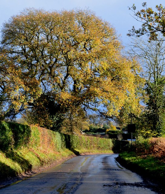
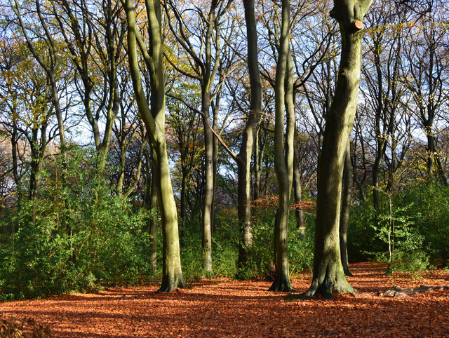
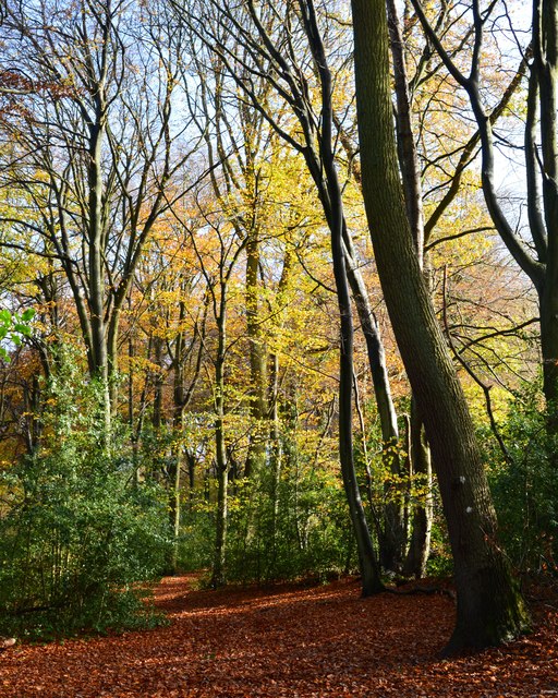
Splashall Bottom Images

Images are sourced within 2km of 51.542692/-1.0218718 or Grid Reference SU6783. Thanks to Geograph Open Source API. All images are credited.

Pasture and farm buildings, Checkendon Corker's Farm viewed from the footpath passing to its west.
Pasture and farm buildings, Checkendon
Corker's Farm viewed from the footpath passing to its west.
The road to Stoke Row Going through Bear Wood
The road to Stoke Row
Going through Bear Wood
Bear Wood, Stoke Row
Stoke Row The road becomes Kit Lane but the maps don't give a name till beyond the end of the village.
Stoke Row
The road becomes Kit Lane but the maps don't give a name till beyond the end of the village.
Stoke Row Green
Stoke Row Green
Stoke Row
Stoke Row
Houses in Stoke Row Looking towards Church View.
Houses in Stoke Row
Looking towards Church View.
Church View, Stoke Row
Basset Wood
Basset Wood
Woods north east of Stoke Row
The Maharajah's Well, Stoke Row This is an unlikely looking structure to find in an Oxfordshire village. Its origins lie in the friendship that developed between Edward Anderton Reade, the son of a local squire who spent his working life in India, and the Maharajah of Benares. In Victorian times the villages of this part of Oxfordshire had only limited access to clean water bringing considerable hardship to the poor of the area. Learning of these difficulties, the Maharajah - who had remained loyal to the British during the Indian Mutiny of 1857 - determined that a charity should be set up to relieve the problem. The result was a well dug to a depth of 368 feet, a considerable engineering achievement. To honour the Maharajah, who never visited Britain, a splendid well canopy was built incorporating a gold elephant representing the Hindu god Ganesh. The well was used until the beginning of the Second World War although by that time most houses in the village had a mains connection. Today the well has been renovated and preserved and is maintained by the Maharajah's Well Trust.

The octagonal cottage to the right was built to house the well warden. The last warden died in 1979 since when it has been rented out to supplement the charity's income.
The Maharajah's Well, Stoke Row
This is an unlikely looking structure to find in an Oxfordshire village. Its origins lie in the friendship that developed between Edward Anderton Reade, the son of a local squire who spent his working life in India, and the Maharajah of Benares. In Victorian times the villages of this part of Oxfordshire had only limited access to clean water bringing considerable hardship to the poor of the area. Learning of these difficulties, the Maharajah - who had remained loyal to the British during the Indian Mutiny of 1857 - determined that a charity should be set up to relieve the problem. The result was a well dug to a depth of 368 feet, a considerable engineering achievement. To honour the Maharajah, who never visited Britain, a splendid well canopy was built incorporating a gold elephant representing the Hindu god Ganesh. The well was used until the beginning of the Second World War although by that time most houses in the village had a mains connection. Today the well has been renovated and preserved and is maintained by the Maharajah's Well Trust. The octagonal cottage to the right was built to house the well warden. The last warden died in 1979 since when it has been rented out to supplement the charity's income.
The Maharajah's Well, Stoke Row This is looking under the canopy of the well where the gold elephant takes pride of place. See <a href="https://www.geograph.org.uk/photo/7620533">SU6784 : The Maharajah's Well, Stoke Row</a> for a wider view and some historical notes.
The Maharajah's Well, Stoke Row
This is looking under the canopy of the well where the gold elephant takes pride of place. See SU6784 : The Maharajah's Well, Stoke Row for a wider view and some historical notes.
1 Langtree Cottages, Checkendon, Oxfordshire 1906 by Maxwell Ayrton in Arts and Crafts style. 

(Source:Historic England)
1 Langtree Cottages, Checkendon, Oxfordshire
1906 by Maxwell Ayrton in Arts and Crafts style. (Source:Historic England)
Foundry Cottage, Checkendon, Oxfordshire C17 with C20 windows. Brick ground floor with areas of flint; timber frame to first floor, rendered panels to left, brick infill to right. Old plain tile roof; brick stacks. 2-unit plan. 2-storey, 3-window range. Central 2-panel door with C20 gabled tile porch. 2-light casement to left. 2 single-light casements to right. Three 2-light casements to first floor. Roof hipped to right. Ridge stack to right and end stack to left.

(Source:Historic England)
Foundry Cottage, Checkendon, Oxfordshire
C17 with C20 windows. Brick ground floor with areas of flint; timber frame to first floor, rendered panels to left, brick infill to right. Old plain tile roof; brick stacks. 2-unit plan. 2-storey, 3-window range. Central 2-panel door with C20 gabled tile porch. 2-light casement to left. 2 single-light casements to right. Three 2-light casements to first floor. Roof hipped to right. Ridge stack to right and end stack to left. (Source:Historic England)
Lane through the beech woods, Hook End, Oxfordshire
After rain, Stoke Row, Oxfordshire
Beech woodland, Stoke Row, Oxfordshire
Bridleway, Stoke Row, Oxfordshire
Show me another place!

Splashall Bottom is located at Grid Ref: SU6783 (Lat: 51.542692, Lng: -1.0218718)

Administrative County: Oxfordshire

District: South Oxfordshire

Police Authority: Thames Valley

What 3 Words

///ritual.improvise.ducks. Near Rotherfield Peppard, Oxfordshire

Related Wikis

Wyfold Court

Wyfold Court is a country house at Rotherfield Peppard in south Oxfordshire. It is a Grade II* listed building. By the year 2000, the estate had been converted...

Stoke Row

Stoke Row is a village and civil parish in the Chiltern Hills, about 5 miles (8 km) west of Henley-on-Thames in South Oxfordshire and about 9 miles (14...

St Peter and St Paul, Checkendon

St Peter and St Paul is the Church of England parish church of Checkendon, a village in Oxfordshire, England. Its parish is part of the Deanery of Henley...

Checkendon

Checkendon is a village and civil parish about 6 miles (10 km) west of Henley-on-Thames in South Oxfordshire and about 9 miles (14 km) north west of Reading...

Bear, Oveys and Great Bottom Woods

Bear, Oveys and Great Bottom Woods is a 64.1-hectare (158-acre) biological Site of Special Scientific Interest west of Henley-on-Thames in Oxfordshire...

Hook End Recording Studios

Hook End Recording Studios was a recording studio located in Hook End Manor, a 16th-century Elizabethan house near Checkendon, Oxfordshire, England. Its...

Highmoor, Oxfordshire

Highmoor is a village and civil parish in the Chiltern Hills in Oxfordshire, about 4 miles (6.4 km) west of Henley-on-Thames. The parish includes the hamlet...

Exlade Street

Exlade Street is a hamlet in Checkendon civil parish in Oxfordshire, about 6 miles (9.7 km) northwest of Reading, in the Chiltern Hills. The hamlet is...

Nearby Amenities

Located within 500m of 51.542692,-1.0218718
Fixme: solar panels?
Lat/Long: 51.5421656/-1.0169663
The data included in this document is from www.openstreetmap.org. The data is made available under ODbL.

Have you been to Splashall Bottom?

Leave your review of Splashall Bottom below (or comments, questions and feedback).